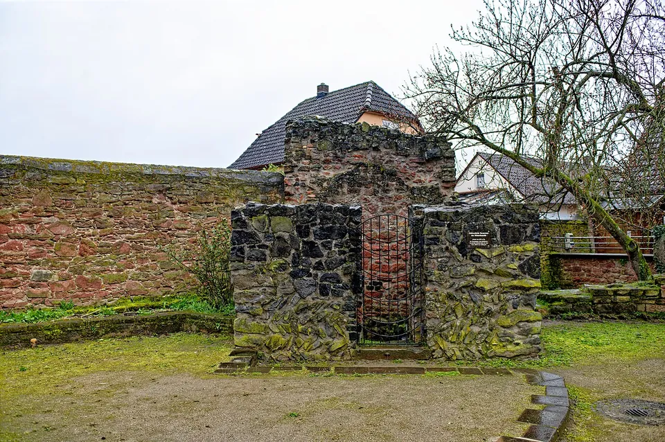
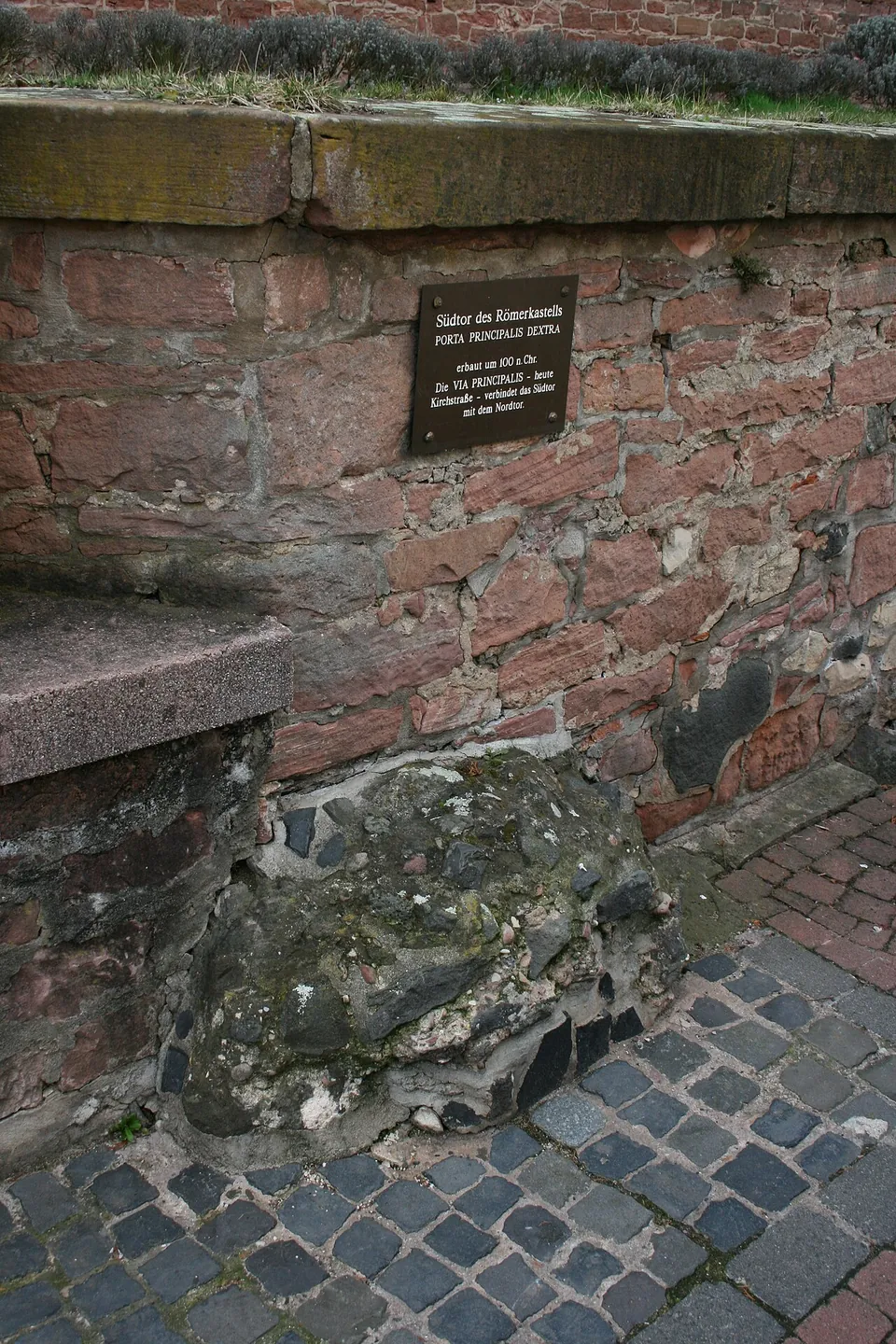
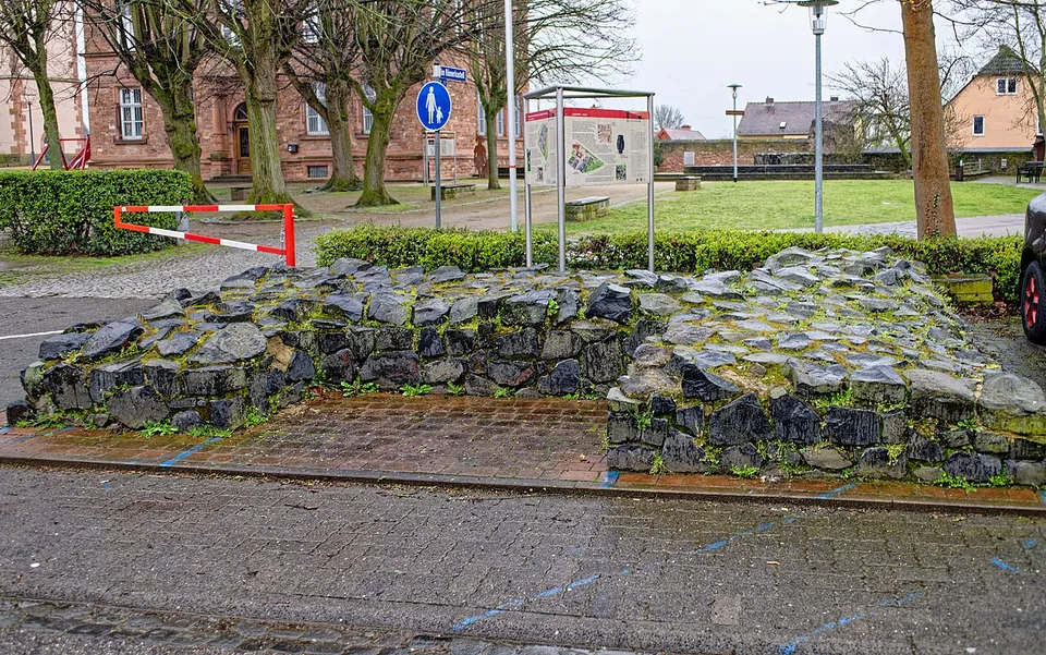
Großkrotzenburg was a Roman auxiliary fort on the Upper Germanic Limes, at the point where the land frontier met the river Main, and the village has been built over it entirely. What you can see is a handful of fragments in the old centre: the lower part of a corner tower, some stretches of wall, and the restored footings of a gate tower.
What is there today
The best piece is the south-west corner tower, beside the local museum. It is the best-preserved part of the fort because its lower storey was later used as a prison (de.wikipedia); the museum says the Roman base was built up in the Middle Ages and served as a jail into modern times, and that the herringbone stone courses on its outer face are the Roman wall of the tower (Museum Großkrotzenburg). A stretch of wall next to it has been rebuilt in sandstone (de.wikipedia).
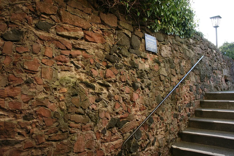
In Breite Straße, in front of the museum, the foundations of the southern tower of the fort’s rear gate (the porta decumana) have been restored. The south wall of the churchyard of St Laurentius is Roman at its core, though you can hardly tell, and in Kirchstraße a plain block of masonry juts out beyond that wall; a plaque there marks the fort’s south gate. Every piece has a sign (de.wikipedia). The museum warns against confusing the Roman walling with the medieval masonry built on top of it.
The street plan still traces the fort: Kirchstraße runs roughly along the main cross street, the via principalis, and Breite Straße along the road to the rear gate (de.wikipedia). A trail of 15 information boards, in German, French and English, links the remains with the sites of the gates, the baths and the Mithras shrine, with an overview of the route at the museum, which is the Limes information centre for the Main-Kinzig district (Museum Großkrotzenburg).
Is it worth the trip?
Only as part of something else. This is a fort you read from fragments and signboards, not one you walk into: the remains are low and scattered through a village. If you are following the Limes along the Main, it is a short stop worth making, and the museum’s Roman collection, with piles from the Roman bridge over the Main, the beneficiarii altar stones (originals and copies) and a model of the fort, makes it much better. The catch is that the museum opens one Sunday afternoon a month, and only in part while it is being rebuilt.
Getting there
The fort lies in the centre of Großkrotzenburg, near the church. From Großkrotzenburg railway station, walk along Bahnhofstraße towards the church; by car, leave the A45 at the Alzenau Nord/Großkrotzenburg exit, and follow the signs to the museum from the edge of the village, where there is parking right outside (the operator). The nearest bus stop, Mitte, is about 240 m from the point on this page (OpenStreetMap).
The remains outside stand in the streets and the grounds by the museum, and no hours or fee are published for them. The museum, at Im Römerkastell 2, opens on the second Sunday of each month from 14.00 to 17.00, with coffee and cake; entry is free and donations are welcome. Parts of it are being rebuilt and only some rooms are open; the remaining dates in 2026 are 8 November and 13 December (Museum Großkrotzenburg, read 2 November 2026 — check before travelling).
Visiting details
- Opening hours
- The remains stand outdoors in the village centre, in the streets and the grounds beside the museum. The museum opens on the second Sunday of each month, 14.00–17.00, and only in part while some rooms are being rebuilt; in 2026 the remaining dates are 8 November and 13 December.
- Tickets
- Free, to the outdoor remains and to the museum on its open Sundays; the museum asks for donations towards its rooms.
- Parking
- The museum says there are parking spaces directly in front of it, in the village centre near the church. Coaches cannot enter Breite Straße; they set down at the town hall in Friedrichstraße and park at the Limesforum in Schulstraße.
Before you go
- The museum is open one afternoon a month; on any other day you see only the remains outside.
Hours and prices checked 2 November 2026 on the operator's own site. Confirm before travelling.
History
The fort stood on a gravel terrace above the floodwaters on the north bank of the Main. North of it lay marshland, so it was probably built mainly to guard the river crossing; south of here the Main itself formed the frontier, the “wet Limes” (de.wikipedia). The fort faced east, towards the Limes, which ran only 20–25 m from its wall (published figures differ). It measured 175 by 123 m, 2.1 hectares, and was garrisoned by the Cohors IV Vindelicorum, an auxiliary unit of about 500 men raised in the Alpine foreland (de.wikipedia).
The stone fort is generally dated to the reign of Trajan, and may have had a predecessor (de.wikipedia); the museum puts its building at about AD 105–110. Wooden pile shoes found while dredging the Main in 1885 and 1903 once steadied the stone piers of a Roman bridge, and tree-ring dating places them in 134, at the end of Hadrian’s reign. Two altar stones of beneficiarii, found in 1960 between the bridge and the fort, suggest a police post at the crossing. The cohort also ran a tilery near the Limes, where five kilns have been excavated; tiles stamped with its name reached as far as Walldürn and the Neuwied basin (de.wikipedia).
West and north-west of the fort lay the civilian village, of which little is known beyond its roads, a cellar and a shrine of Mithras; some of the Mithras sculptures were destroyed in the Second World War with the collections of the Hanau museum (de.wikipedia). The Romans withdrew around 260, and settlers moved into the fort area again some decades later. In the Middle Ages the walls that still stood served as the village’s defences (de.wikipedia).
The site was first excavated by the Hanau history society in 1881 and by the Reich Limes Commission in 1893, under Georg Wolff. As part of the Upper Germanic-Raetian Limes it has been a UNESCO World Heritage Site since 2005 (de.wikipedia).
More photographs
Nearby
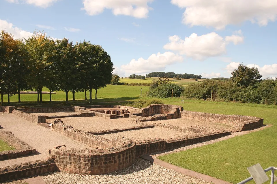
Photo: Haselburg-müller · CC BY-SA 3.0 · Commons
34 km · villa · Hesse
Haselburg Roman villa
The excavated buildings have been rebuilt on their own foundations to a low height, so the site reads as a plan you walk through rather than as standing ruins (the operator).
36 km · fort · Hesse
Castra of Kapersburg
The fort sits in a forest clearing in front of a hill called the Saukopf and covers 134 by 122 m, about 1.6 hectares (the operator).
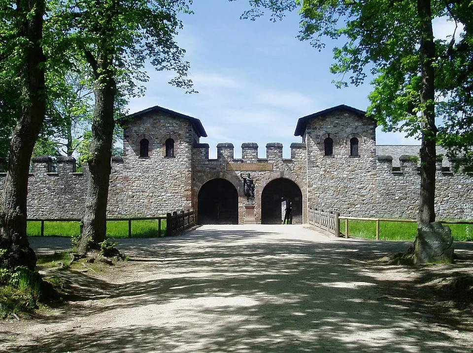
Photo: en:User:Ekem · Public domain · Commons


Straight-line distances.
Sources
Every fact on this page comes from the records below, each used under the licence noted.
| Source | Licence |
|---|---|
| Pleiades 118710 | CC BY |
| Wikidata Q64812298 | CC0 |
| Vici.org 4416 | CC BY-SA (text), CC0 (metadata) |
| OpenStreetMap relation/7920089 | ODbL |
| Wikidata — Kastell Großkrotzenburg (Q1735361, the Roman fort) | licence not recorded |
| Wikipedia (de) — Kastell Großkrotzenburg | CC BY-SA 4.0 |
| Museum Großkrotzenburg — the fort and the corner tower | licence not recorded |
| Museum Großkrotzenburg — the museum and its rooms | licence not recorded |
| Museum Großkrotzenburg — the Limes information centre and the Roman trail | licence not recorded |
| Museum Großkrotzenburg — visitor information and directions | licence not recorded |
| Museum Großkrotzenburg — 2026 opening dates (the operator) | licence not recorded |