

What is there today
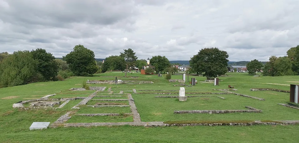
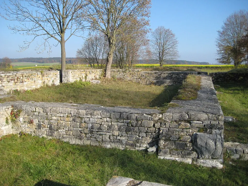
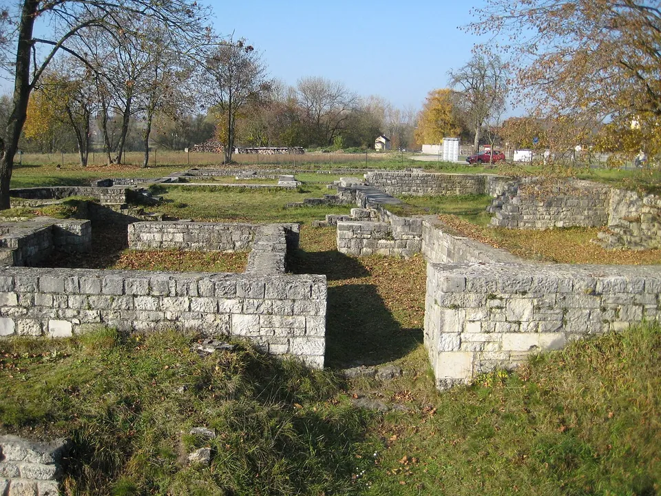
The fort covered about 1.8 hectares, 147 by 125 metres (de.wikipedia), and its ground is now a small archaeological park in which the main buildings are marked out by low walls. In the centre are the walls of the headquarters building, the principia, and just north of it the commander’s house, the praetorium; the barracks, stables and workshops have left nothing visible (de.wikipedia; Commons file descriptions). In the south-west corner stand the walls of the late Roman small fort, the burgus, which the regional nature park notes is still easy to make out (Naturpark Altmühltal). Outside the walls are the rebuilt bath complex and the remains of the mansio, the official guesthouse (Naturpark Altmühltal; Commons file descriptions). The walls are low, from ground level to roughly chest height, and the foundations have been partly rebuilt (de.wikipedia; OpenStreetMap).
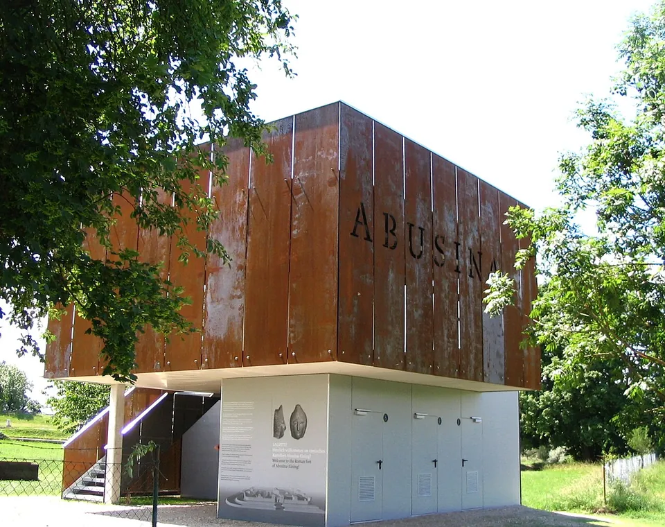
In 2011 the site was redesigned as the Römerpark Abusina Eining: rust-coloured steel panels now stand in front of the ancient gates and building entrances, some of them sound stations, and a steel, glass and concrete visitor pavilion with a viewing platform replaced the old timber pavilion. The site’s tenant, the Verein Historia Romana, opposed the scheme, which also laid a concrete-and-steel walkway into the approach of the river-side gate, the porta decumana (de.wikipedia). A public toilet is mapped at the site (OpenStreetMap). The finds are not here: they are divided between museums in Kelheim, Landshut, Abensberg and Munich (de.wikipedia).
Is it worth the trip?
Worth it if you are staying in Bad Gögging or travelling along the Danube near Regensburg, and less so as a long detour. This is a ground plan, not a ruin with height: there is no gatehouse or tower to look up at, and since 2011 the steel panels dominate the grounds (de.wikipedia). In its favour, it is one of the few forts on this stretch of the frontier that has been fully excavated (de.wikipedia), it has been part of the Upper German–Raetian Limes World Heritage Site since 2005, and OpenStreetMap maps it as open at all times, so it fits easily into a day on the Danube.
Getting there
The fort lies on the high bank of the Danube about 500 m south of the centre of Eining, a village of Neustadt an der Donau (de.wikipedia), right on the road to the spa town of Bad Gögging (Naturpark Altmühltal). Regensburg is about 30 km to the north-east (Pleiades). A car park is mapped about 240 m from the centre of the fort, and the bus stop “Eining, Römerkastell” is about 220 m away (OpenStreetMap).
The Bad Gögging tourist office publishes no opening hours or admission charge for the fort. OpenStreetMap maps the site as open at all times. From April to September the tourist office lists a guided tour of the fort every Saturday, without a price (read 31 October 2026). The fort is also the setting of the Roman festival Salve Abusina, with 2024 and 2026 editions on the tourist office’s site, which has the dates.
Visiting details
- Opening hours
- Not published by the Bad Gögging tourist office. Mapped in OpenStreetMap as open at all times.
- Tickets
- Not published by the Bad Gögging tourist office, which lists a guided tour of the fort on Saturdays from April to September, without a price.
- Parking
- A surface car park is mapped about 240 m from the centre of the fort (OSM way/126179633), with bicycle parking beside it; the bus stop "Eining, Römerkastell" is about 220 m away.
Hours and prices checked 31 October 2026 on the operator's own site. Confirm before travelling.
History
A building inscription dates the foundation to the reign of Titus, about AD 80, when the Cohors IV Gallorum built a timber-and-earth fort to guard the Danube line. In the middle of the 2nd century the Cohors III Britannorum, a part-mounted cohort recorded at Eining from 153, rebuilt it in stone, and that unit stayed until the end of Roman rule in Raetia in the early 5th century (de.wikipedia). The fort and its civilian settlement were destroyed in the Marcomannic Wars, rebuilt, and visited in 213 by the emperor Caracalla, who came to Raetia to direct a campaign against the Alamanni. Alamannic raids destroyed Abusina again in 233 and in 260; a hoard buried in those years and found by chance in 1975, the Eining treasure with parts of Roman parade armour, is now in the Archäologische Staatssammlung in Munich (de.wikipedia).
After the army reforms around 300 the garrison shrank. Published figures for its late strength range from about 50 to 140 men (de.wikipedia; en.wikipedia), and the small fort in the south-west corner was built for them, while the civilians, who had not rebuilt their village after 260, moved inside the old walls (de.wikipedia). The fort was given up in the middle of the 5th century. The Bavarian village that became Eining grew up about 500 m to the north only in the 6th or 7th century, with no continuity from the Roman site (de.wikipedia). Excavation began in 1879 under the local parish priest Wolfgang Schreiner, continued under Paul Reinecke between 1911 and 1920, and resumed in 1968 (de.wikipedia).
More photographs


Nearby
Photo: Amrei-Marie · CC BY-SA 4.0 · Commons
Photo: DALIBRI · CC BY-SA 4.0 · Commons
37 km · fort · Bavaria
Pfünz Roman Fort
The rebuilt north gate, north-west corner tower and stretch of wall are the set piece (de.wikipedia; Naturpark Altmühltal).


Straight-line distances.
Sources
Every fact on this page comes from the records below, each used under the licence noted.
| Source | Licence |
|---|---|
| Pleiades 118539 | CC BY |
| Wikidata Q1735352 | CC0 |
| OpenStreetMap way/34339817 | ODbL |
| OpenStreetMap — Römisches Kastell Abusina (site relation) | licence not recorded |
| Wikipedia (de) — Kastell Eining | CC BY-SA 4.0 |
| Wikipedia (en) — Abusina | CC BY-SA 4.0 |
| Naturpark Altmühltal — Castell Abusina (Eining), description of the remains | licence not recorded |
| Wikidata — Bavarian register monument D-2-7136-0111, Kastell Abusina-Eining (Q98366840) | licence not recorded |
| Wikidata — Bavarian register monument D-2-7136-0117 (Q98378239) | licence not recorded |
| Tourist-Information Bad Gögging — UNESCO World Heritage Limes and Danube Limes | licence not recorded |
| Tourist-Information Bad Gögging — Salve Abusina 2026 | licence not recorded |