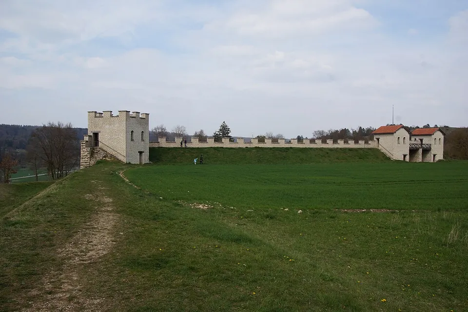
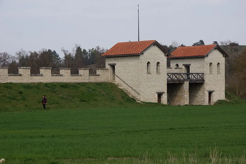


Pfünz is a Roman auxiliary fort on a steep spur 42 m above the Altmühl valley near Eichstätt, built from about AD 90 and part of the Raetian Limes World Heritage Site. What you see first is a modern rebuild of its north gate, one corner tower and the wall between them, put up in the 1990s on top of the Roman wall stumps.
What is there today
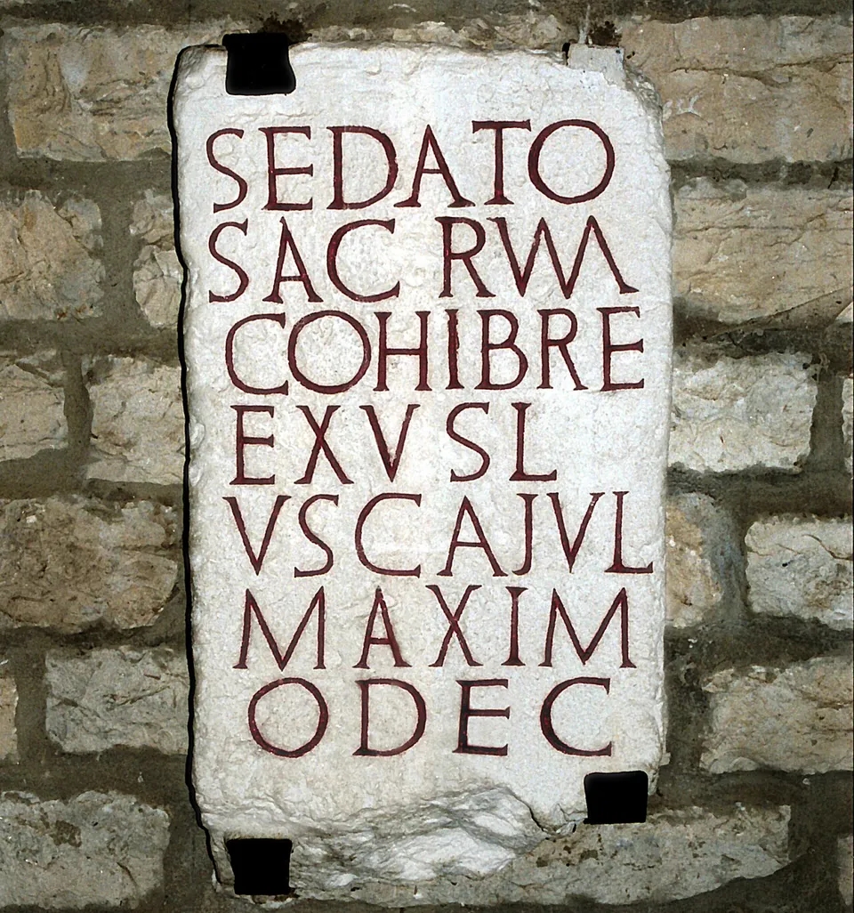
The rebuilt north gate, north-west corner tower and stretch of wall are the set piece (de.wikipedia; Naturpark Altmühltal). Treat them as an impression of a Roman fort rather than a copy of this one: de.wikipedia describes the 1992–94 work as done without archaeological advice, combining details from other forts while ignoring what was found here, so that it lacks the cornice usual at other forts, with the gate and tower a storey too low, and without the white render, painted with red joints to imitate squared stone, that Roman forts carried. Inside a tower of the north gate a reconstructed guardroom shows two soldiers in full kit as they might have looked around AD 230, and copies of the fort’s inscription stones are set up on the rebuilt defences (Naturpark Altmühltal).
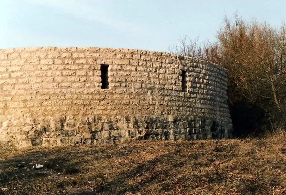
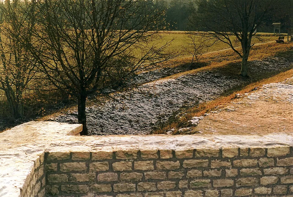
The Roman material is lower down and quieter. The fort’s outline, a skewed rectangle of about 189 × 145 m, still shows clearly as a raised bank; published figures put the area inside it at 2.5 to 2.75 hectares (de.wikipedia; Naturpark Altmühltal). The double ditch, partly cut into the rock, survives best along the west wall. The south-east corner tower was partly rebuilt in 1960, and the lower part of its masonry is original; the north, south and west gates were conserved in 1987–88 (de.wikipedia; Commons file description). The interior is farmed, and the headquarters building shows only as slight rises in the ground (de.wikipedia). A Roman trail explains the fort and its civilian village (Naturpark Altmühltal).
The village, the baths in the valley and the temple of Jupiter Dolichenus outside the south gate were excavated in the 19th century, but no source describes any of them as on show. The finds are in the Museum für Ur- und Frühgeschichte at the Willibaldsburg in Eichstätt, which also has a large model of the fort with some 500 tin figures (de.wikipedia; Naturpark Altmühltal).
Is it worth the trip?
As a stop in the Altmühl valley, yes: it is free, open at any hour and has a car park next to it, and the guardroom with its two soldiers gives children something to look at. Pair it with the museum in Eichstätt, about 6 km away, where part of what was found here is shown.
On its own it is not worth a long detour. The reconstruction is small and, by de.wikipedia’s account, loose with the evidence, and the genuine remains are earthworks and low walls. In winter the rebuilt parts are closed, which leaves the banks and ditches.
Getting there
The fort sits on the Kirchberg just south of the village of Pfünz, in the municipality of Walting (de.wikipedia; Naturpark Altmühltal), about 6 km from the centre of Eichstätt (OpenStreetMap). The Parkplatz Römerkastell Pfünz, a free gravel car park with free public toilets, is about 120 m west of the fort, and three history boards stand beside it (OpenStreetMap). Without a car, the nearest bus stop mapped is Pfünz, Eichstätter Straße, in the village about 450 m to the north; the fort is 42 m above the valley floor, so the last stretch is uphill.
The site is open at all times and free to enter. The rebuilt gate, tower and wall cannot be entered in winter, and no dates are published for that (Naturpark Altmühltal, read 30 October 2026).
Visiting details
- Opening hours
- Open at all times. The rebuilt gate, tower and wall cannot be entered in winter; no dates are published for that closure.
- Tickets
- Free.
- Parking
- Parkplatz Römerkastell Pfünz, a free gravel car park about 120 m west of the fort, with free public toilets beside it (OSM way/24639808, node/306465679).
Before you go
- The fort stands on a spur 42 m above the Altmühl valley. The nearest bus stop mapped, Pfünz, Eichstätter Straße, is in the village about 450 m to the north, so the last stretch is uphill on foot.
Hours and prices checked 30 October 2026 on the operator's own site. Confirm before travelling.
History
The fort was possibly built as early as about AD 90, late in Domitian’s reign, as a timber-and-earth fort on the new road from Kösching to Weißenburg; for a time the frontier may have followed that road, putting Pfünz on the border itself (de.wikipedia). At the latest once the Limes was moved forward to its final line, which in Raetia dates to Hadrian’s reign (117–138), Pfünz became a rear fort some 10 to 15 km behind it — published figures differ (de.wikipedia; Naturpark Altmühltal). It watched a river crossing and a road junction below, and the village name comes from the Latin pons, bridge (de.wikipedia).
A building inscription found in 1888 shows the fort was rebuilt in stone under Antoninus Pius (138–161). Its garrison was the Cohors I Breucorum civium Romanorum, a part-mounted unit of some 500 to 600 men (published figures differ), which in 181 also helped rebuild the small fort at Böhming on the Limes. A second inscription records a general overhaul in 183/184 under Commodus (de.wikipedia).
The end was violent. The excavators found a thick burnt layer, three shield bosses still leaning against a wall in a tower of the south gate, and at the headquarters an iron chain with the shin bone of a prisoner who had burned with the building. Pfünz is one of the rare forts where a fight at the end can be shown (de.wikipedia). The date is disputed: it was long put at the Alamannic raid of 233/234, one historian has argued for Roman troops in the usurpation of Maximinus Thrax in 235, and coins from the village run to Gordian III (238–244), so the archaeologist Thomas Fischer (2008) settles for “around the middle of the 3rd century”. The village burned with the fort; in the temple of Jupiter Dolichenus the excavators found a hoard of 95 silver denarii next to human remains (de.wikipedia).
Later the ruin served as a quarry, among other things for the church of St Nicholas built 50 m from its north-east corner. The excavations that ran from 1884 to 1900 were the most extensive of their day at any Limes fort and village, and afterwards the best-preserved parts of the wall were restored and left visible (de.wikipedia).
More photographs


Nearby
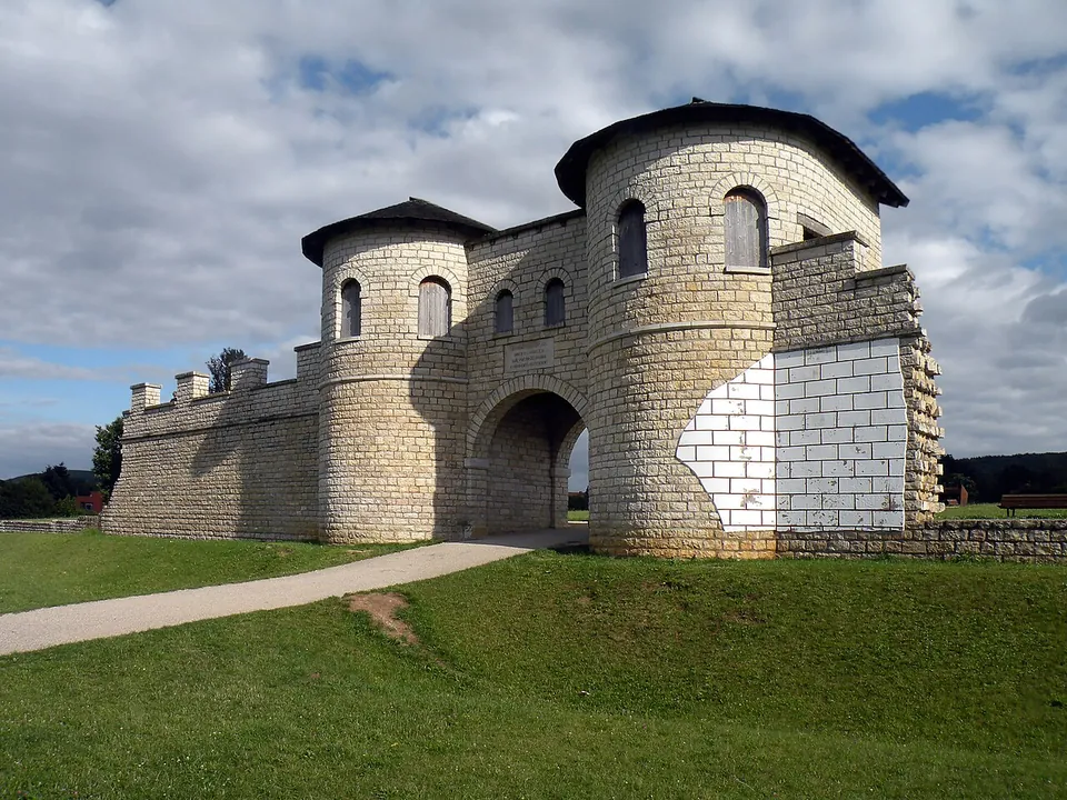
Photo: Vitold Muratov · CC BY-SA 3.0 · Commons
27 km · fort · Bavaria
Weißenburg Roman Fort
The fort's whole area, about 3.1 hectares, is kept free of building as a public park (Deutsche Limeskommission).
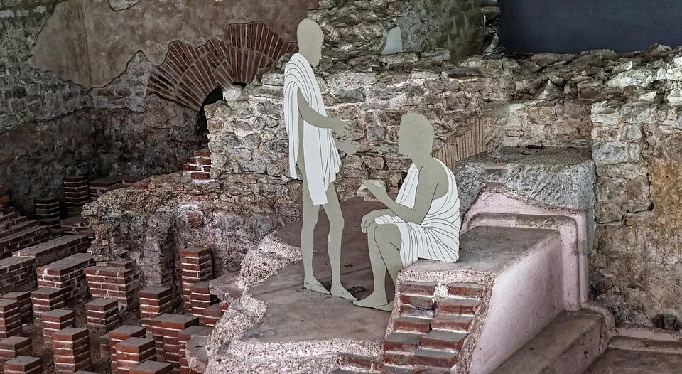
Photo: Burkhard Mücke · CC BY-SA 4.0 · Commons
28 km · bath · Bavaria
Römische Thermen Weißenburg
The ruins lie under the protective building, and you see them from a fixed circuit of walkways above them (de.wikipedia; the operator): the walls of the bathing rooms, their pools, and the rows of short brick pillars of the underfloor heating (hypocausts).
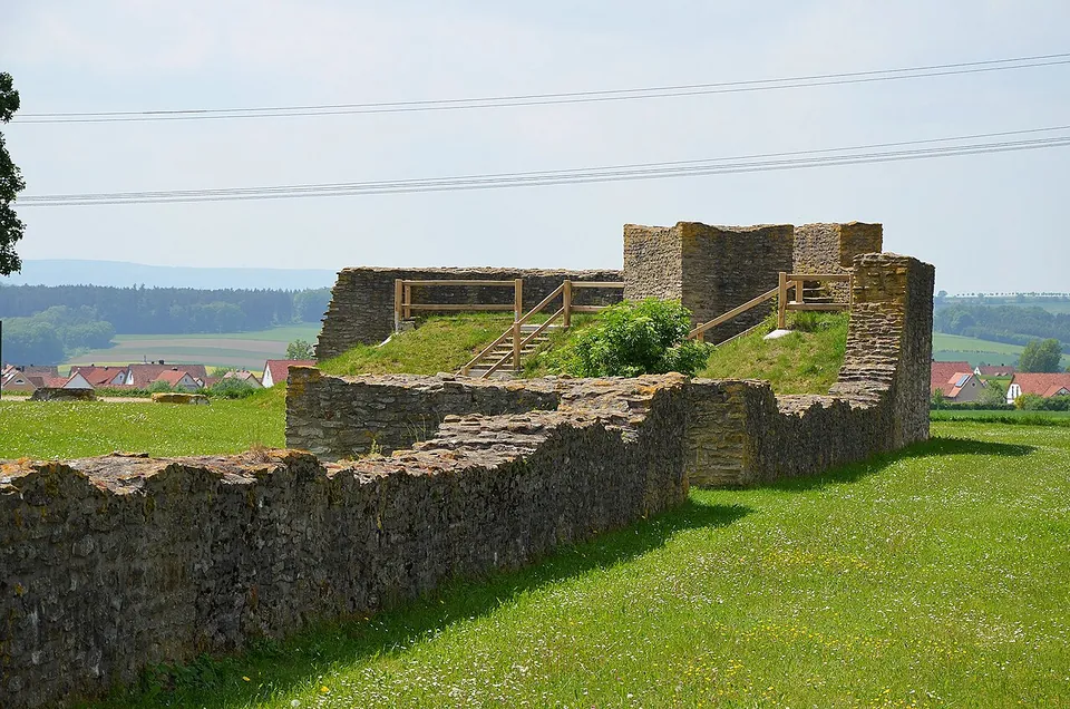
Photo: Carole Raddato · CC BY-SA 2.0 · Commons


Straight-line distances.
Sources
Every fact on this page comes from the records below, each used under the licence noted.
| Source | Licence |
|---|---|
| Wikidata Q1574748 | CC0 |
| Vici.org 4435 | CC BY-SA (text), CC0 (metadata) |
| OpenStreetMap way/24649701 | ODbL |
| Wikipedia (de) — Kastell Pfünz | CC BY-SA 4.0 |
| Wikipedia (en) — Pfünz Roman Fort | CC BY-SA 4.0 |
| Naturpark Altmühltal — Kastell Vetoniana bei Pfünz | licence not recorded |