

What is there today
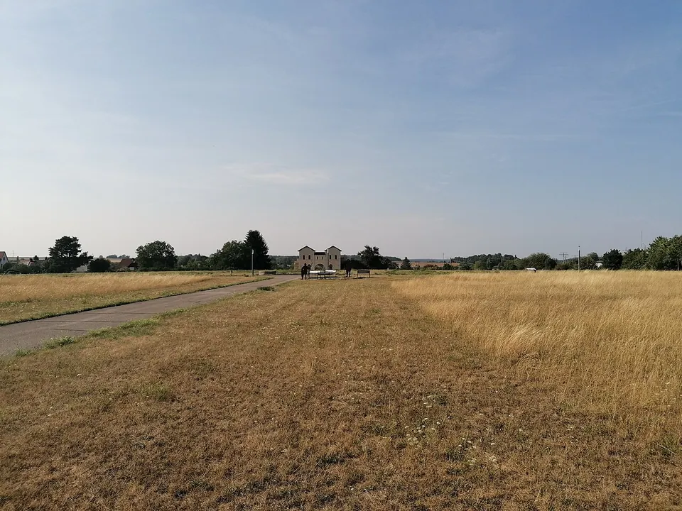
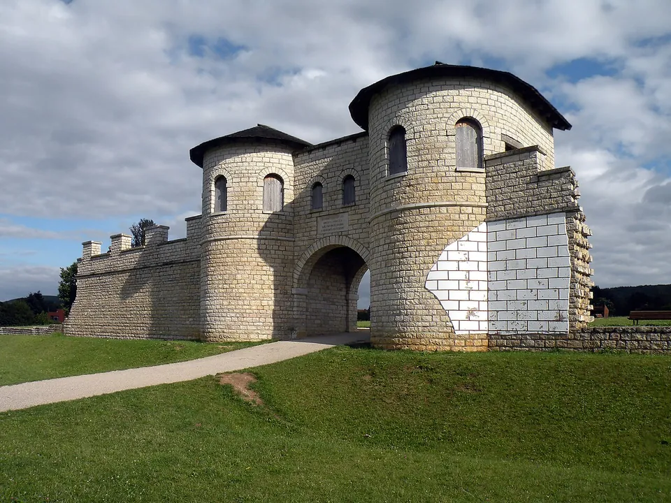
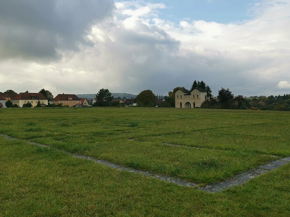
The fort’s whole area, about 3.1 hectares, is kept free of building as a public park (Deutsche Limeskommission). The thing to see is the north gate, rebuilt in 1989/90 on its original foundations from hand-dressed local stone: two towers rounded towards the outside, a 3.5 m wide passage between them, and the adjoining stretches of the fort wall (the town; Deutsche Limeskommission). Inside, the rest of the fort is an open lawn on a rise above the river Schwäbische Rezat, in which the line of the defensive wall and the plan of the headquarters building (principia) are conserved in outline (de.wikipedia). The original foundations themselves are no longer exposed: they were covered over again in 1965 after no method of conserving them had worked (de.wikipedia).
OpenStreetMap maps several information boards within about 40 m of the centre of the fort and tags the site as wheelchair accessible.
Is it worth the trip?
On its own, it is a short stop: one reconstructed gate and a field with a plan traced in it. The gate is a good one, and the reconstruction is honest about its limits — by current knowledge it should probably have been a storey taller (de.wikipedia). What makes Weißenburg worth a detour is that the fort is one of three Roman sights in the same town: the large Roman baths of the civilian settlement, preserved under a protective building about 300 m to the west, and the RömerMuseum in the town centre, built around the Weißenburg treasure, with Bavaria’s free information centre for the World Heritage frontier on its ground floor (the town; de.wikipedia; Deutsche Limeskommission). Taken together they are worth the trip; the fort alone is worth it if you are passing.
Getting there
The fort lies on the western edge of the town near the railway station (the town); the station, Weißenburg (Bay), is about 230 m from the fort, and a bus stop on Gunzenhausener Straße about 190 m (OpenStreetMap). Drivers are asked to use the car park by the Roman baths or the one on Kohlstraße and not to drive into the residential street Am Römerlager, which has no parking (the town). OpenStreetMap maps a free car park about 220 m from the fort, and free public toilets about 260 m away.
The fort area is free and open at all times (the town). The RömerMuseum is a separate ticket: €6, reduced €4, family €12; a €10 Museumsticket (reduced €6, family €19) covers the RömerMuseum, the Roman baths and the town’s ReichsstadtMuseum. The museum opens Tuesday to Sunday, 10.00–17.00 from 15 March to 16 November and with a lunch break (12.30–14.00) until 30 December, and is shut from 1 January to 14 March (weissenburg.de, read 30 October 2026 — check before travelling).
Visiting details
- Opening hours
- The fort area is open at all times.
- Tickets
- Free. The RömerMuseum in the town centre, which holds the Weißenburg treasure, charges €6 (reduced €4, family €12); the Bavarian Limes Information Centre on its ground floor is free. A €10 Museumsticket (reduced €6, family €19) covers the RömerMuseum, the Roman baths and the town's ReichsstadtMuseum.
- Parking
- The town directs drivers to the Römische Thermen / Römerkastell car park or the Kohlstraße car park, and asks them not to drive into the residential street Am Römerlager, which has no parking. OpenStreetMap maps a free surface car park about 220 m from the fort.
Before you go
- The RömerMuseum and its free Limes Information Centre are closed on Mondays and from 1 January to 14 March; the open fort area is not affected.
Hours and prices checked 30 October 2026 on the operator's own site. Confirm before travelling.
History
The Roman name Biriciana survives on the Tabula Peutingeriana, the medieval copy of a late Roman road map, but the fort itself was only proven by excavation in 1890, by the pharmacist Wilhelm Kohl, digging for the local antiquarian society; the excavations went on for the Reich Limes Commission until 1913 (de.wikipedia). A cavalry unit, the Ala I Hispanorum Auriana, first built a fort of timber and earth here, of about 2.8 hectares. The dates published for it differ, from about 90 to about 100 (de.wikipedia; Deutsche Limeskommission: the end of the 1st century). Around the middle of the 2nd century it was replaced by a stone fort of 3.1 hectares, almost square at 170–174 by 179 m, with rounded corners, four gates each flanked by twin towers, and a system of ditches in front of the wall (de.wikipedia; Deutsche Limeskommission).
Magnetic survey has traced 14 long barracks inside. Each housed a troop of cavalry, with four riders sharing a back room and their four horses stabled in the room in front of it, which the excavations showed as greenish traces of manure pits in the front rooms (de.wikipedia). A military diploma of AD 107 found in 1867–68 while the railway was being built records a discharged soldier of the same regiment, Mogetissa, who could now marry his partner Verecunda and legitimise their daughter (de.wikipedia).
The fort and its civilian settlement, which covered about 30 hectares, were destroyed in the Alamannic raids around 253, at the latest 254; the last coins in a hoard found on one of the fort’s main streets date from 251 and 253 (de.wikipedia). The fort area was bought to protect it from building in 1914 and has belonged to the town since 1966 (de.wikipedia; the town). Since 2005 it has been part of the Upper Germanic-Raetian Limes World Heritage Site (de.wikipedia).
More photographs


Nearby
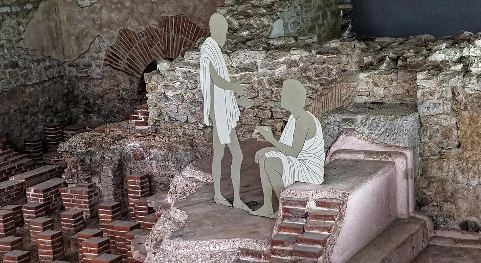
Photo: Burkhard Mücke · CC BY-SA 4.0 · Commons
1 km · bath · Bavaria
Römische Thermen Weißenburg
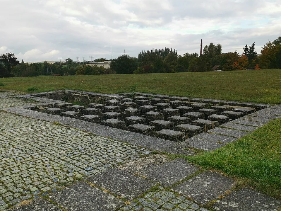
The ruins lie under the protective building, and you see them from a fixed circuit of walkways above them (de.wikipedia; the operator): the walls of the bathing rooms, their pools, and the rows of short brick pillars of the underfloor heating (hypocausts).
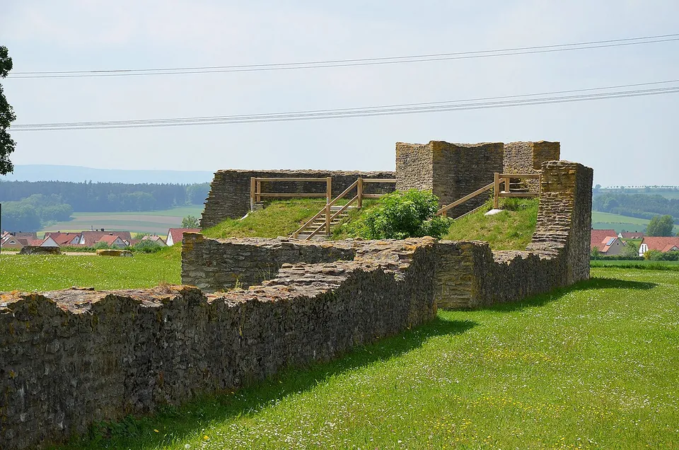
Photo: Carole Raddato · CC BY-SA 2.0 · Commons
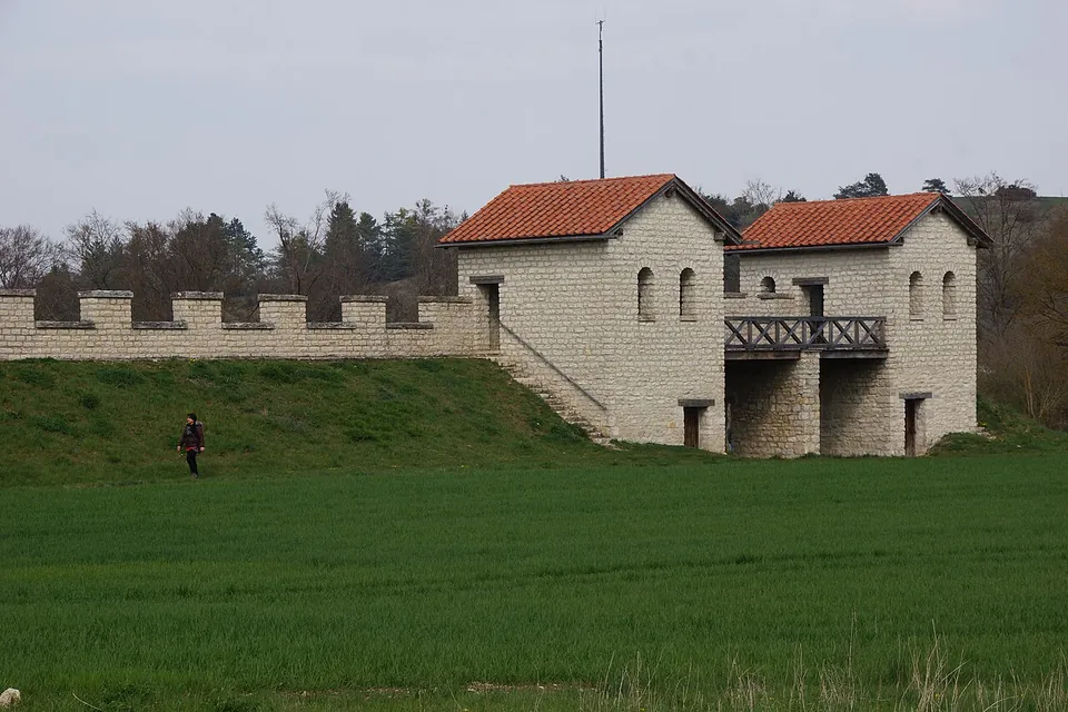
Photo: DALIBRI · CC BY-SA 4.0 · Commons
27 km · fort · Bavaria
Pfünz Roman Fort
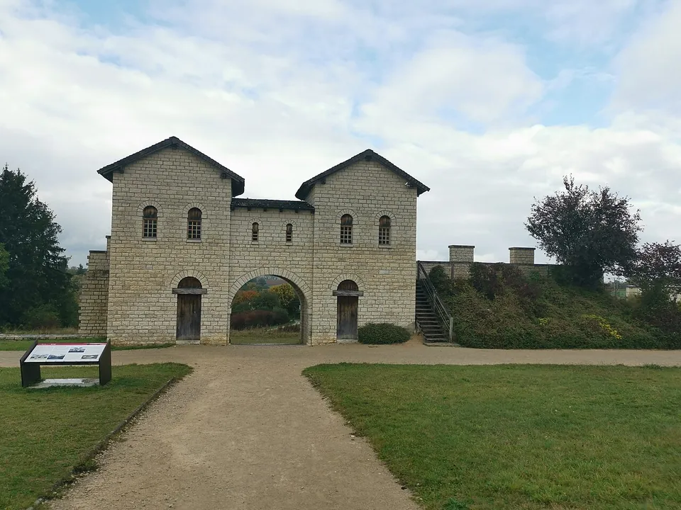
The rebuilt north gate, north-west corner tower and stretch of wall are the set piece (de.wikipedia; Naturpark Altmühltal).


Straight-line distances.
Sources
Every fact on this page comes from the records below, each used under the licence noted.
| Source | Licence |
|---|---|
| Pleiades 118600 | CC BY |
| Wikidata Q638525 | CC0 |
| Vici.org 4432 | CC BY-SA (text), CC0 (metadata) |
| OpenStreetMap way/222090922 | ODbL |
| Wikipedia (de) — Kastell Weißenburg | CC BY-SA 4.0 |
| Wikipedia (en) — Biriciana | CC BY-SA 4.0 |
| Deutsche Limeskommission — 52. Kastell Weißenburg | licence not recorded |
| Stadt Weißenburg — Kastell Biriciana (the site's owner) | licence not recorded |
| Stadt Weißenburg — RömerMuseum (hours and prices) | licence not recorded |
| Stadt Weißenburg — Bayerisches Limes-Informationszentrum | licence not recorded |