

What is there today
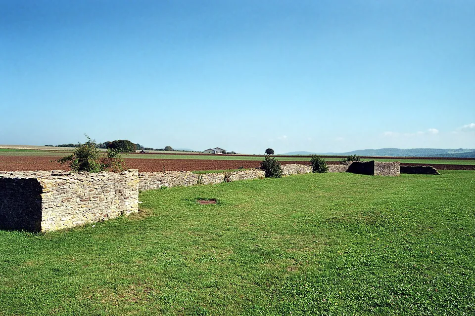
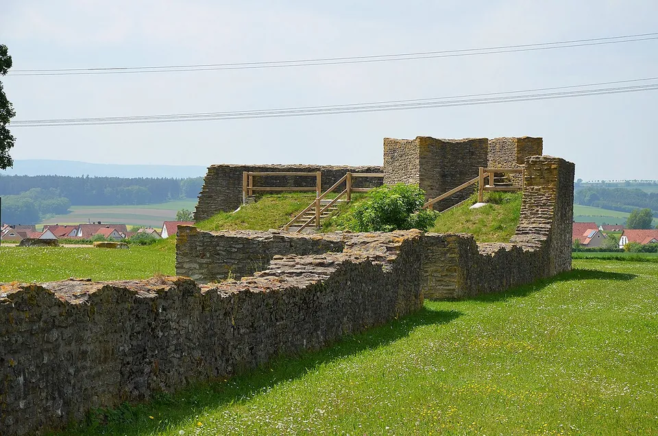
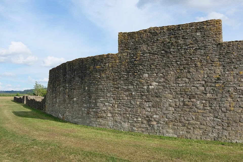
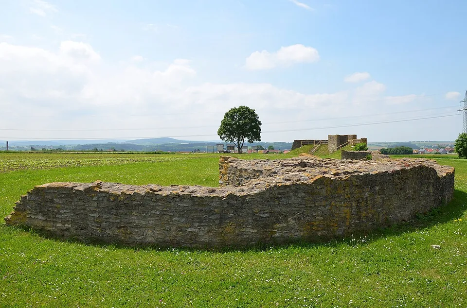
What you see is a reconstruction. After the fort was excavated in 1980–82, its north front was rebuilt in 1982 as an open-air monument meant to look like a Roman fort fallen into ruin rather than a detailed rebuild. The rebuilt wall runs along the north side with its gate and corner towers, and at the north-west corner the tower and the earth rampart behind the wall were raised several metres to serve as a viewpoint (the town’s leaflet; de.wikipedia; Deutsche Limeskommission). The walls can be walked on (the town). The fort as a whole measured about 90 by 80 m, or 0.7 hectares; the rest of its area is now farmed and partly crossed by field tracks (Deutsche Limeskommission). Information boards stand on site (the town; OpenStreetMap).
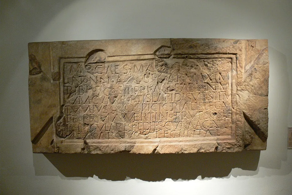
Probably the most remarkable find from the excavations, the building inscription that gives the fort its name, is not here: it is in the RömerMuseum in Weißenburg, with the rest of the finds that went on display (the town; the town’s leaflet).
Is it worth the trip?
On its own, it is a short stop. There is no museum, no café and no charge: a stretch of rebuilt wall in a field, a climb up the corner for the view, and boards to read. Give it twenty minutes. What makes it worth the detour is how it fits with its neighbour. Weißenburg, with its own rebuilt fort gate, its Roman baths and the RömerMuseum holding Sablonetum’s inscription, is just under 4 km to the south (de.wikipedia; the town of Ellingen), so the two make an easy pair. If you are walking, the town’s Limes circular walk makes the fort part of a half-day on the frontier (see below).
Getting there
The fort stands on the rise east of Ellingen, off Höttinger Straße (St 2389) towards Höttingen, about 1.5 km from the town centre (the town). The town’s map of its Limes walk marks a car park at the fort; OpenStreetMap maps no bus stop or station nearby, so without a car you walk from town.
On foot, the town’s Limes circular walk (“Limesrundweg”, 11 km, about three hours) starts at the town hall, climbs east along Höttinger Straße and Karlshofer Straße, passes the information board for a second, unexcavated Roman fort, and reaches Sablonetum by a field track. It then goes on to the line of the Limes itself and the foundations of a Roman watchtower before looping back into town (the town’s leaflet).
There is no charge and no gate: the town describes the site as freely accessible all round (stadt-ellingen.de, read 30 October 2026), and OpenStreetMap tags it as open around the clock.
Visiting details
- Opening hours
- Open at all times; the site is freely accessible all round and the rebuilt wall can be walked on.
- Tickets
- Free.
- Parking
- The town's map of its Limes circular walk marks a car park at the fort, which lies off Höttinger Straße (St 2389) on the rise towards Höttingen; OpenStreetMap maps none within a few hundred metres.
Before you go
- No bus stop or railway station is mapped near the fort. It is about 1.5 km on foot from Ellingen's town centre, or a short drive.
Hours and prices checked 30 October 2026 on the operator's own site. Confirm before travelling.
History
The field the fort stands on is called “In der Burg” (in the castle). The general and Limes researcher Karl von Popp pointed to the name, and on his hint the pharmacist Wilhelm Kohl, working for the Reich Limes Commission, found and first dug the fort in 1895, with unsatisfactory results. It was only properly explored in 1980–82, when the Bavarian State Office for the Preservation of Monuments excavated almost the whole fort and much of the civilian settlement next to it during land consolidation (de.wikipedia). That large-scale excavation with modern methods is what gives the site its importance (de.wikipedia): the plan inside the walls is almost completely known (Deutsche Limeskommission).
The fort was founded around 120 with a defence of timber and earth (de.wikipedia; Deutsche Limeskommission). In 182, under the emperor Commodus, the wall and gates were rebuilt in stone. That is recorded on a sandstone building inscription that was fixed outside the south gate. It names the fort Castellum Sablonetum, roughly “camp on the sand”, and says the work was done on the orders of the provincial governor Quintus Spicius Cerialis by the governor’s infantry guard (pedites singulares) under Aurelius Argivus, a centurion of the Third Italian Legion. Commodus’ name was chiselled out after he was murdered in 192 and his memory condemned (de.wikipedia; the town’s leaflet).
It was a small fort with two gates, in the north and south walls, each flanked by towers, more towers in its rounded corners, an earth rampart behind the wall serving as the walkway, and a ditch 5–6 m wide and 2 m deep (de.wikipedia; the town’s leaflet). The headquarters was reduced to the shrine for the standards, which suggests the garrison was a detachment of a larger unit rather than a unit of its own (de.wikipedia; Deutsche Limeskommission). A long double barrack took up much of the eastern half. Estimates of the garrison have changed: the older figure of two centuries of 80 men, still given in the town’s leaflet, has given way to a possible maximum of more than 260 (de.wikipedia). Fill from wells and rubbish pits shows something of what the soldiers ate: Roman snails seem to have been on the menu, as were figs brought from the Mediterranean (the town’s leaflet). Very probably in the middle of the 2nd century, three men’s skulls, severed probably with a sword, were buried between two post holes; the same blow by the left ear on all three raises the possibility of an execution, even a ritual one (the town’s leaflet).
East of the fort lay its civilian settlement (vicus), with a small bath house (de.wikipedia); geophysical survey in 2011 mapped how far it spread to the south and east (Deutsche Limeskommission). The fort was given up during the Alamannic wars, at the latest around 233, probably in an orderly withdrawal, since no burnt or destruction layer has been found; older publications give 229, a date now rejected (de.wikipedia). Since 2005 it has been part of the Upper Germanic-Raetian Limes World Heritage Site (de.wikipedia).
More photographs


Nearby
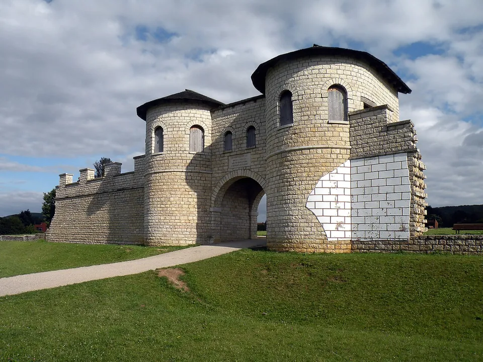
Photo: Vitold Muratov · CC BY-SA 3.0 · Commons
4 km · fort · Bavaria
Weißenburg Roman Fort
The fort's whole area, about 3.1 hectares, is kept free of building as a public park (Deutsche Limeskommission).
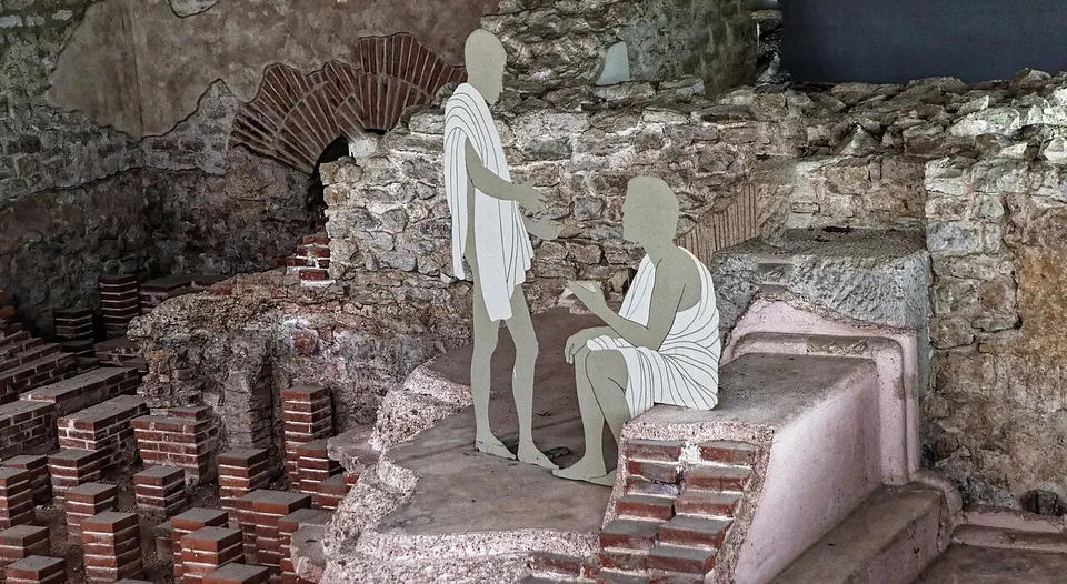
Photo: Burkhard Mücke · CC BY-SA 4.0 · Commons
4 km · bath · Bavaria
Römische Thermen Weißenburg
The ruins lie under the protective building, and you see them from a fixed circuit of walkways above them (de.wikipedia; the operator): the walls of the bathing rooms, their pools, and the rows of short brick pillars of the underfloor heating (hypocausts).
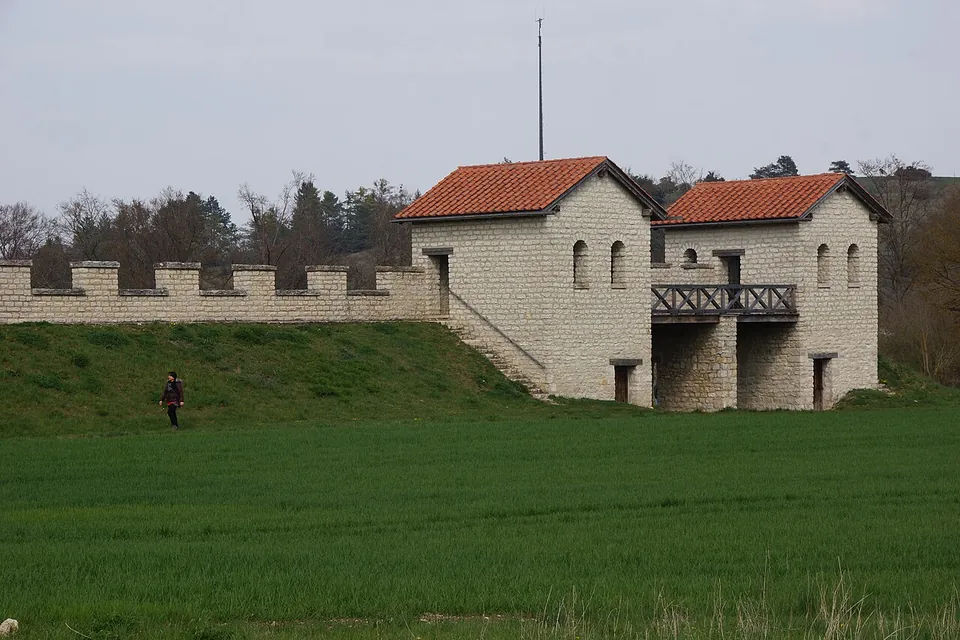
Photo: DALIBRI · CC BY-SA 4.0 · Commons
28 km · fort · Bavaria
Pfünz Roman Fort
The rebuilt north gate, north-west corner tower and stretch of wall are the set piece (de.wikipedia; Naturpark Altmühltal).


Straight-line distances.
Sources
Every fact on this page comes from the records below, each used under the licence noted.
| Source | Licence |
|---|---|
| Pleiades 118945 | CC BY |
| Wikidata Q1214660 | CC0 |
| OpenStreetMap node/10212332077 | ODbL |
| Wikipedia (de) — Kastell Ellingen | CC BY-SA 4.0 |
| Deutsche Limeskommission — 51. Kastell Ellingen | licence not recorded |
| Stadt Ellingen — Römerkastell Sablonetum (access) | licence not recorded |
| Stadt Ellingen — leaflet "Limeskastell Sablonetum" (PDF) | licence not recorded |
| Stadt Ellingen — leaflet "Der Limesrundweg" (PDF) | licence not recorded |