

What is there today
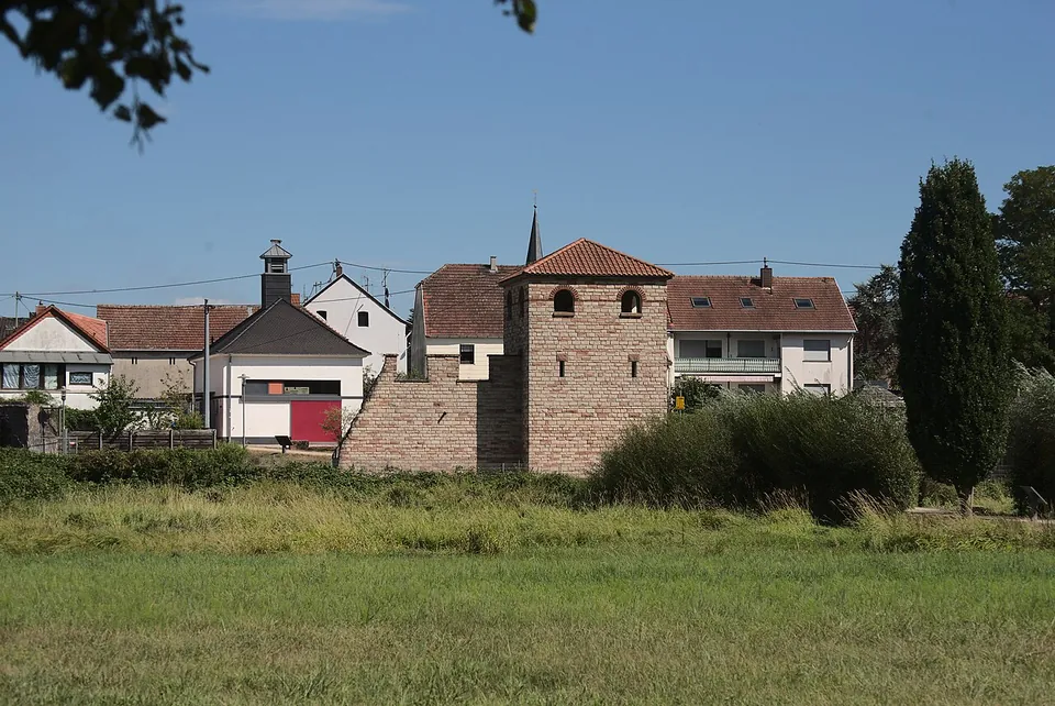
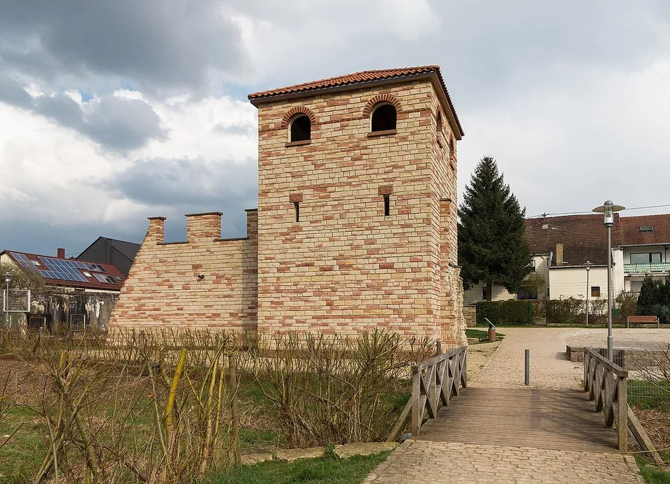
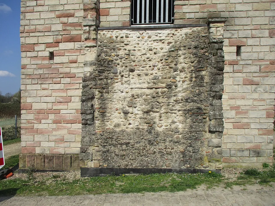
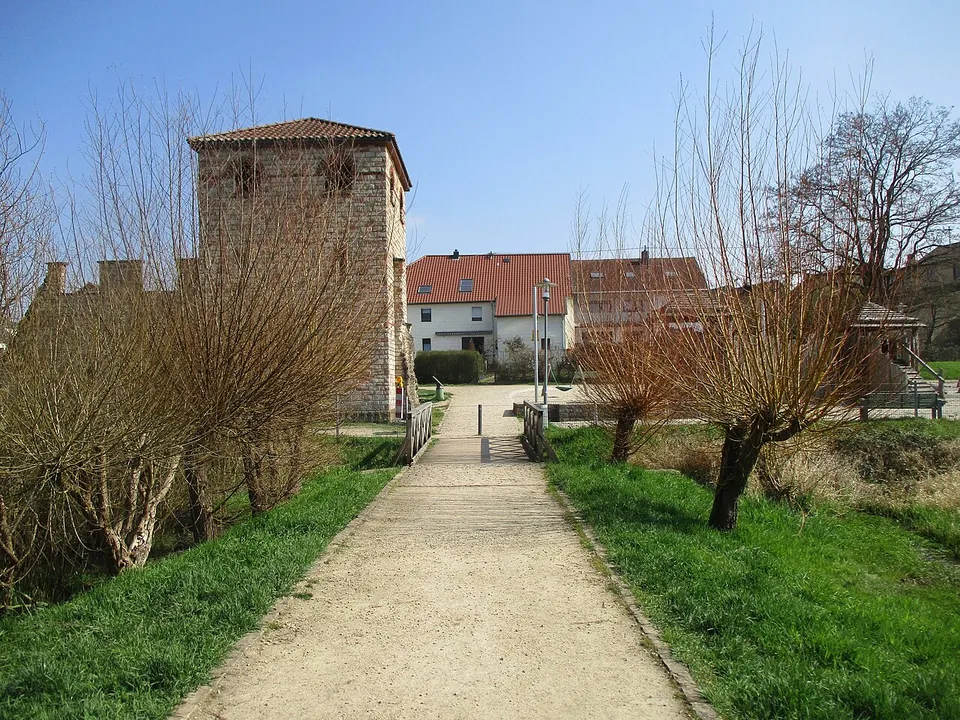
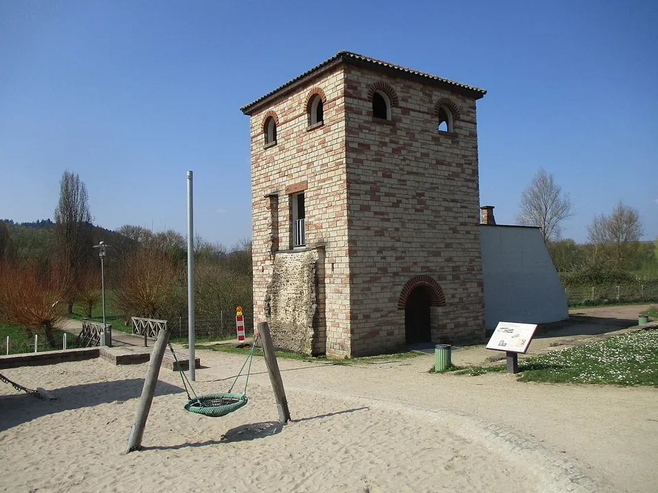
The Römerpark holds a square tower with arched windows and a tiled roof, joined to a short stretch of crenellated wall, set among gravel paths, meadow and a children’s playground. It recreates one of the sixteen towers of the late Roman fort and was built in 2009 (de.wikipedia; Geschichtswerkstatt Dillingen). Information boards stand beside it, one of them a history board titled “Pachten-Contiomagus – Ein Bollwerk gegen die Barbaren” (“a bulwark against the barbarians”), and there are public toilets next to the park (OpenStreetMap).
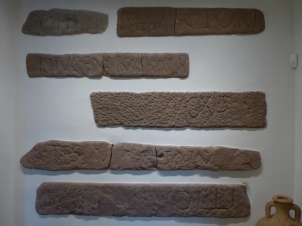
No published source records original Roman walls on view. The fort’s foundations, the temple found within its walls and the town’s cemetery of more than 500 graves have been excavated (de.wikipedia), but no source says any of them can be seen today. Many of the finds are in the Römermuseum Pachten, 120 m away in Fischerstraße, which has been closed for rebuilding since 2022 (de.wikipedia; the museum’s own site shows the building work). A 2026 brochure gives its expected reopening as the end of 2027. Some of the inscribed seat stones from the town’s cult theatre are shown in the Saarlandmuseum in Saarbrücken (the description of a Commons photograph of them).
Is it worth the trip?
Not on its own, at least until the museum reopens. The tower is a modern reconstruction and a history board explains the site, but there is nothing original to look at here. It is worth ten minutes if you are already in Dillingen or passing along the Saar, and it is free. Once the Römermuseum is open again, with a permanent exhibition on how Romans and Celts influenced each other (Keltenwelten brochure), Pachten will be worth a longer stop.
Getting there
The park lies on In der Lach in Pachten, about 1.2 km from the centre of Dillingen/Saar. The nearest bus stops, Pachten Mittelstraße and Pachten Zum Oskar, are about 260 m away, and two car parks lie 230–245 m from the tower. The toilets, in the former Pachten fire station, are wheelchair accessible with a Euro key (OpenStreetMap).
There is no charge: the tower stands in an open public park. The museum’s address is Fischerstraße 2; check its site before going, since it is closed while it is rebuilt (roemermuseum-pachten.de, read 30 October 2026).
Visiting details
- Tickets
- Free. The reconstructed tower stands in the Römerpark, an open public park with a playground; no admission charge is published for it.
- Parking
- Two car parks about 230-245 m from the tower (OpenStreetMap way/1332393353 and way/1332393354).
Before you go
- The Römermuseum Pachten, which holds the finds, has been closed for rebuilding since 2022; a 2026 brochure gives its expected reopening as the end of 2027.
- No original Roman masonry is recorded on view; the tower and wall in the park are a reconstruction of 2009.
Hours and prices checked 30 October 2026 on the operator's own site. Confirm before travelling.
History
The village grew up after Caesar’s conquest of Gaul in 58–51 BC, and coin finds put the start of Gallo-Roman settlement at about 10 BC. Its position explains it: the long-distance roads from Trier to Strasbourg and from Metz to Mainz crossed here, by a ford over the Saar, and in AD 244 a wooden bridge improved the crossing (de.wikipedia). The name joins the Celtic magus, “market”, to a first element that de.wikipedia reads as “confluence”, for the mouth of the Prims nearby; en.wikipedia also gives Latin contio, “meeting”. Contiomagus lived mainly by trade, and Ausonius, an official at the court of Valentinian I, records merchant shipping on the Saar (de.wikipedia; en.wikipedia).
The most unusual finds are sandstone blocks up to 2.6 m long with names cut into them in large letters, interpreted as the seats of a small cult theatre of the second half of the 2nd century that belonged to a temple complex (de.wikipedia). The museum counts 76 such stones, 45 of them carrying personal names, and about 70% of those names are Celtic, although Contiomagus counts as largely Romanised (roemermuseum-pachten.de, announcing a lecture by Jürgen Zeidler of Trier University). The names point to both of the Celtic peoples whose border ran here, the Treveri and the Mediomatrici (de.wikipedia). A cemetery in Margarethenstraße, found by chance in 1950, produced more than 500 graves, with terracotta figures probably from children’s graves and read as toys (de.wikipedia).
Germanic raids troubled the town from the 3rd century, and in 275/276 the Franks nearly razed it; burnt layers and buried hoards, one of them of 4,000 coins found in 1858, point to that troubled time. A fort followed. de.wikipedia places it in the last third of the 3rd century; the local history society notes that a coin of Constantine allows a date in his reign, and that the question is not settled. It measured 134 m east to west and 152 m long, with walls 2.9 m thick and square corner towers 6.73 m across. The theatre’s seat stones were reused in its foundations, and so was a dedication found in a corner tower in 1955 which, in one possible reading of its weathered text, was made “for the safety of the inhabitants of Contiomagus”: it is the stone that identifies the place by its ancient name (de.wikipedia). The fort was destroyed at the end of the 4th or the beginning of the 5th century.
A tombstone of a three-year-old boy carved with the Chi-Rho monogram, found in the old church, points to Christians in late Roman Pachten, and a replica of it is mounted in the church of St. Maximin. Merovingian graves around the church, some edged with Roman stones, suggest the place was resettled by the 7th century at the latest (de.wikipedia). The pastor Philipp Schmitt traced many of the town’s foundations as crop marks in the drought of 1842; the Landesmuseum Trier excavated in 1891 and 1935, and the temple in the fort’s south-east corner came to light in 1961–1963 and 1965 (de.wikipedia).
More photographs



Nearby
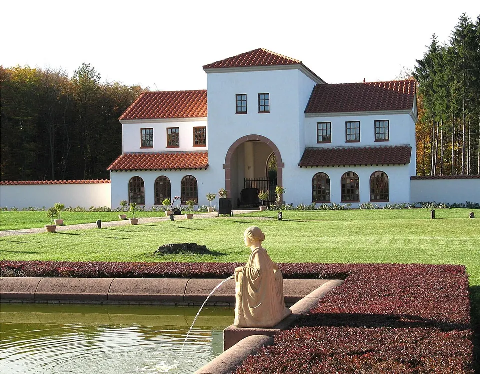
Photo: Johnny Chicago at lb.wikipedia · CC BY-SA 3.0 · Commons
24 km · villa · Saarland
Roman Villa Borg
The buildings around the inner courtyard stand again: the gatehouse, the manor house, the bath house, the residential and working wing and the Roman kitchen.
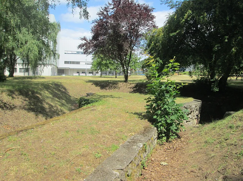
Photo: AnRo0002 · CC0 · Commons
27 km · fort · Saarland
Römerkastell Saarbrücken
Low restored foundation walls in a small park on a street called An der Römerbrücke, in the St. Johann district.
Photo: Carole Raddato from FRANKFURT, Germany · CC BY-SA 2.0 · Commons


Straight-line distances.
Sources
Every fact on this page comes from the records below, each used under the licence noted.
| Source | Licence |
|---|---|
| Pleiades 109426 | CC BY |
| Wikidata Q1129012 | CC0 |
| Vici.org 8441 | CC BY-SA (text), CC0 (metadata) |
| OpenStreetMap node/496384406 | ODbL |
| Wikipedia (de) — Contiomagus | CC BY-SA 4.0 |
| Wikipedia (en) — Contiomagus | CC BY-SA 4.0 |
| Wikipedia (de) — Römermuseum Pachten | CC BY-SA 4.0 |
| Römermuseum Pachten (the museum's own site) | licence not recorded |
| Keltenwelten — Dillingen, Römermuseum Pachten (brochure, 2026) | licence not recorded |
| Geschichtswerkstatt Dillingen — Pachten zur Römerzeit (archived copy, 2022) | licence not recorded |