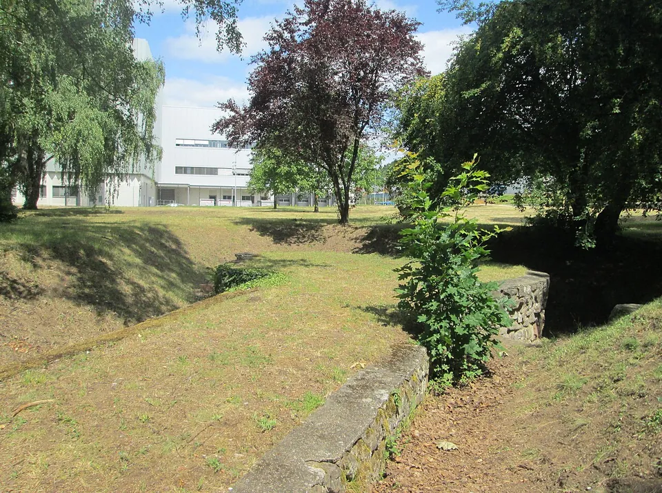
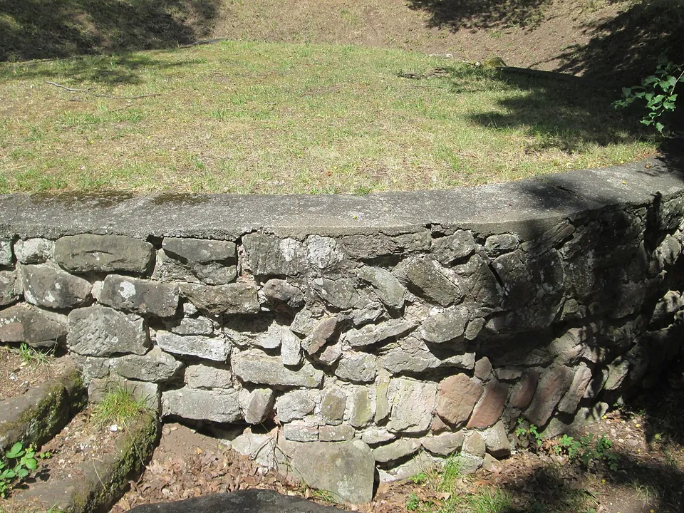
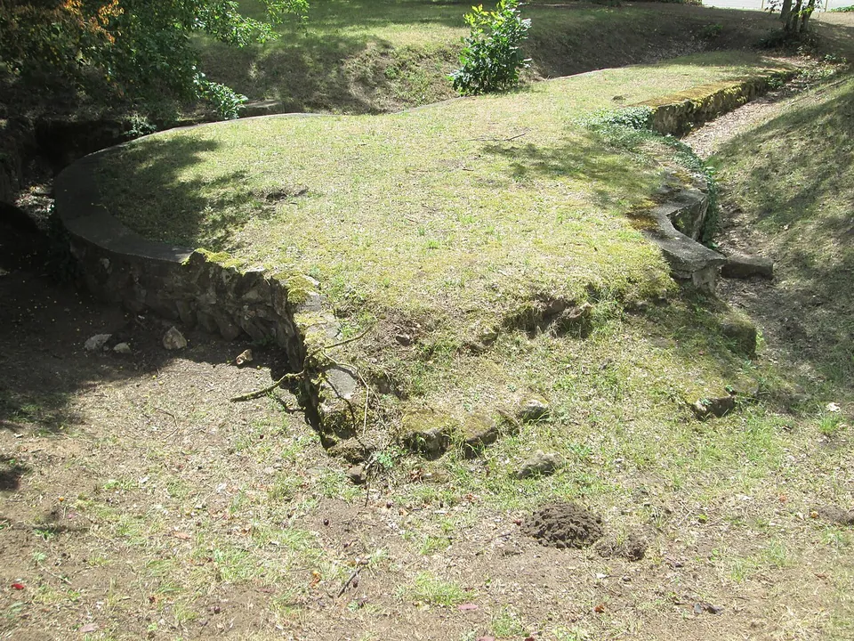


The Römerkastell in Saarbrücken is the ground plan of a small late Roman fort of the second half of the 4th century, its foundations restored and laid out in a little park beside the Saar’s east harbour. About 300 m away, on the wooded slope of the Halberg, is a Mithras sanctuary cut into the rock.
What is there today
Low restored foundation walls in a small park on a street called An der Römerbrücke, in the St. Johann district. It is an urban setting: a commercial site borders it to the north, the railway to the east and the east harbour to the south (de.wikipedia). The fort enclosed about 0.66 hectares, the size of an average fort for a small auxiliary unit. Its plan is polygonal: a near-rectangle at the south-west end, towards the river, joined to a trapezoid at the north-east; four round towers 6.4 to 6.8 m across were uncovered at the corners of the trapezoid. The Roman road from Metz to Worms ran straight through the fort, edged inside it with dressed limestone (de.wikipedia).
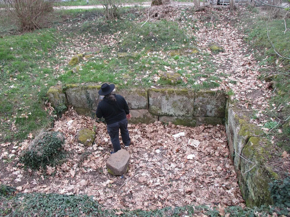
Not everything inside the walls belongs to the fort. The house foundations there are from the older civilian village (the vicus), and no trace of the fort’s own interior buildings has been found. Along the north side no wall has been traced at all (de.wikipedia). After excavation the walls of both the fort and the village houses were restored, so what you see are consolidated footings, at or below the level of the lawn, not walls standing to any height. A history board stands about 40 m from the centre of the site (OpenStreetMap). The finds are held by the Museum für Vor- und Frühgeschichte of the Stiftung Saarländischer Kulturbesitz (de.wikipedia).
The Mithras cave on the Halberg
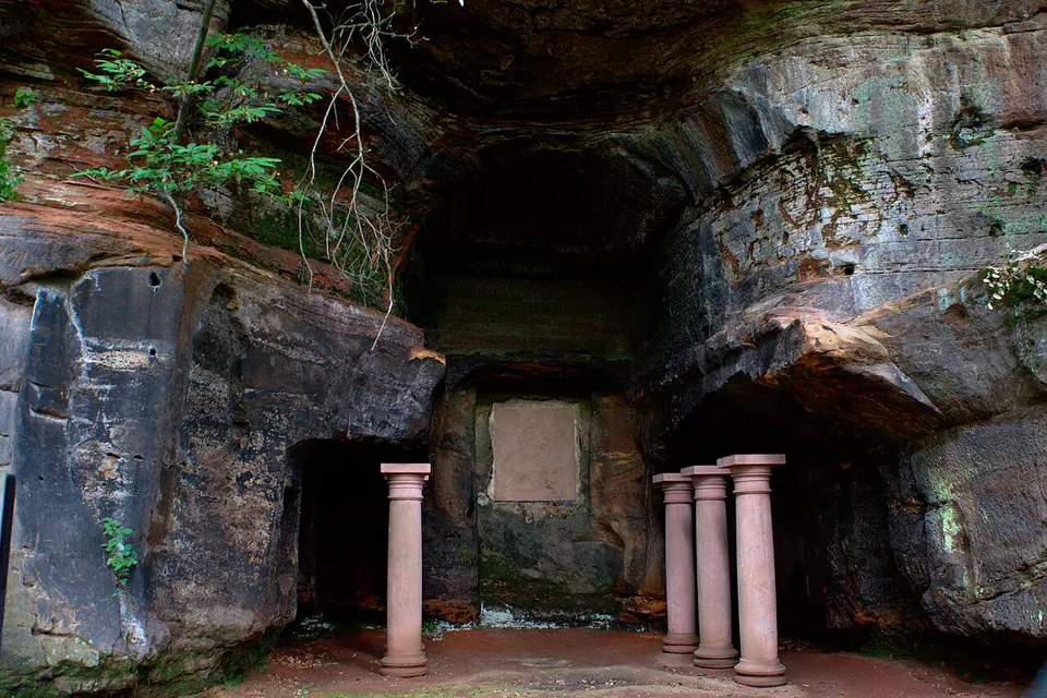
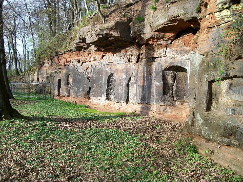
On the west slope of the Halberg, a sanctuary of the god Mithras was cut into the sandstone (de.wikipedia; Pleiades). The worked rock face runs for about 43 m and is pierced with holes and niches; the cave itself is about 6.5 m wide and 9 m deep, with a central aisle between raised benches (The New Mithraeum). It is dated to the second half of the 3rd century (de.wikipedia). Finds include ritual equipment and tableware from the cult meals, and its congregation was probably founded by traders from the settlement below (Tourismus Zentrale Saarland).
The cave was later used by Christians, as finds confirm (Tourismus Zentrale Saarland). Legend has St Arnual found a hermitage here in the 7th century, but the traces found point only to a hermitage of the 15th century (de.wikipedia). In 1772 the cave was taken into the gardens of the Monplaisir palace on the hill and decorated with columns (de.wikipedia): the columns are a garden addition, not part of the Roman sanctuary. Locally it is called the “Heidenkapelle”, the heathens’ chapel. The remains are open to visit (de.wikipedia), at Brebacher Landstraße 30 (Tourismus Zentrale Saarland), and the cave is station 4 of the “Historischer Halberg” trail, a walk of about two hours past 19 information stelae (Tourismus Saarbrücken).
Is it worth the trip?
If you are in Saarbrücken, yes, for an hour or so. The fort and the Mithras cave are two Roman sites a few hundred metres apart, both free and open, with a bus stop close by, and the cave, a sanctuary hewn out of a cliff, is the more striking of the two.
As a destination in its own right, no. The fort is a set of low, restored footings in a park squeezed between a railway, a harbour and a commercial site; it rewards someone who wants to see the outline of a late Roman fort, not someone expecting walls. Saarbrücken itself, or other Roman sites in the Saarland, should be the reason for the journey.
Getting there
The park lies about 2.3 km from the point OpenStreetMap maps as Saarbrücken’s centre. The bus stop “Halberg Römerstadt” is about 145 m from the remains, and there is a free gravel car park about 80 m away and bicycle stands about 70 m away (OpenStreetMap).
The remains lie in an open public park and there is no charge (de.wikipedia; OpenStreetMap maps it as open at all times). No operator publishes opening hours for the fort or the cave.
Visiting details
- Opening hours
- Open ground in a small public park. No operator publishes opening hours; OpenStreetMap maps the site as open at all times.
- Tickets
- Free.
- Parking
- A free gravel car park about 80 m from the remains (OpenStreetMap way/26788931), with bicycle stands about 70 m away.
History
From the 1st century AD a village, the vicus Saravus, grew up at the foot of the Halberg where two Roman highways crossed: one from the legionary fortress at Strasbourg to Trier, the other from Metz to Worms. Its name is attested by a milestone inscribed vico saravo, and the Saar was navigable at the time (de.wikipedia). The village was burnt down in an Alamannic raid in 259/260, rebuilt, and fell victim to a new Germanic incursion around 350, which may have been what prompted the building of the fort (de.wikipedia).
The fort is dated by its coins. A coin of the usurper Magnentius (350–353) was found in the part of the village the fort was built over, so the fort cannot be earlier than 353; its own coins run from Tetricus (271–274) to Julian (360–363). That probably places it either in Julian’s campaigns in Gaul of 357–359 or in Valentinian I’s last strengthening of the frontier defences (364–375). After the Rhine crossing of 406 the area passed more and more under Germanic control, and fort and village were probably destroyed or abandoned (de.wikipedia). Whether the north wall was ever finished has been questioned; only future excavation can settle it (de.wikipedia).
Roman remains in Saarbrücken were known from the 17th century, but the fort itself was found only in 1924, when the conservator Carl Klein dug in the village area ahead of new building. Further excavations followed in 1927, 1932 and 1962. All the records of the pre-war digs were lost in a bombing raid in the Second World War, so some questions about the early findings can no longer be answered (de.wikipedia).
More photographs



Nearby
Photo: Starkiller3010 · CC BY-SA 4.0 · Commons
15 km · villa · Saarland
European Archaeological Park of Bliesbruck-Reinheim
On the German side, the villa is the Roman site.
Photo: Carole Raddato from FRANKFURT, Germany · CC BY-SA 2.0 · Commons
22 km · city · Saarland
Schwarzenacker
The town covered 25 to 30 hectares, and about one hectare of it has been excavated (de.wikipedia).
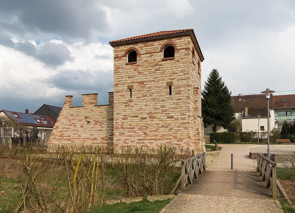
Photo: Amber16 · CC BY-SA 4.0 · Commons
27 km · fort · Saarland
Contiomagus
The Römerpark holds a square tower with arched windows and a tiled roof, joined to a short stretch of crenellated wall, set among gravel paths, meadow and a children's playground.


Straight-line distances.
Sources
Every fact on this page comes from the records below, each used under the licence noted.
| Source | Licence |
|---|---|
| Pleiades 109298 | CC BY |
| Wikidata Q66282597 | CC0 |
| Vici.org 10295 | CC BY-SA (text), CC0 (metadata) |
| OpenStreetMap way/25397079 | ODbL |
| Wikipedia (de) — Kastell Saarbrücken | CC BY-SA 4.0 |
| Pleiades — Halberg Mithraeum | licence not recorded |
| Wikidata — Halberg Mithraeum (Q26706748) | licence not recorded |
| Wikipedia (de) — Halberg (Saarland) | CC BY-SA 4.0 |
| Wikipedia (de) — Rundweg Historischer Halberg | CC BY-SA 4.0 |
| The New Mithraeum — Mithräum von Saarbrücken | licence not recorded |
| Tourismus Zentrale Saarland — Mithras-Heiligtum | licence not recorded |
| Tourismus Saarbrücken — "Historischer Halberg" trail | licence not recorded |