

What is there today
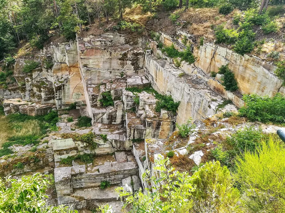
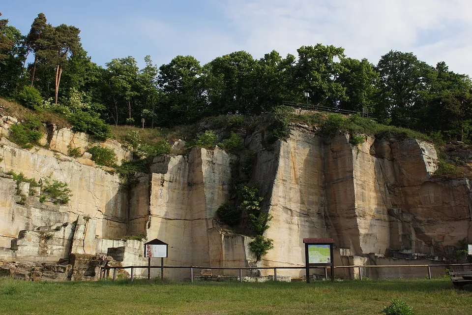
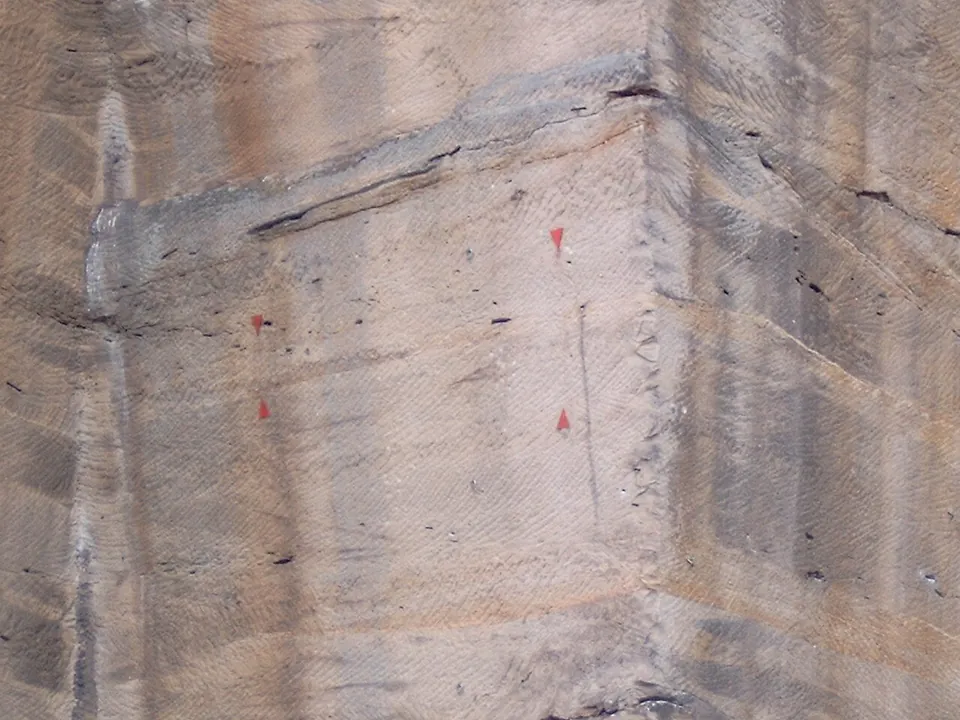
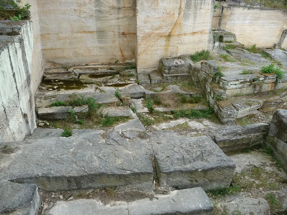
A half-round quarry cut into the hillside about 150 m above the town, cleared almost entirely of the rubble that once filled it (the owner, the Drachenfels-Club). The grooves left by the quarrymen’s hammers show the size of what they took out: blocks 1.2 to 3 m long, 0.6 to 1.4 m wide and about 0.6 m high. The channel down which the blocks were moved into the valley on runners and rollers is still easy to make out (de.wikipedia).
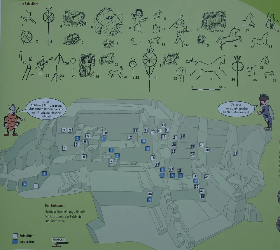
Because the lower levels were filled with waste as work went on, the tool marks, inscriptions and drawings there survived very well (de.wikipedia). On the faces are horses, standards and human heads (the owner), along with wheels and hooked crosses that may be religious symbols or simply work marks (de.wikipedia). The owner thinks the legionaries and quarrymen probably cut them to mark out their working areas. A board at the quarry maps the positions of the rock pictures and inscriptions. Not everything cut into the rock is Roman: names and dates from the 20th century are carved into some faces, and a memorial niche is cut into the cliff (Commons photographs; OpenStreetMap maps a memorial beside the quarry).
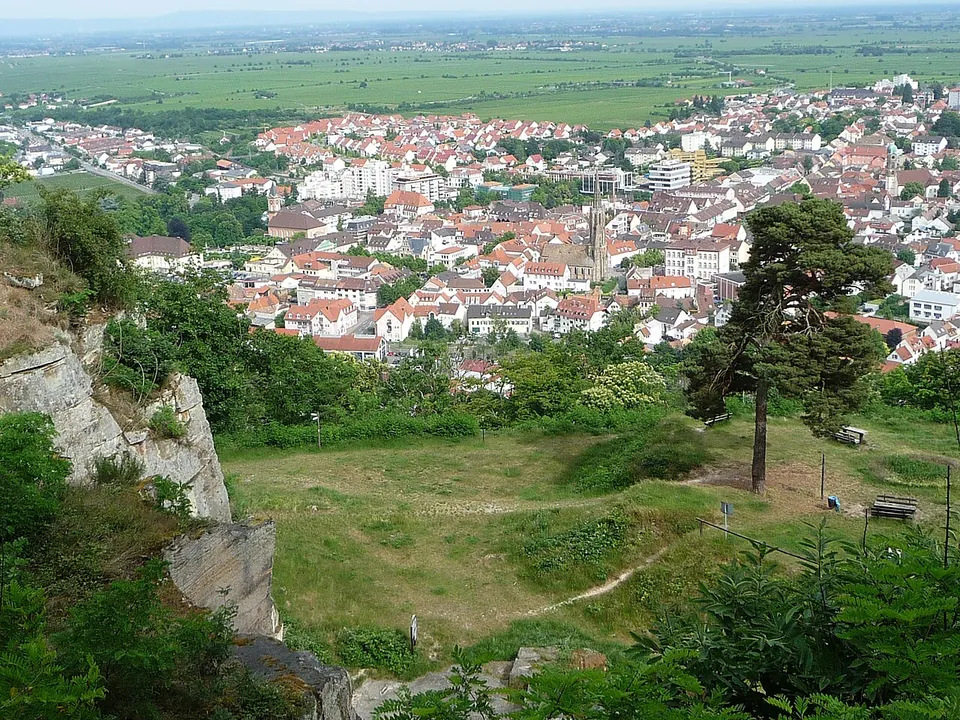
A wooden shelter stands on the platform, with a wide view over the town and south and east across the Rhine plain (the owner).
Is it worth the trip?
If you are in Bad Dürkheim, yes. There is no ticket, nothing on record closes it, and it lies about 150 m above the town, so the walk up is a modest climb. What you see is the Roman work itself: rock faces as the quarrymen left them, with the marks of their tools and the signs they cut.
Be clear about what it is, though. This is a quarry, so there are cliffs, ledges and cut steps and no buildings, and the inscriptions and drawings are scratched marks that take the board and some patience to find. On its own it does not justify a long journey. It fits into a walk with the Heidenmauer, the Celtic ring wall directly above it, or a half day with the Villa rustica of Weilberg, about 2.6 km away.
Getting there
The quarry lies in woodland on the north-west edge of Bad Dürkheim (de.wikipedia), and you reach it on foot, either via the Kastaniendelle or via the Schaeferwarte (the owner). Bad Dürkheim station is about 900 m away in a straight line, the nearest bus stop (“Bad Dürkheim, Bau 2000”) about 180 m, street parking in the town about 330 m and the nearest car parks about 430 m; the last stretch is on unsurfaced footpaths (OpenStreetMap).
There is no ticket: the owner publishes no charge and no opening hours, and OpenStreetMap tags the site as open at all hours (drachenfelsclub.de, read 31 October 2026).
Visiting details
- Opening hours
- Open woodland ground with no gate on record. OpenStreetMap tags it open at all hours; the owner publishes no opening hours.
- Tickets
- No charge is published. The owner's page names no ticket or fee, and OpenStreetMap tags none.
- Parking
- No car park is mapped at the quarry. The nearest mapped parking is street parking in Bad Dürkheim about 330 m away in a straight line, with car parks from about 430 m; the last stretch is an uphill footpath.
Before you go
- The approach is on unsurfaced woodland paths, uphill from the town.
Hours and prices checked 31 October 2026 on the operator's own site. Confirm before travelling.
History
The quarry was worked around AD 200 by the 22nd Legion, whose base at Mainz lay a good 60 km away (de.wikipedia); the owner’s page dates the work to about AD 220. The stone is a whitish quartzite-like sandstone, cut out by several work gangs on levels one above another. Each block was freed on two sides with hammers and then loosened from below, and both kinds of tool turned up in the excavations. Now and then the men also shaped capitals and round stones, perhaps for columns (de.wikipedia).
The inscriptions name the people. One is a dedication to Jupiter and the Genius of the emperor Septimius Severus by a detachment of the 22nd Legion; others name soldiers of the legion such as Natalis and Vogellinus Perpetuus, or commemorate the standard-bearer Dativus Proculus. Work inscriptions assign a working face to a named man, one of them on 8 August (de.wikipedia).
In the Middle Ages the quarry was wrongly linked with the Burgundians and the Nibelungenlied, and early in the 20th century local people called it the “Krummholzer Stuhl” (de.wikipedia). Excavations took place in 1884, 1893/94, 1916/17, 1934/35 and 1937–1939. In the Nazi period there were attempts to prove by excavation that it had been an ancient Germanic cult site, taken up from 1937 by the Ahnenerbe, a research body close to the SS. They failed: the many sun-wheel signs found here allowed a Germanic reading in principle, but every one of them had demonstrably been cut into rock already worked in Roman times. Excavations in the second half of the 20th century added what is known of Roman quarrying technique and brought more inscriptions to light (de.wikipedia).
The site belongs to the Drachenfels-Club, the amenity society (Verschönerungsverein) of Bad Dürkheim and its surroundings (the owner), and the state’s list of cultural monuments records it as an individual monument (de.wikipedia). Directly above it lies the Heidenmauer, a fortified Celtic settlement of 26 hectares from the late Hallstatt period (de.wikipedia).
More photographs



Nearby
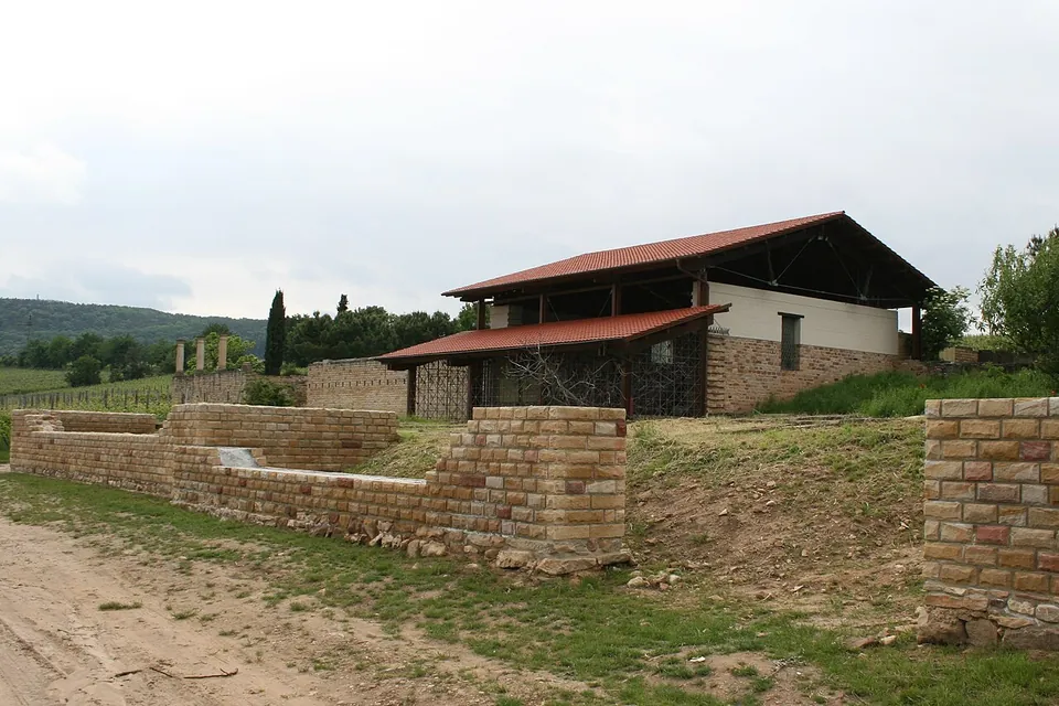
Photo: Haselburg-müller · CC BY-SA 3.0 · Commons
3 km · villa · Rhineland-Palatinate
Villa rustica of Weilberg
What you walk round is an open-air museum, and much of it is reconstruction on original foundations.
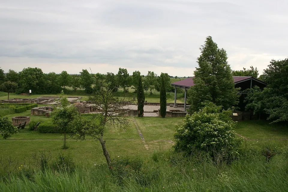
Photo: Haselburg-müller · CC BY-SA 3.0 · Commons
3 km · villa · Rhineland-Palatinate
Villa rustica of Wachenheim
The site covers about 1.5 hectares (de.wikipedia; the operator gives 15,000 m², the same figure).
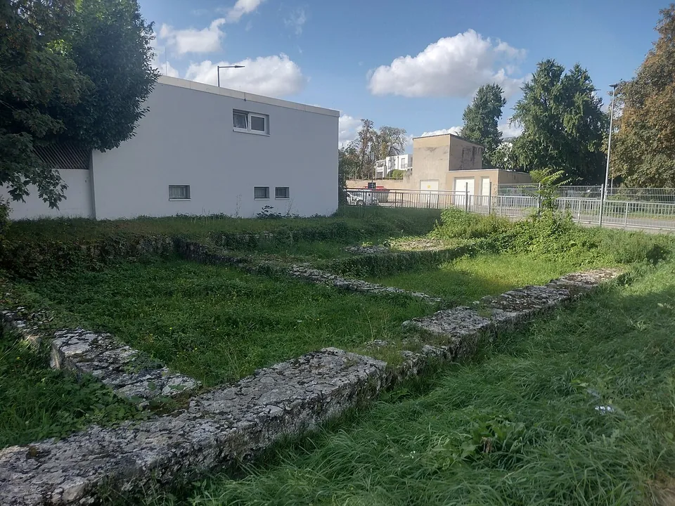
Photo: Heiko Fischer · CC BY-SA 4.0 · Commons
31 km · fort · Rhineland-Palatinate
Kastell Alzey
The fort was large, a slightly skewed square of 163.5 by 159 m covering 2.6 hectares, with walls up to 3 m thick and, probably, fourteen towers around 12 m high (de.wikipedia; regionalgeschichte.net gives the walls as up to 3.5 m thick).


Straight-line distances.
Sources
Every fact on this page comes from the records below, each used under the licence noted.
| Source | Licence |
|---|---|
| Wikidata Q883114 | CC0 |
| OpenStreetMap way/1462245258 | ODbL |
| Wikipedia (de) — Kriemhildenstuhl | CC BY-SA 4.0 |
| Wikipedia (en) — Kriemhildenstuhl | CC BY-SA 4.0 |
| Drachenfels-Club — Kriemhildenstuhl (the site's owner) | licence not recorded |