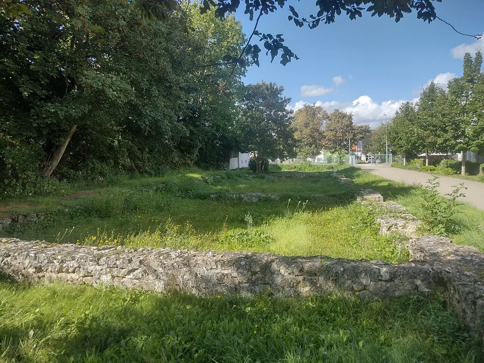
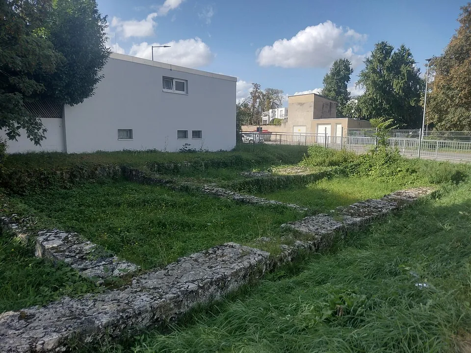
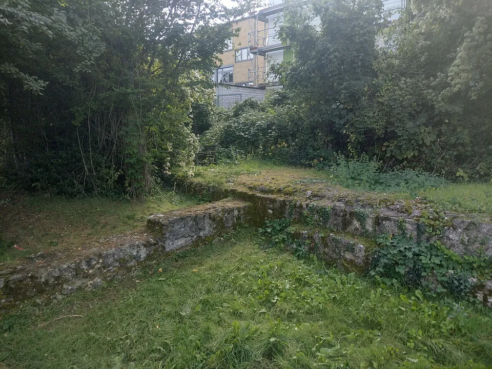


Kastell Alzey is the late Roman fort the emperor Valentinian I probably had built between 367 and 370 in what is now Alzey in Rheinhessen. What you can see today is modest: the low foundation walls of a row of barrack rooms that stood against its west wall, laid out in a lawn beside a school and a car park.
What is there today
The fort was large, a slightly skewed square of 163.5 by 159 m covering 2.6 hectares, with walls up to 3 m thick and, probably, fourteen towers around 12 m high (de.wikipedia; regionalgeschichte.net gives the walls as up to 3.5 m thick). Almost none of that stands. The ruin still marked the town’s skyline in engravings of about 1620; after that the townspeople took it apart for building stone, almost completely (de.wikipedia).
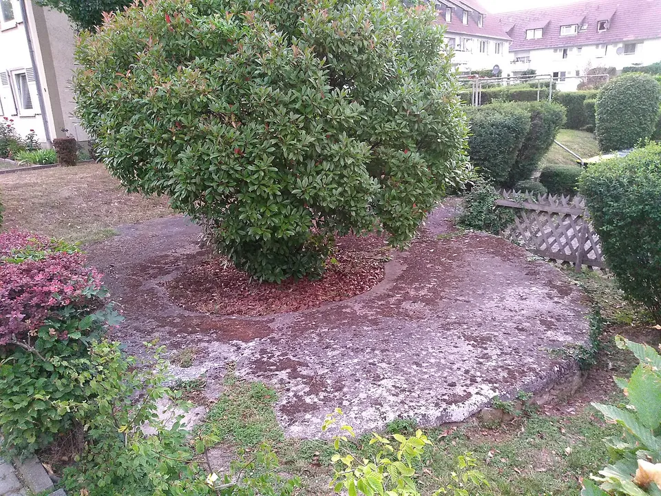
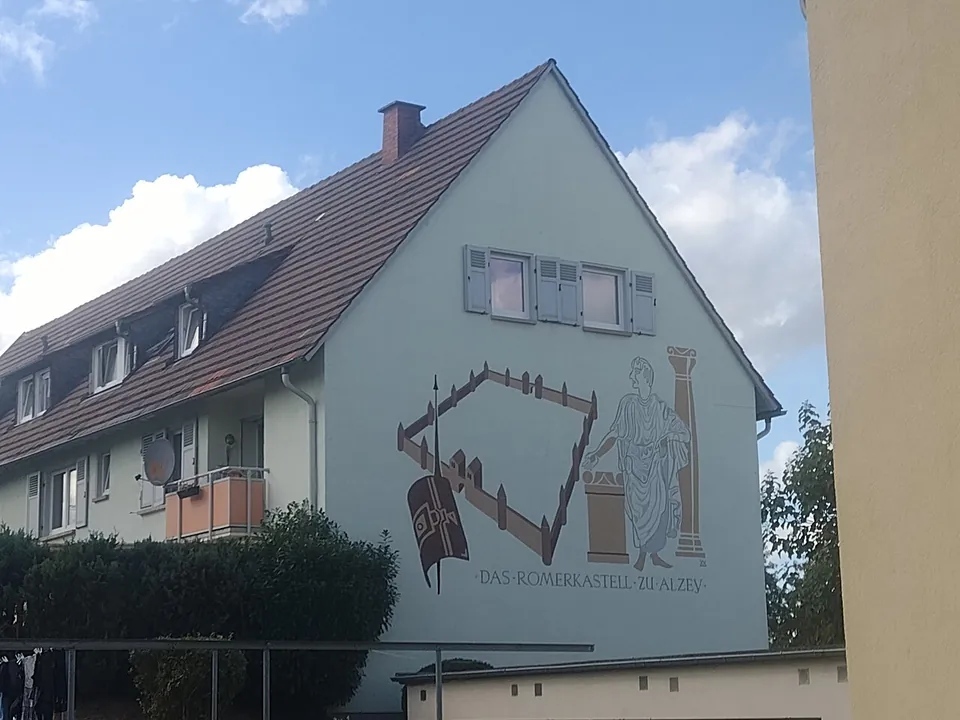
The part laid out for visitors is a stretch of the barracks on the west side: the foundations of rooms built with their backs against the fort wall, which de.wikipedia and regionalgeschichte.net both describe as still visible. Photographs show knee-high walls of pale rubble stone tracing a row of rectangular rooms in the grass. The rooms averaged about 8 by 5 m, and one room of the west barracks had a simple hypocaust heating system (de.wikipedia). A painted house gable in the town shows the plan of the fort, and the remains of one corner tower lie in a garden on Dr.-Georg-Durst-Straße (Commons file description, citing the state monument list).
The fort’s best finds are in the town museum. Its Steinhalle, opened in March 2023, displays the town’s Roman stone monuments, at their core the large sculptures Friedrich Behn found in the fort area in 1929 and 1931: altars and dedication stones, among them remains of nine Jupiter columns and altars to Apollo Grannus and Sirona, along with architectural pieces. The museum also shows the Nymph altar of 22 November 223 and a model of the fort (the city’s museum page). That altar was found built into the fort wall as reused stone, and it is the first inscription to name the Roman settlement (de.wikipedia).
Is it worth the trip?
Not on its own. The open-air remains are a ten-minute look: a pattern of low walls, no standing fort wall, nothing to climb. If you are in Alzey, or driving between Mainz and Worms, it is worth combining with the museum, which is free and holds the stone monuments found in the fort area. Together they give a fair picture of a late Roman frontier fort; the foundations alone do not.
Getting there
Alzey lies about 30 km south-west of Mainz and 22 km north-west of Worms, in a straight line (de.wikipedia). The remains are near the Gymnasium am Römerkastell (de.wikipedia), about 40 m from the ZOB Gymnasium bus stops, and a free public car park is mapped about 75 m away (OpenStreetMap); the city’s own event listings name a Parkplatz Römerkastell at Jean-Braun-Straße / Frankenstraße.
The remains are freely accessible (de.wikipedia), with no ticket; no hours are published for them. The museum (Antoniterstraße 41) is free and opens Monday to Friday 10.00–12.30 and 13.30–16.30, and on Saturdays, Sundays and public holidays 10.00–12.00 and 14.00–16.30 (museum-alzey.de, read 1 November 2026). Until 31 December 2026 it also shows a special exhibition, “Giganten im Garten”, on the people of Alzey discovering their town’s antiquity between 1900 and 1914.
Visiting details
- Opening hours
- The excavated barrack foundations by the west wall are open ground with no published hours. The town museum (Antoniterstraße 41), whose Steinhalle holds the Roman stone monuments found in the fort area, opens Monday to Friday 10.00–12.30 and 13.30–16.30, and on Saturdays, Sundays and public holidays 10.00–12.00 and 14.00–16.30.
- Tickets
- Free, both the fort remains and the museum.
- Parking
- A free public car park is mapped about 75 m from the remains (OSM way/30983551); the city's event listings name a Parkplatz Römerkastell at Jean-Braun-Straße / Frankenstraße. The ZOB Gymnasium bus stops are about 40 m away.
Before you go
- Only one short stretch of the fort can be seen, the foundations of the barrack rooms against the west wall; the townspeople quarried almost all of the rest away after about 1620. The remains of a corner tower lie in a garden on Dr.-Georg-Durst-Straße.
Hours and prices checked 1 November 2026 on the operator's own site. Confirm before travelling.
History
The Romans found a small Celtic settlement here around 50 BC, and a Roman village grew up in its place. An altar of AD 223 names it the vicus Altiaiensium, and the Alamanni burned it in 352/353 (de.wikipedia; regionalgeschichte.net). The fort, called Alteium, was built over part of its ruins as one of the last Roman reinforcements of the Rhine frontier. Two coins of a series struck between 367 and 375 lay under its structures, and Valentinian I is recorded in Alzey in 370 and 373, from laws he issued there. It may have guarded a crossing of the Selz and a road junction, or served mainly as temporary quarters for units of the mobile field army (de.wikipedia).
Its regular garrison stayed only a few years and may have left as early as 383. The fort was destroyed in the early 5th century, probably when Germanic peoples crossed the Rhine in 406/407. East Germanic allies of Rome, probably Burgundians, then moved in, building timber-framed houses across the open courtyard and turning the headquarters into a three-aisled hall; that phase ended in fire some time after 425. de.wikipedia ties these years to the Nibelungenlied and its minstrel Volker von Alzey, and the archaeologist Jürgen Oldenstein has suggested Volker could have been the fort’s Burgundian commander. Around 450 Alamannic federates occupied the fort once more. At some point - the 440s or as late as the 6th century - the old headquarters became a simple church, the forerunner of the St. Georgskirche that stood until about 1800 (de.wikipedia).
In 1902 Karl Schuhmacher and Jakob Curschmann recognised part of the wall and the foundations of a round tower at the south-west corner. The nursery owner Jean Braun, who then owned the ground and later helped found the town museum, went on to find more of the west side, the west gate and two well-preserved rooms of a barrack block on the south wall. In 1925 Wilhelm Unverzagt identified the burnt layer that ends the second phase; the late Roman pottery he published from Alzey is still used to date other sites of the period (de.wikipedia).
More photographs


Nearby
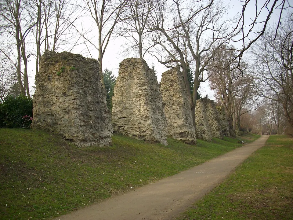
Photo: Nixnubix · CC BY-SA 4.0 · Commons
29 km · aqueduct · Rhineland-Palatinate
Römersteine
Along the path stands a line of rough masonry stumps, the cores of the piers that once carried the water channel across the valley.
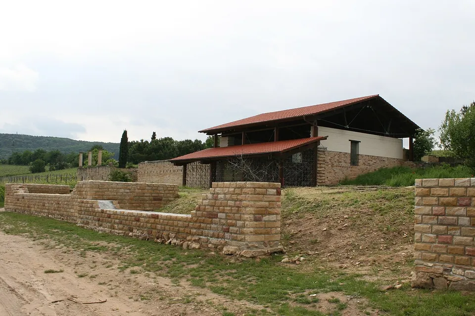
Photo: Haselburg-müller · CC BY-SA 3.0 · Commons
29 km · villa · Rhineland-Palatinate
Villa rustica of Weilberg
What you walk round is an open-air museum, and much of it is reconstruction on original foundations.
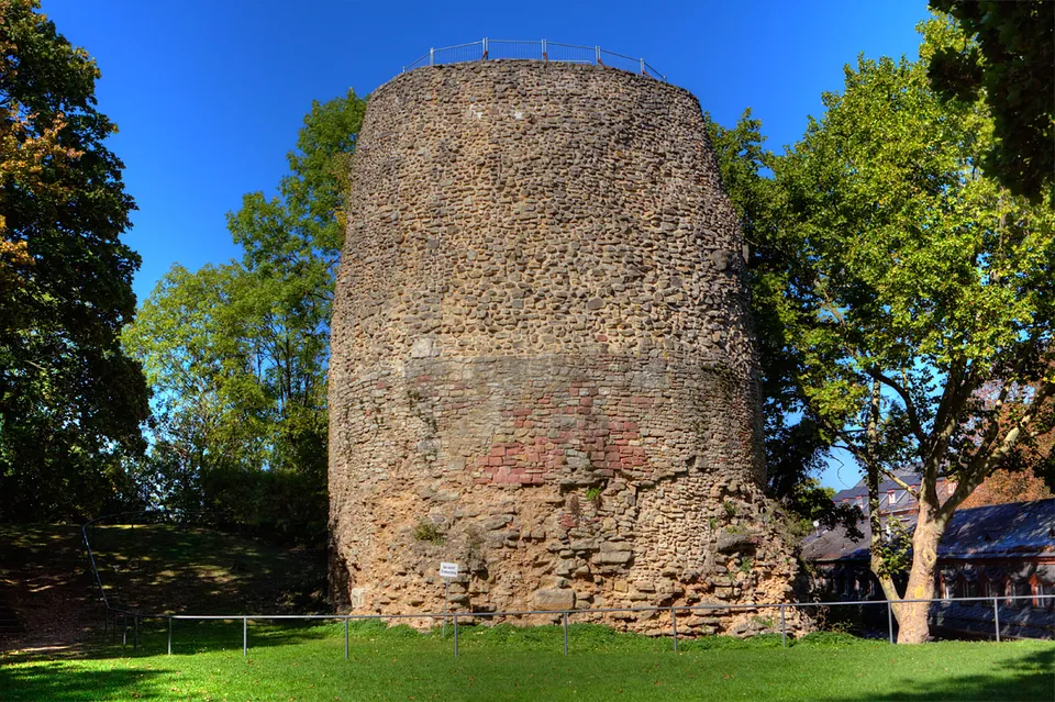
Photo: Martin Bahmann · CC BY-SA 3.0 · Commons
30 km · tomb · Rhineland-Palatinate
Drususstein
What you see is a slightly tapering cylinder of Roman cast masonry, mortar and rubble with larger dressed blocks set into it, standing on a square base of which only part is visible.


Straight-line distances.
Sources
Every fact on this page comes from the records below, each used under the licence noted.
| Source | Licence |
|---|---|
| Pleiades 108736 | CC BY |
| Wikidata Q1735330 | CC0 |
| Vici.org 8225 | CC BY-SA (text), CC0 (metadata) |
| OpenStreetMap way/30983550 | ODbL |
| Wikipedia (de) — Kastell Alzey | CC BY-SA 4.0 |
| Wikipedia (en) — Castra Alteium | CC BY-SA 4.0 |
| regionalgeschichte.net (Institut für Geschichtliche Landeskunde, Mainz) — Das Alzeyer Römerkastell | licence not recorded |
| Museum Alzey — opening hours and admission | licence not recorded |
| Stadt Alzey — Museum der Stadt Alzey and its Steinhalle | licence not recorded |
| Stadt Alzey — Römertag 2023 flyer (Parkplatz Römerkastell) | licence not recorded |