

What is there today
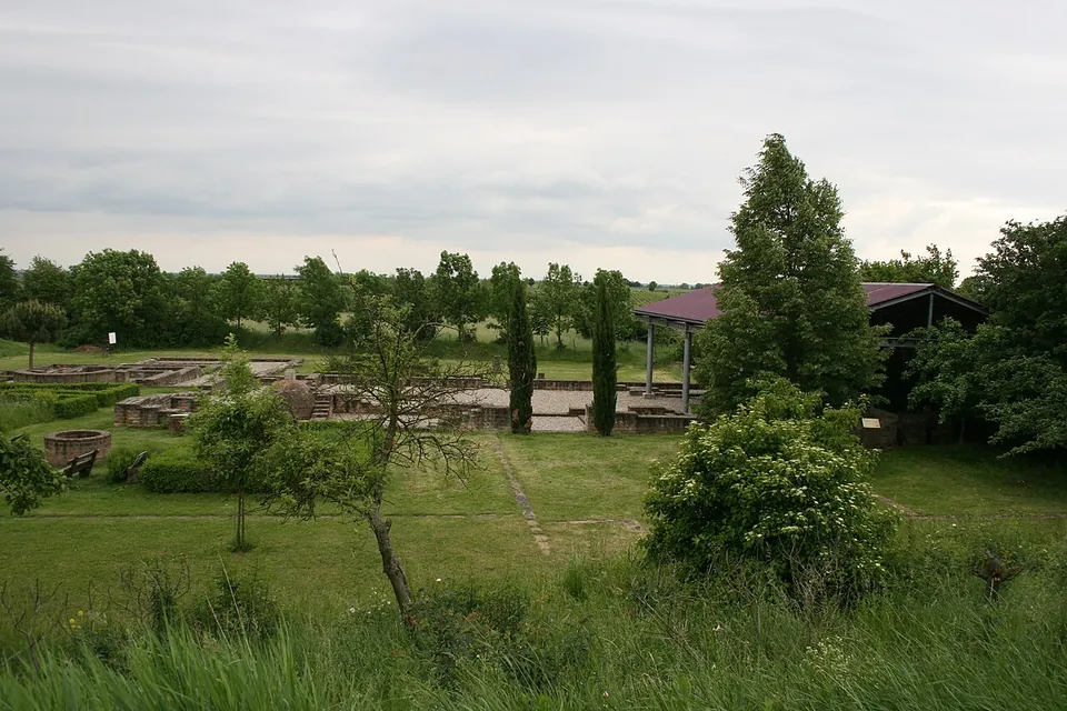
The site covers about 1.5 hectares (de.wikipedia; the operator gives 15,000 m², the same figure). What you see are the excavated walls, restored and in places rebuilt, standing low across a lawn, so the estate reads mostly as a ground plan. The manor house dominates it: its front, with a portico on three sides and wings at each end, ran to 65 m (de.wikipedia).
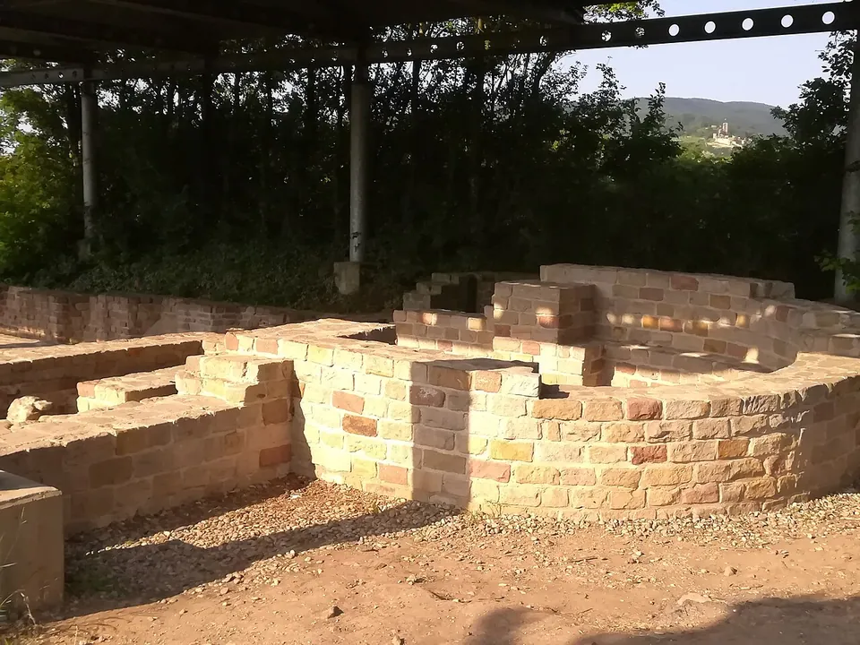
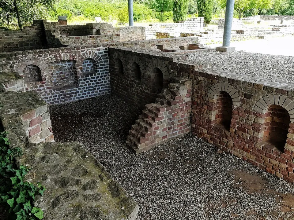
A modern roof covers the western end of the house. Under it are a cellar of 12 × 4 m with six window niches and nine round-arched wall niches, and behind it a bath suite, probably the owner’s, rebuilt in the form of its earlier phase (de.wikipedia). The operator calls the cellar one of the largest Roman cellars along the Rhine. A second bath, thought to be the servants’, was added to the east wing in a later building phase (de.wikipedia).
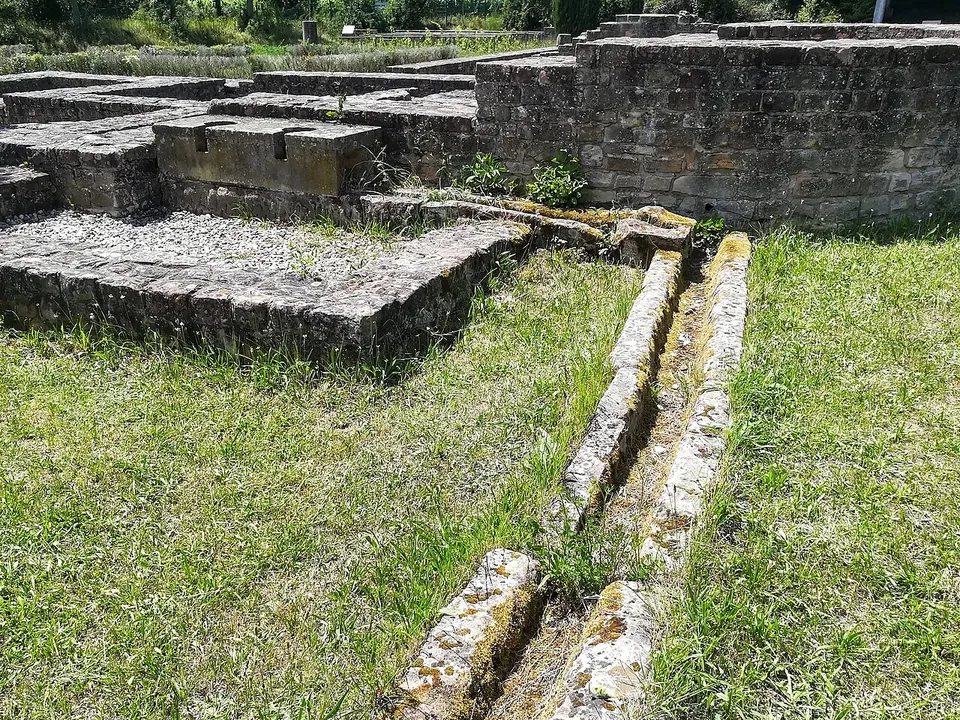
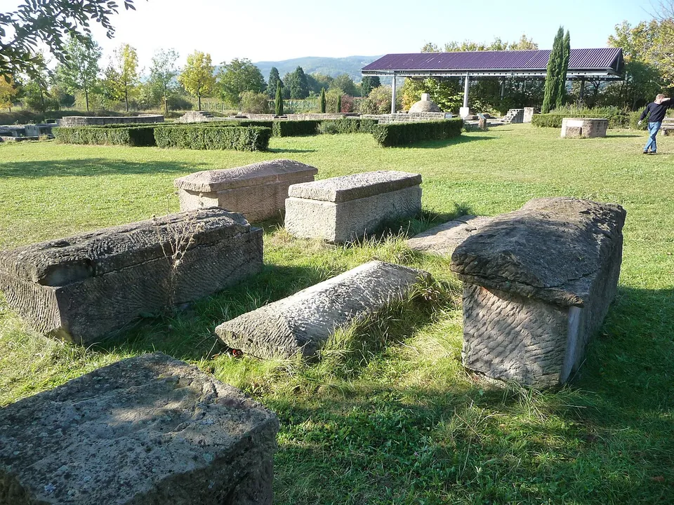
East and north of the house are the farm buildings: a large building that served mostly as a stable, with a small heated living area in its northern part, and a storage building on top of an older smokehouse and a grain-drying kiln. Paving slabs mark where further annexes to the house and a threshing floor stood, and a well, an oven and a lime kiln have been reconstructed between the buildings. Stone sarcophagi are displayed on the grounds (de.wikipedia). Finds from the estate and its cemetery are shown at the Historisches Museum der Pfalz in Speyer (the operator).
Is it worth the trip?
Yes, if you are on the German Wine Route anyway: it is right beside the main road about 2.5 km from Bad Dürkheim, there is free parking at the fence, and its point is completeness. Besides the manor house, almost every farm building of the estate can be made out on the ground, which is what the operator singles out about it. Don’t expect standing rooms. Apart from the roofed cellar, the walls are low restored courses, and much of what is visible has been rebuilt on the excavated lines. The operator’s guided tour takes about an hour, a fair measure of the site; if you want someone to explain it, time the visit for one of those tours.
Getting there
The villa is on the Bundesstraße 271 between Wachenheim and Friedelsheim, with car parks on both sides of the road (de.wikipedia); OpenStreetMap maps them about 90 m from the villa, one of them tagged free of charge. No bus stop or railway station is mapped nearby, so come by car or by bicycle.
Neither the Förderkreis Villa rustica Wachenheim, the association that looks after the site, nor the town of Wachenheim, which owns it, publishes opening hours or an admission charge, and the grounds are fenced. What the operator does publish is its guided tours: about an hour, starting at 16.00 at the main entrance, €5 per adult with group rates on request. In 2026 they run on set dates, about once a month, from April to November, the last of the year on 27 November (villa-rustica.com, read 30 October 2026).
Visiting details
- Opening hours
- No opening hours are published by the association that looks after the site or by the town of Wachenheim. The grounds are fenced.
- Tickets
- No admission charge is published. The only price the operator gives is for its guided tours, €5 per adult (special rates for groups), about an hour, at 16.00 from the main entrance on set dates from April to November.
- Parking
- Free car parks on both sides of the main road beside the site, about 90 m from the villa (OSM way/1095554316, fee=no, and way/1095554315).
Before you go
- No bus stop or railway station is mapped near the site; it is easiest by car or bicycle.
Hours and prices checked 30 October 2026 on the operator's own site. Confirm before travelling.
History
The earliest finds from the site go back to the Neolithic. Roman settlement began around AD 20 with timber buildings, and the estate was enlarged step by step (de.wikipedia). The operator links the finds of this first phase to a Germanic population that had moved in from Bohemia or the Elbe-Saale region. Published dates for the stone buildings differ: the operator’s pages put the start of building in stone in the early 2nd century in one place and in the 3rd in another, and the state the restored walls show is dated to the 3rd century (de.wikipedia) or to the early 4th (the operator).
In the 5th century the main house burned down. The estate was still lived in on a reduced scale well into that century, as burials laid in the area of the storage building show (de.wikipedia); the operator dates the end of settlement to the 6th century, after almost 480 years.
The remains came to light in 1980 during the reorganisation of the vineyards. The land was taken out of cultivation and bought by the public authorities (de.wikipedia), and over almost ten years archaeologists from the state monuments office in Speyer, led by Helmut Bernhard, excavated nearly the whole farmyard (the operator). In 1997 building work uncovered the estate’s cemetery about 500 m to the south; the part excavated held 22 inhumation and 46 cremation graves dating from the late 3rd to the early 5th century (de.wikipedia; the operator for the distance). Since 1991 the Förderkreis has cared for the site, and the town plans to set up three sandstone columns with a stepped platform in front of the portico, modelled on column fragments found in the excavation; the heritage authority has approved the work (the operator).
More photographs


Nearby
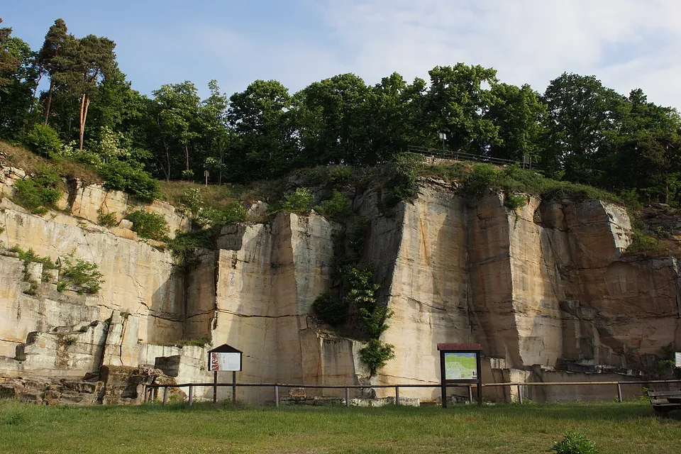
Photo: Maik Riede · CC BY-SA 4.0 · Commons
3 km · quarry · Rhineland-Palatinate
Kriemhildenstuhl
A half-round quarry cut into the hillside about 150 m above the town, cleared almost entirely of the rubble that once filled it (the owner, the Drachenfels-Club).
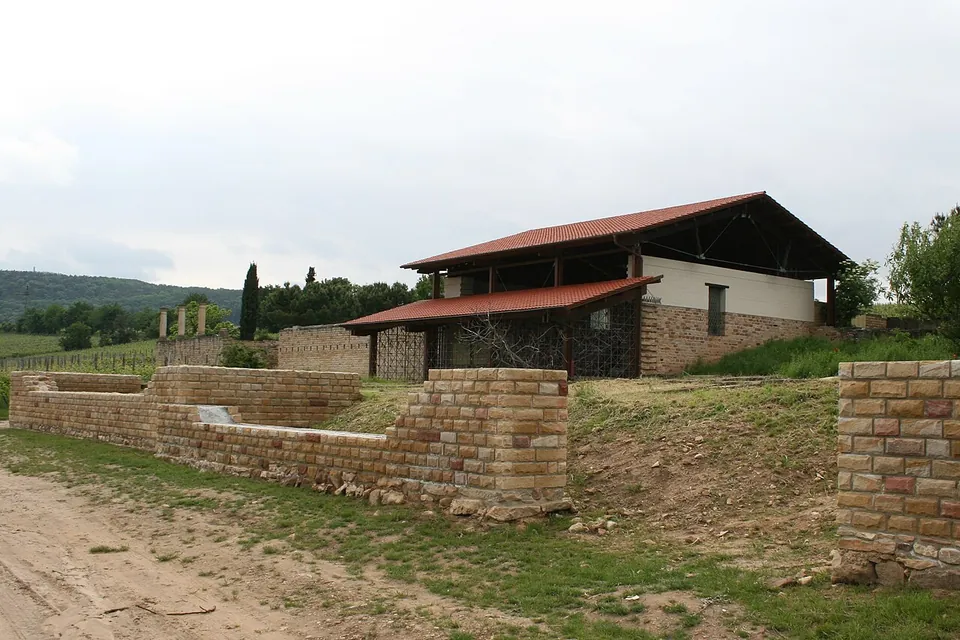
Photo: Haselburg-müller · CC BY-SA 3.0 · Commons
4 km · villa · Rhineland-Palatinate
Villa rustica of Weilberg
What you walk round is an open-air museum, and much of it is reconstruction on original foundations.
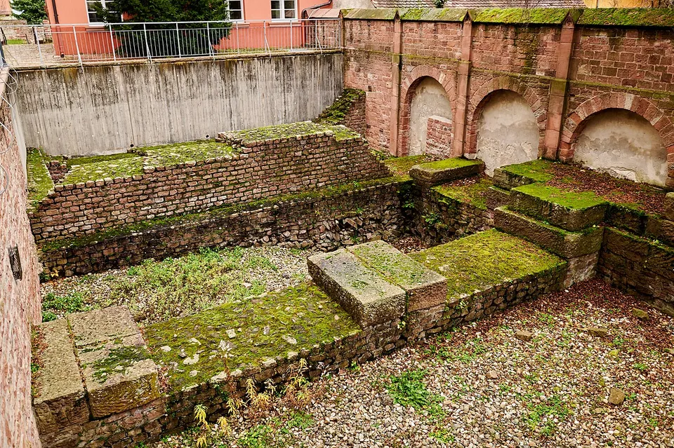
Photo: Tilman2007 · CC BY-SA 4.0 · Commons
30 km · city · Baden-Württemberg
Lopodunum
The Roman town lies under the medieval one, so what you see is a series of conserved fragments.


Straight-line distances.
Sources
Every fact on this page comes from the records below, each used under the licence noted.
| Source | Licence |
|---|---|
| Wikidata Q2525967 | CC0 |
| OpenStreetMap way/36779584 | ODbL |
| Wikipedia (de) — Villa rustica (Wachenheim) | CC BY-SA 4.0 |
| Förderkreis Villa rustica Wachenheim (the association that looks after the site) — Kulturdenkmal Villa rustica Wachenheim | licence not recorded |
| Förderkreis Villa rustica Wachenheim — guided tours 2026 | licence not recorded |
| Förderkreis Villa rustica Wachenheim — English and French page | licence not recorded |
| Förderkreis Villa rustica Wachenheim — contact and information | licence not recorded |