

What is there today
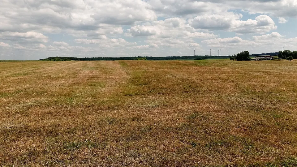
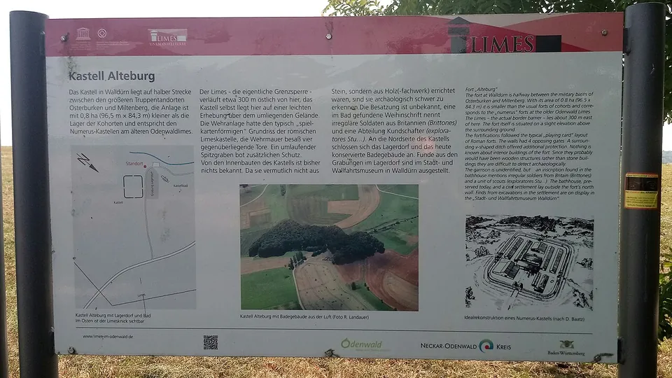
Be clear about this before you go: the fort itself has gone. It lies under a meadow on a low rise, and apart from the bath nothing of the ancient buildings is visible (de.wikipedia; OpenStreetMap notes that no remains can be made out on the ground). An information board on the fort, with its plan and an aerial photograph, is mapped about 70 m from the fort point (OpenStreetMap).
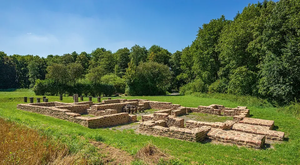
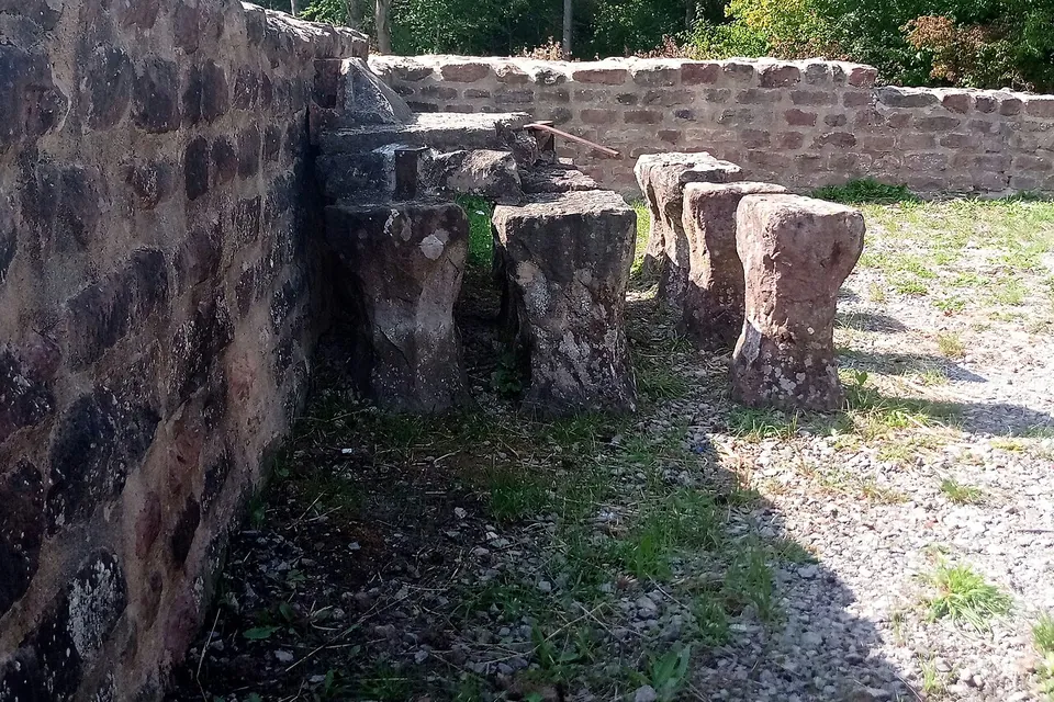
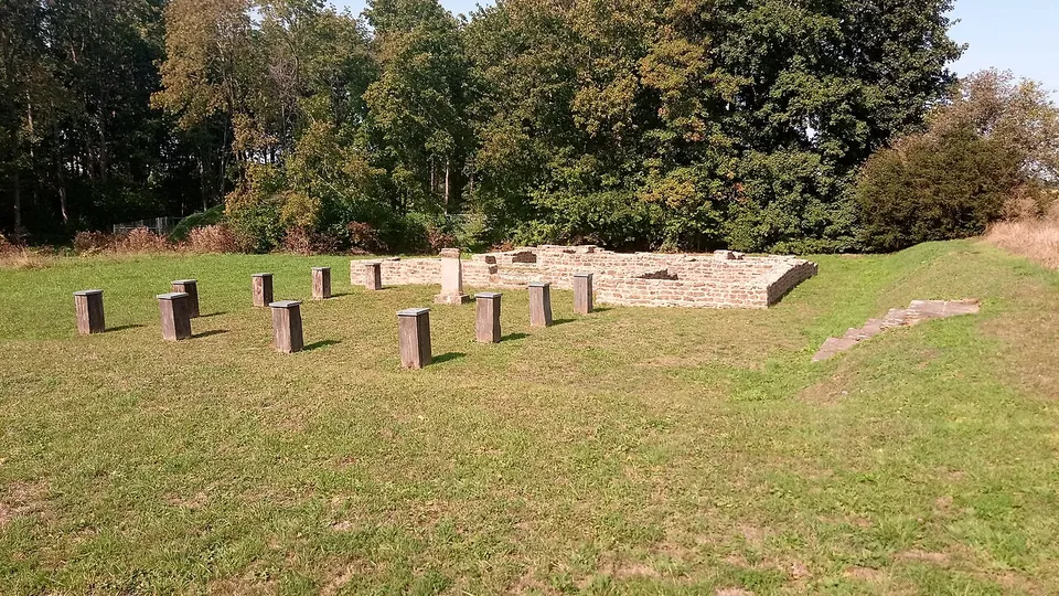
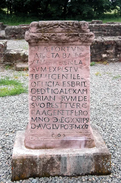
The bath, about 140 m from the fort site, is the thing to see. Its foundation walls were excavated again in 1972/73 and then conserved for the public (de.wikipedia), and the town says the whole complex can be followed in its basic layout: a row of rooms running from the cold bath with its plunge pool through the warm room to the hot room (de.wikipedia), with pillars of the underfloor heating (hypocaust) standing in places. Short timber posts mark where the wooden entrance hall stood (de.wikipedia). A copy of the bath’s dedication altar to Fortuna, dated 232, stands at the site, and boards explain the bath and this stretch of the Limes.
The camp village (vicus) spread out around the fort. A stretch of it between the fort and the bath was excavated in 1982/83, finding cellars, wells and two hoards of metalwork, but nothing of the village is visible today (de.wikipedia).
Is it worth the trip?
For most travellers it is a short stop rather than a destination. The bath survives only as low, restored foundation walls and the fort is an empty field, so allow half an hour. It is worth it if you are following the Limes through the Odenwald or are already in Walldürn: the plan of a Roman bath can be followed room by room, it costs nothing and it is open all year. The inscription found here is one of the most discussed on the Upper German Limes (de.wikipedia), but what stands at the bath is a copy.
Getting there
The site lies about 1.5 km south-east of Walldürn, reached from the L577 towards Waldstetten, with a free car park about 90 m from the fort point (the town of Walldürn; OpenStreetMap). No bus stop is mapped nearby, so come by car or bicycle, or walk out from the town.
The bath is open-air and accessible all year, and entry is free. The town’s tourist information books a guided tour of the bath and the fort area, about an hour, for €2.50 a person (wallduern.de, read 31 October 2026). Finds from the 1972/73 excavation are in the Roman department of the Stadt- und Wallfahrtsmuseum in Walldürn, with further material in the Badisches Landesmuseum in Karlsruhe (de.wikipedia), but the town lists its museum as currently closed.
The Limes ran about 300 m east of the fort, where it turned sharply south at watchtower Wp 7/39 (de.wikipedia). North of the town, a 2.2 km Limes trail passes conserved watchtower foundations, one with an annexe, and a reconstructed palisade; it has its own car park (the town of Walldürn).
Visiting details
- Opening hours
- Open-air and accessible all year (the Römerbad, the conserved fort bath; the fort itself is a meadow).
- Tickets
- Free. A guided tour of the bath and the fort area, about 60 minutes, costs €2.50 a person and can be booked all year through the Walldürn tourist information.
- Parking
- Free car park about 90 m from the fort point (OSM way/297599267, fee=no); the town lists parking on site, reached from the L577 between Walldürn and Waldstetten.
Before you go
- No bus stop or railway station is mapped near the site; it needs a car, a bicycle or a walk of about 1.5 km from the town.
- The Stadt- und Wallfahrtsmuseum in Walldürn, which shows finds from the 1972/73 excavation in its Roman department, is listed by the town as currently closed.
Hours and prices checked 31 October 2026 on the operator's own site. Confirm before travelling.
History
The fort stood on the outer Limes, which older research dated to about 155; newer tree-ring dates from Osterburken and Murrhardt suggest the line was built shortly after 161, though the question is still open (de.wikipedia). It measured 84.3 by 96.5 m, about 0.8 hectares, with a stone wall, a gate on each side and a double ditch in front; the buildings inside were of timber and clay (de.wikipedia). A fort that size could house only one unit, as the archaeologist Dietwulf Baatz noted. The dedication of 232 names a scouting unit, the exploratores Stu…, whose full name is lost, and Britons; Baatz thought only the scouts were stationed here (de.wikipedia).
The first bath was built in the mid-2nd century with tiles from the brickworks of the 22nd Legion, repaired around 185, and in use until after 200, when it probably burnt down. Its successor was inaugurated on 13 August 232, with an altar to Fortuna that says the old bath had collapsed with age. It too ended in a fire (de.wikipedia).
The latest coin from the site is of the emperor Gallienus (253–260). The frontier was given up in 259/260, and the fort was destroyed by fire (de.wikipedia).
In 1772 remains of the Limes and the fort could still be seen above ground. The fort and the bath were excavated in 1896 and 1897 under Wilhelm Conrady, with funds from the Reichs-Limeskommission. In the 1970s the town of Walldürn bought the fort area with the state monuments office, so that it became one of the first archaeological monuments in Baden-Württemberg in public hands. The fort, its village and the bath have been part of the Limes World Heritage Site since 2005 (de.wikipedia).
More photographs



Nearby
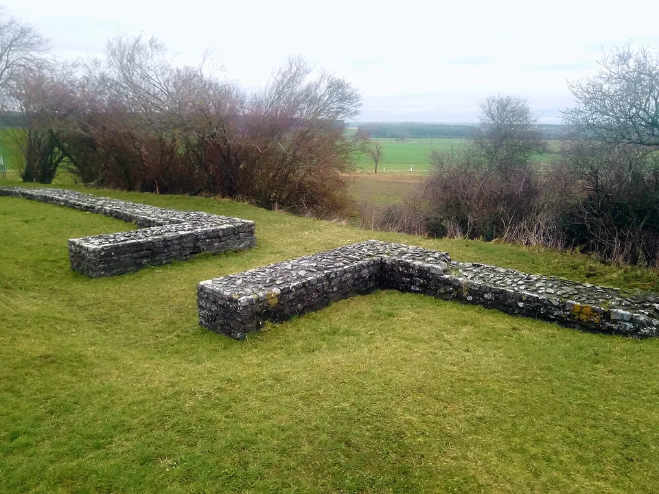
Photo: Granpar · CC BY-SA 4.0 · Commons
7 km · fort · Baden-Württemberg
Kleinkastell Haselburg
Kleinkastell Haselburg is the site of a small Roman fort on the Limes, the frontier of the empire, in open farmland between the villages of Reinhardsachsen and Gerolzahn near Walldürn.
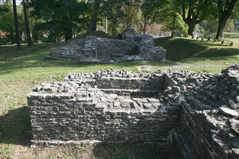
Photo: Haselburg-müller · CC BY-SA 3.0 · Commons
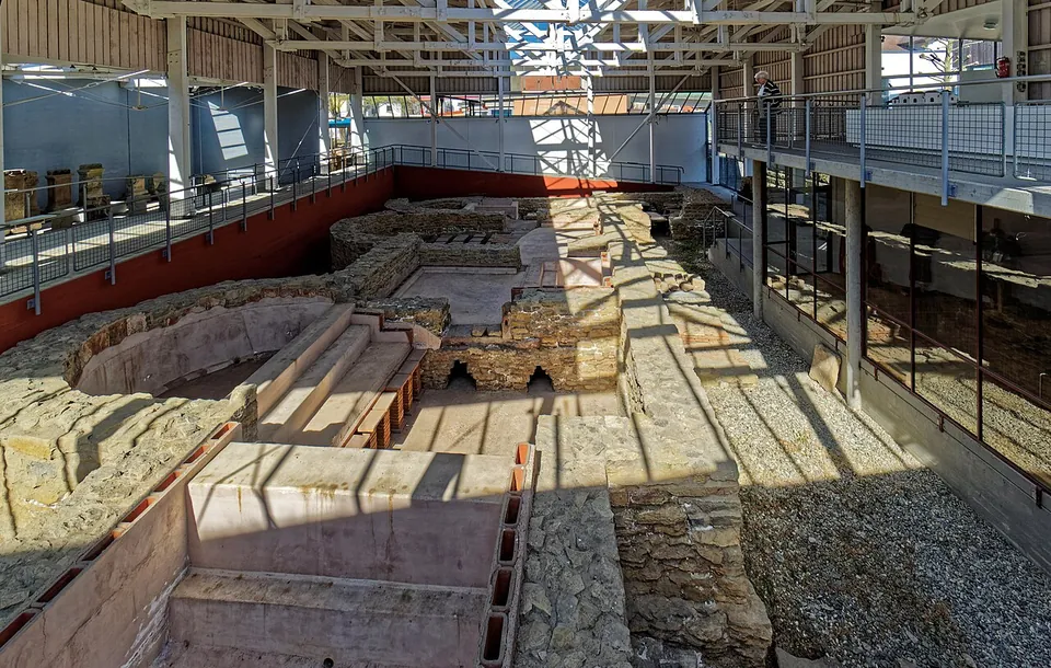
Photo: Holger Uwe Schmitt · CC BY-SA 4.0 · Commons
17 km · fort · Baden-Württemberg
Osterburken
The Roman places are spread across the town; the museum's own three-hour tour takes in the museum, the fort and the Limes tower.


Straight-line distances.
Sources
Every fact on this page comes from the records below, each used under the licence noted.
| Source | Licence |
|---|---|
| Pleiades 119043 | CC BY |
| Wikidata Q1735436 | CC0 |
| Vici.org 8159 | CC BY-SA (text), CC0 (metadata) |
| OpenStreetMap node/1447968026 | ODbL |
| Wikipedia (de) — Kastell Walldürn | CC BY-SA 4.0 |
| Wikidata — Roman fort Alteburg with camp village and bath (Q64812350, World Heritage component) | licence not recorded |
| Wikidata — Kastellbad Walldürn (Q101552215) | licence not recorded |
| Vici.org — Kastellbad Walldürn | licence not recorded |
| Vici.org — Lagerdorf Walldürn | licence not recorded |
| OpenStreetMap — Kastellbad Walldürn (way/85288303) | licence not recorded |
| Stadt Walldürn — Römer & Limes (the town's tourism page, hours and tours) | licence not recorded |