

What is there today
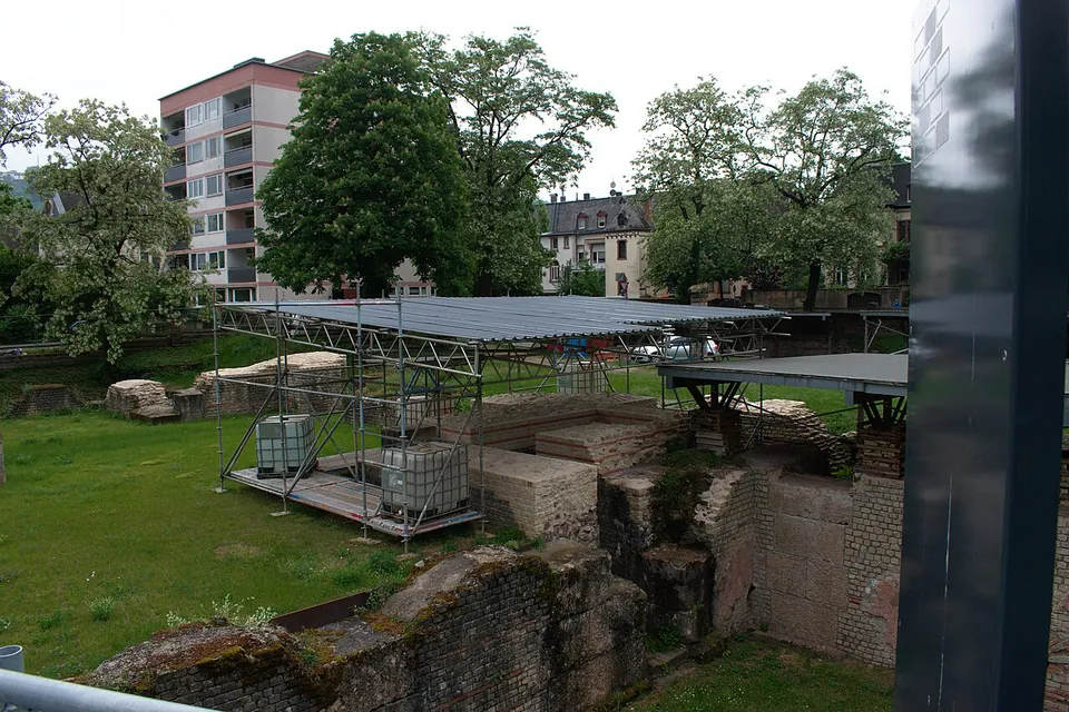
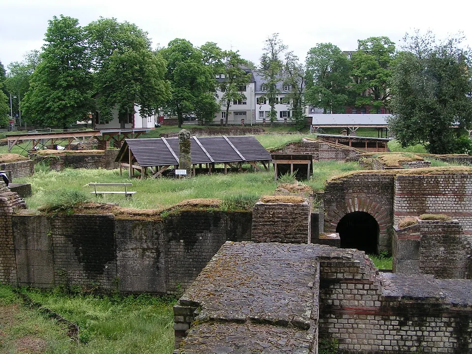
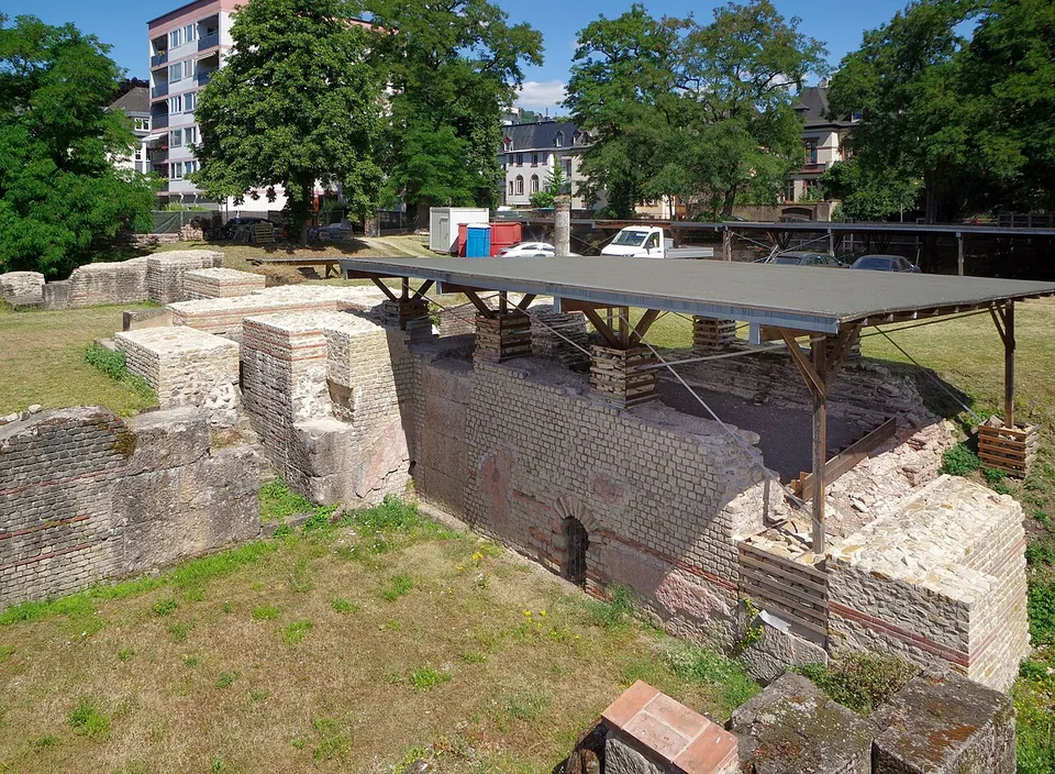
This is an excavated ground plan, not a standing building. Only the foundations and the underground service tunnels have survived, but because of that the drains, furnaces, pools and heating system can be followed here better than in Trier’s other two Roman baths (en.wikipedia). Walls of brick and stone rise in places above the foundations, some pierced by arched openings (Commons photographs), and the most endangered parts are covered by protective roofs (the operator).
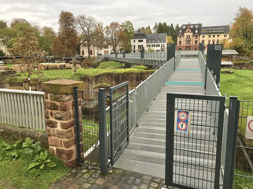
You see it all from a visitor walkway that runs over the site; the ground itself, with its original remains, some of them very fragile, may not be entered. Along the walkway nine stations explain the architecture and the lavish fittings of the baths, show with reconstructions how a Roman bath was used, and cover what happened to the site after antiquity and the restoration work now going on (the operator). The walkway is step-free (the operator).
Is it worth the trip?
Yes, as a short stop on a walk round Roman Trier, and it costs nothing. It lies about 340 m from the Roman bridge over the Moselle (OpenStreetMap), so the two go well together. What you get is the plan of a huge bath building and its service tunnels, laid out below you with explanations, rather than walls to stand under: in its day only the Baths of Trajan in Rome covered a larger area (de.wikipedia), but little of that size is visible at a glance. For standing Roman bath walls, the east front of the Imperial Baths is the stop to make.
Getting there
The baths are at Südallee 48 in Trier (the operator). The bus stop “Barbarathermen” is served by lines 1 and 10. From the main station, line 3 towards Feyen runs to Südallee/Kaiserstraße, about 300 m from the baths on foot. There is no parking at the site itself; the nearest car parks the operator names are in Lorenz-Kellner-Straße (200 m), at the Rathaus (300 m) and in Speestraße (400 m).
The walkway is open every day: 09.00 to 18.00 from April to September, 09.00 to 17.00 in March and October, and 09.00 to 16.00 from November to February. It is free. The operator warns that its Roman monuments can close at short notice in bad weather (zentrum-der-antike.de, read 30 October 2026; check before travelling).
Visiting details
- Opening hours
- Daily 09.00–16.00 in January, February, November and December, 09.00–17.00 in March and October, 09.00–18.00 from April to September.
- Tickets
- Free. The visitor walkway over the baths needs no ticket.
- Parking
- No parking at the site itself. The operator names car parks in Lorenz-Kellner-Straße (200 m), at the Rathaus (300 m) and in Speestraße (400 m). The bus stop "Barbarathermen" is served by lines 1 and 10.
Before you go
- The baths are seen from a visitor walkway over the site; the excavated ground itself may not be entered.
- The operator warns that the Roman monuments can close at short notice in bad weather.
Hours and prices checked 30 October 2026 on the operator's own site. Confirm before travelling.
History
The baths were built in the second half of the 2nd century, probably because the older baths on the Viehmarkt had become too small for the growing town. The complex measured 172 by 240 m, about 4.2 hectares, and covered two city blocks and a street; water came from the Ruwer aqueduct. Building on that scale can only be explained as a state-funded project (de.wikipedia).
The bath building itself, 172 by 96 m, was laid out along a north–south axis, with two almost identical bathing wings mirroring each other on either side of it. In front of the long north entrance front lay the great courtyard of the palaestra, enclosed by a portico. Inside, small cold plunge pools led to a large vaulted hall and then to the heated, cross-shaped tepidarium; the caldarium, 20 by 30 m, projected far beyond the south front, and two large pools of 13 by 23 m projected from it too, as apses. The plan, with high halls linked by lower rooms so that every room had daylight and air, closely resembles that of the Hadrianic baths at Leptis Magna (de.wikipedia). The operator likewise describes the layout of pools and halls as following a North African model, and says finds show rich marble fittings and niches made to look like sea grottoes.
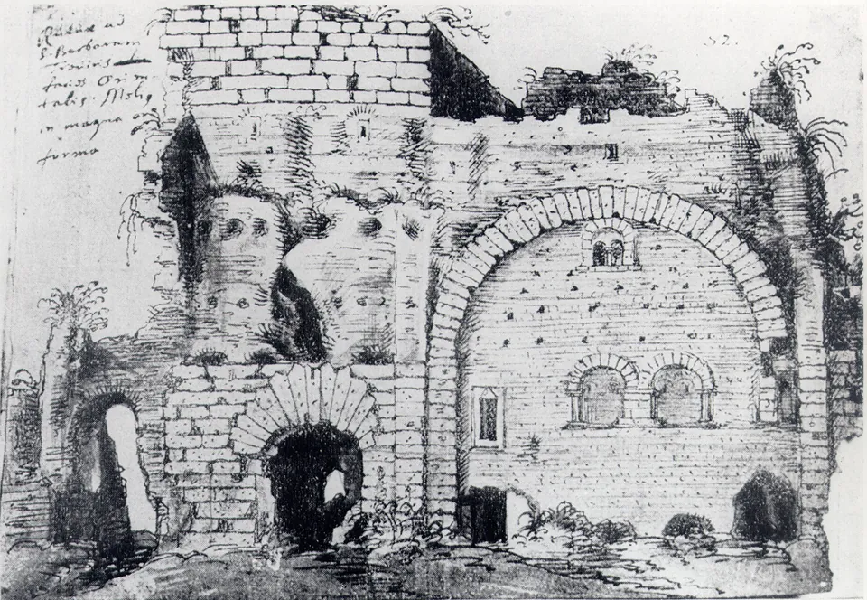
The baths came through the Germanic invasions of the 3rd century apparently without serious damage, and coins and pottery show them in use to the end of the 4th. Bathing ended with the destruction of Trier early in the 5th century. People then built homes into the ruins, which is read as the beginning of the suburb of St. Barbara, whose parish church gave the baths their name. Early Christian grave inscriptions point to a church on the site, possibly already in Merovingian times, and in the Middle Ages fortified buildings went up inside the ruins (de.wikipedia).
What still stood was used hard. During the imperial diet held at Trier in 1512, the emperor Maximilian I had cannon fired at the standing walls as a test. From 1611 the ruins were quarried for the building of the Jesuit college (de.wikipedia), and in the 1670s the French general Vignory blew up what was left to clear open ground around the city; published accounts give the year as 1673 or 1675 (de.wikipedia; hr.wikipedia). The site was closed to visitors from 2000 while the remains were restored, and reopened on 23 July 2015 with the new walkway (de.wikipedia). Since 1986 the baths have been part of the UNESCO World Heritage Site of Trier’s Roman monuments, cathedral and Church of Our Lady (de.wikipedia).
More photographs



Nearby
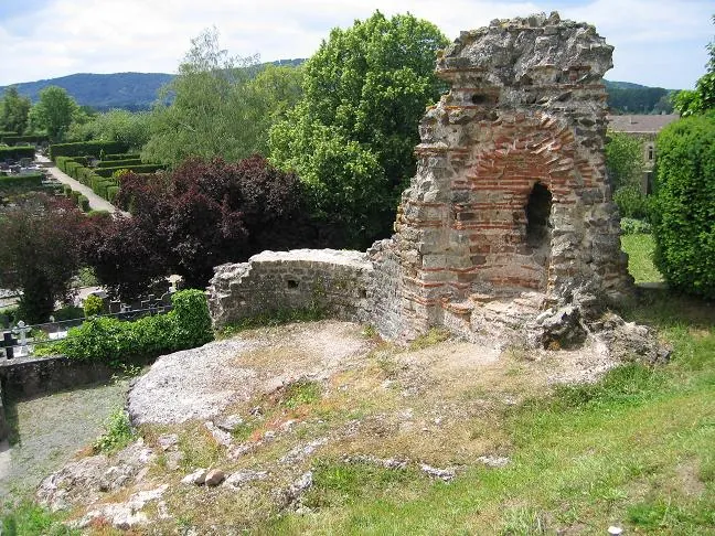
Photo: Johannes Simon · Public domain · Commons
7 km · villa · Rhineland-Palatinate
Kaiservilla Konz
The piece the tourist board points to is part of a cold-water basin, about 4 m high.
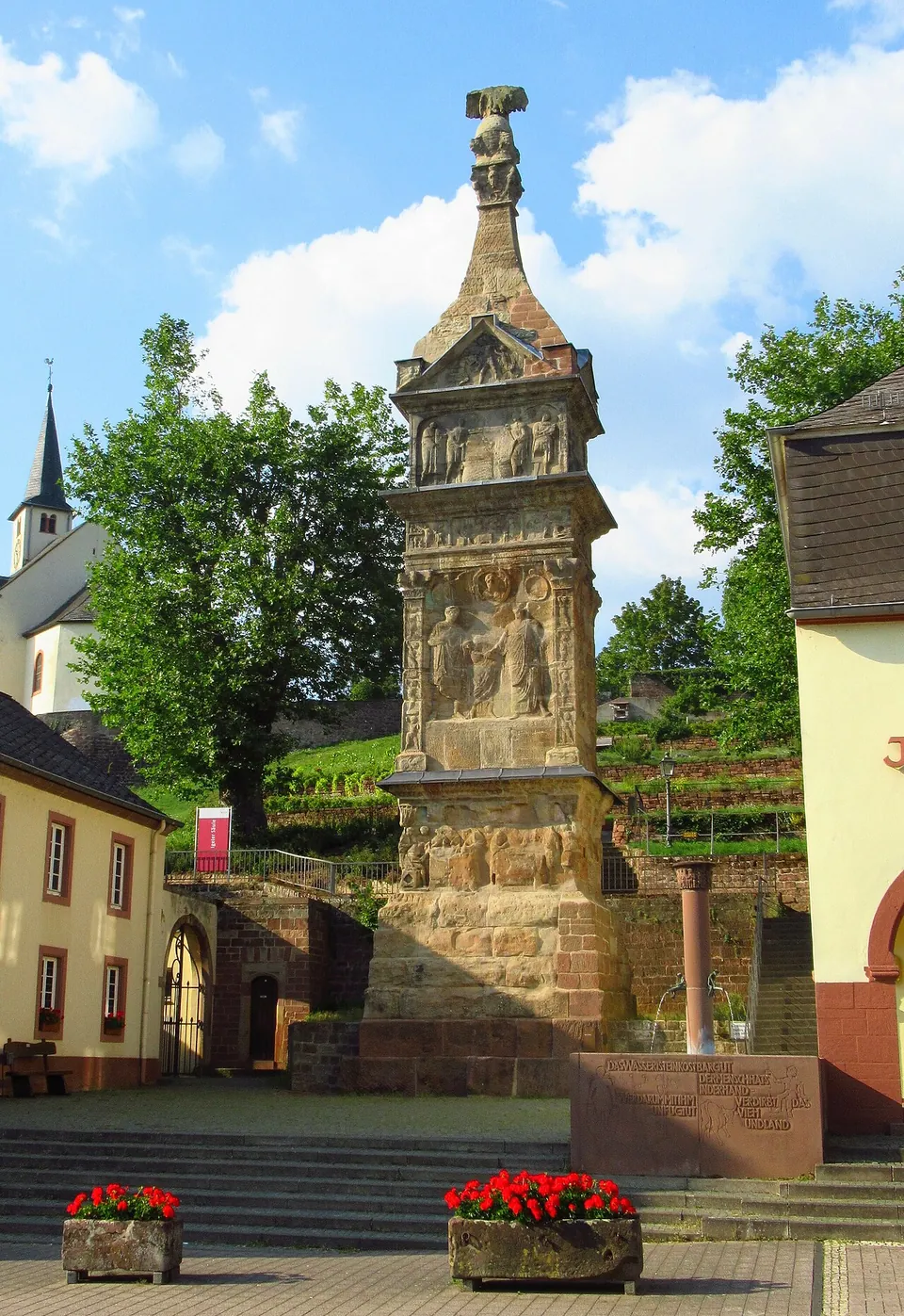
Photo: Dkvtig · CC BY-SA 4.0 · Commons
7 km · tomb · Rhineland-Palatinate
Igel Column
The monument itself, still standing where the Romans built it.
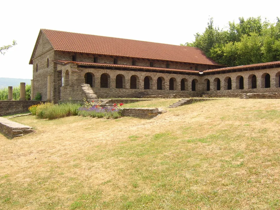
Photo: Areks · CC BY-SA 3.0 · Commons
11 km · villa · Rhineland-Palatinate
Villa urbana of Longuich
What you see first is a long stone building with a tiled roof and an arcade of round arches.


Straight-line distances.
Sources
Every fact on this page comes from the records below, each used under the licence noted.
| Source | Licence |
|---|---|
| Pleiades 538561167 | CC BY |
| Wikidata Q807733 | CC0 |
| OpenStreetMap way/19428692 | ODbL |
| Wikipedia (de) — Barbarathermen | CC BY-SA 4.0 |
| Wikipedia (en) — Barbara Baths | CC BY-SA 4.0 |
| Wikipedia (hr) — Barbarine toplice | CC BY-SA 4.0 |
| Zentrum der Antike (GDKE Rheinland-Pfalz, the operator) — Barbarathermen, hours, admission and getting there | licence not recorded |