

What is there today
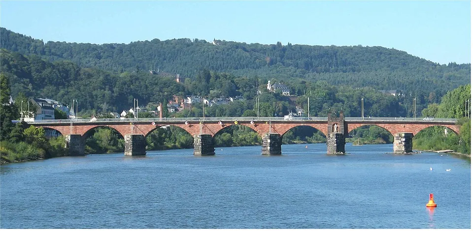
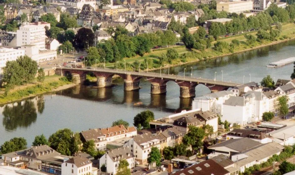
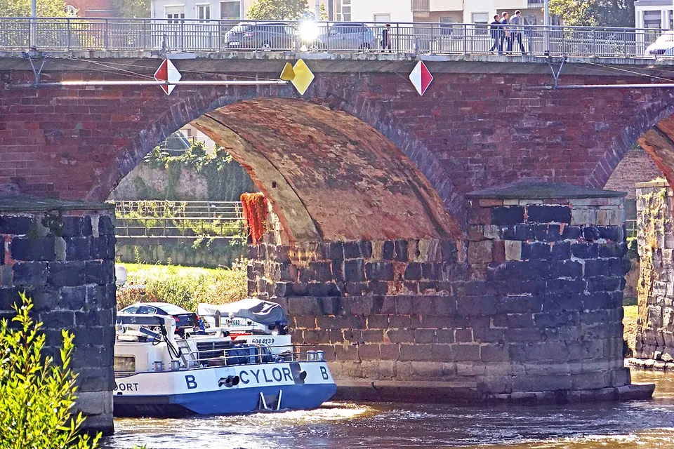
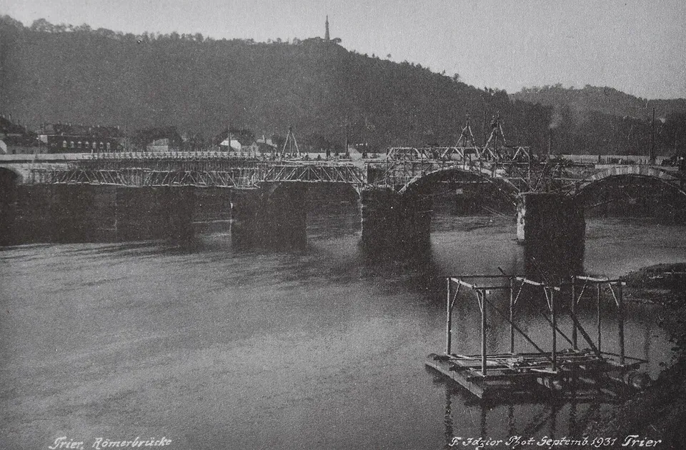
What you are looking for is the piers, not the arches. The piers are Roman, founded on the riverbed with blocks of basalt and bluestone and pointed on the upstream side to stand up to floods and ice. The arches of reddish stone above them were added in the Middle Ages and renewed in 1716–18 after French troops blew the bridge up in 1689, and the road on top was widened in 1931, when it gained its cantilevered footways (de.wikipedia). All nine Roman piers survive, but the two nearest the city have been hidden in the built-up riverbank since an alteration in Roman times, so not all nine can be seen (de.wikipedia).
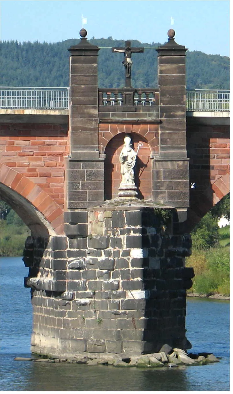
On the fifth pier from the west stand a crucifix and a statue of St Nicholas of Myra, put up during the rebuilding of 1716–18 (de.wikipedia). Its modern deck links the federal roads 49 and 51 (KuLaDig), and thousands of cars, cyclists and pedestrians cross it every day (Tourist-Information Trier). A tactile model is mapped about 30 m from the bridge (OpenStreetMap).
Is it worth the trip?
Not on its own, but it belongs on any walk round Roman Trier, it is free, and it is a short stop. The Barbara Baths are about 330 m away (OpenStreetMap), so the two make an easy pair. Know what you are seeing: this is a busy road bridge, and the Roman work is the dark stone of the piers, best seen from the riverbank rather than from the pavement on top, where you are walking on the later arches and the deck of 1931. What makes it remarkable is not how it looks but that a bridge built under Antoninus Pius is still one of the city’s main crossings over the Moselle (de.wikipedia; Tourist-Information Trier).
Getting there
The bridge is about 1.5 km from the Porta Nigra as mapped (OpenStreetMap). The bus stop “Bei der Römerbrücke” is about 110 m away, and a public pay car park about 155 m away (OpenStreetMap). A footpath and cycle path runs from the bridge along the river for 1.5 km to the old fishing village of Zurlauben, past cranes of the 15th and 18th centuries (Tourist-Information Trier).
The bridge is freely accessible and costs nothing (Tourist-Information Trier, read 30 October 2026).
Visiting details
- Opening hours
- Freely accessible. It is a working road bridge with footways for pedestrians.
- Tickets
- Free. No admission is charged.
- Parking
- A public pay car park about 155 m from the bridge (OSM way/128084055). The bus stop "Bei der Römerbrücke" is about 110 m away (OpenStreetMap).
Before you go
- The Roman part is the stone piers in the river; the arches and the road on top are medieval to modern, and the bridge carries through traffic.
Hours and prices checked 30 October 2026 on the operator's own site. Confirm before travelling.
History
There were bridges here from the start of Roman Trier. A timber bridge on piles stood from 18/17 BC, a date read from its piles by tree-ring dating in 1963, and it is one of the fixed points for dating the city’s foundation (de.wikipedia). KuLaDig records an older ford at the crossing, with a timber pile from it dated to 122 BC. In 71, under Vespasian, a second bridge was built a short way downstream, with limestone piers standing on a grid of oak piles driven into the riverbed (de.wikipedia).
The present bridge, the third, was built about 25 m upstream of that one in the reign of Antoninus Pius; published dates for the piers run from 142 to 155. The piers were founded on the riverbed inside watertight cofferdams, partly with stone quarried at the former volcano of Hohe Buche in the eastern Eifel. On them stood a timber superstructure carrying a road about 10 m wide, some 14 m above the river at normal water, so that ships sailing downstream no longer had to lower their masts; going upstream against the strong current, they were hauled from the bank (de.wikipedia). Towers and gates guarded both ends; a gate like the Porta Nigra, known in the Middle Ages as the Porta Inclyta, stood at the bridge, but whether on the left or the right bank is disputed (de.wikipedia).
Romans threw coins off the bridge as an offering, and experts estimate that about a million could still lie in the riverbed (en.wikipedia); the Tourist-Information names the goddess Mosella as the recipient, and adds that diving for them is not allowed. Coins, tools, jewellery, small bronzes and even stone monuments recovered from the river at the bridge are shown in the Rheinisches Landesmuseum (de.wikipedia).
The timber deck had to be renewed again and again, and it was only in the Middle Ages that stone arches replaced it: de.wikipedia’s article on the bridge dates them to between 1190 and 1490, possibly under Archbishop Baldwin (1307–1354), while its article on Roman Trier gives 1343 under Baldwin. The western bridge gate was demolished in 1806 and the eastern one in 1869. Goethe crossed the bridge in October 1792 and noted that it was “auch noch im Altertum gegründet”, founded in antiquity (KuLaDig). On 2 March 1945 American troops crossed it intact towards Trier-West; why the German army did not blow it up is not known (de.wikipedia). Extensive archaeological investigations followed after the war, when the Moselle was canalised (de.wikipedia). Since 1986 the bridge has been part of the UNESCO World Heritage Site of Trier’s Roman monuments, cathedral and Church of Our Lady (de.wikipedia).
More photographs


Nearby
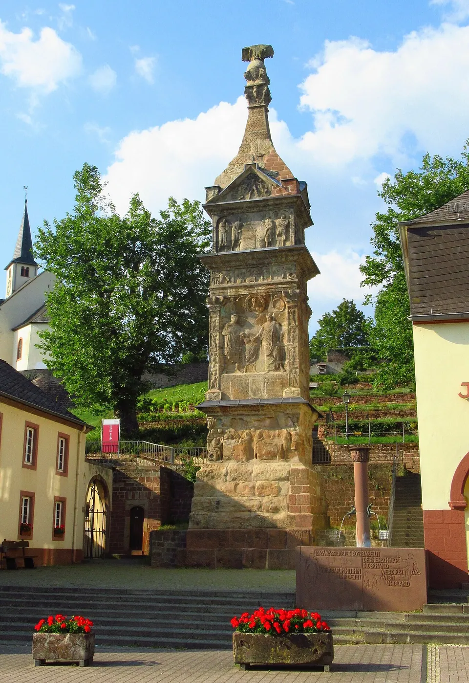
Photo: Dkvtig · CC BY-SA 4.0 · Commons
7 km · tomb · Rhineland-Palatinate
Igel Column
The monument itself, still standing where the Romans built it.
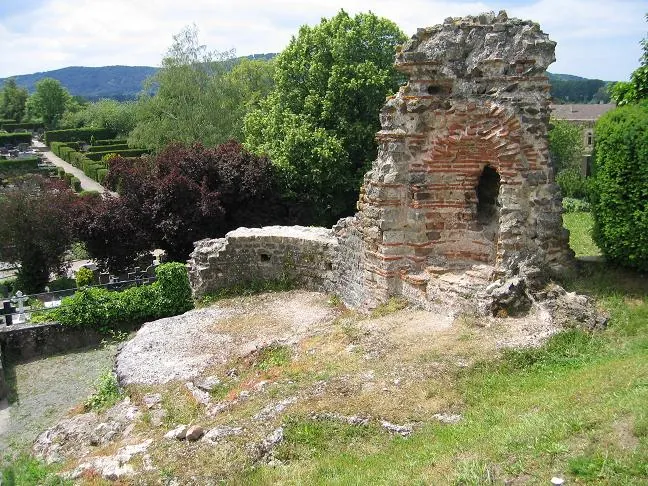
Photo: Johannes Simon · Public domain · Commons
7 km · villa · Rhineland-Palatinate
Kaiservilla Konz
The piece the tourist board points to is part of a cold-water basin, about 4 m high.
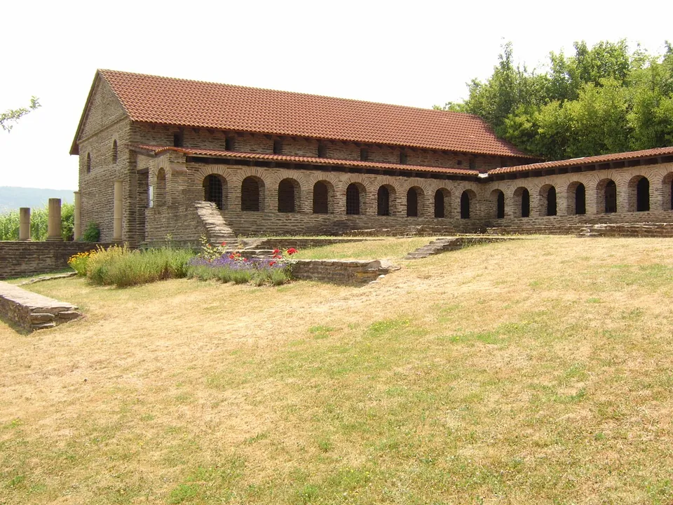
Photo: Areks · CC BY-SA 3.0 · Commons
11 km · villa · Rhineland-Palatinate
Villa urbana of Longuich
What you see first is a long stone building with a tiled roof and an arcade of round arches.


Straight-line distances.
Sources
Every fact on this page comes from the records below, each used under the licence noted.
| Source | Licence |
|---|---|
| Pleiades 110234 | CC BY |
| Wikidata Q284125 | CC0 |
| OpenStreetMap way/212717316 | ODbL |
| Wikipedia (de) — Römerbrücke (Trier) | CC BY-SA 4.0 |
| Wikipedia (en) — Roman Bridge (Trier) | CC BY-SA 4.0 |
| Wikipedia (de) — Augusta Treverorum (section Römerbrücke) | CC BY-SA 4.0 |
| KuLaDig (Landschaftsverband Rheinland) — Römerbrücke Trier | licence not recorded |
| Tourist-Information Trier (Trier Tourismus und Marketing GmbH) — Römerbrücke, access and admission | licence not recorded |