

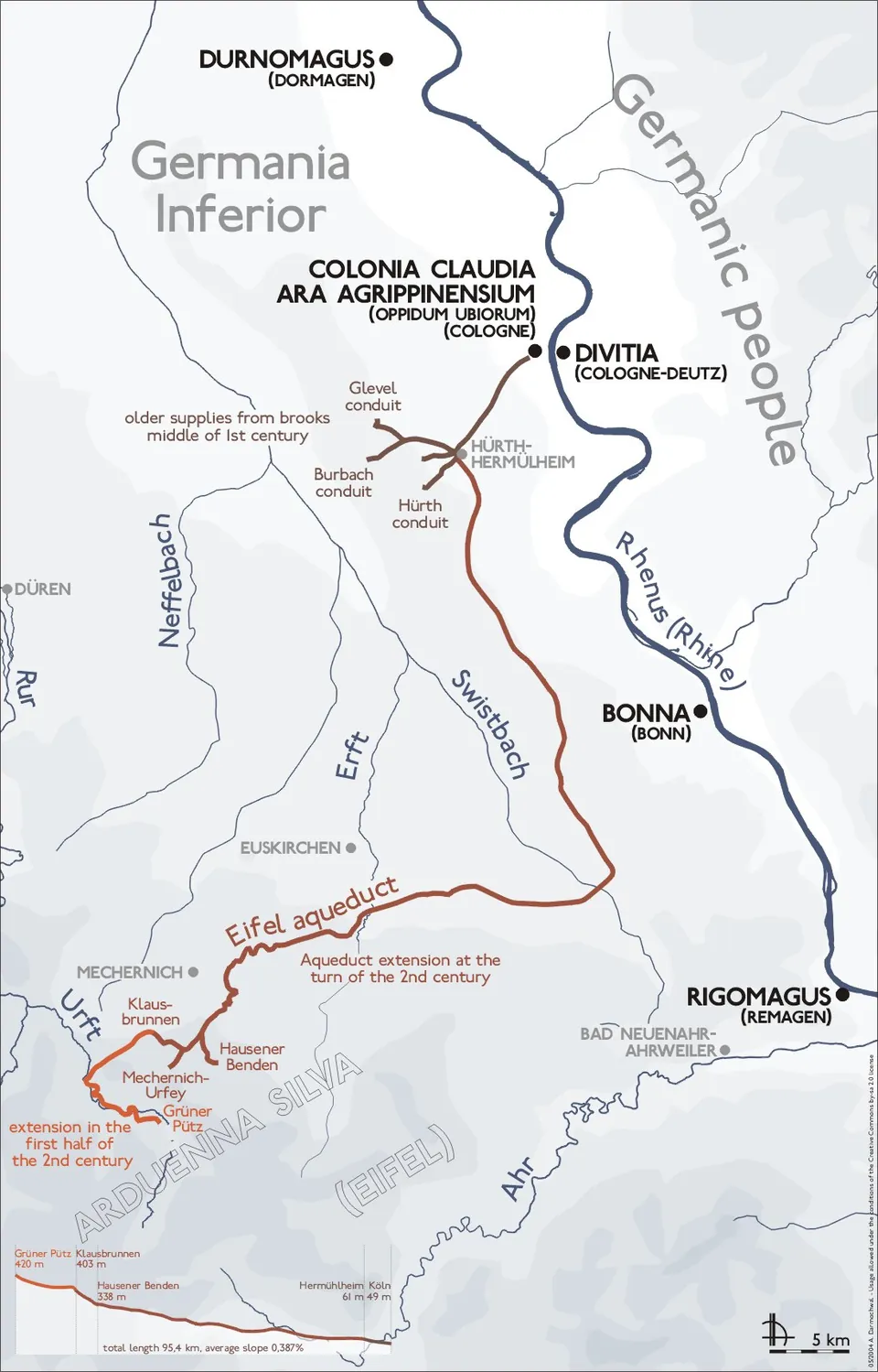
The Eifel Aqueduct carried spring water about 95 km from the hills of the Eifel to Roman Cologne, almost all of it underground. You will not see it as one structure: it survives as a string of separate stops along a waymarked trail, the best known of them a partly rebuilt bridge at Vussem, spring houses and a collecting basin in the Eifel, and excavated stretches of conduit in the towns on the way to Cologne.
What is there today
Very little of the aqueduct ever stood above ground, and most of what did was quarried away in the Middle Ages (de.wikipedia). What a visitor sees are the places where archaeologists have opened, restored and, where needed, roofed over a piece of it and put it beside the trail (KuLaDig). In order from the source:
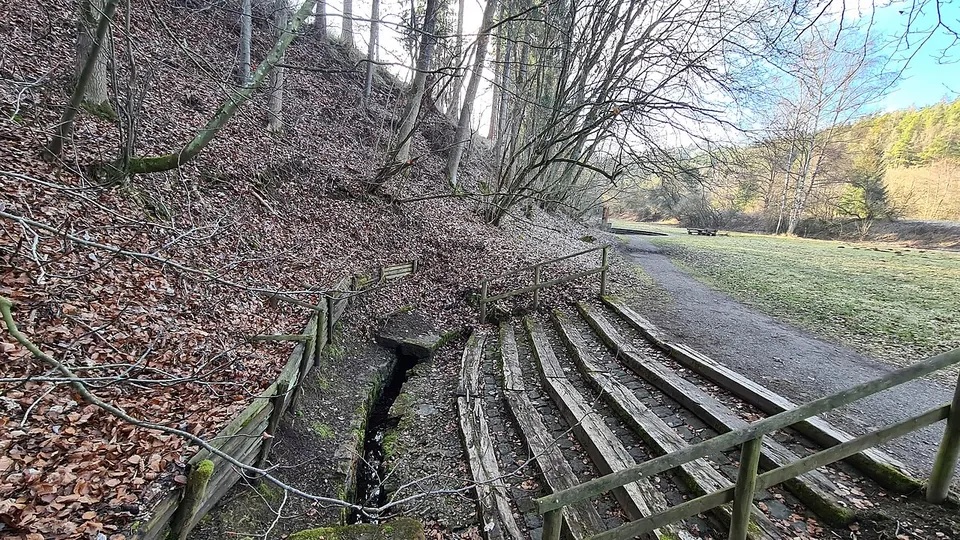
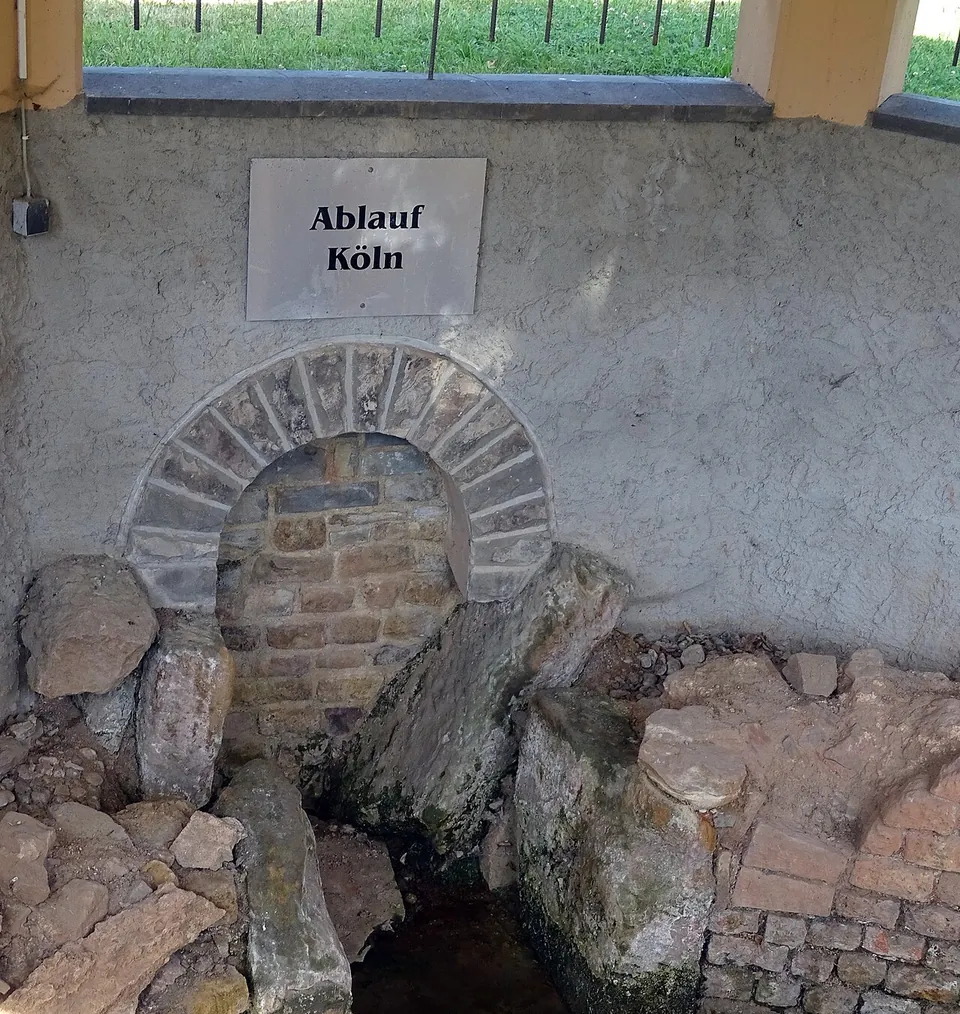
- Grüner Pütz, near Nettersheim. The spring in the Urft valley where the aqueduct begins, with its collecting channel. Near it a culvert that carried the line over a small stream is still completely preserved (de.wikipedia).
- Klausbrunnen, Mechernich-Kallmuth. A second spring house, rebuilt after excavation and covered by a protective building (de.wikipedia).
- Eiserfey. A collecting basin on the line, one of the stops on the trail’s second stage (roemerkanal.de).
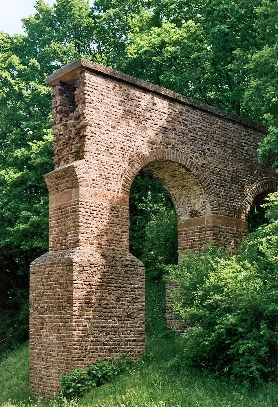
- Vussem. Probably the best-known structure of the whole aqueduct (KuLaDig). A bridge carried the water across a side valley of the Veybach about 10 m above the valley floor, on at most twelve piers; published lengths range from 70 to 80 m (KuLaDig and de.wikipedia give 80 m, en.wikipedia 70 m). After pier foundations were excavated in 1959, part of the bridge was rebuilt on the Roman foundations, and a restoration in 2011 left the original Roman masonry easy to tell from the modern rebuild (KuLaDig).
- Vollem. A small bridge with a single arch over a stream, a well-preserved example of the many minor crossings on the line (de.wikipedia).
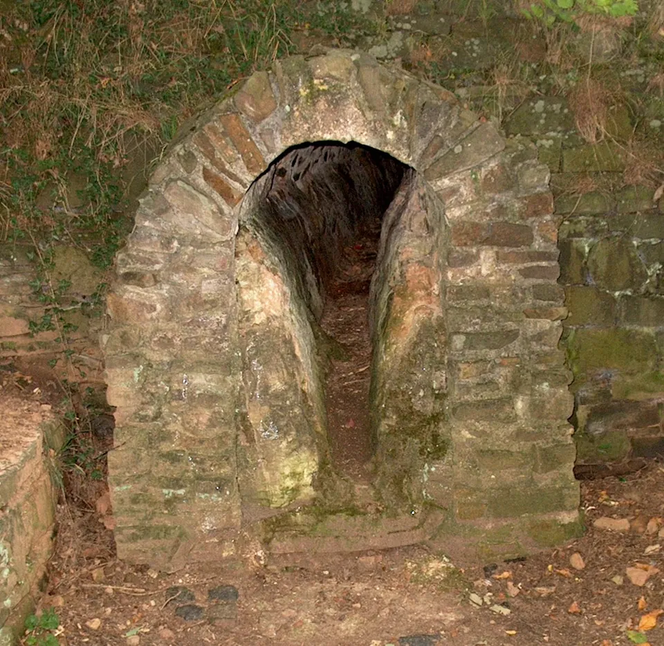
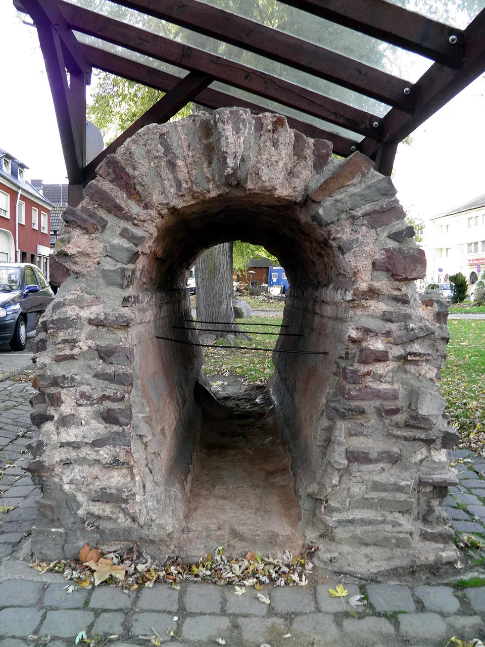
- Kreuzweingarten. A stretch where the conduit walls are thickened by lime crust deposited by the hard Eifel water (Commons photograph, below).
- Rheinbach. The Römerkanal-Infozentrum, an exhibition on Roman aqueduct building, on the Eifel aqueduct itself and on the “aqueduct marble” cut from its lime deposits (the operator). The medieval town wall reused chunks of the conduit (de.wikipedia).
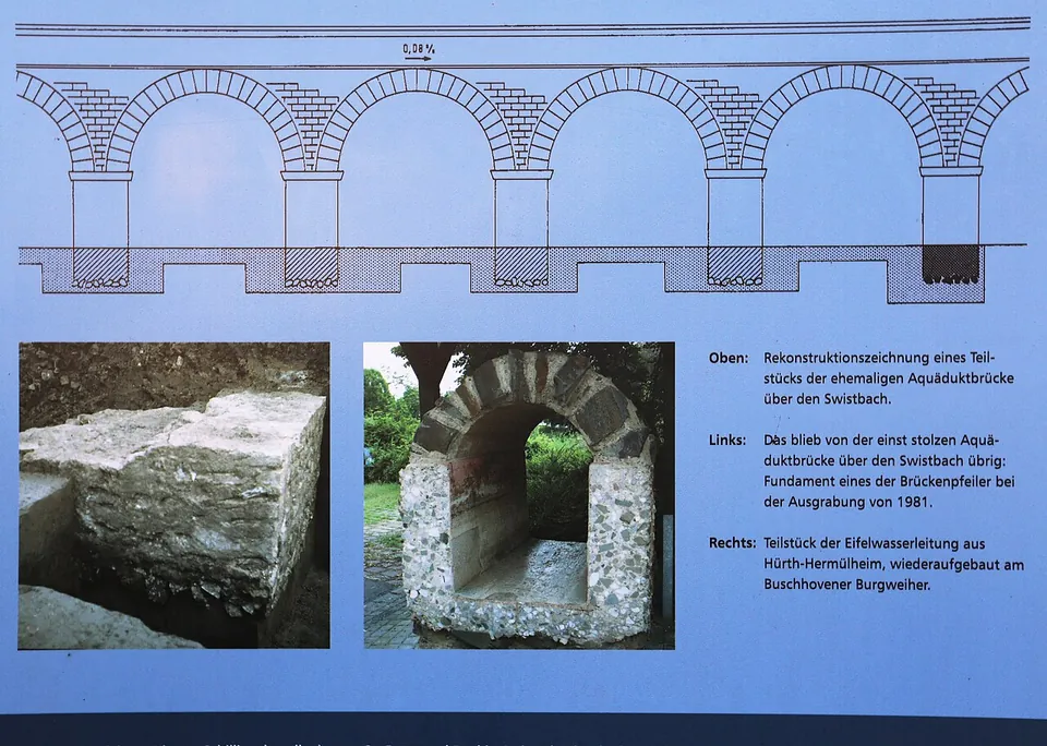
- The Swistbach crossing. The most notable bridge on the line (en.wikipedia), between Rheinbach and Lüftelberg: 1,400 m long and up to 10 m high, with an estimated 295 arches. Only a low strip of rubble remains (de.wikipedia).
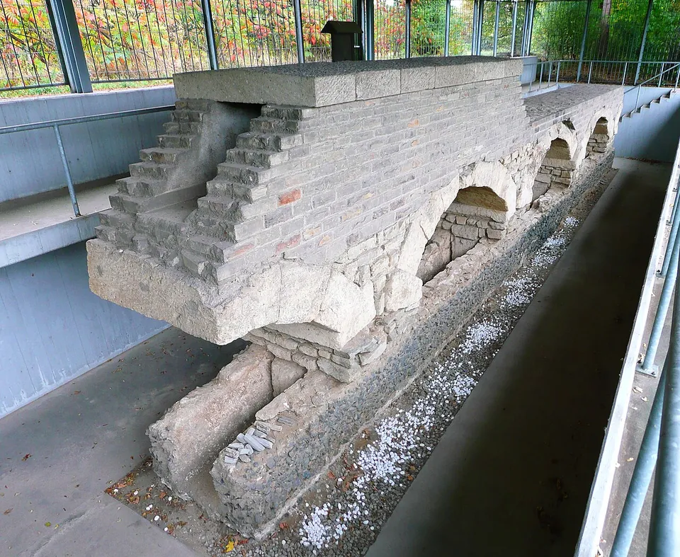
- Hürth-Hermülheim. Three complete and two cut arches, found in 1962 by the secondary school, standing in the channel of an older conduit that the Eifel line was later connected to. The lost upper channel has been restored, and a protective building closed by grilles lets you see them (KuLaDig).
Short sections of the conduit have also been set up in towns along the route, among them Rheinbach, Bornheim and Brühl (Commons photographs).
Is it worth the trip?
It depends on how you like to travel. There is no Pont du Gard here: the route was laid out so that it crossed no large or deep valleys, and both long bridges were pulled down in later centuries for their stone (de.wikipedia). Each stop is small, and the rebuilt arches at Vussem are only part of a bridge, so no single one of them is worth a long detour on its own.
The aqueduct comes into its own on foot. The Römerkanal-Wanderweg follows it for 120 km from Nettersheim to Cologne in seven stages of 13 to 22 km (roemerkanal.de), and its information boards give a good picture of the line’s course (de.wikipedia). For a day by car, pair Vussem and the other stops of the trail’s second stage, the Klausbrunnen and Eiserfey, with the free exhibition in Rheinbach. The last stretch of the line runs through Brühl and Hürth into Cologne (de.wikipedia), so Hürth fits into a visit to Roman Cologne.
Getting there
The stops are spread between Nettersheim in the Eifel and Hürth on the way into Cologne, so choose a section first. Public transport is dense enough for the trail to be walked in stages (de.wikipedia).
- Vussem: a free car park about 20 m from the bridge, and the bus stop “Vussem Schule” about 300 m away (OpenStreetMap).
- Vollem: a free car park about 60 m from the bridge (OpenStreetMap).
- Grüner Pütz: free street-side parking about 200 m from the spring; the nearest rail stop, Urft (Steinfeld), is about 2 km away (OpenStreetMap).
- Hürth-Hermülheim: by the secondary school in Hermülheim (KuLaDig), on the Duffesbach and reached from the Vussemweg (de.wikipedia).
- Rheinbach: the Römerkanal-Infozentrum is at Himmeroder Wall 6, entered through the Naturparkzentrum in the Himmeroder Hof, with parking on the Himmeroder Wall. It opens Tuesday to Friday 10.00–12.00 and 14.00–17.00, and Saturday, Sunday and public holidays 11.00–17.00. It is closed on Mondays (also when a holiday falls on a Monday), 24–26 and 31 December, 1 January, Weiberfastnacht, Veilchendienstag and during the Rheinbach Classics. Entry is free (roemerkanal.de, read 30 October 2026).
No source records a charge for any of the open-air remains, and none publishes opening hours for them.
Visiting details
- Opening hours
- The remains along the route are open-air and publish no hours. The Römerkanal-Infozentrum in Rheinbach opens Tuesday to Friday 10.00–12.00 and 14.00–17.00, Saturday, Sunday and public holidays 11.00–17.00; closed on Mondays (also when a holiday falls on a Monday), 24–26 and 31 December, 1 January, Weiberfastnacht, Veilchendienstag and during the Rheinbach Classics.
- Tickets
- Free. Entry to the Römerkanal-Infozentrum is free (the operator), and no source records a charge for any of the open-air remains.
- Parking
- At Vussem a free car park lies about 20 m from the bridge (OSM way/271425001); at the Vollem bridge, about 60 m away (OSM way/638798028); for the Infozentrum, on the Himmeroder Wall in Rheinbach (the operator). At the mapped point near the Grüner Pütz there is free street-side parking (OSM way/400609690).
Before you go
- This is not one site but a line of separate stops spread over about 95 km; plan which ones to see before setting out.
Hours and prices checked 30 October 2026 on the operator's own site. Confirm before travelling.
History
Before this aqueduct, Cologne drew its water from springs and streams in the Ville hills south-west of the city. When that supply was no longer enough for the growing city, a new line was built to the springs of the Eifel, whose hard, lime-rich water was rated especially highly (de.wikipedia). It was built around AD 80. No inscription or text records the builders, but they are taken to have been the army, the only body with the means; the army’s commander and governor of the district around that time was Sextus Iulius Frontinus, later Rome’s curator of the water supply (de.wikipedia).
The main line was 95.4 km long, or 130 km with the feeders from further springs, and could deliver up to 20,000 cubic metres of water a day. It ran entirely by gravity, mostly about 1 m below ground to keep out the frost, in a vaulted channel 70 cm wide and 1 m high, large enough to walk through. Near Kall it crossed the watershed between the Meuse and the Rhine at the one point where that was possible without a tunnel or a pressure pipe (de.wikipedia).
The line worked until about 260 and was not restored after Cologne was plundered for the first time (de.wikipedia). From Carolingian times it served as a quarry. Most prized was the lime sinter, up to 30–40 cm thick, that had built up on the channel walls: polished, it looked like brown to reddish marble, and as “aqueduct marble” it was made into columns, window jambs and altar slabs as far away as Paderborn, Hildesheim and Roskilde Cathedral in Denmark (de.wikipedia; KuLaDig gives the 40 cm figure). In 1867 the mining official C. A. Eick recognised the Grüner Pütz as the spring farthest from Cologne; Waldemar Haberey studied the line systematically from 1940 to 1970, and from 1980 Klaus Grewe mapped the whole route (de.wikipedia).
More photographs





Nearby
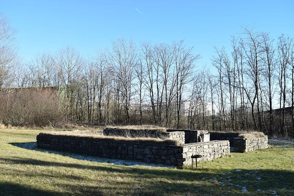
Photo: Marcin-Janek · CC BY-SA 4.0 · Commons
3 km · temple · North Rhine-Westphalia
Tempelheiligtum Zingsheim
Two squares of grey rubble wall, one inside the other.
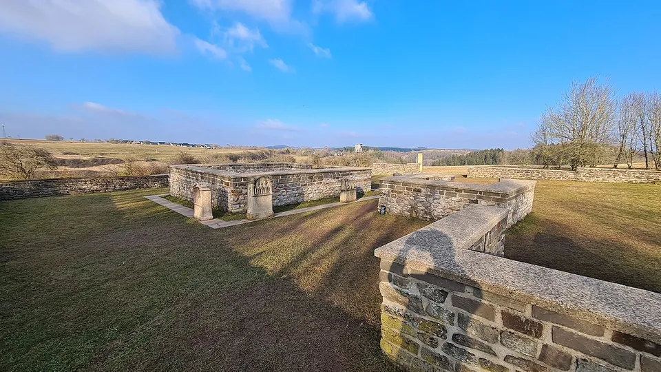
Photo: TimeTravelRome · CC BY 2.0 · Commons
3 km · temple · North Rhine-Westphalia
Görresburg
A low wall encloses a trapezoid of grass holding three small, almost square buildings, all facing east (KuLaDig, LVR; Eifel Tourismus).
Photo: Klaus Littmann · CC BY-SA 3.0 · Commons


Straight-line distances.
Sources
Every fact on this page comes from the records below, each used under the licence noted.
| Source | Licence |
|---|---|
| Wikidata Q751092 | CC0 |
| Vici.org 7918 | CC BY-SA (text), CC0 (metadata) |
| OpenStreetMap relation/2724073 | ODbL |
| Wikipedia (de) — Eifelwasserleitung | CC BY-SA 4.0 |
| Wikipedia (en) — Eifel Aqueduct | CC BY-SA 4.0 |
| KuLaDig (LVR) — Römische Brücke der Eifelwasserleitung in Vussem | licence not recorded |
| KuLaDig (LVR) — Aquädukt der Römischen Eifelwasserleitung in Hürth | licence not recorded |
| KuLaDig (LVR) — Römerkanal-Infozentrum am Himmeroder Hof | licence not recorded |
| Römerkanal-Infozentrum — hours and admission (the operator) | licence not recorded |
| Römerkanal-Wanderweg — the seven stages | licence not recorded |
| Freundeskreis Römerkanal e. V. — Informationszentrum | licence not recorded |
| Pleiades — Vussem aqueduct | licence not recorded |