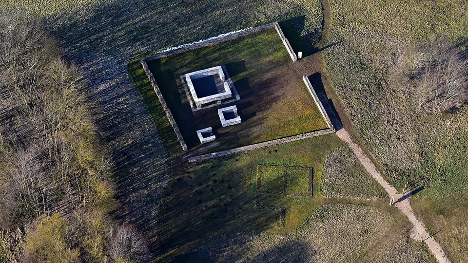
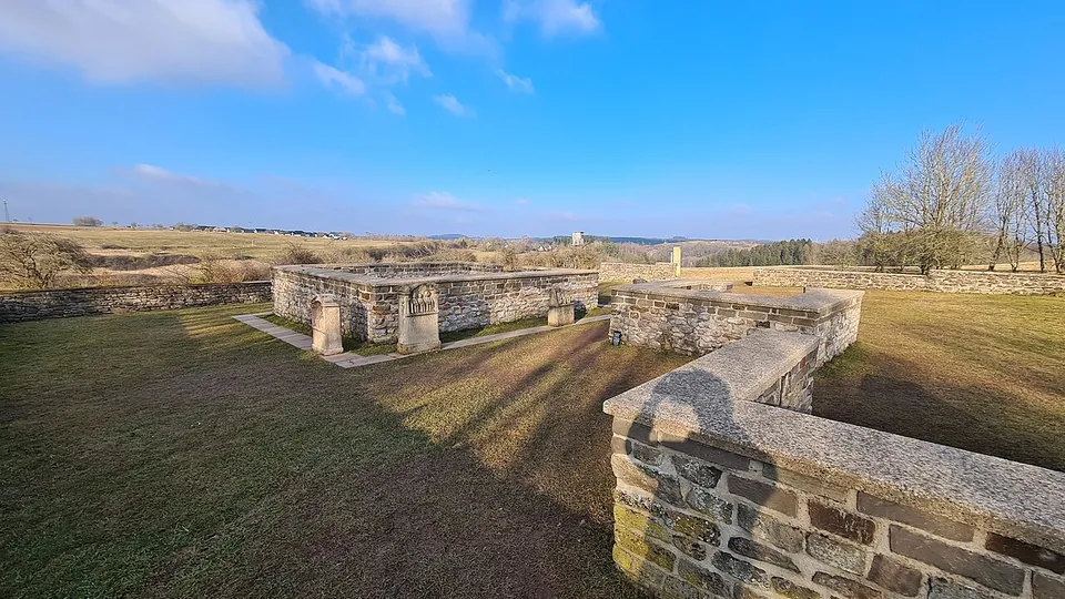


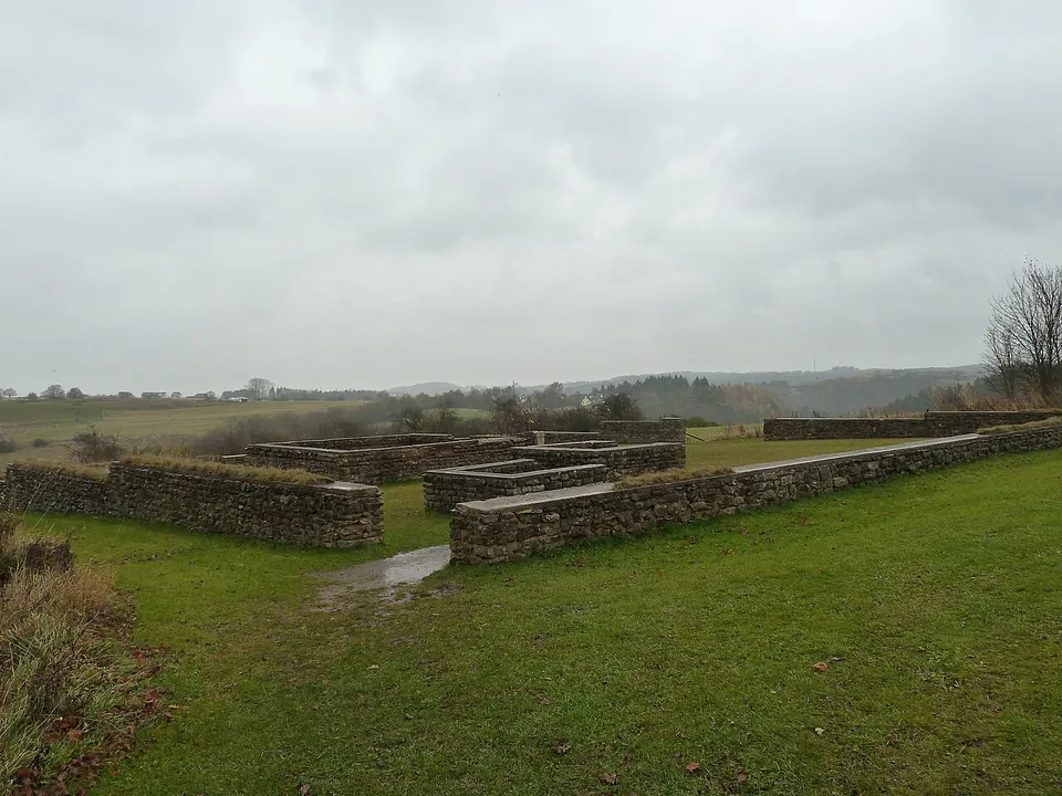
The Görresburg is a small Roman temple precinct on a hill spur above the Urft valley near Nettersheim in the Eifel, where local mother goddesses, the Aufanian Matrons, were worshipped from the later 1st century to around 400 (de.wikipedia; Eifel Tourismus). What you see is a rebuilt ground plan and copies of the altars, in a fine open setting.
What is there today
A low wall encloses a trapezoid of grass holding three small, almost square buildings, all facing east (KuLaDig, LVR; Eifel Tourismus). The walls you see date from the 1976-77 restoration, which secured and partly rebuilt the excavated remains so that the outlines of the buildings read clearly (KuLaDig; de.wikipedia). The main temple is about 6 m square (KuLaDig).
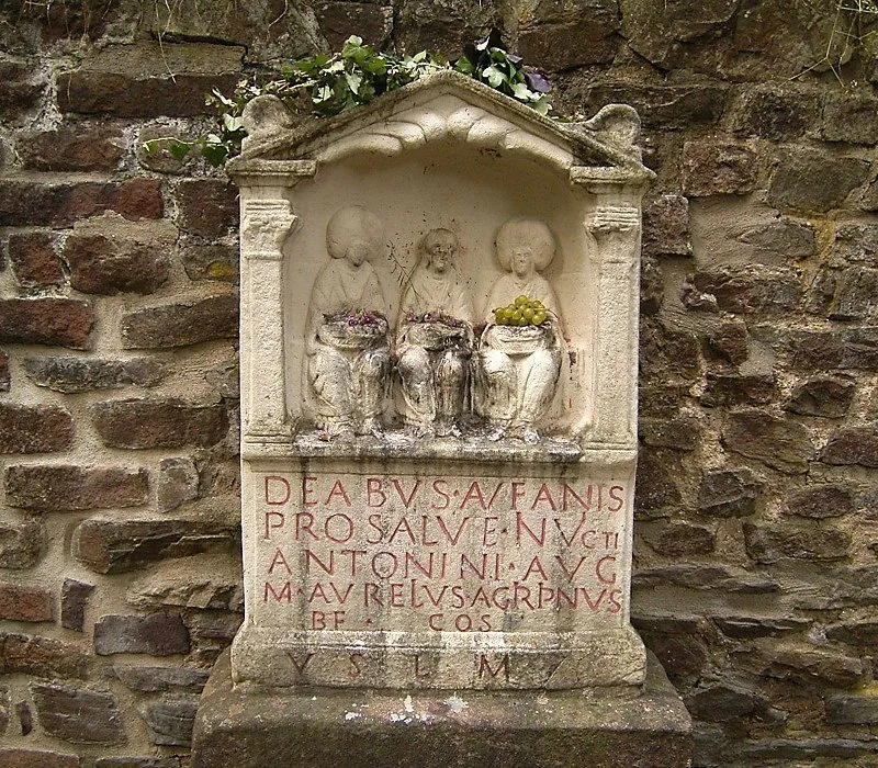
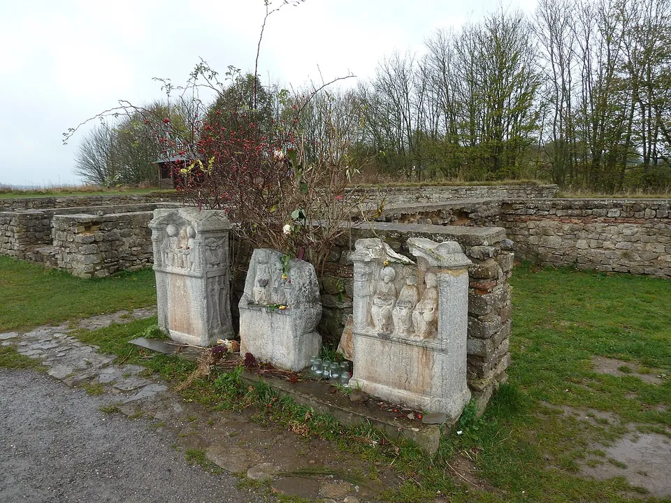
In front of it stand casts of three of the dedication stones found here, carved with the Matrons as a trio of women, the form typical of Lower Germany (KuLaDig; de.wikipedia; OpenStreetMap’s description counts four copies). The originals, more than 40 inscribed stones and fragments in all, are in the LVR-LandesMuseum in Bonn (de.wikipedia; KuLaDig). People still leave fruit and other offerings in front of the copies, and the hilltop looks out over the Eifel landscape (Eifel Tourismus).
The precinct stood at the northern end of a Roman settlement (Eifel Tourismus), and today it is part of the Archäologischer Landschaftspark Nettersheim, opened in 2014, which takes in that settlement down to the Urft (de.wikipedia). Along its circuit you can see parts of the old street layout, houses and workshops and a small late Roman fort (Eifel Tourismus), whose wall line and gate were marked out above the excavated remains in 2013 (KuLaDig).
Is it worth the trip?
As part of a walk round the Nettersheim park, or as a short detour from stage 6 of the Eifelsteig long-distance trail (as Eifel Tourismus suggests), yes: it is free, always open, and it shows the whole plan of a Matrons’ sanctuary on the ground. It is not worth a long drive on its own. The walls are a 1970s rebuilding, the altars are casts, and the original stones are in Bonn; if the carvings are what draws you, go there.
Getting there
The sanctuary lies about 1.3 km from Nettersheim station as the crow flies (OpenStreetMap). Regional trains on the Cologne-Trier line stop there every hour (RB22, RB24 and RE12), and there are several car parks in the village, among them 38 spaces at the Naturzentrum Eifel on Urftstraße, about 1.1 km from the site (the Naturzentrum). The park’s 4.5 km circular path starts at the Naturzentrum (Eifel Tourismus), and a mapped footpath reaches the precinct (OpenStreetMap).
The sanctuary is freely accessible at any time, with no ticket (Eifel Tourismus, page as of January 2026). The Naturzentrum, which has an exhibition of original Roman finds from the excavations (Eifel Tourismus), is open April to October on weekdays 09.00-17.30 and at weekends 10.00-17.30, and November to March until 16.00; it is closed on 24, 25 and 31 December and on Weiberfastnacht and Rosenmontag (naturzentrum-eifel.de, read 31 October 2026). Its page gives no admission price for the exhibition.
Visiting details
- Opening hours
- Open-air site, freely accessible at any time.
- Tickets
- Free.
- Parking
- No car park at the sanctuary itself. The Naturzentrum Eifel in Nettersheim (Urftstraße 2-4) lists car parks in the village, among them 38 spaces at the Naturzentrum, about 1.1 km from the sanctuary.
Before you go
- The walls on show date from the 1976-77 restoration and the dedication stones are casts; the originals are in the LVR-LandesMuseum in Bonn.
Hours and prices checked 23 January 2026 on the operator's own site. Confirm before travelling.
History
The name, which suggests a castle (Burg), is misleading: “Görresburg” is an old field name for the spot, older than the discovery of the temple (de.wikipedia). Worship here began in the second half of the 1st century AD as a cult place fenced with wood around an earth altar; it does not go back to pre-Roman times (de.wikipedia). An older stone wall about 8.6 m square, on the same alignment as the later temple, may have surrounded a sacred marker, perhaps a tree, before the stone temple was built around 160 (KuLaDig). The sanctuary was probably in use until the early 5th century (de.wikipedia).
The dedication stones date to the early 3rd century (KuLaDig). The cult is notably linked with soldiers of the First Legion Minervia, based in Bonn, which kept a station of beneficiarii, soldiers on the governor’s staff who policed the roads, at Nettersheim (KuLaDig). One of them, Marcus Aurelius Agrippinus, set up an altar to the Aufanian goddesses “for the welfare of the unconquered Antoninus Augustus” (KuLaDig). Bonn also had the most important known sanctuary of these goddesses (KuLaDig).
The temple stood beside a Roman settlement on the road from Cologne to Trier, identified with Marcomagus, a station named in the ancient road lists (de.wikipedia; the LVR calls the identification likely). The settlement was probably destroyed by fire in the Frankish raids around 275, and around 316 a small fort was built to control the Urft crossing (KuLaDig).
The site was found in 1909 and excavated by the Provinzialmuseum Bonn under Hans Lehner and Joseph Hagen (de.wikipedia); Lehner’s report appeared in 1910. Further excavations followed in 1976-77, when the walls were secured and rebuilt, and in 2012 (KuLaDig).
More photographs


Nearby
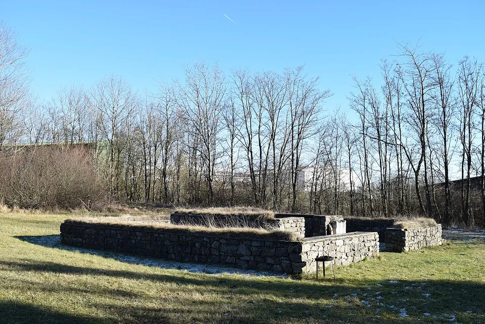
Photo: Marcin-Janek · CC BY-SA 4.0 · Commons
3 km · temple · North Rhine-Westphalia
Tempelheiligtum Zingsheim
Two squares of grey rubble wall, one inside the other.
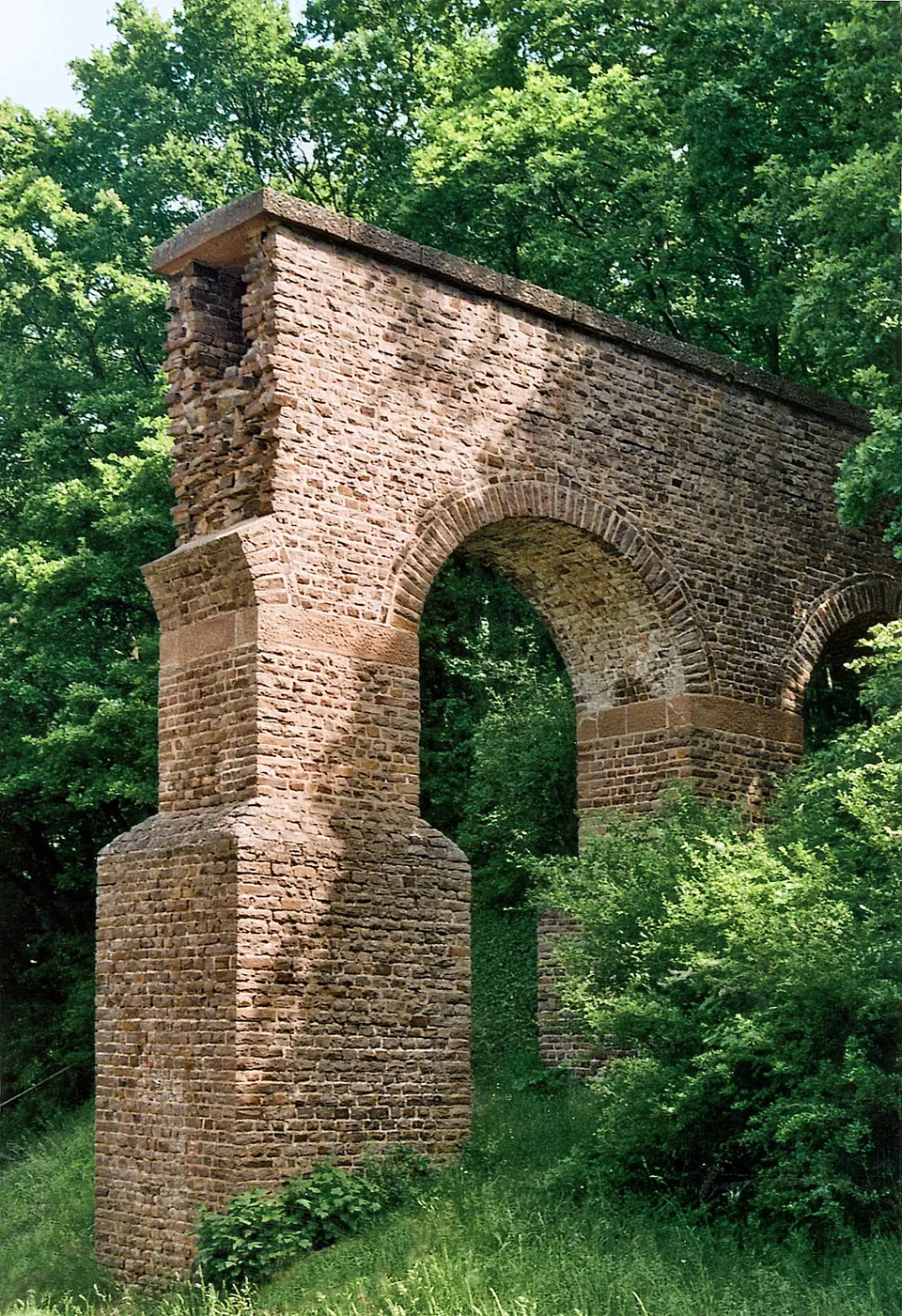
Photo: Mediatus · CC BY-SA 3.0 · Commons
3 km · aqueduct · North Rhine-Westphalia
Eifel Aqueduct
Very little of the aqueduct ever stood above ground, and most of what did was quarried away in the Middle Ages (de.wikipedia).
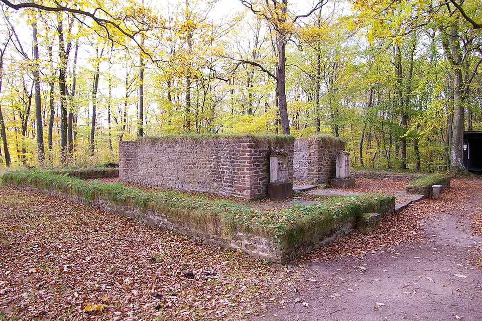
Photo: Klaus Littmann · CC BY-SA 3.0 · Commons


Straight-line distances.
Sources
Every fact on this page comes from the records below, each used under the licence noted.
| Source | Licence |
|---|---|
| Pleiades 109013 | CC BY |
| Wikidata Q1559564 | CC0 |
| OpenStreetMap way/44900409 | ODbL |
| Wikipedia (de) — Görresburg | CC BY-SA 4.0 |
| KuLaDig (LVR) — Römischer Vicus und Matronenheiligtum „Görresburg“ | licence not recorded |
| KuLaDig (LVR) — Tempel für die Aufanischen Matronen auf der Görresburg | licence not recorded |
| Eifel Tourismus — Römisches Matronenheiligtum Görresburg (archived copy, 23 January 2026) | licence not recorded |
| Eifel Tourismus — Archäologischer Landschaftspark | licence not recorded |
| Naturzentrum Eifel — opening hours | licence not recorded |
| Naturzentrum Eifel — getting there and parking | licence not recorded |