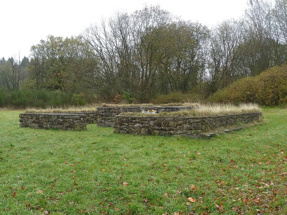
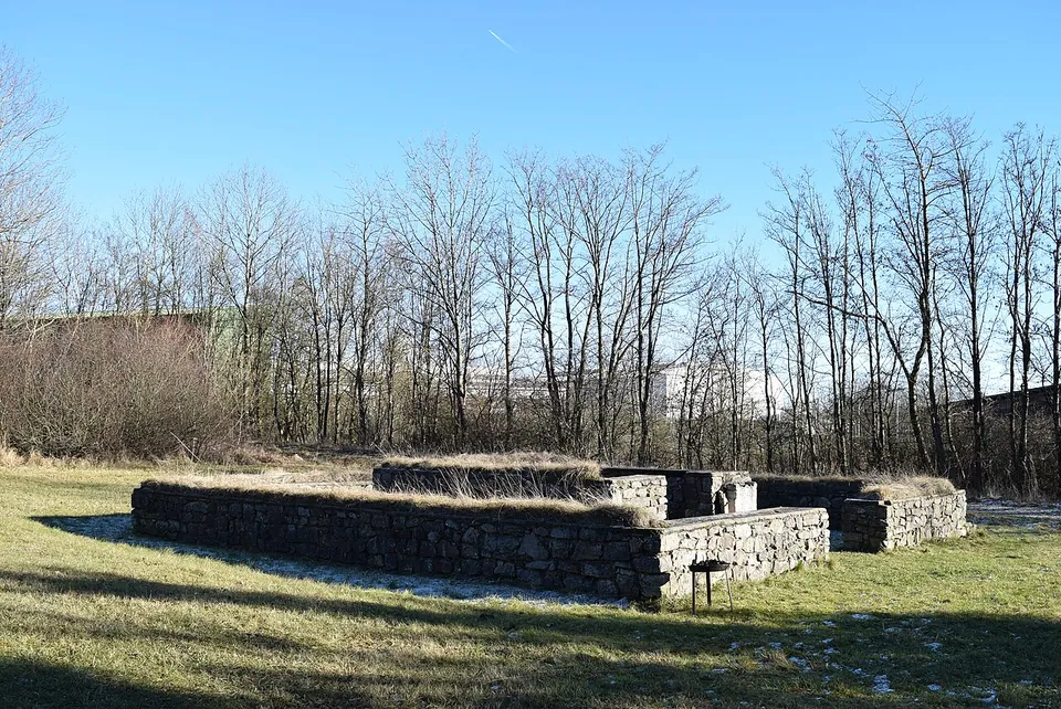
The Tempelheiligtum Zingsheim is a small Gallo-Roman temple of the Matronae Fachinehae, local mother goddesses, a kilometre outside the village of Zingsheim in the Eifel foreland. What you see is a low rebuild of its ground plan, made in 1975–76, standing in a meadow beside an industrial estate.
What is there today
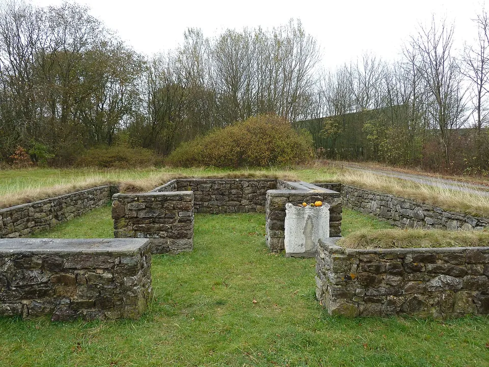
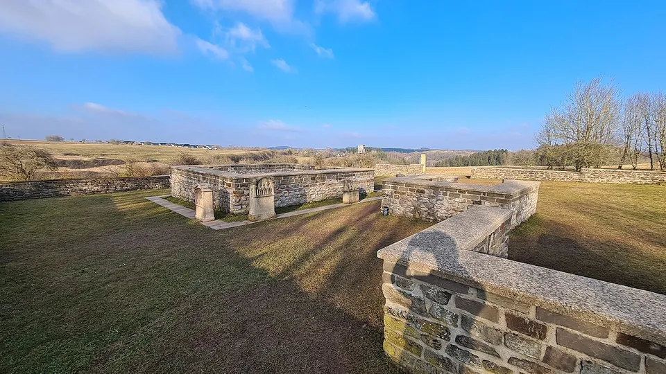
Two squares of grey rubble wall, one inside the other. The inner one is the cella, the shrine room, about 4.5 by 3.7 m inside; the outer one is the walkway round it, about 9.5 by 8.5–9 m, where worshippers came close to the shrine and left their offerings (KuLaDig, de.wikipedia).
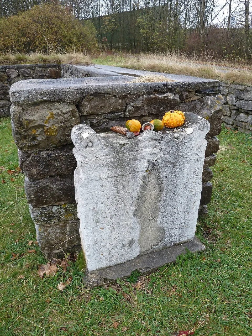
Be clear about what is Roman. The excavators found only the footings of the outer wall, with regular masonry only at the cella, preserved to a height of about 0.6 m; the walls on show were rebuilt on that plan when the site was restored in 1975–76 (de.wikipedia, KuLaDig). The present way in is not evidence of anything either: no entrance was found (KuLaDig). The two votive stones set up at the plan are copies of stones found in a Frankish cemetery about a kilometre to the west (KuLaDig). An information board stands beside the temple (OpenStreetMap).
Is it worth the trip?
On its own, no: it is a ten-minute stop, and the setting, a strip of meadow screened by trees from the sheds of an industrial estate, does not help. Its value is as part of a small group. The Görresburg, another matron sanctuary in the same municipality, is about 3.3 km to the south-west, and the Tempelbezirk Pesch about 5 km to the north-east; de.wikipedia notes that Zingsheim lies between the two. If you are visiting either, this is a short detour that shows the whole plan of a single temple at a glance, and photographs from 2012 and 2021 show fruit and candles left on the stones.
Getting there
The temple lies about a kilometre south-west of Zingsheim’s village centre, on the plot called “Vor Hirschberg” near the road from Zingsheim to Nettersheim, street address Auf der Heide (de.wikipedia, KuLaDig). Farm tracks and a footpath pass right beside it; no car park is mapped at the site. The nearest bus stops in Zingsheim, Marmagener Str./Rathaus and Zingsheim Rathaus, are about 740–790 m away as the crow flies (OpenStreetMap). It is an open field monument with no gate and no ticket, and nobody publishes opening hours for it; de.wikipedia describes it as freely accessible.
Visiting details
- Opening hours
- No set hours; an open-air field monument that de.wikipedia describes as freely accessible. No operator publishes opening times.
- Tickets
- Free; there is no ticket office or gate.
- Parking
- No car park is mapped at the site. Farm tracks and a footpath pass within 15 m of the temple (OSM way/1248131470, way/851738537).
Before you go
- What stands is a low 1975–76 rebuild of the ground plan, and the two votive stones are copies.
- The nearest mapped bus stops, Marmagener Str./Rathaus and Zingsheim Rathaus in Zingsheim, are about 740–790 m away in a straight line.
Hours and prices checked 1 November 2026 on the operator's own site. Confirm before travelling.
History
Votive stones to the Fachinehae turned up around 1900 about a kilometre to the west, at Gleisinger Heck, reused as the sides of graves in a Frankish cemetery of the Merovingian period. Building remains and decorated fragments later came to light at “Vor Hirschberg” when new farm tracks were laid out (de.wikipedia dates this to the early 20th century, KuLaDig to the 1960s), and the Rhineland’s archaeological service excavated from 1963 (de.wikipedia, KuLaDig).
The dig exposed about 1,700 m² and found a four-sided ambulatory temple: a cella walled in greywacke and limestone rubble set in mortar, ringed by a walkway whose tiled roof rested on wooden posts. Numerous nails found around the cella and walkway are read as a sign of timber construction. A later wall about 8.5 m long was added on the south-east side, possibly to display votive gifts. Roman walls cut about 30 m to the north-west were not investigated further, and the archaeologist Frank Biller assumes the temple belonged to a larger complex not yet found (de.wikipedia).
Two inscription fragments name the goddesses, one reading “Matroni[s] Fa(c)hin[e]hab[us]”. Other finds include the torso of a genius, a life-size hand in yellow sandstone, a woman’s head, and a fragment of a draped female figure that probably held a fruit basket and is read as a matron (de.wikipedia). The origin of the goddesses’ name is not settled; recent research, KuLaDig reports, derives it from a Germanic river name meaning “river with fish weirs”. Some of the worshippers bore Germanic names, which points to a native cult, while the stone temple and the votive stones show it given Roman form; the quality of some dedications suggests the worshippers were well off (KuLaDig).
Twenty-two coins date the use of the sanctuary. The earliest is an as of the 1st or 2nd century, and the series ends with a coin of Theodosius I struck at Lugdunum between 388 and 392 (de.wikipedia). The finds are mostly of the 3rd and 4th centuries and stop towards the end of the 4th, which dates the sanctuary’s abandonment (KuLaDig). The site is a protected archaeological monument (KuLaDig).
More photographs
Nearby
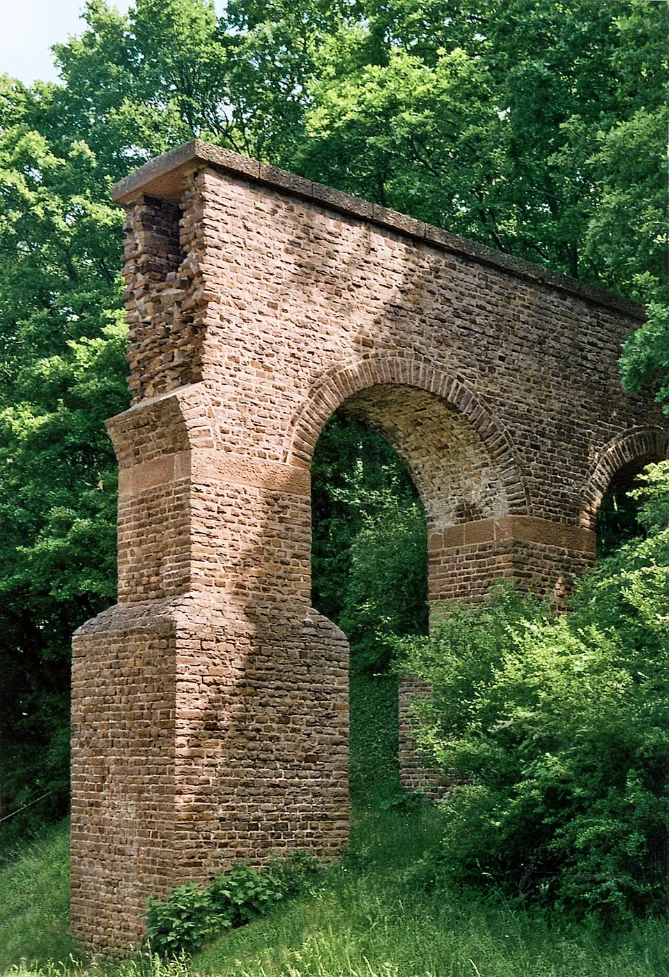
Photo: Mediatus · CC BY-SA 3.0 · Commons
3 km · aqueduct · North Rhine-Westphalia
Eifel Aqueduct
Very little of the aqueduct ever stood above ground, and most of what did was quarried away in the Middle Ages (de.wikipedia).
3 km · temple · North Rhine-Westphalia
Görresburg
A low wall encloses a trapezoid of grass holding three small, almost square buildings, all facing east (KuLaDig, LVR; Eifel Tourismus).
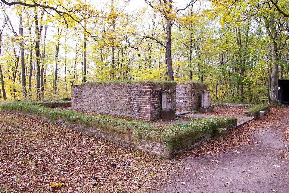
Photo: Klaus Littmann · CC BY-SA 3.0 · Commons


Straight-line distances.
Sources
Every fact on this page comes from the records below, each used under the licence noted.
| Source | Licence |
|---|---|
| Pleiades 214198449 | CC BY |
| Wikidata Q22694716 | CC0 |
| OpenStreetMap node/413596798 | ODbL |
| KuLaDig (LVR-Amt für Bodendenkmalpflege im Rheinland) — Matronenheiligtum in Zingsheim | licence not recorded |
| Wikipedia (de) — Tempelheiligtum Zingsheim | CC BY-SA 4.0 |