

What is there today
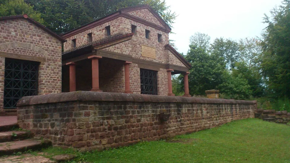
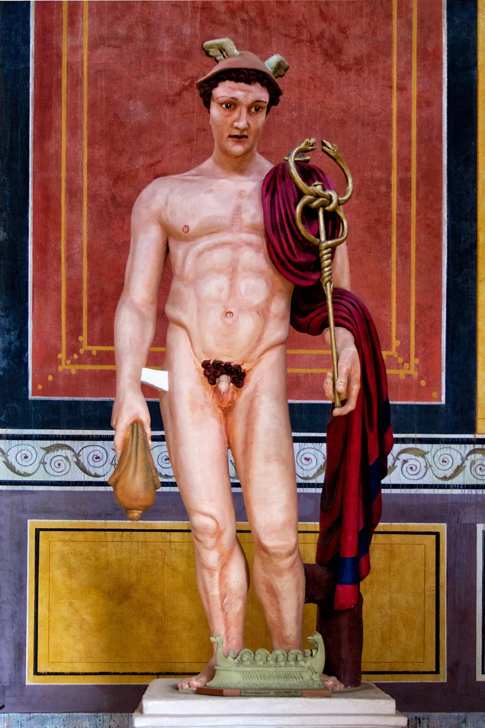
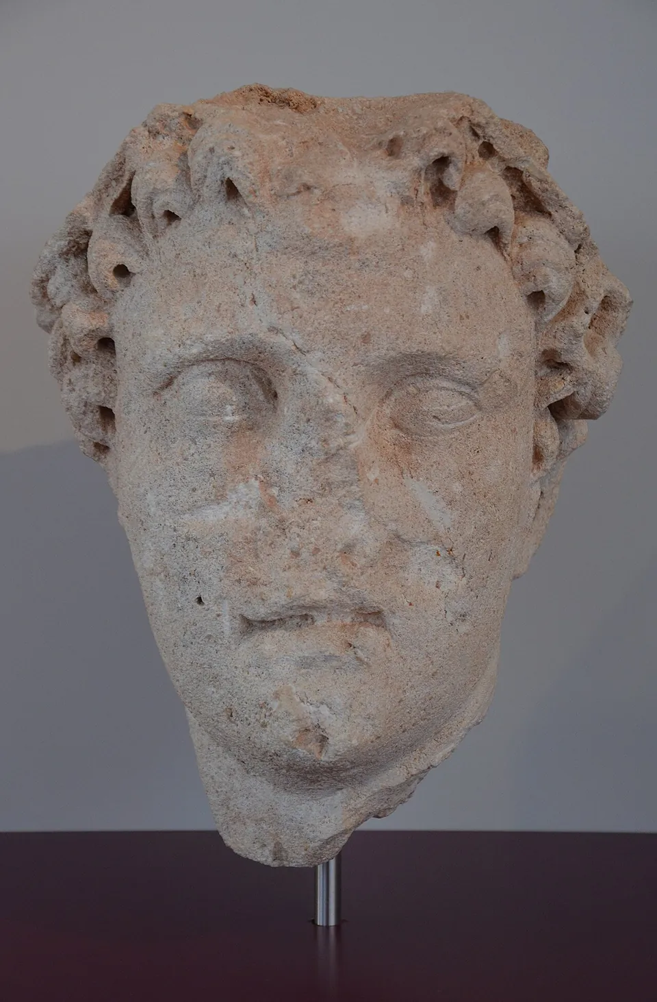
Inside a walled precinct of about 46 × 36 m (de.wikipedia), the main temple has been rebuilt: a Gallo-Roman ambulatory temple with a portico on three sides, Tuscan columns, and a central chamber, the cella, rising above the portico roof. The building measures 10.80 × 9.80 m and the cella 7.50 × 5.70 m. A Latin inscription over the front, dated 1 August 1989, records that it was excavated by Sabine Faust and rebuilt by Karl-Josef Gilles. The cella has been painted inside, and since 2002 it has held a painted statue of Mercury, 2.08 m tall, made around a cast of the original head found in the well (the operator). A smaller temple, Temple II, has also been rebuilt and painted inside in black, red and white after plaster found in the main temple, and a large secular building, whose purpose is still unclear, stands rebuilt too (the operator).
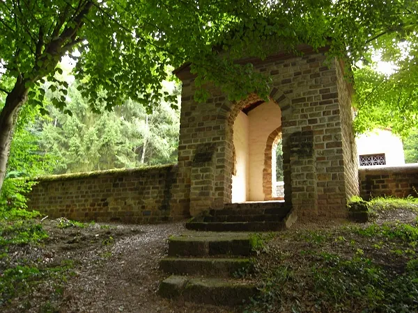
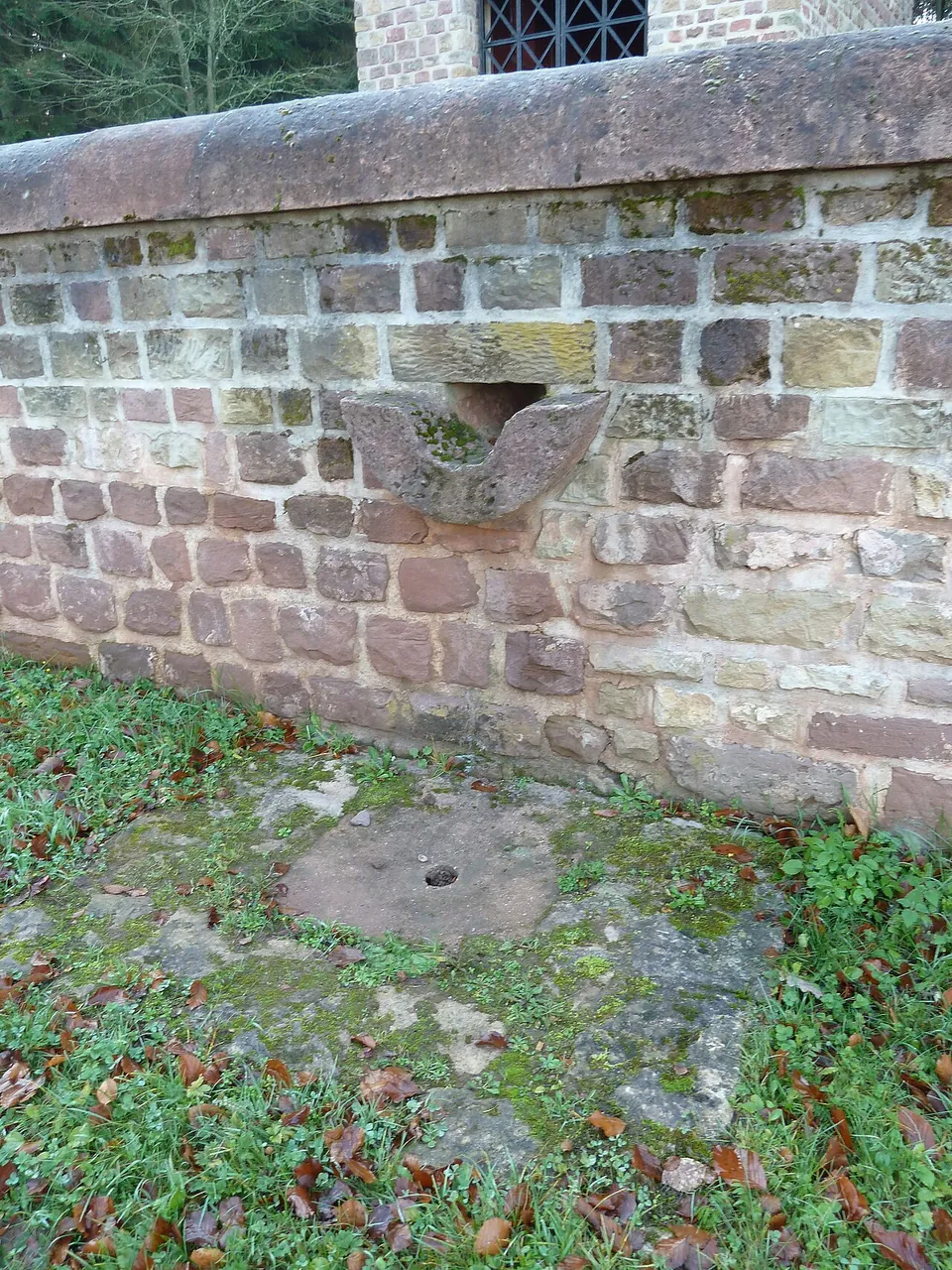
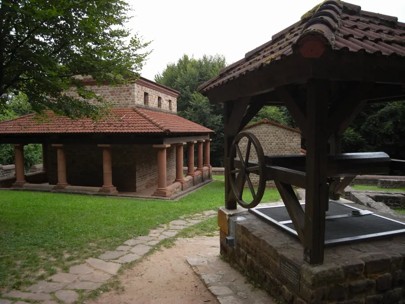
The other temples are shown as ground plans: the outlines of two small temples on the floor and in the portico of the main temple, and the plan of an older temple in front of a second large ambulatory temple. The operator’s site plan also names four small treasury buildings and two gates in the precinct wall. Some of what you walk past is original and in place: parts of the sandstone gutters in front of the main temple’s portico, and part of the floor of Temple II, with a sandstone block whose crescent-shaped cutting once held a cult image. The well, about 15 m deep and lined with masonry for its upper 9 m before it runs into the rock, has been given a working reconstruction of the Roman piston pump whose parts were found in it, and a copy of the dedication inscription found in the shaft, completed, is set up beside it. A Jupiter column in the lower precinct is modern, built with a copy of a Corinthian capital found in one of the temples (the operator).
The operator is candid about the limits of the rebuild: some details, such as the roof tiles, depart from the Roman original, and the large room of the secular building was probably closed by a wall, unlike the reconstruction. A cleared strip through the trees gives a view down the Moselle valley to Trier in clear weather. A free audio guide in German, French and English plays from a QR code on the board at the entrance (the operator), and toilets are mapped beside the temple (OpenStreetMap).
About 700 m away, at the foot of the hill, lies the roadside settlement of Tabernae, which gave Tawern its name. It was uncovered in the mid-1990s; its buildings lined both sides of a road more than 6 m wide, and the cellars are the best-preserved remains (Mosellandtouristik). OpenStreetMap maps excavated walls and a stretch of the Roman road there. Its information boards were renewed in 2026, but the 1:75 model of the settlement, normally shown in a pavilion, was away for restoration when the operator last reported on it in September 2026.
Is it worth the trip?
Yes, if you want to see what a Gallo-Roman temple looked like, and especially if you are in Trier anyway: the rebuilt main temple, with its painted cult room and statue, shows the type more clearly than any ground plan can, it costs nothing, it is open all year, and it comes with a walk through the woods. Go knowing what it is. The temples you see were rebuilt in the late 1980s on the excavated site; the original material is the ground plan, the well and a few stones in place. The head of Mercury, the best-known find, has been photographed in the Rheinisches Landesmuseum in Trier, and the statue in the temple is a modern figure. The settlement at the foot of the hill is a short add-on, better seen once its model is back.
Getting there
The precinct is signposted from the Konz–Saarburg road after Konz-Könen and from the Konz–Perl road at Temmels, and in the village the signs lead to a small car park for about ten cars on its edge (the operator; de.wikipedia). From there a forest road climbs to the temple: published figures range from 800 m to 1 km, or 10 to 15 minutes on foot. There are bus stops in the village, the nearest about 1 km in a straight line from the temple, but no timetable was checked; a car is the practical way.
Both the temple precinct and the settlement are open all year, and neither charges admission; the volunteer association that looks after them, the Verein Römisches Tawern, asks for donations. Guided tours are given by arrangement, at €3 per adult and €2 per pupil or student, at least €15 per tour (roemisches-tawern.de, read 30 October 2026).
Visiting details
- Opening hours
- Open all year; no daily opening times are published, and de.wikipedia describes the grounds as accessible round the clock. The roadside settlement (Vicus Tabernae) at the foot of the hill is also open all year.
- Tickets
- Free for both the temple precinct and the roadside settlement; the volunteer association that looks after them asks for donations. A free audio guide in German, French and English is reached by a QR code on the information board at the entrance and takes 20–30 minutes. Guided tours must be booked in advance; €3 per adult and €2 per pupil or student, at least €15 per tour, with group rates of €30–50 for up to 30 people (€20–40 for school groups).
- Parking
- Signposts lead from the village of Tawern to a small car park for about ten cars, from which a forest road climbs to the precinct (de.wikipedia; the operator). OpenStreetMap maps a car park about 260 m from the temple (way/665939852).
- On foot
- About 15 min from the parking
Before you go
- The temple stands in woodland on the Metzenberg, reached on foot up a forest road; published figures for the walk from the car park range from 800 m to 1 km, or 10 to 15 minutes, uphill.
- The 1:75 model of the Roman settlement, normally shown in a pavilion at the vicus, was away for restoration when the operator last reported on it (September 2026).
- Bus stops are mapped in the village of Tawern, the nearest about 1 km in a straight line from the temple and about 300 m from the vicus; no timetable was checked.
Hours and prices checked 30 October 2026 on the operator's own site. Confirm before travelling.
History
The Roman road from Trier to Metz, and on via Lyon to the Mediterranean, passed about 200 m from the temple, and travellers coming north caught their first sight of Trier from the hill (the operator). At its foot a roadside settlement grew up, with an inn and craftsmen serving the road (Mosellandtouristik); published dates for its founding run from shortly before the turn of the era (Mosellandtouristik) to the first half of the 1st century AD (the operator). The sanctuary on the hill was built in that same first half-century (the operator). Travellers on the road, which de.wikipedia calls the Via Agrippa, are said to have made offerings here to Mercury, god of trade and traffic (de.wikipedia).
The precinct originally held probably five temples, their fronts in a line facing the valley. Over time four ancillary buildings and two gates were added; one temple was replaced by a new one directly uphill behind it, and three others gave way to a larger temple with a portico on three sides, which held a larger-than-life statue of Mercury (de.wikipedia). An inscribed stone block from the well carries two phases of dedication: first by a man named Gratus, who gave Mercury what was probably a small temple, and later by three slaves he had freed, who probably paid for building or repairing the well (the operator). Other finds from the shaft include an altar dedicated to both Apollo and Mercury and reliefs of the horse goddess Epona and of the Egyptian pair Isis and Serapis.
A coin deep in the well shows it was still intact at the end of the 4th century. The precinct was probably destroyed by Christians around the time of the ban on pagan cults in 392, its statues and inscriptions broken and thrown into the well (de.wikipedia; the operator). The site was known from the 1930s, but its extent was not; it was excavated in 1986–87 under the Rheinisches Landesmuseum Trier, and the plan to conserve the foundations soon became a partial reconstruction, the first in the wider Trier area (the operator; de.wikipedia).
More photographs



Nearby
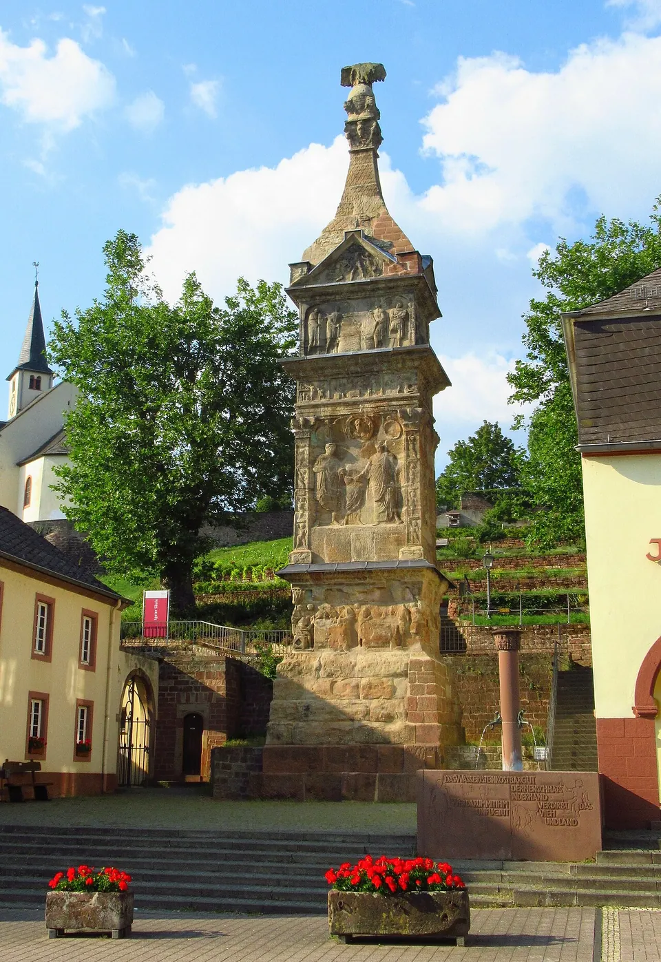
Photo: Dkvtig · CC BY-SA 4.0 · Commons
6 km · tomb · Rhineland-Palatinate
Igel Column
The monument itself, still standing where the Romans built it.
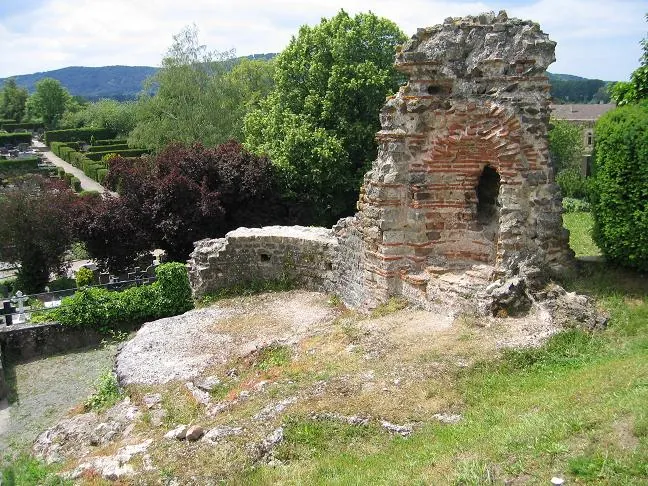
Photo: Johannes Simon · Public domain · Commons
6 km · villa · Rhineland-Palatinate
Kaiservilla Konz
The piece the tourist board points to is part of a cold-water basin, about 4 m high.
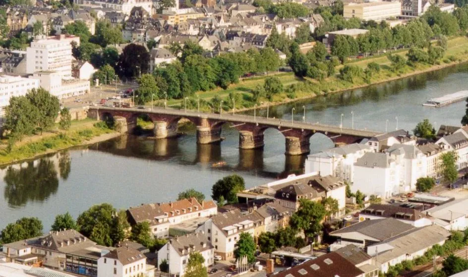
Photo: Stefan Kühn · CC BY-SA 3.0 · Commons
13 km · bridge · Rhineland-Palatinate
Roman Bridge
What you are looking for is the piers, not the arches.


Straight-line distances.
Sources
Every fact on this page comes from the records below, each used under the licence noted.