

What is there today
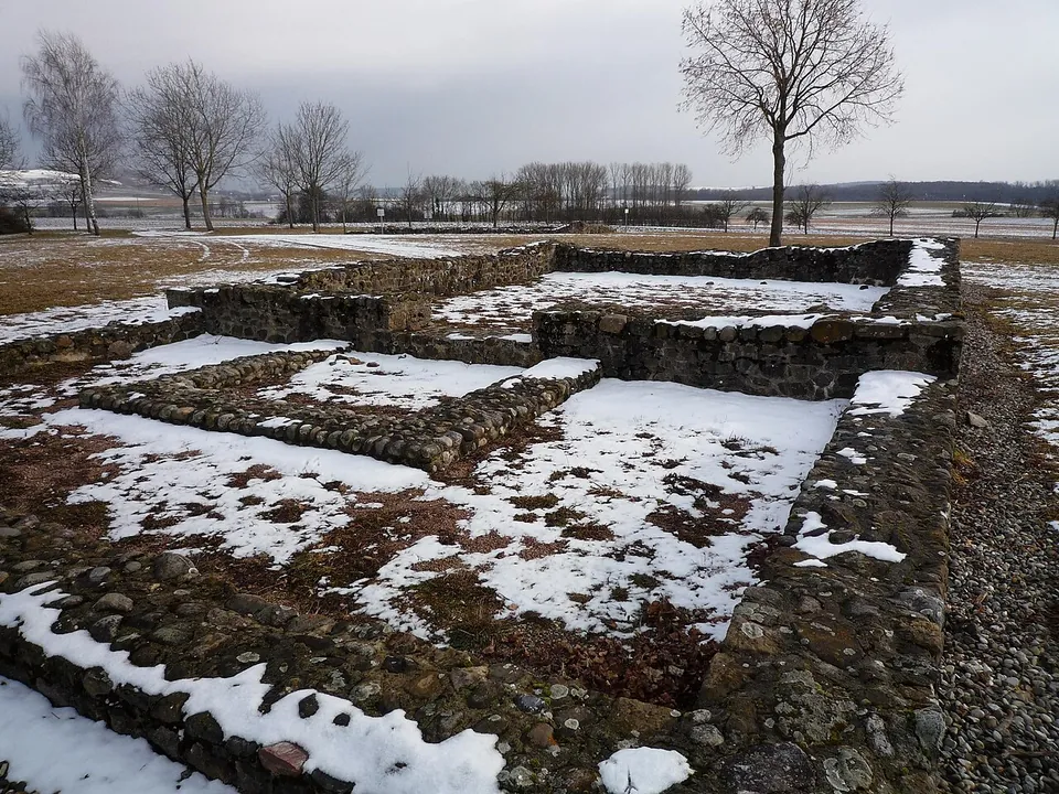
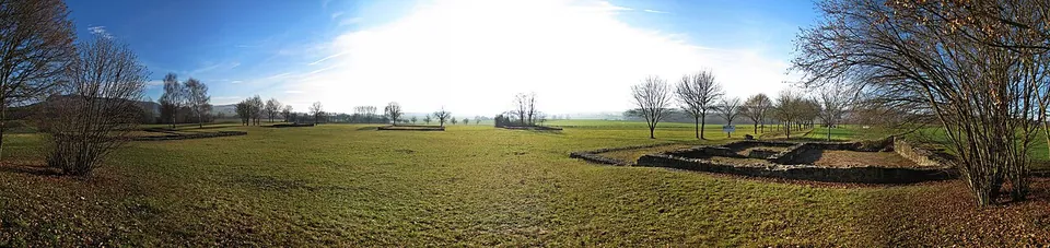
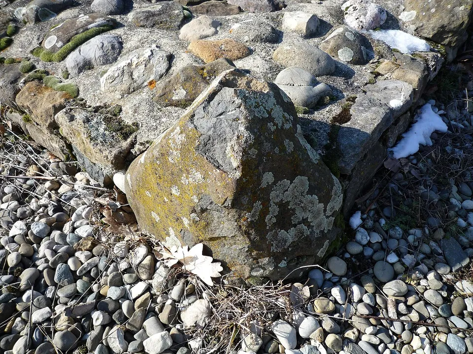
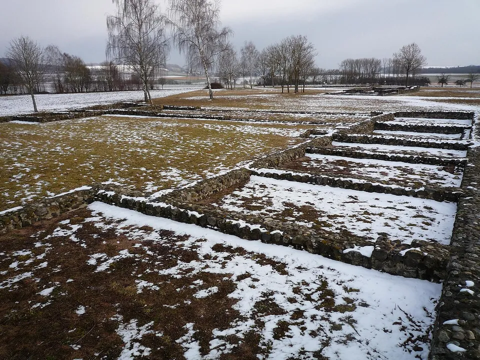
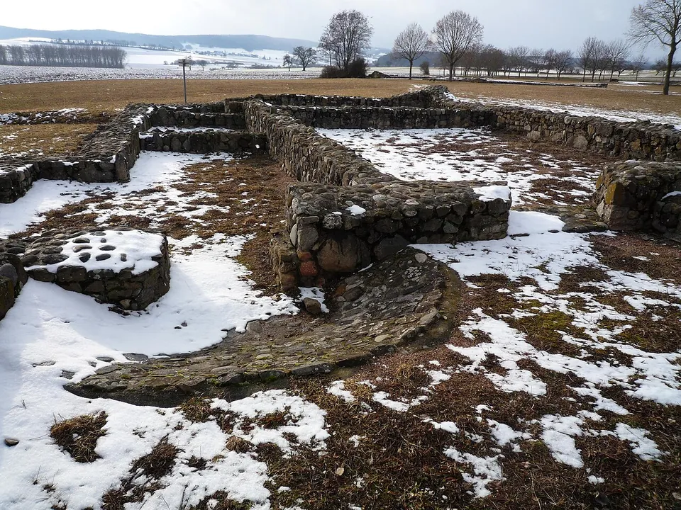
The walls are what you see, and they are low: the town of Tengen describes the farm as almost completely restored in its foundations, and de.wikipedia says the ground plans were rebuilt with modern methods, completing whatever original masonry survived. No building has been raised above its foundation walls, and there are no roofs. What you get instead is the plan of an entire Roman farm in one place. The walled grounds cover 5.4 hectares, and published counts of what you can walk between differ: the town speaks of ten excavated stone buildings, de.wikipedia of nine, of which the stable and the slaughterhouse were covered over again after the dig.
At the centre is the main house, about 35 by 40 m, its ten rooms set around a courtyard of some 600 m² (de.wikipedia; the town page). Facing its entrance hall is a temple, larger than most Roman temples of its kind in Baden-Württemberg; nothing found says which god it served. The bath house lies at the lowest point of the grounds, where the outflow of its cold-water basin is still clear, with a rebuilt drain leading away (the town’s leaflet). OpenStreetMap maps information boards beside the buildings, among them the main house and the temple. The finds, with a copy of the farm’s coin hoard, are shown in the Archäologisches Hegau-Museum in Singen (de.wikipedia).
Is it worth the trip?
Worth it if you are in the Hegau, around Singen, or following the Römerstraße Neckar–Alb–Aare route, which passes the site: it is one of the larger Roman farms in southern Germany (the town ranks it second in Baden-Württemberg and Bavaria), no admission charge is published, and it is laid out so that the whole working estate reads at a glance. It is not worth a long detour on its own. These are restored foundation walls in a field, explained by information boards, and an hour or so covers them; pairing the visit with the finds in Singen makes a fuller half-day.
Getting there
The site lies in open farmland south-south-east of Büßlingen, a village of the town of Tengen in the Konstanz district, about 1 km west of the B 314 and 2 km from the Swiss border (de.wikipedia). It is on the road from Singen via Storzeln to Büßlingen, and from Büßlingen you follow the signs (the town’s page and leaflet). There is a free car park about 200 m from the main house, and grass paths lead between the buildings (OpenStreetMap). No bus stop is mapped at the site; the nearest is about 900 m away on the main road, so this is a visit by car or bicycle.
The town publishes no opening hours or admission charge for the site, and OpenStreetMap maps it as free and open at all times (read 30 October 2026). The town ran a guided tour of the site as part of its 2026 programme of walks.
Visiting details
- Opening hours
- The town publishes no opening hours. It describes an open-air site reached by following the signs from Büßlingen, and OpenStreetMap maps it as open at all times.
- Tickets
- No admission charge is published, and OpenStreetMap maps the site as free.
- Parking
- Free gravel car park about 200 m from the main house (OSM way/640125438); grass paths lead between the buildings.
Before you go
- No bus stop is mapped at the site. The nearest, at the Schlatt am Randen turn-off on the main road, is about 900 m away; in practice this is a car or bicycle visit.
Hours and prices checked 30 October 2026 on the operator's own site. Confirm before travelling.
History
A terra sigillata bowl of the late 1st century dates the founding, and comparison with finds from Rottenburg and the forts at Heilbronn-Böckingen and Bad Nauheim puts it at AD 75 to 80. The first buildings were probably of timber, though no finds at Büßlingen confirm it, and building in stone is assumed only from the mid-2nd century, by comparison with villas nearby. Some of the pottery is of Celtic origin, which suggests that Romans and Celts lived on the farm together (de.wikipedia). The farm lay in the province of Germania Superior, about 15 km from the vici at Schleitheim (Iuliomagus) and Orsingen (de.wikipedia).
The poor, waterlogged soils of the area suited livestock better than crops, and bones found on the site are mostly of oxen. On estimates in de.wikipedia, 40 to 50 people may have lived and worked here, with up to 100 hectares of land; the surplus may have supplied the towns of Tasgetium (Eschenz) or Iuliomagus.
The end is dated by a hoard of about a hundred coins (99 or 100 in different counts) hidden in the wall of one of the outbuildings by someone who had collected them between 240 and 259. The Alamanni pushing south in the years after 260 may be why it was never recovered; the farm ended in 263 at the earliest, after some 190 years (the town; de.wikipedia), though whether the latest coin, which gives that date, belongs to the hoard is not certain. What came after is uncertain too: a 4th-century brooch and traces of a post-built structure in the courtyard of the main house suggest some later use by Romans or Alamanni, though none of the finds proves a lasting settlement (de.wikipedia).
The first finds came up during drainage work around 1900. Land consolidation made excavation necessary from 1976; the town of Tengen commissioned it, under the Konstanz district archaeologist Jörg Aufdermauer, with the aim of creating an open-air museum, and excavation, reconstruction and paths were finished in 1982 (de.wikipedia). The site is a protected Kulturdenkmal under Baden-Württemberg’s heritage law.
More photographs


Nearby
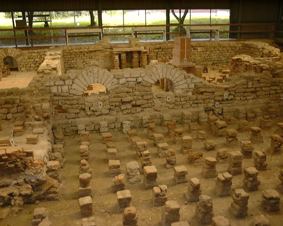
Photo: Nowic · CC BY-SA 3.0 · Commons
18 km · bath · Schleitheim District, Schaffhausen
Iuliomagus
The Thermenmuseum shows the remains of the Roman baths (de.wikipedia): walls of the bath rooms and rows of small brick pillars, under a roof (Wikimedia Commons photograph).
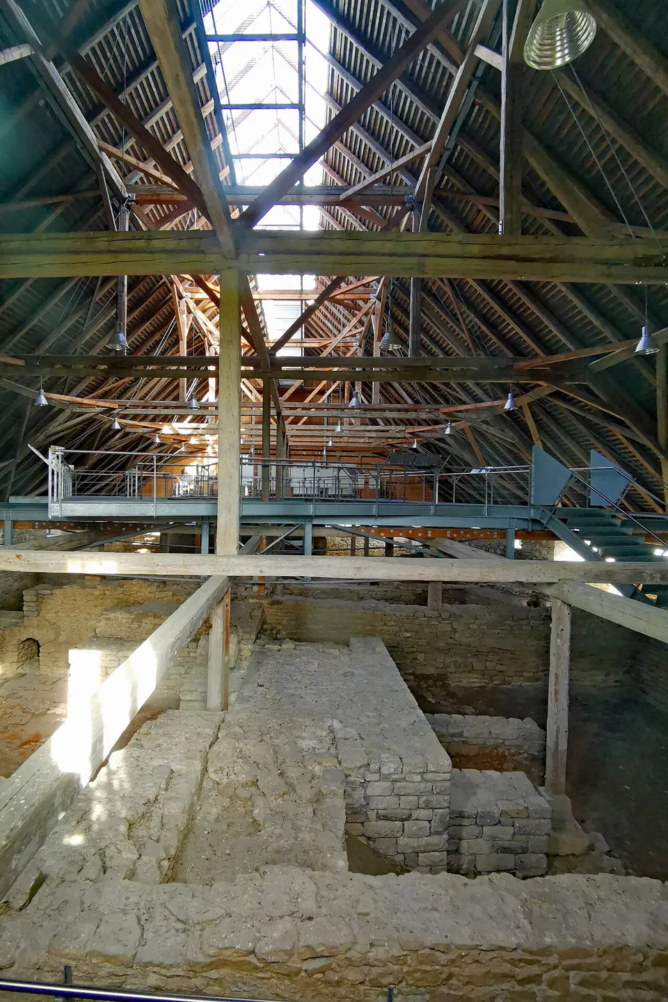
Photo: PaulT (Gunther Tschuch) · CC BY-SA 4.0 · Commons
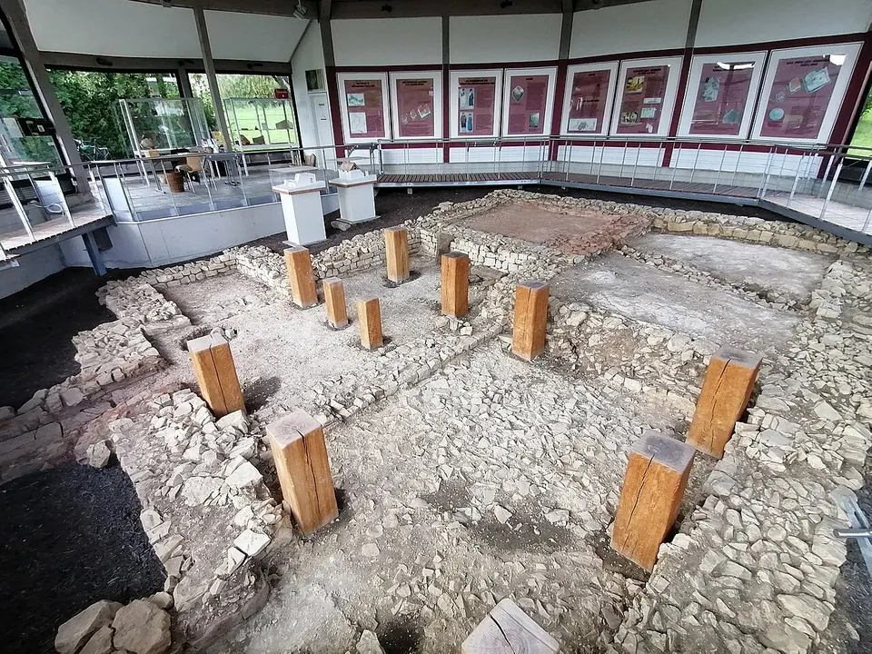
Photo: Schwartenmagen · CC BY-SA 4.0 · Commons
24 km · bath · Baden-Württemberg
Römisches Bad
What you see are the bath's foundation walls, conserved where they were excavated and roofed over with a shelter that has been open to the public since May 1998, so a visit works in any weather (de.wikipedia; the operator).


Straight-line distances.
Sources
Every fact on this page comes from the records below, each used under the licence noted.
| Source | Licence |
|---|---|
| Wikidata Q1169580 | CC0 |
| Vici.org 8195 | CC BY-SA (text), CC0 (metadata) |
| OpenStreetMap way/1387288584 | ODbL |
| Wikipedia (de) — Römischer Gutshof von Büßlingen | CC BY-SA 4.0 |
| Stadt Tengen — Römischer Gutshof Büßlingen (the town that runs the open-air site) | licence not recorded |
| Stadt Tengen — Der römische Gutshof von Tengen-Büßlingen, visitor leaflet (PDF) | licence not recorded |