What is there today
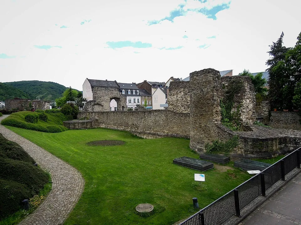
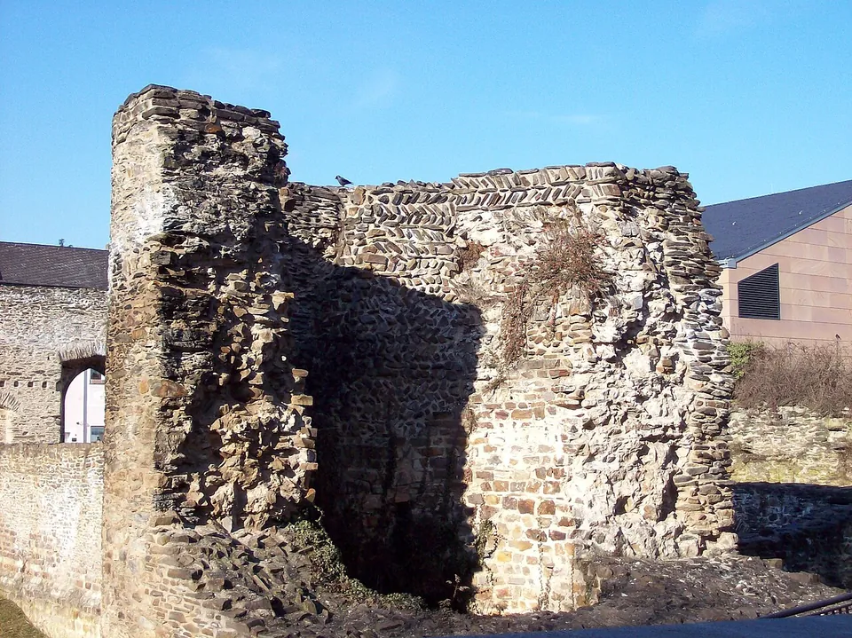
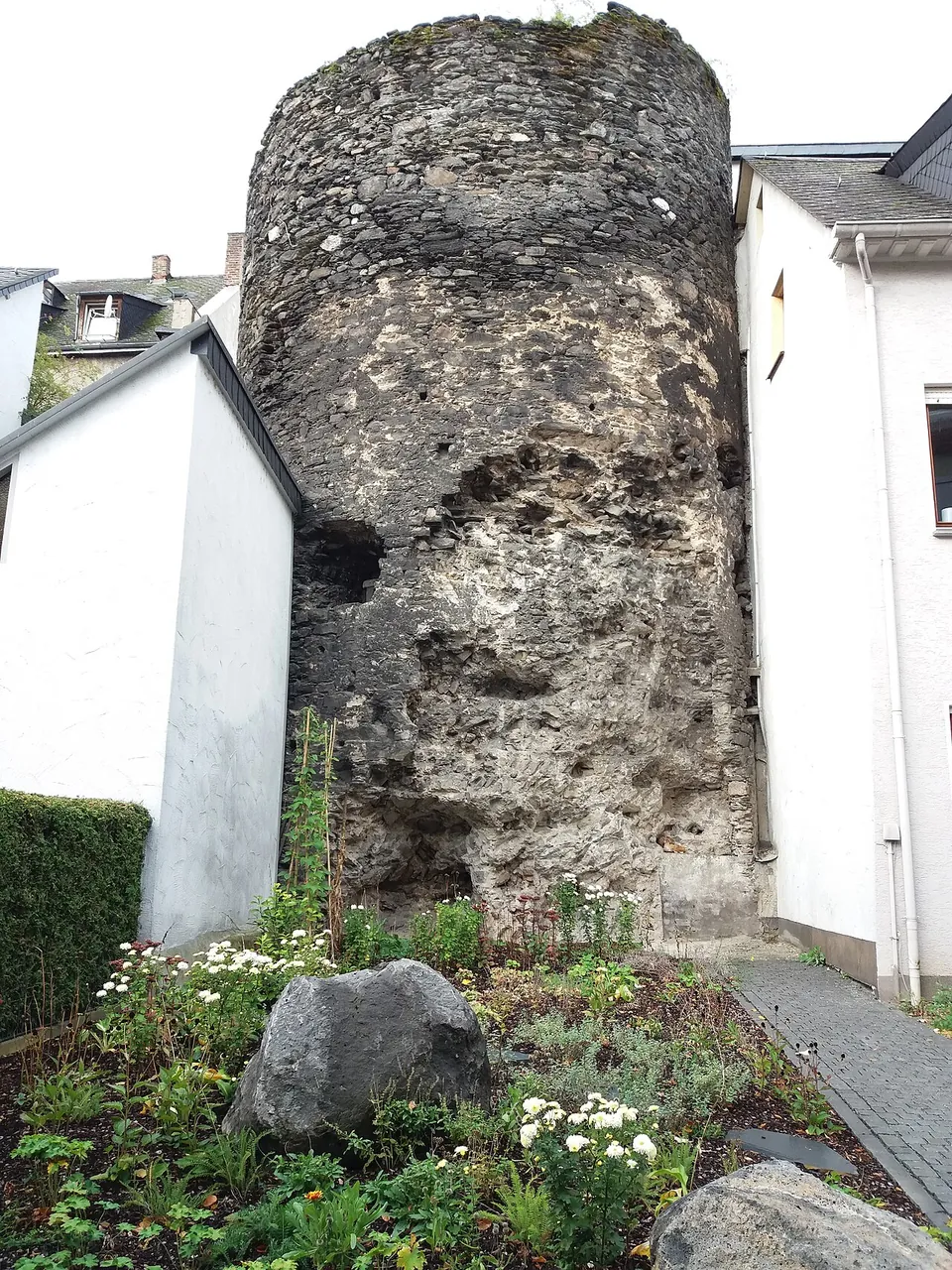
The longest exposed stretch is in the park at Kirchgasse and Angertstraße, on the south side of the fort. Excavations in 1989–1995 uncovered the fort wall here without a break for more than 55 m; Tower 9 still stands up to 8 m high, while its neighbour, Tower 8, survives only to ground level. The finds were thought important enough that the heritage office stopped a police station being built on the plot and had the area kept open (de.wikipedia). Three of the more than 40 graves found in 1989–1990 have been conserved in place (de.wikipedia); Commons photographs of the park show them under low glass-topped cases in the lawn.
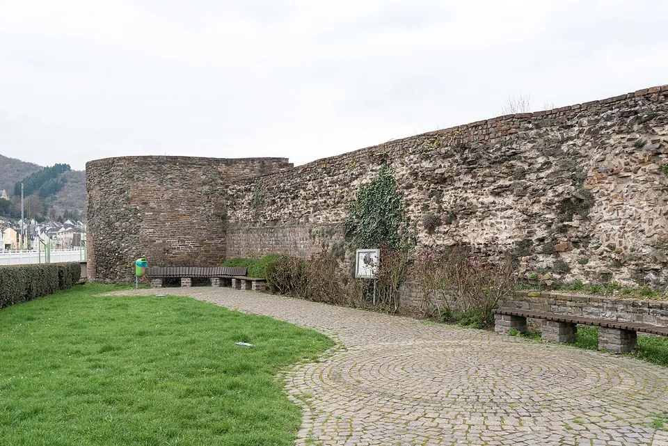
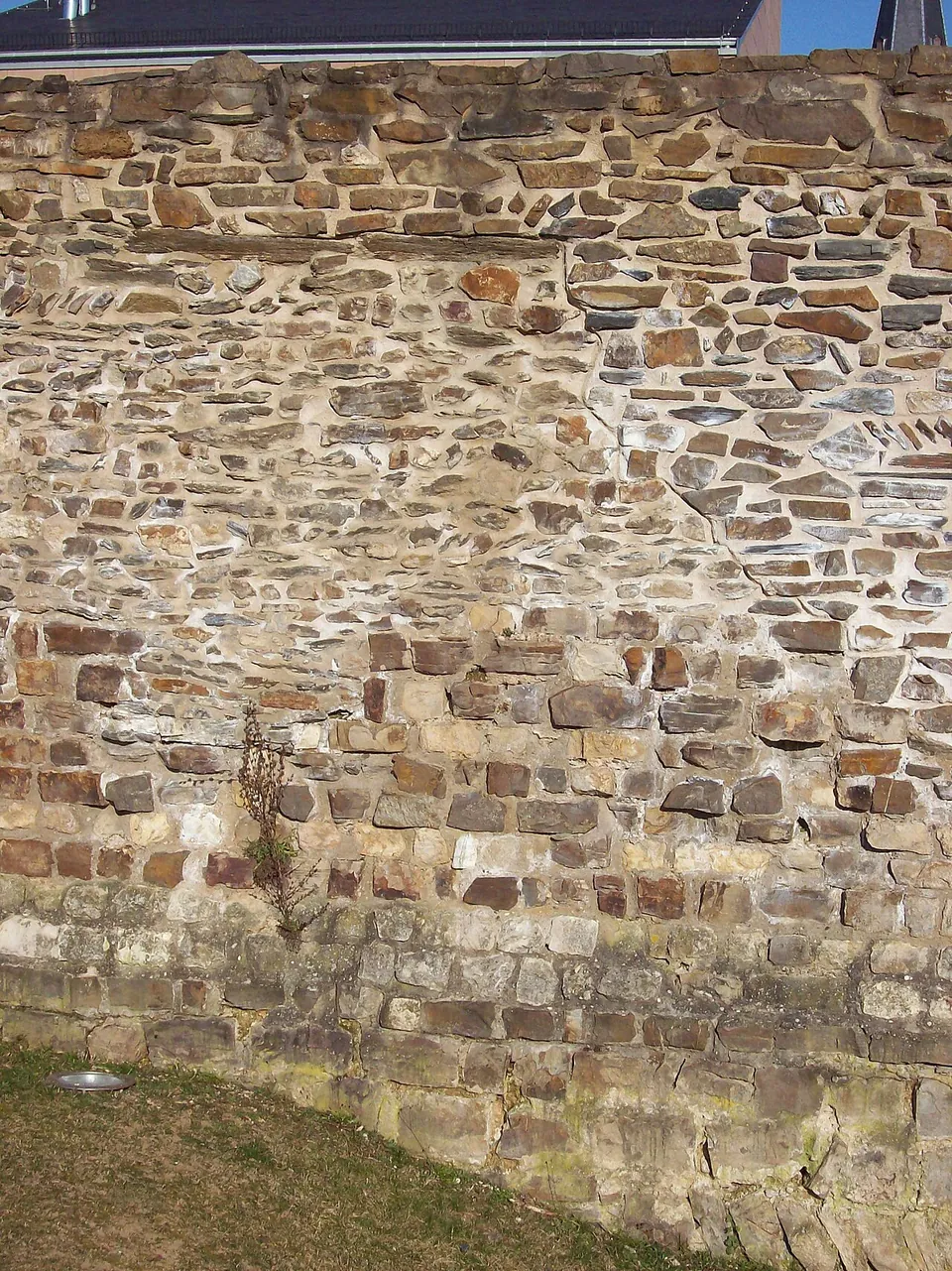
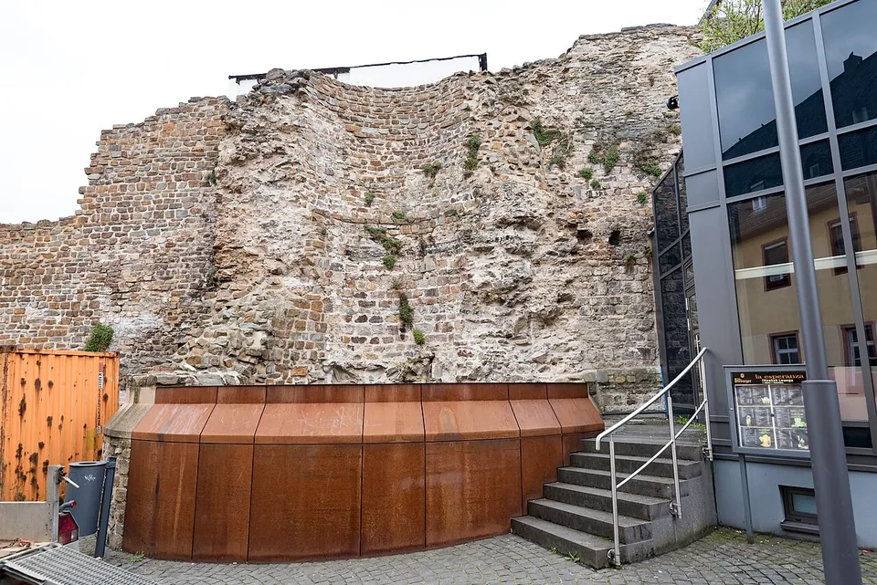
On the west side, a row of houses was demolished early this century to make way for an underground car park, and about 50 m of wall is freely accessible again (de.wikipedia); this is the stretch on Karmeliterstraße. The museum’s free exhibition “Römer in Boppard” opened there, at Karmeliterstraße 7, in January 2020 (Rheinsteig tourist portal; Museum Boppard). Other towers and pieces of wall turn up between houses around the old town, whose core the fort remains form (de.wikipedia; Tourist Information Boppard). In the masonry, look for courses laid in a herringbone pattern (opus spicatum), which the fort wall has at varying heights (de.wikipedia). The walls served as the town wall into the Middle Ages, and later building and facing are mixed in with the Roman work (de.wikipedia; Commons file descriptions).
The fort’s bath lay where the church of St. Severus stands. Excavations under the church in 1963–1966 also found a 5th-century baptismal font, which was left in place; since December 2011 it can be seen on guided tours of the church (de.wikipedia). Other Roman finds are in the town museum in the Kurfürstliche Burg (de.wikipedia), which, unlike the Roman exhibition, charges admission: €4 for adults (Museum Boppard).
Is it worth the trip?
Yes, if you are anywhere on the Middle Rhine. This is standing late Roman wall, not a foundation plan in the grass, and it costs nothing to see: the remains are open at all times, the exhibition is free, and the whole thing is in the middle of a town with a railway station and a Rhine boat landing a few minutes’ walk away. What it is not is a self-contained ruin. The fort is the core of Boppard’s old town, so the walls come in pieces between streets and houses, and a visit means walking from the park to the western wall and looking for the rest. What you see is the defences; the bath, the one building inside the fort that the sources describe, lies under the church.
Getting there
The fort lies in the centre of Boppard. From the fort’s mapped point, the main station, Boppard Hbf, is about 400 m away, the Boppard Süd halt about 270 m and the KD Rhine boat landing about 270 m (OpenStreetMap). Bus stops at Marienberger Straße are about 70 m away, and there is a paid car park about 135 m away, with free public toilets nearby (OpenStreetMap).
The walls are freely accessible and can be visited at any time (Tourist Information Boppard, via Romantischer Rhein). The exhibition “Römer in Boppard” at Karmeliterstraße 7 is free and opens Tuesday to Friday 10.00–17.00 and Saturday and Sunday 11.00–18.00, also on Mondays that are public holidays; it is closed from 24 December 2026 to 6 January 2027 (Museum Boppard, read 1 November 2026).
Visiting details
- Opening hours
- The open-air remains can be seen at any time. The free exhibition "Römer in Boppard" (Karmeliterstraße 7) opens Tuesday to Friday 10.00–17.00 and Saturday and Sunday 11.00–18.00, also on Mondays that are public holidays 11.00–18.00; closed 24 December 2026 to 6 January 2027.
- Tickets
- Free, both the fort walls and the "Römer in Boppard" exhibition.
- Parking
- A paid car park is mapped about 135 m from the point (OSM way/1149162787); bus stops at Marienberger Straße about 70 m away.
Before you go
- The fort is part of the town centre, not a fenced site; the walls stand in pieces between houses and streets, with the largest stretch in the park at Kirchgasse / Angertstraße.
Hours and prices checked 1 November 2026 on the operator's own site. Confirm before travelling.
History
Roman settlement at Boppard goes back to the 1st century. The name probably comes from an earlier Celtic settlement, Boudobriga, and the place appears as Bouobriga on the Peutinger Table and as Bontobrice in the Antonine Itinerary. A village of fishermen and traders lay by the river at the mouth of the Mühltal, prospering in the 1st to 3rd centuries (de.wikipedia).
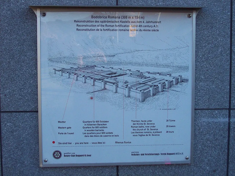
After the Rhine had again become the frontier in the 3rd century, the fort was built about a kilometre from the village around the middle of the 4th century, on slightly raised ground above the reach of floods. It measured 308 × 154 m, about 4.6 hectares, with a wall 3 m thick on the landward sides and up to 28 towers set roughly every 27 m. Unlike the late Roman forts at Andernach, Koblenz, Bingen or Mainz, it did not have to fit around existing buildings, and it seems to have been laid out to a plan (de.wikipedia; Pleiades). The towers were unusually massive, about 10 m high and 8.70 m across, and the Notitia dignitatum, a 5th-century list of Roman offices, records artillerymen, milites balistrarii, as the garrison, under the commander in Mainz. A military bath, 50 × 35 m, was built against the north wall at the same time; coins of Constantius struck between 341 and 346 were found beneath its floor (de.wikipedia).
The garrison left early in the 5th century, but people went on living inside the walls. The bath burned around 406/407, and a church, the forerunner of today’s St. Severus, was built over it in the middle of the 5th century (de.wikipedia). The walls remained the town wall into the 12th century, and the south wall stayed part of the medieval defences after that. Large pieces were lost in the 19th century, a section of the west wall was knocked down in 1969, and in the early 1990s Towers 1 to 5 at the south-west corner were demolished for the realignment of the B 9 road (de.wikipedia). Since 2002 the fort has been part of the Upper Middle Rhine Valley World Heritage Site (de.wikipedia).
More photographs
Nearby
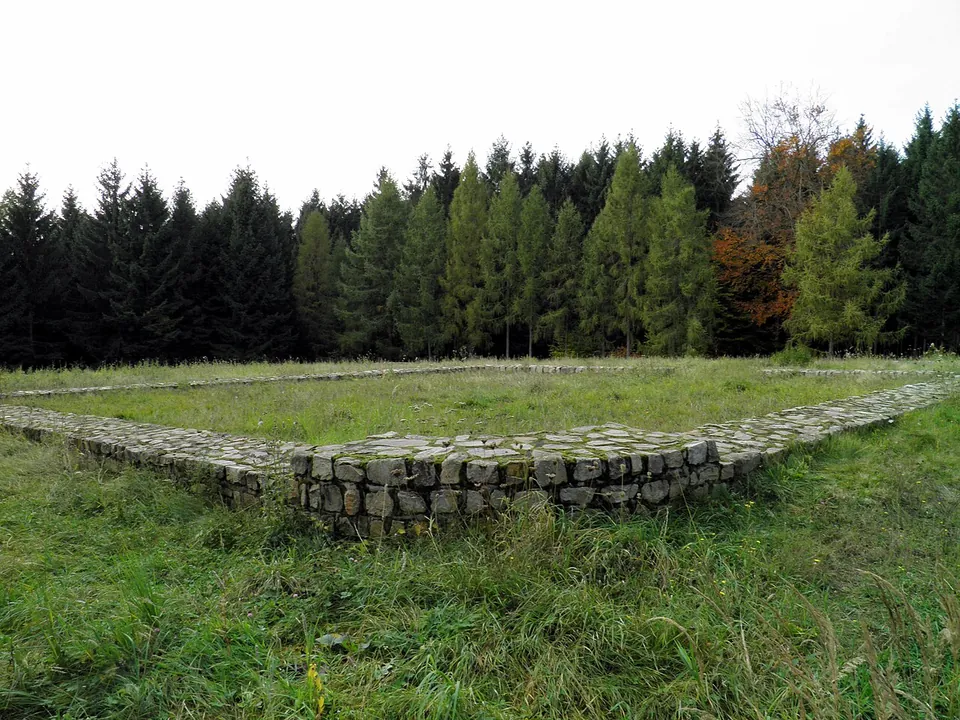
Photo: Carole Raddato from FRANKFURT, Germany · CC BY-SA 2.0 · Commons
22 km · fort · Rhineland-Palatinate
Kleinkastell Hillscheid
The fort's outline lies in a clearing in the Hillscheid forest.
47 km · fort · Rhineland-Palatinate
Rigomagus
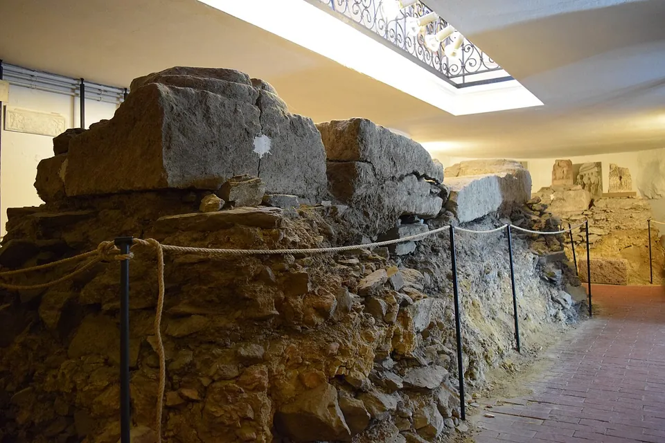
The Römisches Museum occupies a 15th-century chapel on Kirchstraße.
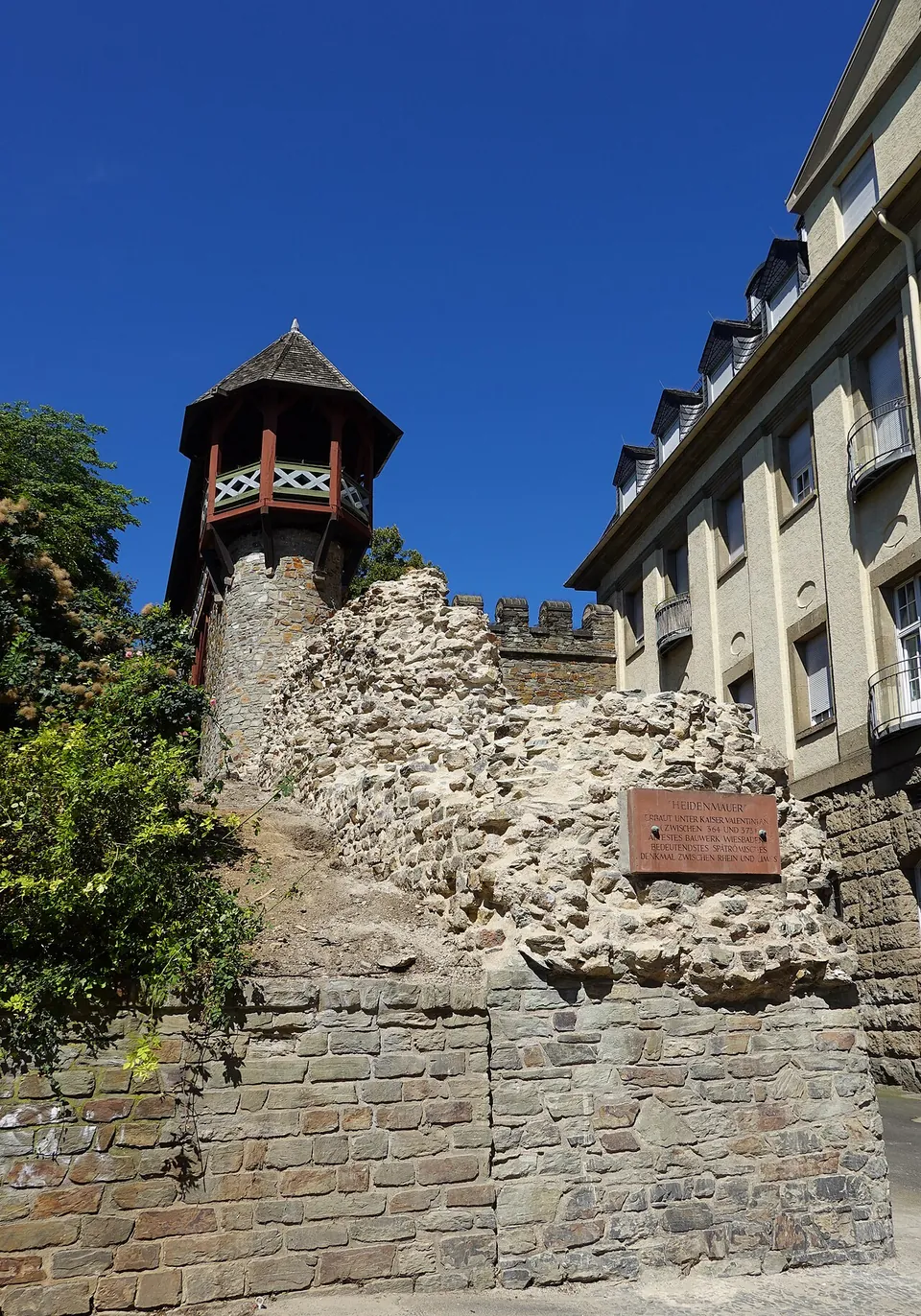
Photo: Geolina163 · CC BY-SA 4.0 · Commons
49 km · city · Hesse
Aquae Mattiacae
The wall has been traced for 520 m through the old town, but only two short stretches stand above ground, one on each side of the Römertor (the city's Stadtlexikon), about 80 m in all (de.wikipedia).


Straight-line distances.
Sources
Every fact on this page comes from the records below, each used under the licence noted.
| Source | Licence |
|---|---|
| Pleiades 108817 | CC BY |
| Wikidata Q1735338 | CC0 |
| Vici.org 8209 | CC BY-SA (text), CC0 (metadata) |
| OpenStreetMap node/2959910952 | ODbL |
| Wikipedia (de) — Kastell Boppard | CC BY-SA 4.0 |
| Romantischer Rhein (Tourist Information Boppard) — Römerkastell | licence not recorded |
| Museum Boppard — Römer in Boppard (hours and admission) | licence not recorded |
| Museum Boppard — visiting the museum in the Kurfürstliche Burg (admission) | licence not recorded |
| Rheinsteig — exhibition "Bontobrice - Römer in Boppard" | licence not recorded |