What is there today
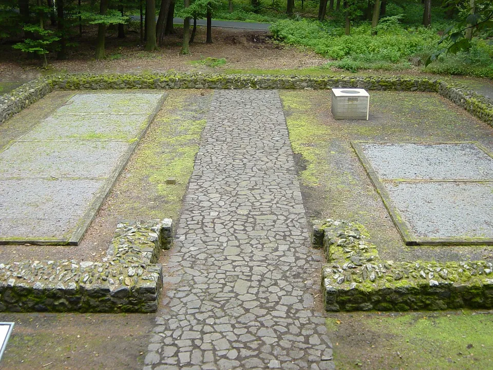
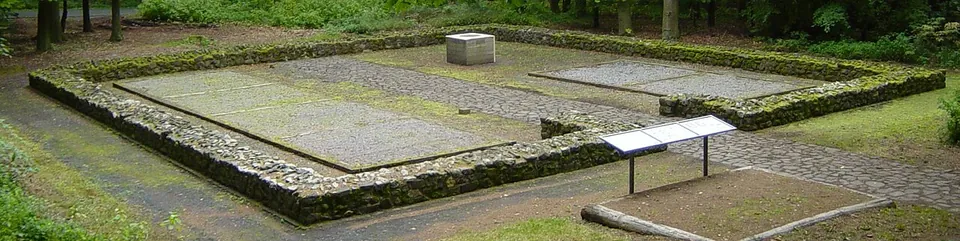
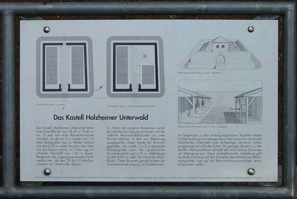
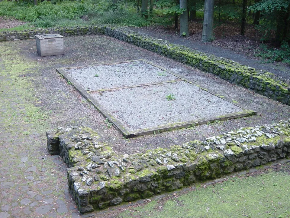
The whole fort is laid out at ground level. After the site was excavated between 1988 and 1991 it was conserved and partly rebuilt in 1995 (de.wikipedia). What you see is a low wall of rubble stone enclosing the square, a gap where the gate was, a paved camp street through the middle, and the floors of the two barracks either side of it marked out in gravel (Commons photographs). The plan on show is the fort’s second building phase, including the well that was dug inside it then; the information board beside it, as photographed in 2007, has plans of both phases and drawings of how the gate tower and the barracks may have looked (board on site).
The fort sits right against the Limes itself. The bank of the frontier runs past it, and for about half a kilometre beyond the fort it survives well in the woodland (de.wikipedia). OpenStreetMap maps two information boards within 170 m, one of them titled “Der Limes – und was von ihm blieb”.
Is it worth the trip?
On its own, only if small forts are your thing. Nothing stands higher than a low wall, no finds are shown on site, and it takes little time to walk round a square this size. What it does well is make sense: along the rest of this stretch the Limes towers show only as faint bumps in the ground (de.wikipedia), while here the whole plan of a frontier post is readable, with the board telling you what each part was.
It is best as a stop on a walk along this stretch of the frontier. The Limes bank leads north-east out of the wood towards the reconstructed watchtower Wp 4/49, about 2.2 km away in a straight line (de.wikipedia; Wikidata points of the two sites), and the fort is a station on Pohlheim’s yearly Limes walk (de.wikipedia).
Getting there
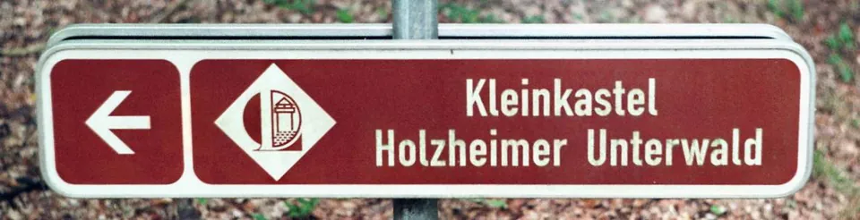
The fort lies in the small wood called Holzheimer Unterwald, between Holzheim and Grüningen (both part of Pohlheim) and Lang-Göns, a few metres west of the road from Grüningen (K 162), 200 m north of where it meets the Langgöns–Holzheim road (L 3133) (de.wikipedia). It is listed as a sight on the Deutsche Limes-Straße, the tourist route along the frontier (de.wikipedia), and a brown sign points the way in.
There are two free gravel car parks about 90 m and 130 m away, and a forest track runs right beside the walls (OpenStreetMap). No bus stop is mapped near the fort; the Gießen–Münzenberg bus runs through Grüningen and Holzheim (Stadt Pohlheim).
No body publishes opening hours or an admission charge: the remains lie in the open in the wood.
Visiting details
- Tickets
- Free
- Parking
- Two free gravel car parks about 90 m and 130 m from the fort (OSM way/632581903 and way/632581904); a forest track passes right beside the walls.
Before you go
- No body publishes opening hours or an admission charge for it; the remains lie in the open in a small wood.
- No bus stop is mapped near the fort. The Gießen–Münzenberg bus runs through the villages of Grüningen and Holzheim, so without a car this is a walk from there.
History
The Limes in the Wetterau was built up after Domitian’s wars against the Chatti (83–85), and this fort was one of its posts. The samian pottery found here and the way it was built make a date under Trajan likely, early in the 2nd century, and pottery shows that it was still in use in the second third of the 3rd century (de.wikipedia; Deutsche Limeskommission). The Romans gave up the land east of the Rhine and its Limes forts after the attacks of 259/260 (de.wikipedia).
It is one of the smallest installations of its kind on the Upper German Limes: about 18.6 by 19.4 m, around 360 m². A wall about a metre thick of basalt stone, with sharp corners rather than the rounded ones of most Limes forts, was ringed by a ditch 2 m wide and 1 m deep. The gate faced the frontier, with the fort’s only tower above it, and a small back door opened on the far side. Inside, each of two half-timbered barracks held four rooms of about 12 m², where up to four men slept, cooked and ate, though some rooms may have stabled animals instead. Later, probably in the second half of the 2nd century, the back door was walled up, one barrack lost two rooms, and a well was dug in the space this freed, which suggests a smaller garrison that cared more about its own security (de.wikipedia). Published depths for the well are 9 to 9.5 m (Deutsche Limeskommission; de.wikipedia).
The fort probably watched over traffic through the pass the L 3133 uses today, and from here there was a long view north-west towards the Lahn (de.wikipedia). Nothing is known of the unit’s name; its men were a detachment, perhaps from the forts at Arnsburg or Butzbach. The names of four of them survive in fragments, scratched into their samian tableware, among them MAT[ernus?] and VICT[or] or VICT[orinus]. The best-known find is a small hoard of 35 coins, 34 of them silver denarii, running from Vitellius in AD 69 to a coin struck by 176 at the latest for Faustina, the wife of Marcus Aurelius. A Germanic shield boss and Germanic pottery record a growing Germanic presence in the frontier zone from the later 2nd century (de.wikipedia).
The fort was first mentioned in writing in 1843. A Gießen law professor, Carl Gareis, dug it from 1879, unprofessionally enough that it was wrongly recorded and misread, and the Reichs-Limeskommission re-examined it in 1894. Looters working the remote site from the early 1970s threatened to destroy it, which led to the rescue excavations of 1988–1991 under Gabriele Seitz (de.wikipedia). Since 2005 the fort has been part of the UNESCO World Heritage Site of the Upper Germanic-Raetian Limes (de.wikipedia).
More photographs
Nearby
21 km · fort · Hesse
Castra of Kapersburg
The fort sits in a forest clearing in front of a hill called the Saukopf and covers 134 by 122 m, about 1.6 hectares (the operator).
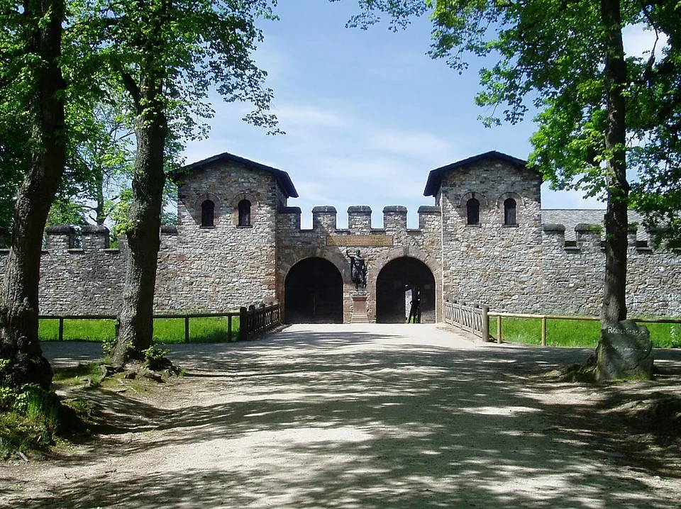
Photo: en:User:Ekem · Public domain · Commons
Photo: Karsten11 · Public domain · Commons
30 km · fort · Hesse
Castellum of Heidenstock
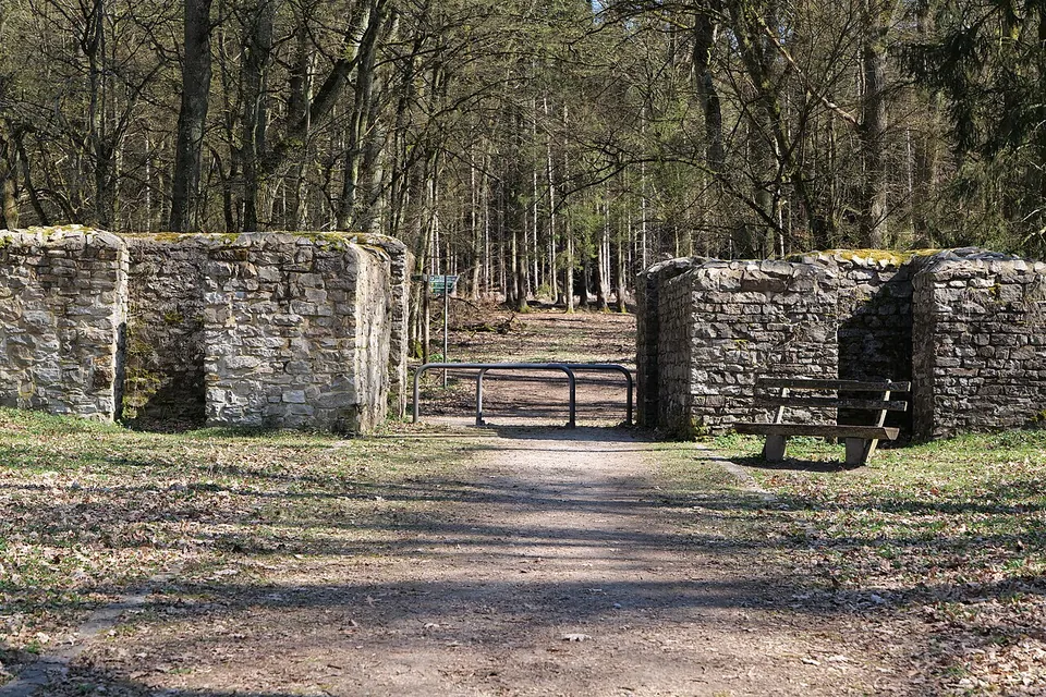
The fort measured 19.4 by 23.4 m, with the rounded corners of Roman forts of its time and a single gate facing the frontier (de.wikipedia).


Straight-line distances.
Sources
Every fact on this page comes from the records below, each used under the licence noted.
| Source | Licence |
|---|---|
| Wikidata Q1746874 | CC0 |
| Vici.org 4476 | CC BY-SA (text), CC0 (metadata) |
| OpenStreetMap node/39332517 | ODbL |
| Wikipedia (de) — Kleinkastell Holzheimer Unterwald | CC BY-SA 4.0 |
| Deutsche Limeskommission — doctoral scholarship on the fortlet Holzheimer Unterwald | licence not recorded |
| Stadt Pohlheim — Zahlen und Daten (monuments and bus lines) | licence not recorded |