

What is there today
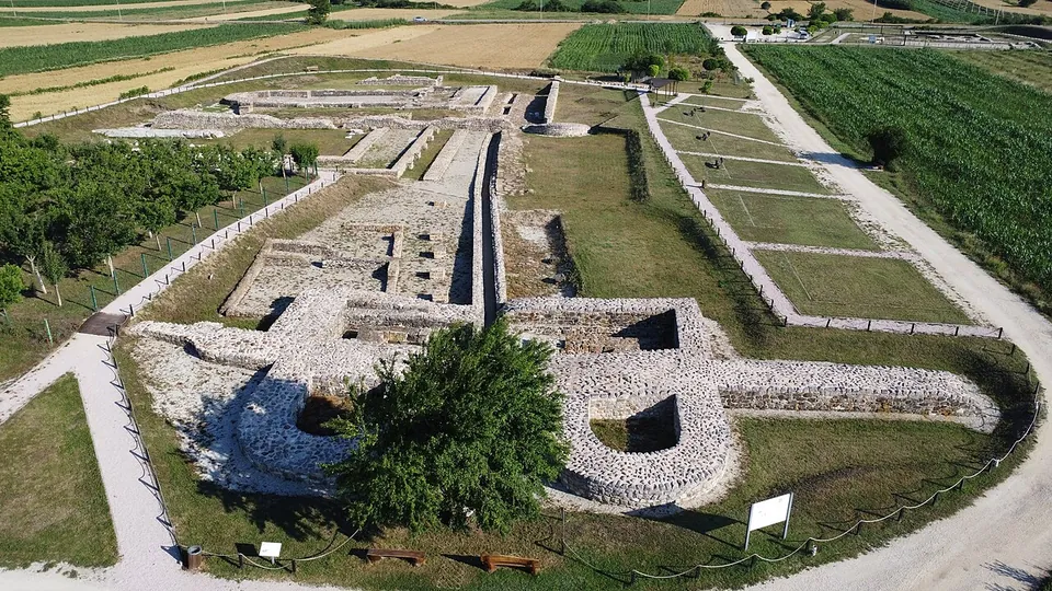
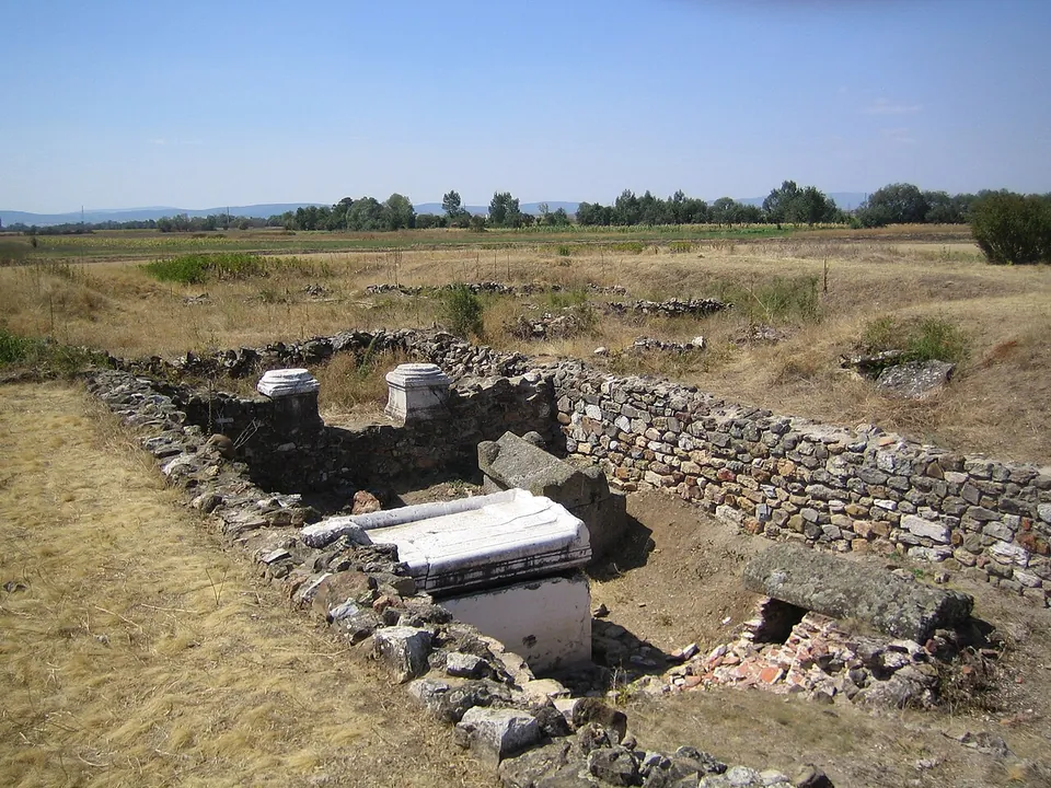
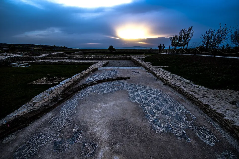
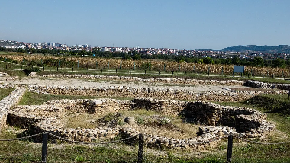
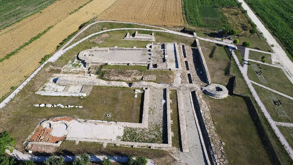
What you walk through is low: walls, foundations and floors laid out in the grass, with the north gate and its two towers giving the site its character (de.wikipedia, en.wikipedia). Excavation has uncovered the town’s baths, a church over the northern cemetery outside the walls, and several early Christian basilicas, one with a baptistery beside it (en.wikipedia). The northern cemetery, damaged during the Kosovo war, has been restored and is open to visitors again, and its marble sarcophagi, imported from the Mediterranean, are unique in the region (de.wikipedia). Photographs from 2016 to 2024 show a geometric mosaic floor lying in the open and the baths roped off beside an information board. OpenStreetMap maps history boards at the gate and at the baths, 55 m apart, an information office about 170 m from the gate, and public toilets.
Most of the town is unexcavated. The walled Roman town covered about 36 hectares, and geophysical survey has traced remains over more than 120 hectares in all, but digging has so far concentrated on the north entrance (en.wikipedia, de.wikipedia).
Is it worth the trip?
If you are in Pristina, yes. By area it is the largest archaeological site in Kosovo (de.wikipedia), it is a short drive from the capital, and the park has been laid out for visitors. Go for the scale of the place and the story of a Roman town that became a bishop’s seat, not for standing buildings: the remains are low walls and foundations, and a first-time visitor should expect a field of ruins rather than a townscape.
Combine it with Gračanica (Graçanicë), 1.3 km to the east, where the lower walls of the monastery were built with gravestones from Ulpiana, their inscriptions still visible (en.wikipedia, it.wikipedia).
Getting there
The ruins lie about 1.3 km west of Gračanica, just north of the road to Laplje Selo (it.wikipedia). A free car park, run by the Archaeological Institute of Kosovo, is mapped about 200 m from the north gate; no bus stop is mapped nearby, so come by car or taxi (OpenStreetMap).
No official source publishes the park’s opening hours or whether entry is charged, and Kosovo’s tourism portal was offline for reconstruction on 30 September 2026. OpenStreetMap lists Monday to Friday 09.30–15.30 and Saturday 10.00–14.00, which is a useful guide but not a confirmation.
Visiting details
- Tickets
- Unknown
- Parking
- A free car park run by the Archaeological Institute of Kosovo is mapped about 200 m from the north gate (OSM way/616256669).
Before you go
- No official source publishes current opening hours or an admission price, and Kosovo's tourism portal was offline for reconstruction when checked on 30 September 2026. OpenStreetMap lists Monday–Friday 09.30–15.30 and Saturday 10.00–14.00; treat that as a guide only.
- No bus stop is mapped within 300 m (OpenStreetMap); plan on a car or a taxi from Pristina.
History
Finds of the Late Bronze and Early Iron Age under the later temple show the place was settled before Rome (de.wikipedia), and the town grew in the 1st century AD, possibly out of a Dardanian fortified settlement. It was made a municipium before 117 and was probably named after Trajan, Marcus Ulpius Traianus (en.wikipedia); de.wikipedia allows that the grant may have come under Hadrian. The ore deposits of its hinterland were probably the source of its wealth (de.wikipedia). In the second half of the 2nd century a classical Roman temple was built near the north gate, its marble platform 11.6 by 18.3 m (de.wikipedia).
The town peaked in the 3rd and 4th centuries, as an important political and economic centre in Dardania, and in the second half of the 4th century it became the seat of Dardania’s bishop. The Goths sacked it in 471 or 472 (accounts differ on the year), and an earthquake in 518 devastated it. Justinian rebuilt the town and renamed it Iustiniana Secunda; after the Slavs burned it in the early 7th century it fell into ruin, and its stone was carried off for other buildings (en.wikipedia).
Its location was lost until the 20th century. Road works in 1927 turned up ruins (de.wikipedia), and graves found in 1953 confirmed the location; the first excavations ran from 1954 to 1959 (en.wikipedia). During and after the Kosovo war the site was damaged and looted (de.wikipedia). The German Archaeological Institute and the Archaeological Institute of Kosovo excavated here between 2009 and 2012 (de.wikipedia), and in 2016 the town became a protected archaeological park of 161 hectares. In 2022 a 70 m basilica was found in the north-east of the site, with a floor mosaic, uncovered in 2023, recording that Justinian commissioned it (en.wikipedia).
More photographs


Nearby
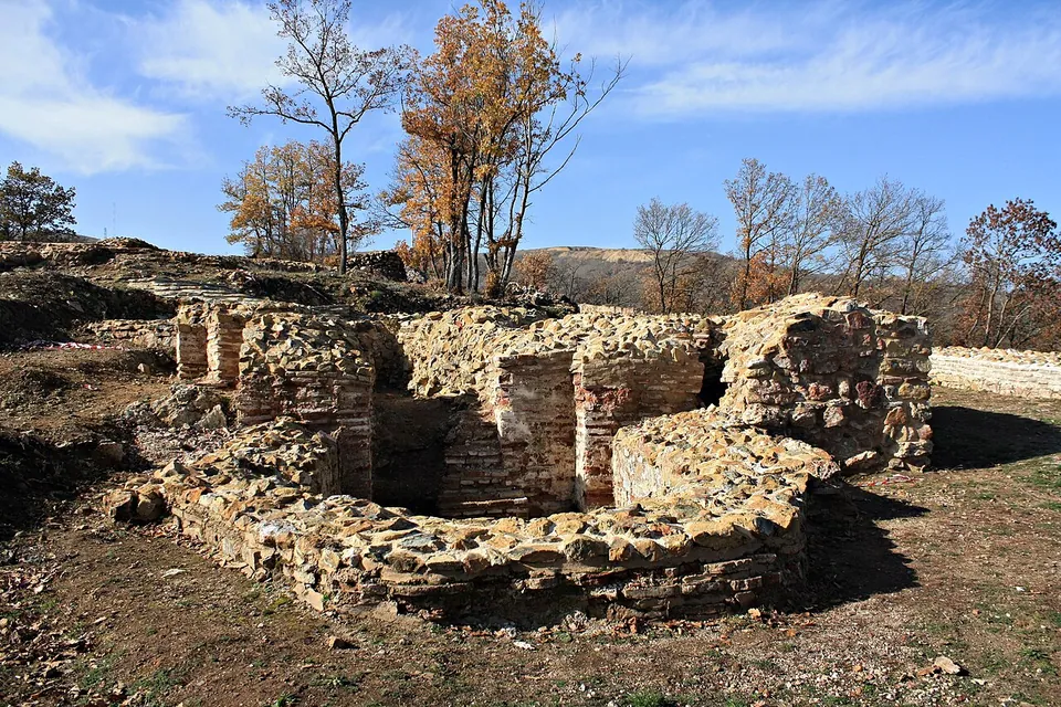
Photo: Gentiana Pallaska · CC BY-SA 4.0 · Commons
15 km · fort · Municipality of Fushë Kosovë / Kosovo Polje
Harilaq Fortress
The fort is small, about 1.3 hectares.

Straight-line distances.
Sources
Every fact on this page comes from the records below, each used under the licence noted.
| Source | Licence |
|---|---|
| Pleiades 482027 | CC BY |
| Wikidata Q1512876 | CC0 |
| OpenStreetMap way/475387265 | ODbL |
| Wikipedia (en) — Ulpiana | CC BY-SA 4.0 |
| Wikipedia (de) — Ulpiana | CC BY-SA 4.0 |
| Wikipedia (it) — Ulpiana | CC BY-SA 4.0 |
| Wikipedia (sq) — Ulpiana | CC BY-SA 4.0 |
| Wikipedia (sr) — Улпијана | CC BY-SA 4.0 |
| OpenStreetMap — Porta Veriore e Qytetit (north gate) | licence not recorded |