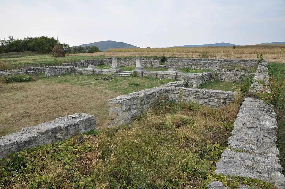
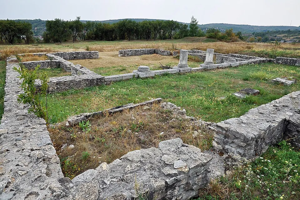
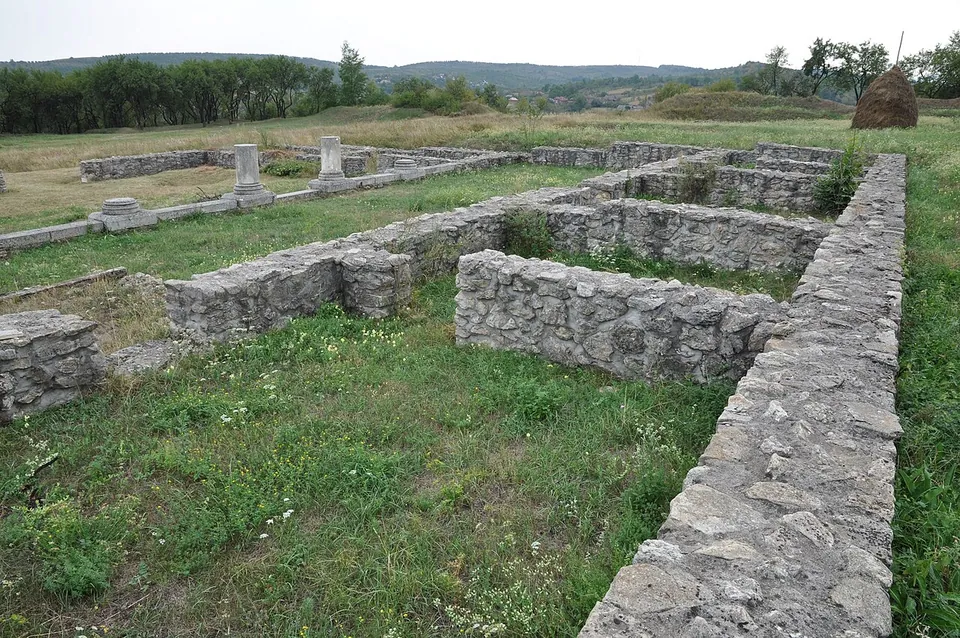


Buciumi is a Roman auxiliary fort on the north-western frontier of Dacia, at the edge of the village of the same name in Sălaj, 15 km from Zalău. Its walls have been partly restored and conserved, and its consolidated buildings, with a row of white column bases, can be walked through in open fields.
What is there today
The stone fort was a rectangle with rounded corners, 134 by 167 m, 2.24 ha, with a wall 1.2 m thick and a ditch 9–10 m wide in front of it; its main and side gates had double passages (de.wikipedia). The walls have been partly restored and conserved and can be visited (de.wikipedia). The photographs show consolidated walls, knee to waist high, outlining buildings in the fort, with a row of short white column bases. The military village lay north-east of the fort and its baths about 150 m to the east-south-east, both located by geophysical survey (de.wikipedia).
Is it worth the trip?
For fort enthusiasts on the way to or from Porolissum, yes: it is a fort of the Limes Porolissensis whose plan you can walk. There is nothing standing above waist height, and no visitor facilities are recorded, so it is a short stop rather than a destination.
Getting there
The fort lies in the fields “Cetate” or “Grădiște” at the northern edge of Buciumi, on a terrace where two streams meet before flowing into the Agrij (de.wikipedia), about 15 km from Zalău (OpenStreetMap). No car park, bus stop or railway station is mapped within 300 m.
No operator publishes opening hours or admission for the fort; the finds are in the county museum in Zalău (de.wikipedia; searched 3 October 2026).
Visiting details
- Tickets
- Unknown
Before you go
- No operator page publishes opening hours or admission for the fort (searched 2026-10-03).
- No car park, bus stop or railway station is mapped within 300 m in OpenStreetMap.
History
The garrison guarded the north-western section of the frontier and the traffic over the Ragului pass, which led out of the province, and the Poicului pass towards the fort at Resculum (de.wikipedia). A timber-and-earth fort came first; the stone fort was built in 114 (ro.wikipedia). The units recorded here by inscriptions, stamped tiles and military diplomas include cohorts of Britons (de and ro.wikipedia). With the rest of the Dacian Limes, the fort became a UNESCO World Heritage Site in 2024 (de.wikipedia).
Nearby
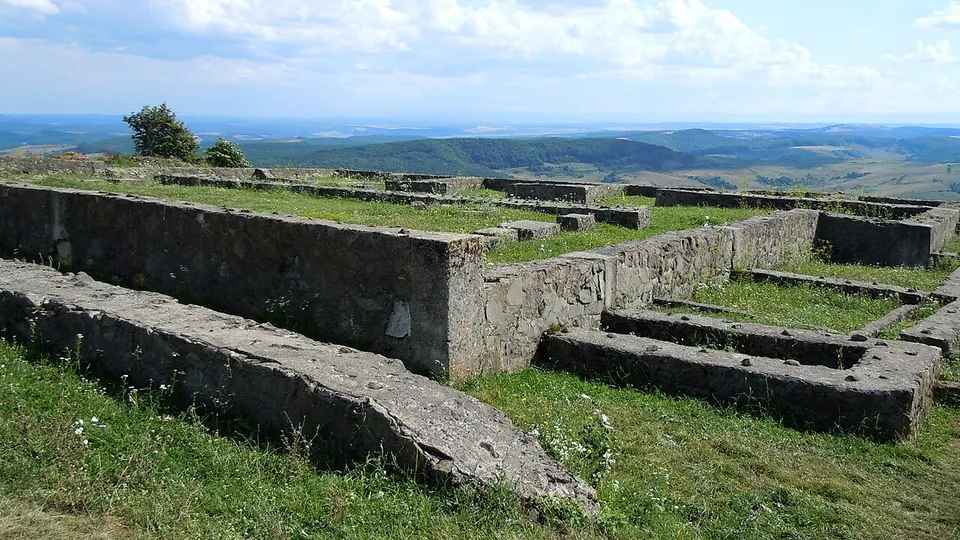
Photo: Saturnian · CC BY-SA 3.0 · Commons
17 km · fort · Sălaj County
Porolissum
The fort on Pomet hill is one of the largest camps in Dacia, 226 by 294 m, first built with earth ramparts and rebuilt in stone; its walls are 1.5 m thick, with two ditches (en.wikipedia).

Straight-line distances.
Sources
Every fact on this page comes from the records below, each used under the licence noted.
| Source | Licence |
|---|---|
| Pleiades 206991 | CC BY |
| Wikidata Q499806 | CC0 |
| OpenStreetMap way/228886054 | ODbL |
| Wikipedia (de) — Kastell Buciumi | CC BY-SA 4.0 |
| Wikipedia (ro) — Castrul roman de la Buciumi | CC BY-SA 4.0 |
| Wikipedia (en) — Docidava (castra) | CC BY-SA 4.0 |