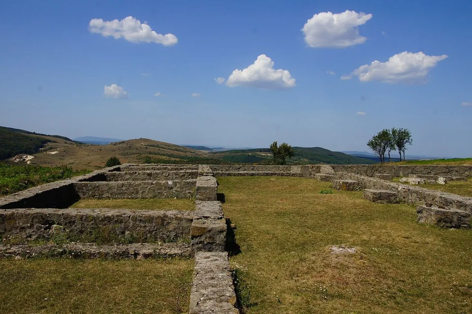
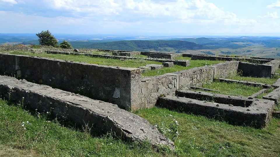
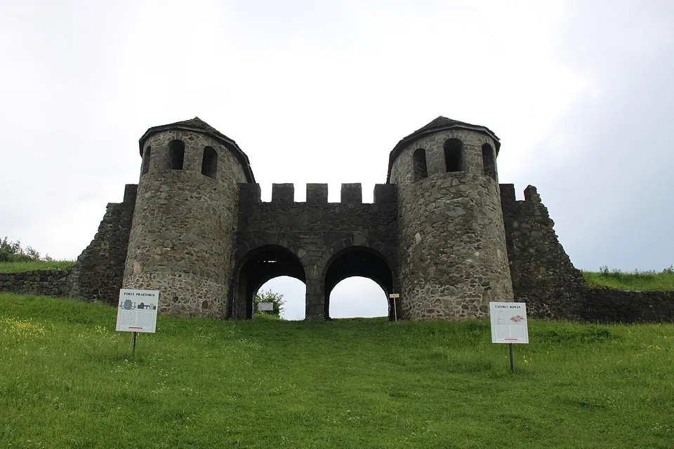


Porolissum was the Roman frontier town at the north-west corner of Dacia: a large fort on Pomet hill, 8 km from Zalău, with a civilian town on the terraces south and west of it that became a provincial capital. It is one of the largest and best-preserved Roman sites in Romania (en.wikipedia), with a rebuilt main gate, the walls of the headquarters building and an amphitheatre.
What is there today
The fort on Pomet hill is one of the largest camps in Dacia, 226 by 294 m, first built with earth ramparts and rebuilt in stone; its walls are 1.5 m thick, with two ditches (en.wikipedia). Its main gate, the Porta Praetoria, has been rebuilt with its round-fronted towers, and in the photographs the walls of the headquarters building (principia) stand knee- to waist-high across the hilltop. A smaller fort, 67 by 101 m, lies on Citera hill 700 m to the north-east (en.wikipedia).
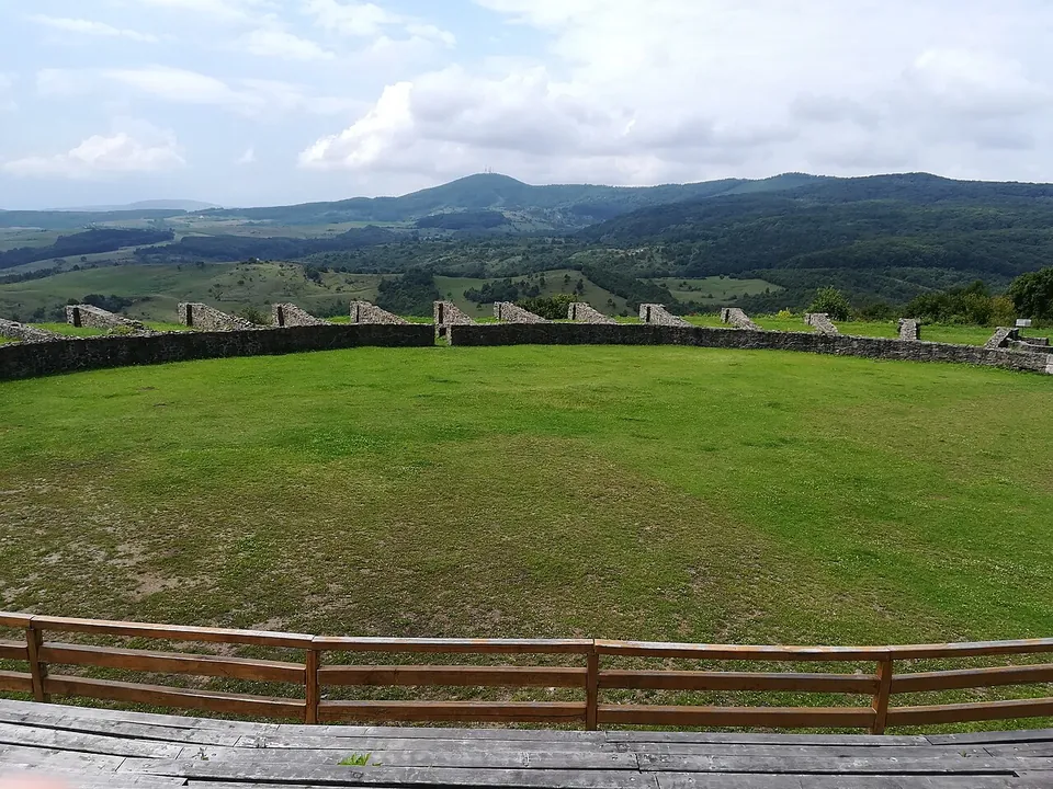
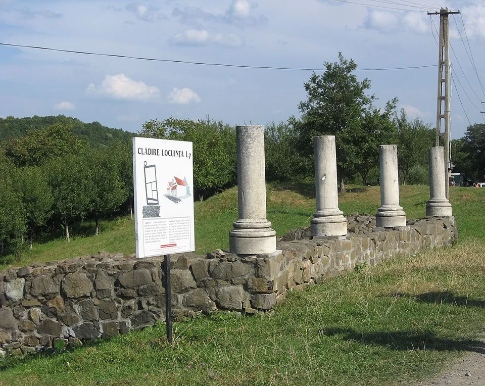
Excavation, running since 1977 and ongoing, has also uncovered public baths, a customs house, a temple of Liber Pater, a group of four buildings, houses of the civilian town and the amphitheatre (en.wikipedia). The amphitheatre, with room for 5,000–5,500 spectators, was built in wood under Hadrian and rebuilt in stone in 157; its oval arena wall survives (en.wikipedia). Part of the Dacian Limes, Porolissum was added to the UNESCO World Heritage list in 2024 (de.wikipedia).
Is it worth the trip?
Yes. It is one of the best-preserved Roman sites in Romania, a fort and a town on an open hilltop with long views over the hills of Sălaj, and the rebuilt gate gives the scale of the walls without you having to imagine it. Expect a walk: the remains spread over the hill and its terraces, and the gate is a reconstruction, the rest low walls.
Getting there
The site lies 8 km from Zalău, between the villages of Moigrad-Porolissum and Jac (en and hu.wikipedia). OpenStreetMap maps no car park, bus stop or railway station within 300 m of the fort, so plan on driving from Zalău.
No operator page publishes opening hours or an admission price for the site: the county museum in Zalău, whose archaeologists dig here, lists hours and prices only for its museums in town (searched 3 October 2026). Ask the museum before making a special trip.
Visiting details
- Tickets
- Unknown
Before you go
- No operator page publishes opening hours or admission for the site; the Zalău county museum's own pages cover only its buildings in town (searched 2026-10-03).
- No car park, bus stop or railway station is mapped within 300 m of the fort in OpenStreetMap.
History
In 106, at the beginning of his second war against the Dacians, Trajan established a military stronghold here to guard the main passage through the Carpathians; it became the centre of the defence of north-western Dacia (en.wikipedia). Its garrisons came from across the empire, among them a cohort of Britons, a cohort of Lingones and units of archers from Palmyra (en.wikipedia).
The civilian settlement grew on the terraces south and west of the fort. When Hadrian created the province of Dacia Porolissensis in 124, named after the town, Porolissum became its administrative centre, and under Septimius Severus it was made a municipium. It traded with the peoples beyond the frontier and was probably a customs station on the main road out of the province (en.wikipedia). Inscriptions record the fort’s rebuilding under Caracalla and its hasty rebuilding again under Gallienus (253–268); the town was probably abandoned under Gallienus, after 256 (it.wikipedia).
More photographs


Nearby
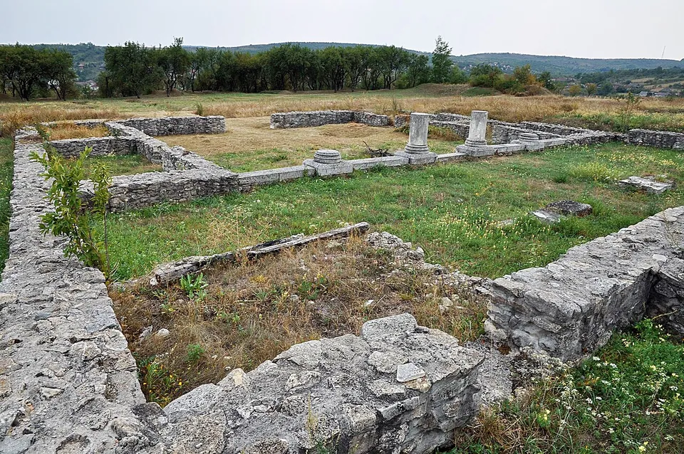
Photo: Saturnian · CC BY-SA 3.0 · Commons
17 km · fort · Sălaj County
Buciumi
The stone fort was a rectangle with rounded corners, 134 by 167 m, 2.24 ha, with a wall 1.2 m thick and a ditch 9–10 m wide in front of it; its main and side gates had double passages (de.wikipedia).

Straight-line distances.
Sources
Every fact on this page comes from the records below, each used under the licence noted.
| Source | Licence |
|---|---|
| Pleiades 207361 | CC BY |
| Wikidata Q542391 | CC0 |
| Vici.org 2154 | CC BY-SA (text), CC0 (metadata) |
| OpenStreetMap way/206305822 | ODbL |
| Wikidata — Castrum Porolissum (Q15966906, the fort) | licence not recorded |
| Wikipedia (en) — Porolissum | CC BY-SA 4.0 |
| Wikipedia (de) — Porolissum | CC BY-SA 4.0 |
| Wikipedia (it) — Porolissum | CC BY-SA 4.0 |
| Wikipedia (hu) — Porolissum | CC BY-SA 4.0 |
| Muzeul Județean de Istorie și Artă Zalău — visiting hours (its town museums only) | licence not recorded |