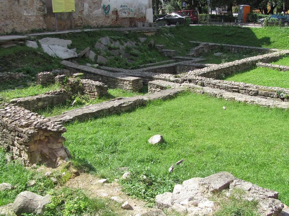
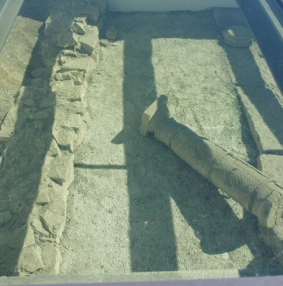
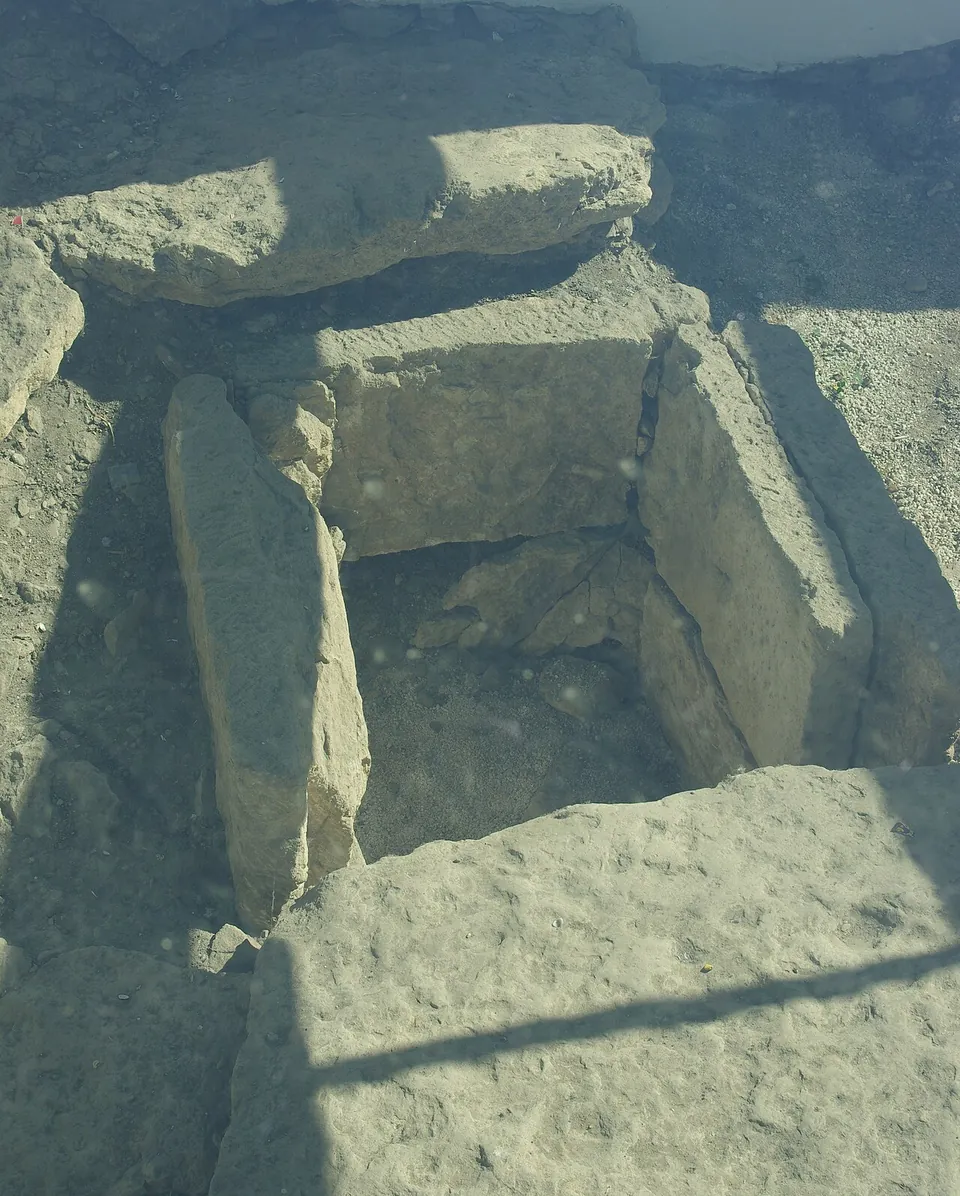
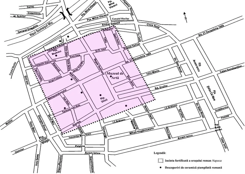
Napoca was the Roman town under the centre of Cluj-Napoca, now Romania’s second-largest city. It became a municipium under Hadrian, later a colonia, and for a time it was a provincial capital. Little of it is on show: foundations under glass panels in the main square, Piața Unirii, and the low walls of Roman buildings in an open-air archaeological park near Piața Muzeului.
What is there today
Piața Unirii. In front of the Matthias Corvinus monument, work to lay out the Roman remains for display began in 2008, as the first phase of a remodelling of the square (ro.wikipedia). Under glass panels you look down on stretches of stone wall, stone slabs and a fallen column (Commons photographs, 2012). Roman houses have been excavated in the square (hu.wikipedia).
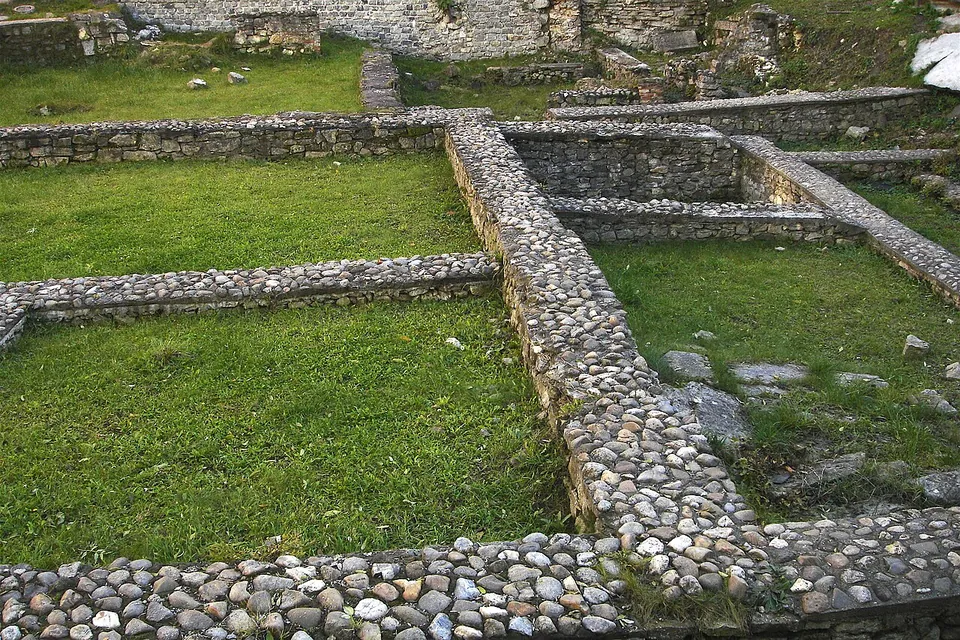
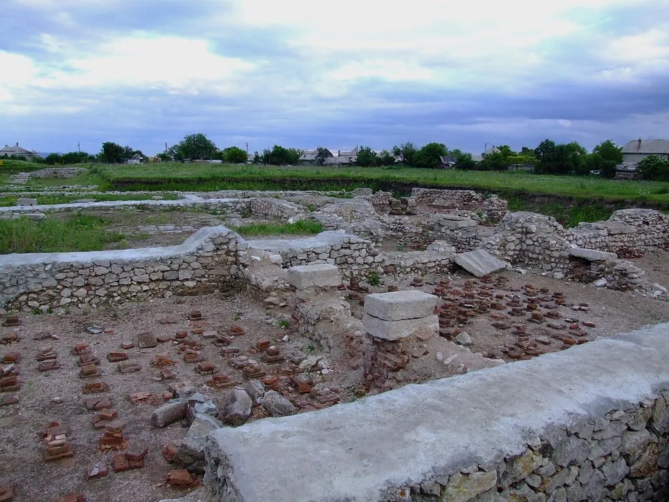
Piața Muzeului and Strada Victor Deleu. The national list of historic monuments records “the ancient and medieval town” here, with ruins of buildings, two stretches of enclosure wall, medieval buildings and Roman buildings heated by a hypocaust, the Roman underfloor heating. Roman houses have been excavated on Strada Victor Deleu (hu.wikipedia), and in the archaeological park there low walls are laid out in the grass (Commons). In Piața Muzeului archaeologists have also found a Roman street 5 m wide, paved with stone slabs and lined with colonnaded buildings, probably the town’s main north–south street, and the remains of a monumental building (hu.wikipedia).
The rest of the town lies under the modern centre. Its walls, of cut stone blocks, ran roughly where the medieval walls later stood on the south and west. Remains of the south wall have been found near the Minorite church on Strada Napoca and in the courtyard of the puppet theatre (hu.wikipedia).
Is it worth the trip?
Not on its own. If you are in Cluj, the glass panels in Piața Unirii are on your way and the park by Piața Muzeului is a short walk further; together they make a short stop. What survives of Napoca is foundations: no Roman building stands, and most of the town is still under the city.
Getting there
Both spots are in the centre of Cluj-Napoca. The glass panels are in Piața Unirii, the main square, in front of the Matthias Corvinus monument (ro.wikipedia). The archaeological park lies by Piața Muzeului, about 450 m to the north-west.
The glass panels are in the open square, and no operator publishes hours or a charge for either spot (searched 3 October 2026). A local newspaper reported that excavations for the city’s metro would start in the square’s car park in September 2026 and last at least six months (actualdecluj.ro).
Visiting details
- Tickets
- Free
Before you go
- Archaeological excavations for the Cluj metro were reported to start in the car park of Piața Unirii in September 2026 and to last at least six months (actualdecluj.ro, 13 August 2026).
- No operator publishes opening hours for the remains (searched 2026-10-03); both spots are in public squares.
History
The name Napoca is older than the Roman conquest, and several origins have been proposed for it (en.wikipedia). The Roman settlement grew up after 106 on the right bank of the Someșul Mic, where the main north–south and east–west routes of the salt trade met (ro.wikipedia). The oldest inscription naming it is a Roman milestone found at Aiton in 1758, from the road between Potaissa (Turda) and Napoca. Published dates for the stone range from 107 to 110 (en, ro and hu.wikipedia).
Hadrian raised Napoca to a municipium, Municipium Aelium Hadrianum Napoca, in 117 or 124 (ro.wikipedia), and it became the capital of the new province of Dacia Porolissensis (en and ro.wikipedia). Under Marcus Aurelius, or possibly Commodus, it was promoted to colonia as Colonia Aurelia Napoca, with the ius Italicum, the highest urban status in the empire (ro.wikipedia); hu.wikipedia credits the ius Italicum to Septimius Severus instead. The town covered about 25 ha, and its population is estimated at no more than 10,000 (hu.wikipedia). Among its workshops was one of the 2nd century that made bronze brooches (ro.wikipedia).
Whether Napoca had a fort is disputed. Wikidata records a Roman fort here, and de.wikipedia says the Dacian settlement was turned into a legionary camp after the conquest. Romanian Wikipedia says the colony had no garrison of its own and was defended by the ala Siliana from the fort at Gilău and later by the Fifth Macedonian Legion from Potaissa. No source describes visible remains of a fort.
Published dates for the end differ: de.wikipedia puts the town’s decline around 250, amid raids by Germanic peoples and the Carpi, while en.wikipedia dates the Roman administration’s departure to 274. Some people stayed on: two cemeteries south and south-east of the town contain burials in the Roman manner (en.wikipedia). In 1974 Nicolae Ceaușescu added the ancient name to the city’s Romanian name, Cluj (en and de.wikipedia).
More photographs
Nearby
26 km · fort · Cluj County
Potaissa
The fortress covered about 23.5 ha, 408 m by 573–580 m (published figures differ), on a terrace above the Arieș river; the Roman town lay 30–40 m below it (de.wikipedia).


Straight-line distances.
Sources
Every fact on this page comes from the records below, each used under the licence noted.
| Source | Licence |
|---|---|
| Pleiades 207304 | CC BY |
| Wikidata Q2368758 | CC0 |
| OpenStreetMap way/1145050481 | ODbL |
| Wikipedia (en) — History of Cluj-Napoca | CC BY-SA 4.0 |
| Wikipedia (ro) — Istoria Clujului | CC BY-SA 4.0 |
| Wikipedia (hu) — Napoca | CC BY-SA 4.0 |
| Wikipedia (de) — Cluj-Napoca | CC BY-SA 4.0 |
| Wikipedia (ro) — Piața Unirii din Cluj-Napoca | CC BY-SA 4.0 |
| Wikidata — Orașul antic și medieval, LMI CJ-I-s-B-06921 (Q42848696) | licence not recorded |
| actualdecluj.ro — excavations in the Piața Unirii car park (13 August 2026) | licence not recorded |