


Photo: geomcrae · CC BY-SA 4.0 · Commons

site · Constanța County
Tropaeum Traiani
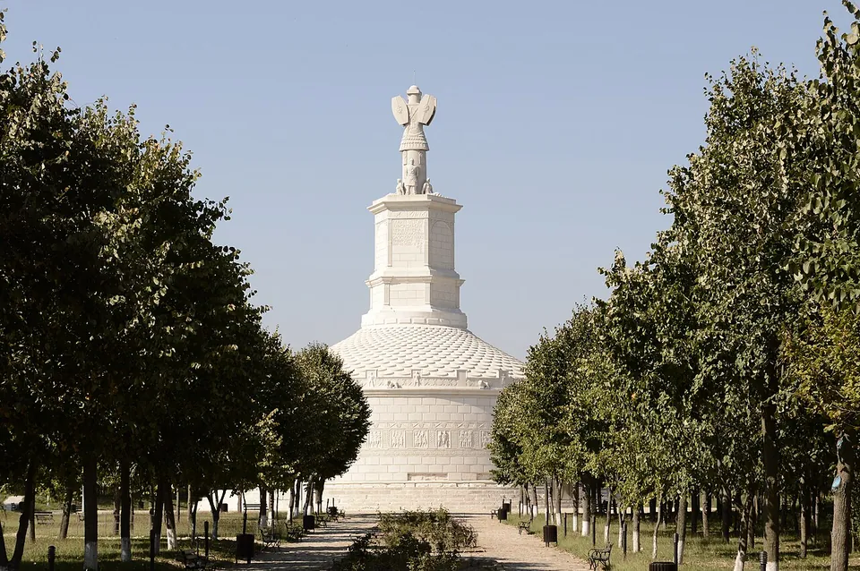
The monument is the reconstruction, built in 1977 on one of the hypothetical models of the ruined original (ro.wikipedia).
Ticketed
Tropaeum Traiani, Cetatea Tropaeum Traiani, Cetatea romană Adamclisi
city · Constanța County, Romania
1 place to see, the best preserved and best known first.
Photo: geomcrae · CC BY-SA 4.0 · Commons
site · Constanța County
The monument is the reconstruction, built in 1977 on one of the hypothetical models of the ruined original (ro.wikipedia).
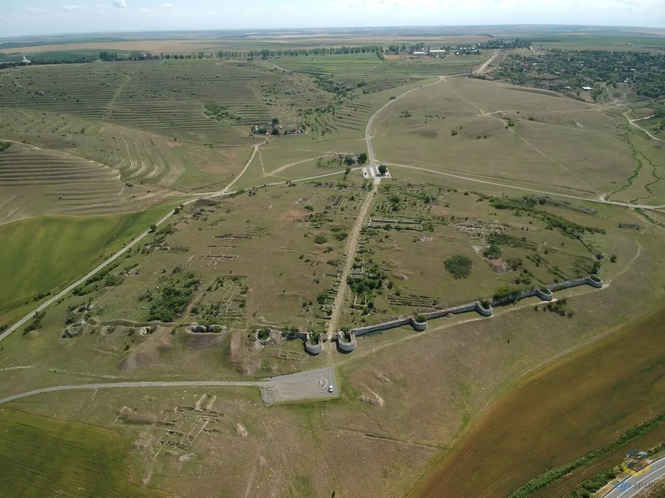
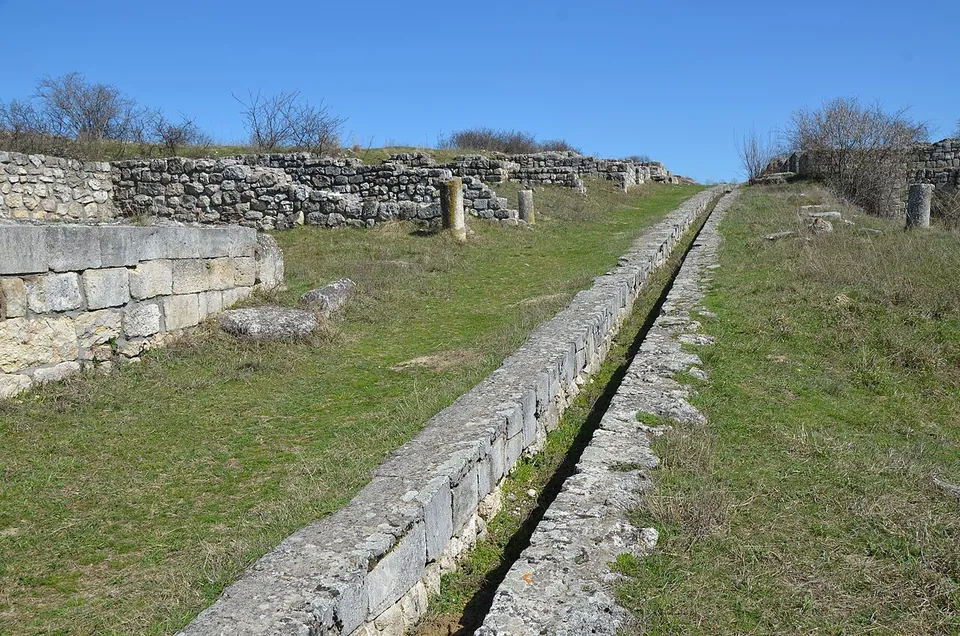
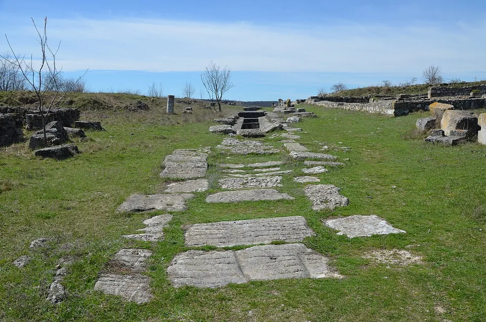
The town is an open-air ruin of walls and ground plans rather than standing buildings. From the air you can follow the circuit wall and its rounded towers, the streets crossing the enclosure and the excavated buildings inside. The main street, rebuilt at the beginning of the 4th century, keeps a well-preserved central drain for rain and wastewater, with a step on which a ceramic water pipe ran; the main gate, on the east side, was rebuilt under Constantine and Licinius in 316 with horseshoe-shaped towers, and four Christian basilicas have been excavated (en.wikipedia). The town’s baths are a separate protected monument within the same ensemble (ro.wikipedia). OpenStreetMap names a Basilica Forensis and a “basilica with transept D” among the ruins and maps the Cardo Maximus and the Via Principalis as paths.
Yes, if you come for the Trophy: the two are one visit, and the town is what turns a monument into a place. On its own it is a site for people who enjoy reading a plan on the ground, with nothing standing much above head height in the photographs. The operator publishes no ticket price for the town itself, only for the monument and the museum, so check at the museum in the village.
Adamclisi lies on the DN3 between Constanța and Ostrov, about 63 km by road from Constanța (the operator). There is a car park about 190 m from the ruins, and no bus stop or railway station is mapped nearby, so plan on a car.
From 1 October 2026 to 30 April 2027 the operator, the Museum of National History and Archaeology in Constanța (MINAC), opens the Tropaeum Traiani museum complex daily from 09.00 to 17.00. It lists no ticket for the walled town; a guide costs 75 RON, about €14. The Trophy and the museum in the village (Str. Muzeului 15) are 16 RON, about €3.00, each, with 8 RON for pensioners and 4 RON for pupils and students (minac.ro, read 3 October 2026). The summer schedule for 2027 was not yet published.
Before you go
Hours and prices checked 3 October 2026 on the operator's own site. Confirm before travelling.
The area came under Roman rule in stages: it was absorbed into the province of Moesia in AD 46. In the winter of 101–102, during Trajan’s First Dacian War, the Battle of Adamclisi was fought nearby, and in 109, with the Dacians defeated, the Trophy was built beside an altar to the fallen. The walled town, probably also built around 109, took its name from the monument; it was settled with veterans of the Dacian Wars and made a municipium (en.wikipedia).
The Costoboci destroyed the town in 170. Rebuilt under the Severan dynasty, it was destroyed again by the Carpi in 238, and substantially rebuilt under Constantine the Great with improved defensive walls. It survived until the Avars sacked it in 587, after which it ceased to be an important city of Dobruja and is not mentioned for seven hundred years (en.wikipedia).
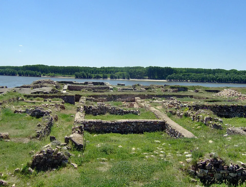
Photo: Elerium at Romanian Wikipedia · Public domain · Commons
46 km · fort · Constanța County
The fortress is a rectangle of 105 by 127 m with walls over 2 m thick; it had seven towers, three rectangular, two quarter-circle and two horseshoe-shaped, and a gate 2.5 m wide on the south-east side, with an outlet towards the river port on the south-west (en.wikipedia).
Straight-line distances.
Every fact on this page comes from the records below, each used under the licence noted.
| Source | Licence |
|---|---|
| Pleiades 217027 | CC BY |
| Wikidata Q5124784 | CC0 |
| Vici.org 19286 | CC BY-SA (text), CC0 (metadata) |
| OpenStreetMap relation/20620443 | ODbL |
| Wikipedia (en) — Civitas Tropaensium | CC BY-SA 4.0 |
| Wikipedia (ro) — Tropaeum Traiani (the protected ensemble and its components) | CC BY-SA 4.0 |
| MINAC — visiting hours and prices (the operator) | licence not recorded |
| MINAC — cold-season visiting hours, from 1 October 2026 (the operator) | licence not recorded |
