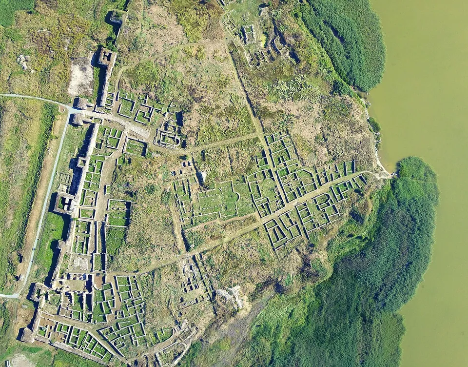
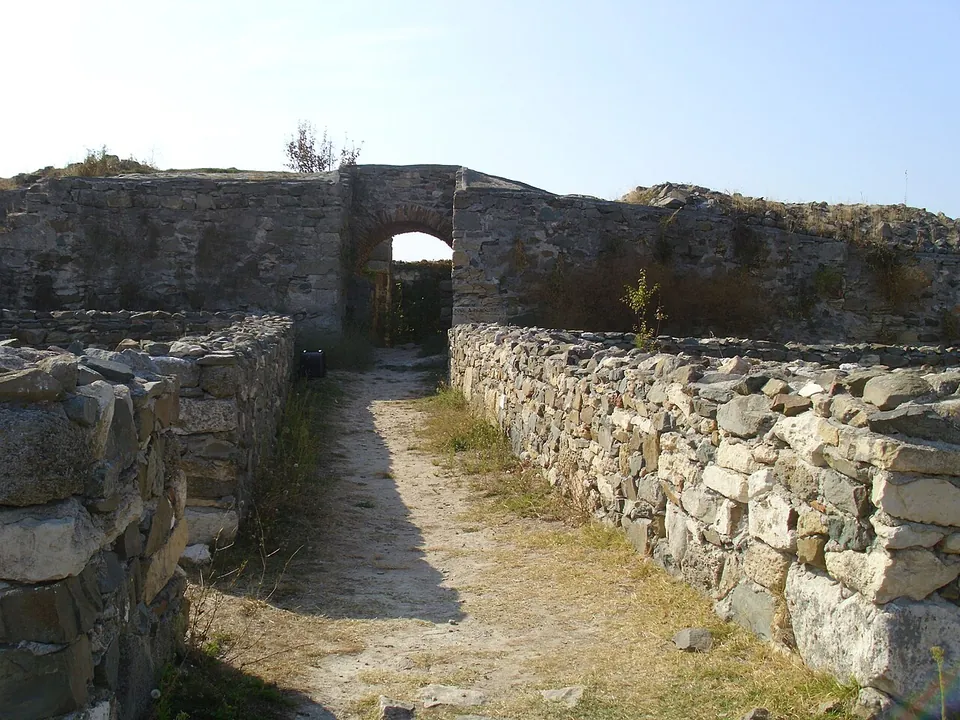
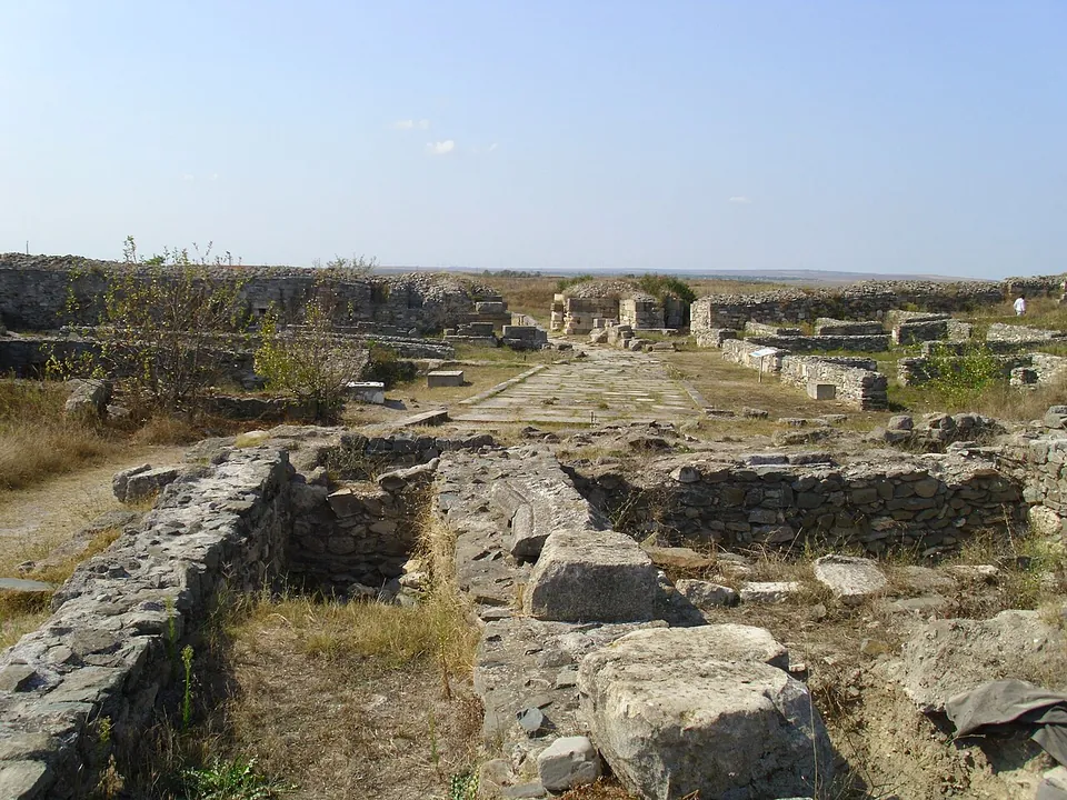


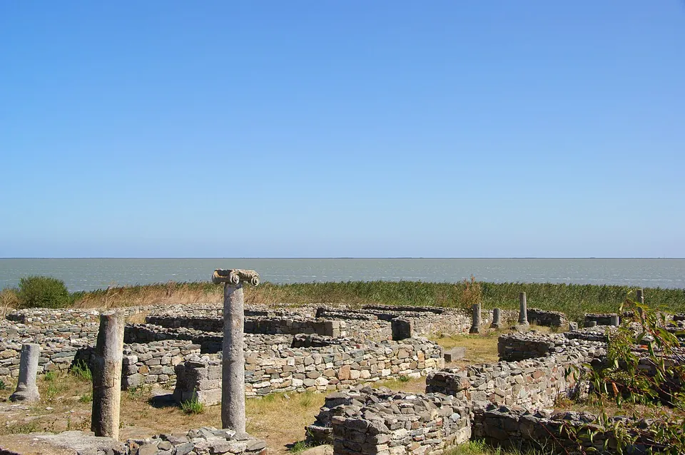
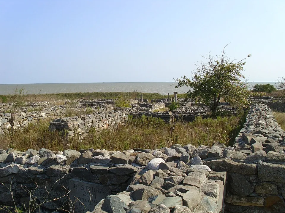
Histria is considered the oldest city on what is now Romanian soil, a Greek colony founded by settlers from Miletus in the 7th century BC that lived on under Rome until the 7th century AD. Its ruins lie on the shore of Lake Sinoe, near the village of Istria, with the walls, baths, basilicas and houses of the Roman and late Roman city.
What is there today
The site is two cities in one, and it helps to know which is which. Greek Histria covered about 80 ha in all, more than half of it water, and parts of it now lie under Lake Sinoe. Its sacred area, in the north-east corner of the acropolis, was dedicated above all to Apollo the Healer and had four temples by the later 6th century BC (en.wikipedia).
Rome rebuilt the city several times. In the 1st to 3rd centuries AD the city got a new wall and two bath complexes: Thermae I, of the 1st century, enlarged in the early 2nd and back in use in the 4th, and the larger Thermae II outside the acropolis walls, of about 1,000 m². After the Carpi razed the city in 238 it was rebuilt much smaller, about 6–7 ha behind a stronger wall, which was rebuilt again under Diocletian and Constantine. In the 4th to 6th centuries an episcopal basilica stood at the centre of the city among at least five other churches, and by the 6th century the quarter by the baths was full of town houses with colonnaded courtyards and stone staircases to upper floors. The bases of a colonnade that roofed a row of shops are still visible, with one shop counter standing to its full height (en.wikipedia). The site museum, founded in 1982, shows finds from the excavations (en.wikipedia).
Is it worth the trip?
Yes. More than a thousand years of history are laid out here on a lakeshore, and the late Roman walls and houses are substantial enough to walk through rather than just look down on. It is flat, with little shade in the photographs, and needs time; come by car.
Getting there
Histria lies on the inland shore of Lake Sinoe, north of Năvodari, near the modern village of Istria (en.wikipedia); the nearest town mapped in OpenStreetMap, Năvodari, is about 28 km away. No bus stop or railway station is mapped nearby. The operator lists a car park, a museum, an archaeological base and a restaurant at the site.
From 1 October 2026 to 30 April 2027 the operator, the Museum of National History and Archaeology in Constanța (MINAC), opens the Histria museum complex daily from 09.00 to 17.00. The ruins are 16 RON, about €3.00, with 8 RON for pensioners and 4 RON for pupils and students; the museum is a separate ticket at the same prices, and a guide costs 75 RON, about €14 (minac.ro, read 3 October 2026). The summer schedule for 2027 was not yet published.
Visiting details
- Opening hours
- Daily 09.00–17.00 from 1 October 2026 to 30 April 2027 (the operator's cold-season schedule). The summer schedule for 2027 was not yet published on 3 October 2026.
- Tickets
- The ruins (the "cetate") are 16 RON (about €3.00), 8 RON for pensioners and 4 RON for pupils and students; the site museum is a separate ticket at the same prices. A guide costs 75 RON (about €14).
- Parking
- The operator lists a car park among the site's facilities, with a museum, an archaeological base and a restaurant.
Before you go
- No bus stop or railway station is mapped near the site; the nearest town in OpenStreetMap, Năvodari, is about 28 km away.
Hours and prices checked 3 October 2026 on the operator's own site. Confirm before travelling.
History
Milesian settlers founded Histria to trade with the native Getae; published dates for the foundation differ, between 657/656 BC and 630 BC. The city issued the earliest documented coin on today’s Romanian territory, a silver drachma of about 480 BC, and was destroyed several times, by the Scythians and probably the Bastarnae among others, and besieged by the Getae. The Romans first occupied it in 71 BC without leaving a garrison, and it came under Roman rule in 29 BC, when Marcus Licinius Crassus annexed Dobruja (en.wikipedia).
In 100 AD the governor of Moesia Inferior confirmed the city’s territory as far as the Danube Delta, whose salted fish was then “almost the only income” of the city, and under Caracalla inscriptions call it “the most brilliant city of the Histrians”. The Carpi destroyed it in 238 and the Goths destroyed its walls again in 295; rebuilt each time, it became an important Christian centre in the 4th–6th centuries. As the bay silted up, its access to the sea was gradually cut, though trade went on into the 6th century. The Avar and Slav invasions of the 7th century seem to have destroyed the city entirely, and its name disappeared (en.wikipedia). The ruins were identified in 1868 and Vasile Pârvan began excavating them in 1914 (en.wikipedia; the operator).
More photographs


Nearby
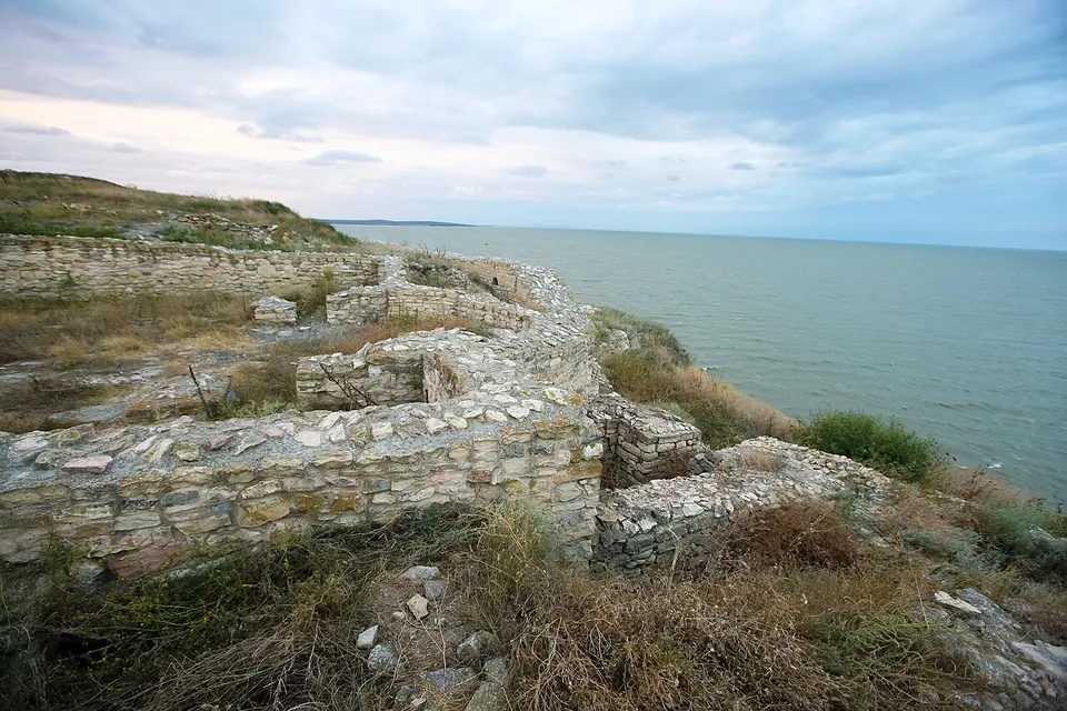
Photo: MHStudio · CC BY-SA 3.0 ro · Commons
27 km · city · Tulcea County
Argamum
The ruins, partly excavated and restored, stand 6 km from the fishing village of Jurilovca on the high, steep shore of the lake: a city gate, the fortress wall, streets, early Christian basilicas and earthworks (de.wikipedia).
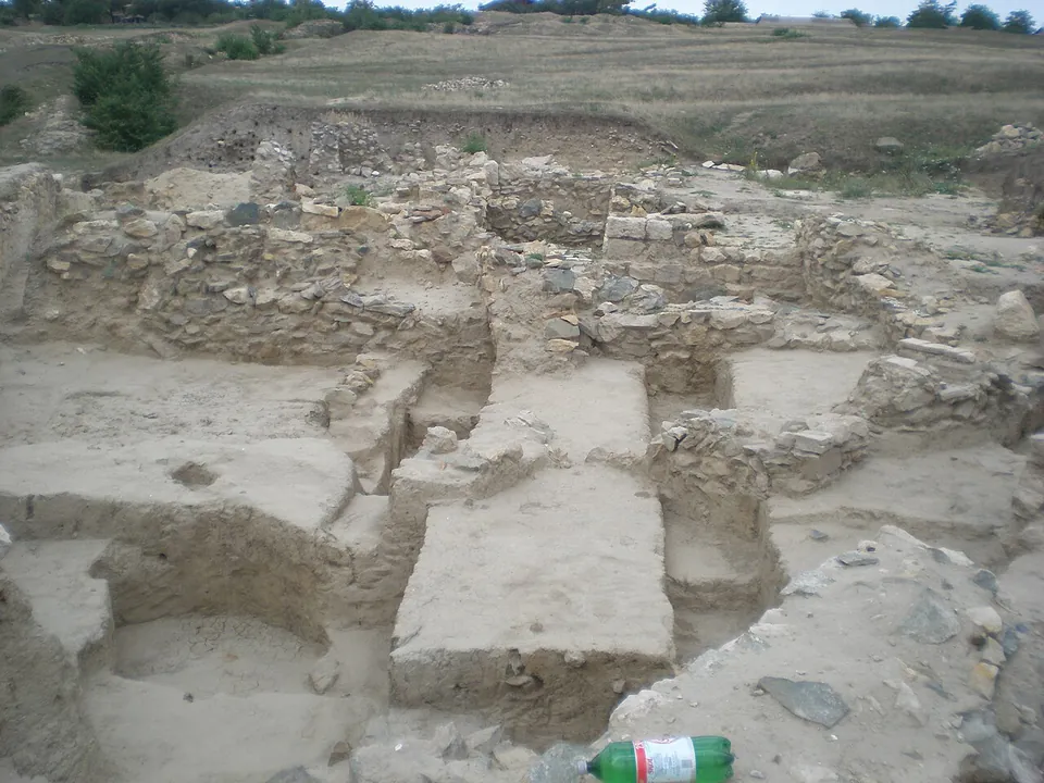
Photo: Leontin l · CC BY-SA 4.0 · Commons
34 km · fort · Constanța County
Ulmetum
The fortress is an irregular trapezoid of about 2 ha, with 13 towers and two main gates, to the south-west and the north-west; the north-west gate was walled up at some point in its history (MINAC).
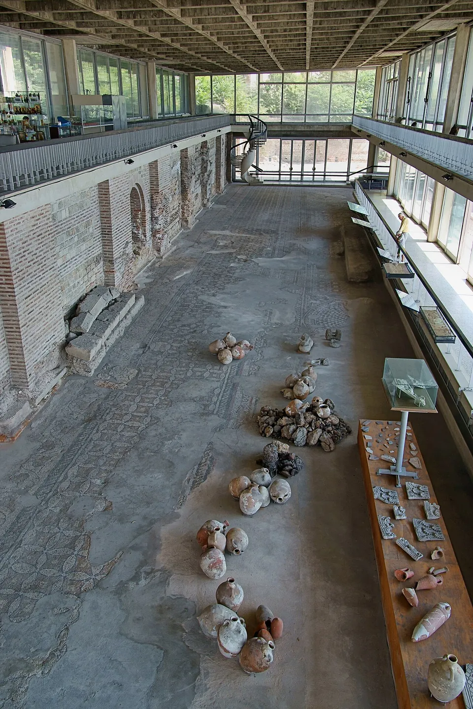
Photo: Alexandru Pănoiu from Bucharest, Romania · CC BY-SA 2.0 · Commons
43 km · city · Constanța County
Tomis
The Roman Mosaic Edifice was built in the 4th century, probably under Constantine the Great, on the western cliff above the modern port, replacing earlier harbour buildings; it linked the level of the city with that of the ancient harbour on several terraces (ro.wikipedia).


Straight-line distances.
Sources
Every fact on this page comes from the records below, each used under the licence noted.
| Source | Licence |
|---|---|
| Pleiades 216839 | CC BY |
| Wikidata Q1164460 | CC0 |
| OpenStreetMap way/132066800 | ODbL |
| Wikipedia (en) — Histria (ancient city) | CC BY-SA 4.0 |
| Wikipedia (ro) — Histria | CC BY-SA 4.0 |
| Wikipedia (de) — Histria (Schwarzes Meer) | CC BY-SA 4.0 |
| MINAC — visiting hours and prices, and the Histria museum complex (the operator) | licence not recorded |
| MINAC — cold-season visiting hours, from 1 October 2026 (the operator) | licence not recorded |