

In the northern suburb of Nea Ionia, two late Roman aqueducts still stand on tall piers of stone and brick, one at Eleftheroupoli and one at Alsoupoli, 1.3 km apart. They were once taken for part of Hadrian’s aqueduct, but the Ministry of Culture dates them to the 3rd–5th century AD, as parts of a system that brought water to Athens (the Ministry).
What is there today
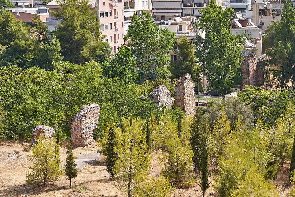
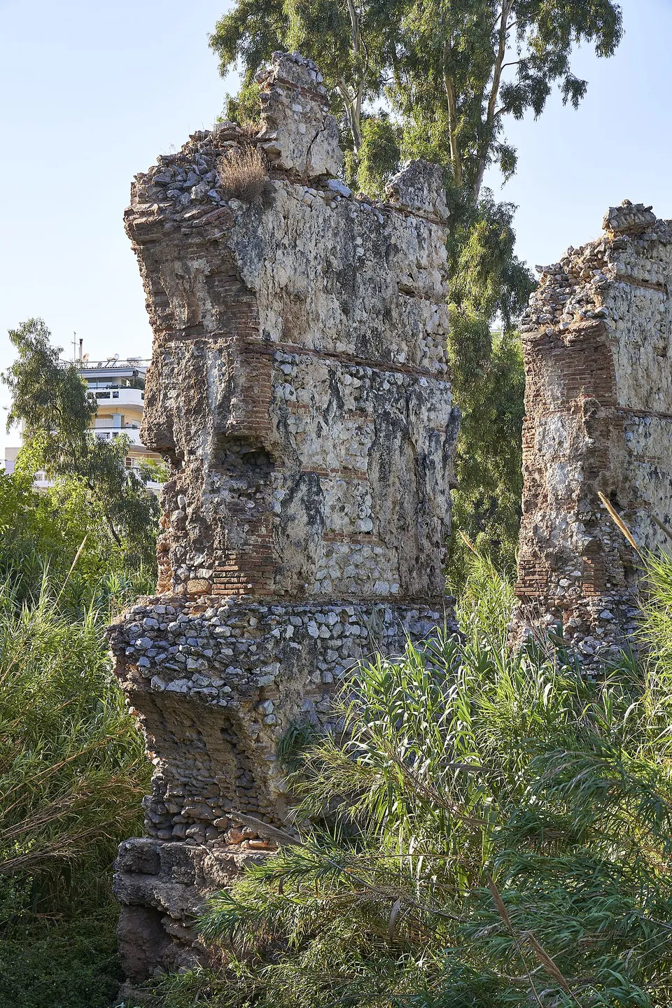
The Eleftheroupoli bridge crosses the Podoniftis torrent, which rises on Mount Pentelikon, at the junction of Emmanouil Pappa and Filellinon streets. Eleven of its piers still stand, over a length of 98 m and up to 11.5 m high. Over the streambed it carried two tiers of arches, and a single tier on the rising ground either side; the piers stand on stone bases, shaped at their ends in the deepest part of the bed to protect them from the rushing water. The vaulted channel that ran along the top has not survived. The piers are built of alternating bands of solid brick and rough stone in mortar around a core of stones cast in mortar (the Ministry).
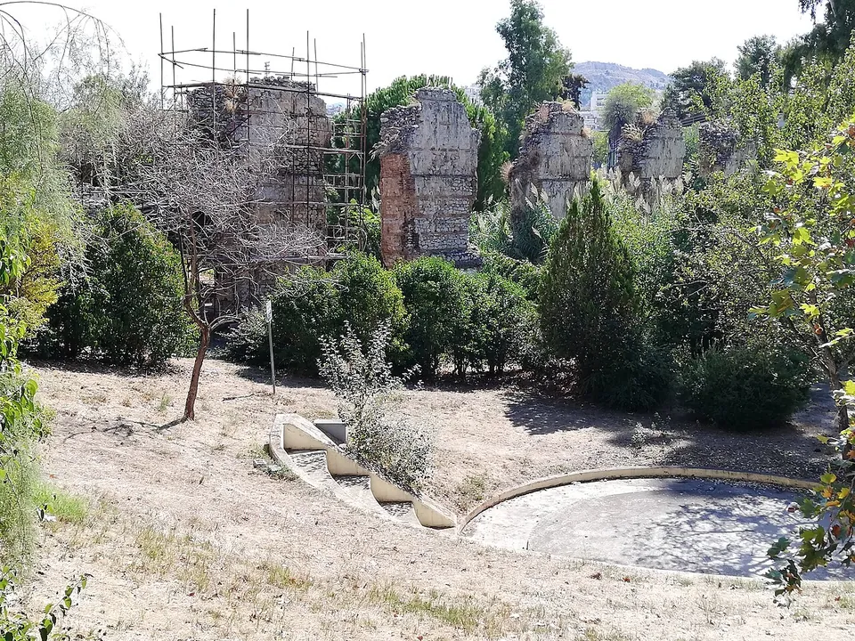
The Alsoupoli bridge, in the district the Ministry calls Kalogreza, is the second of the two (the Ministry). By Kapodistriou Avenue a line of its piers stands among pines on a slope in the middle of the suburb (the photograph and its description).
Is it worth the trip?
Only if you have time for the suburbs: the bridges are impressive ruins in an ordinary residential setting, free to see from the street and the park, but they are 8 km from the centre of Athens and offer no more than the piers themselves (the photographs; OpenStreetMap).
Getting there
Nea Ionia lies north of central Athens. Buses stop at “Gefyra” about 120 m from the Alsoupoli bridge (OpenStreetMap); the Eleftheroupoli bridge stands at the junction of Emmanouil Pappa and Filellinon streets (the Ministry). No operator publishes hours or a fee: the bridges are seen in the open.
Visiting details
- Tickets
- Free
- Parking
- The two water bridges stand about 1.3 km apart in Nea Ionia, a northern suburb of Athens; buses stop at "Gefyra" about 120 m from the Alsoupoli bridge (OSM node/4585130045). The bridges stand in the open beside streets and in a small park (the photographs); no operator publishes hours.
History
The Hadrianic aqueduct, begun in 134 and finished in 140 under Antoninus Pius, brought water to Athens through a 25 km tunnel from the area of Tatoi to a reservoir at the foot of Lycabettus (el.wikipedia). The two aqueducts of Nea Ionia were long counted part of it; the Ministry now treats them as later works, of the 3rd to 5th century.
Nearby
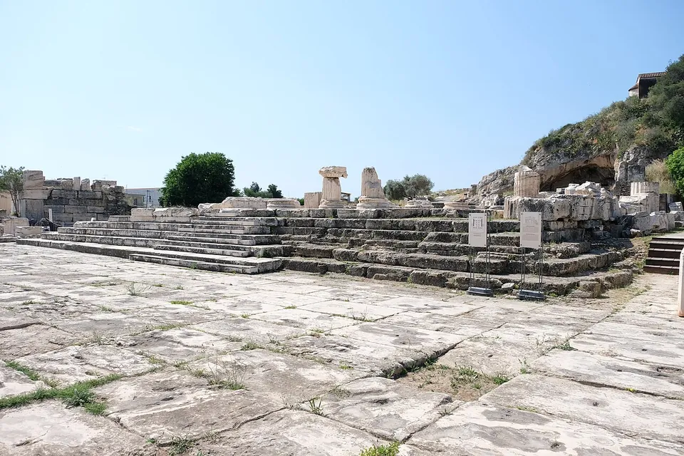
Photo: Davide Mauro · CC BY-SA 4.0 · Commons
21 km · site · West Attica
Eleusis
The visit follows the Processional Road, the end of the Sacred Way from Athens, through the Greater and the Lesser Propylaia to the Telesterion (the operator).

Straight-line distances.
Sources
Every fact on this page comes from the records below, each used under the licence noted.
| Source | Licence |
|---|---|
| Wikidata Q56397091 | CC0 |
| OpenStreetMap way/1086805183 | ODbL |
| Ministry of Culture and Sports (Odysseus) — Υδραγωγείο-υδατογέφυρα στην Ελευθερούπολη | licence not recorded |
| Wikipedia (el) — Αδριάνειο Υδραγωγείο | CC BY-SA 4.0 |
| Wikipedia (en) — Achaia (Roman province) | CC BY-SA 4.0 |