

What is there today
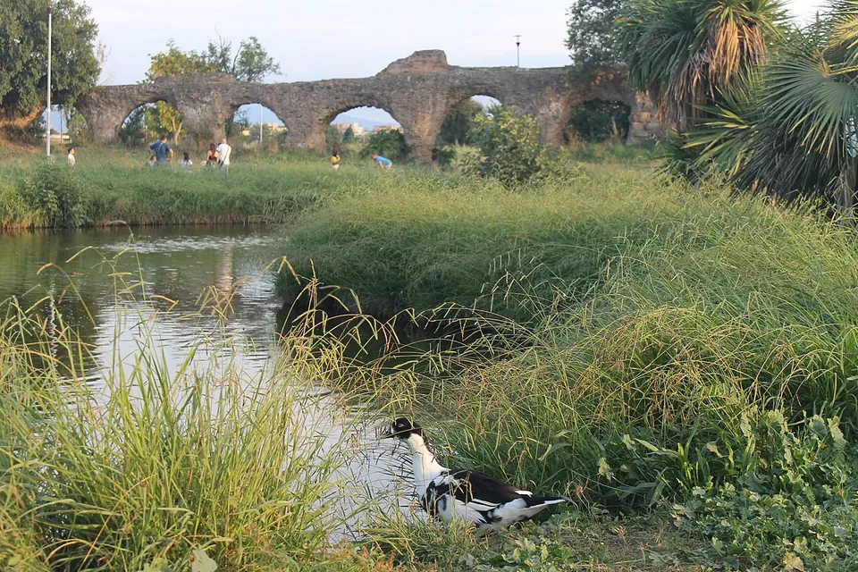
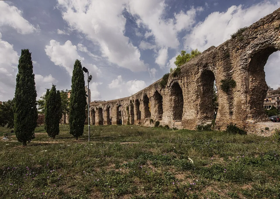
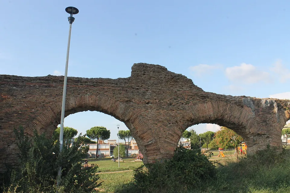
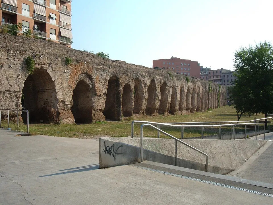
The aqueduct ran for about 22 km from springs at Pantano Borghese, east of the city, to baths in the Campus Martius (Sovrintendenza Capitolina; the Wikipedia editions give 22.4 to 22.7 km). Its first stretch was underground; from the Torre Angela estate it rose onto arches to cross one stream valley after another, and it reached Via di Tor Pignattara before going underground again to Porta Maggiore (Sovrintendenza Capitolina). Nothing of it is visible inside the Aurelian Walls (it.wikipedia). What you can see today is a broken line of arcades across the eastern districts, from the city outwards:
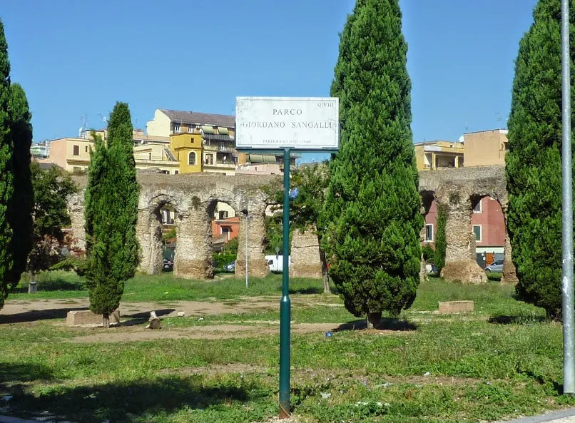
- Tor Pignattara. The second-longest visible stretch runs along Via dell’Acquedotto Alessandrino, south of Via Casilina, across a valley whose lowest point is where Via Carlo Della Rocca crosses it; the ruins stand among houses and in a public park, Parco Giordano Sangalli, and end at Via di Tor Pignattara (en.wikipedia). The arches by the park were restored in 1997 (it.wikipedia).
- Centocelle. The longest continuous stretch above ground runs along Via dei Pioppi and Via degli Olmi, and its biggest arches loom over the busy Viale Palmiro Togliatti, north of Via Casilina (en.wikipedia). The road follows the old Fosso di Centocelle, and the arches there are the aqueduct’s highest: it.wikipedia gives 20.65 m, en.wikipedia 20 to 25 m. The brick facing is very well preserved here, while the other stretches are heavily eroded (en.wikipedia).
- Tor Tre Teste and beyond. From Centocelle the line can be followed through open fields and scattered farmsteads towards the ring road, the Grande Raccordo Anulare, on noticeably lower arches wherever it crossed a ditch or hollow; behind the Tor Tre Teste housing estate a public park has been laid out around the ruins (en.wikipedia).
The arches are of concrete faced with brick, and each pier carries four small travertine brackets at the top whose purpose is unknown (en.wikipedia). What stands has been reworked several times since it was built (Sovrintendenza Capitolina); see History below.
Is it worth the trip?
For an aqueduct enthusiast, yes: this is a long run of tall Roman arches you can walk along for free, at any hour, by metro line C. Centocelle, where the arches are highest and best preserved, is the stretch to see.
Be clear about the setting, though. The Centocelle crossing was once an impressive sight in the Roman countryside and is now completely surrounded by a densely built residential neighbourhood (en.wikipedia), and Viale Palmiro Togliatti is a busy main road. It means a trip out to Rome’s eastern suburbs, about 7 km from the Colosseum, and a first-time visitor with only a few days in the city will find more in the centre.
Getting there
The arches over Viale Palmiro Togliatti are about 650 m from Mirti and 900 m from Alessandrino, both stations on metro line C, and about the same distance from the Frassini and Castani/Faggi tram stops (OpenStreetMap). Turismo Roma gives the addresses as Via degli Olmi 105 and Via di Tor Pignattara.
There is nothing to pay and no gate: the arches stand beside public streets and in parks. Neither the Sovrintendenza Capitolina, Roma Capitale’s heritage office, nor its tourism office lists a ticket or a guided visit (both read 20 October 2026).
Visiting details
- Opening hours
- Open air. The arches along Via degli Olmi and Viale Palmiro Togliatti in Centocelle, and along Via dell'Acquedotto Alessandrino at Tor Pignattara, stand beside public streets and parks and can be seen at any time; no opening hours are published for the parks around them.
- Tickets
- Free to look at. Neither Roma Capitale's heritage office (Sovrintendenza Capitolina) nor its tourism office lists a ticket or a guided visit.
- Parking
- Easiest by metro line C. Mirti station is about 650 m from the arches over Viale Palmiro Togliatti, and Alessandrino about 900 m; the tram stops Frassini and Castani/Faggi are both under 900 m away (OpenStreetMap).
Before you go
- The arches stand in a densely built residential district in Rome's eastern suburbs, about 7 km from the Colosseum, not in open country.
- No part of the aqueduct is visible inside the Aurelian Walls.
Hours and prices checked 20 October 2026 on the operator's own site. Confirm before travelling.
History
Alexander Severus built the aqueduct in AD 226 to supply the Baths of Nero in the Campus Martius, which he had rebuilt and enlarged and which took his name as the Thermae Alexandrinae (en, it and de.wikipedia); they stood between the Pantheon and Piazza Navona (de.wikipedia). Its water was gathered from the marshy springs of Pantano Borghese, near the fourteenth mile of the ancient Via Prenestina, close to Colonna and in today’s municipality of Monte Compatri (it and en.wikipedia), an area Turismo Roma describes as lying at the foot of the Alban Hills and the Prenestini Mountains. Building in brick let the engineers take a straighter line than earlier aqueducts had, largely on arches (it.wikipedia). Published figures for how much water it carried differ widely, from about 21,600 m³ a day (it.wikipedia) to between 120,000 and 320,000 m³ a day depending on the season (en.wikipedia).
The arches were repaired again and again. In the time of Diocletian, around the turn of the 3rd and 4th centuries, they were refaced in brick and extra arches were added on new piers to strengthen the structure; in the 5th or 6th century the whole was refaced again in bands of tufa blocks and brick; and Pope Hadrian I (772–795) reinforced it with reused squared stone blocks and restored its facing and towers (Sovrintendenza Capitolina; Turismo Roma names Diocletian). It remained in use into the 8th century (en.wikipedia). Raffaello Fabretti described it in 1680 (en.wikipedia), and in the 1580s Pope Sixtus V tapped the same springs for a new aqueduct, the Acqua Felice, which reaches Rome by a different route (de.wikipedia).
More photographs


Nearby
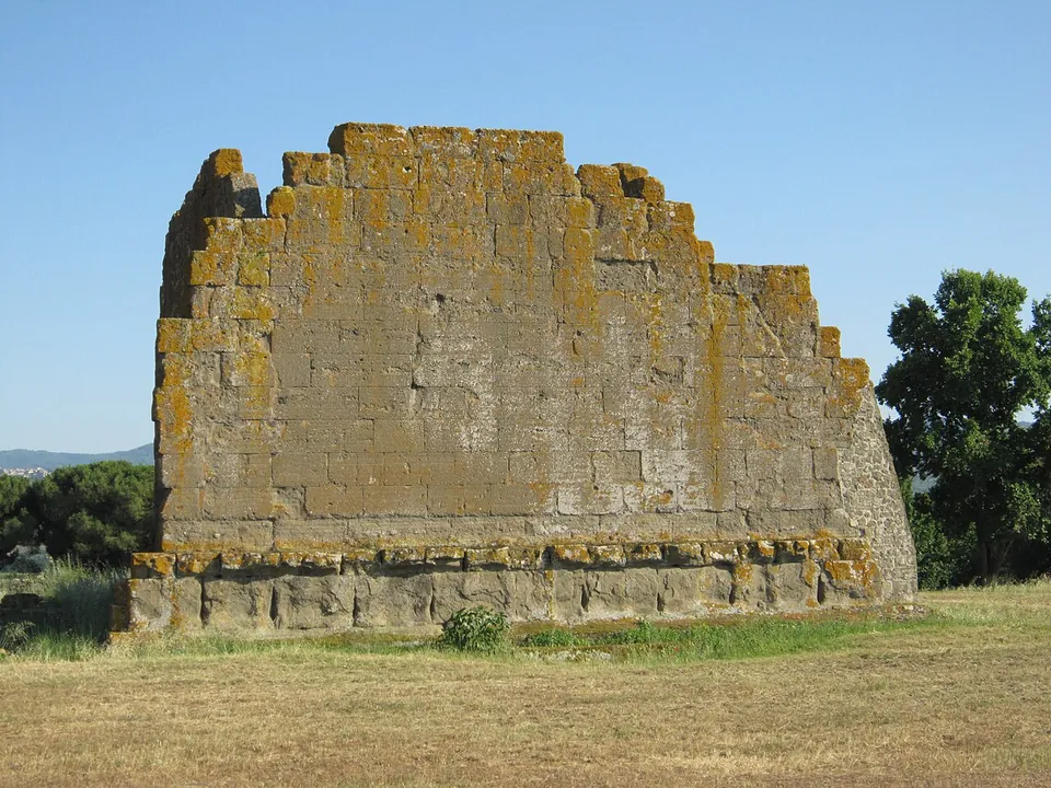
Photo: Carlomorino · CC BY-SA 3.0 · Commons
12 km · city · Lazio
Gabii
The park the state holds covers about 70 hectares on the southern rim of a volcanic crater whose lake was drained in the 19th century (the operator; en.wikipedia).
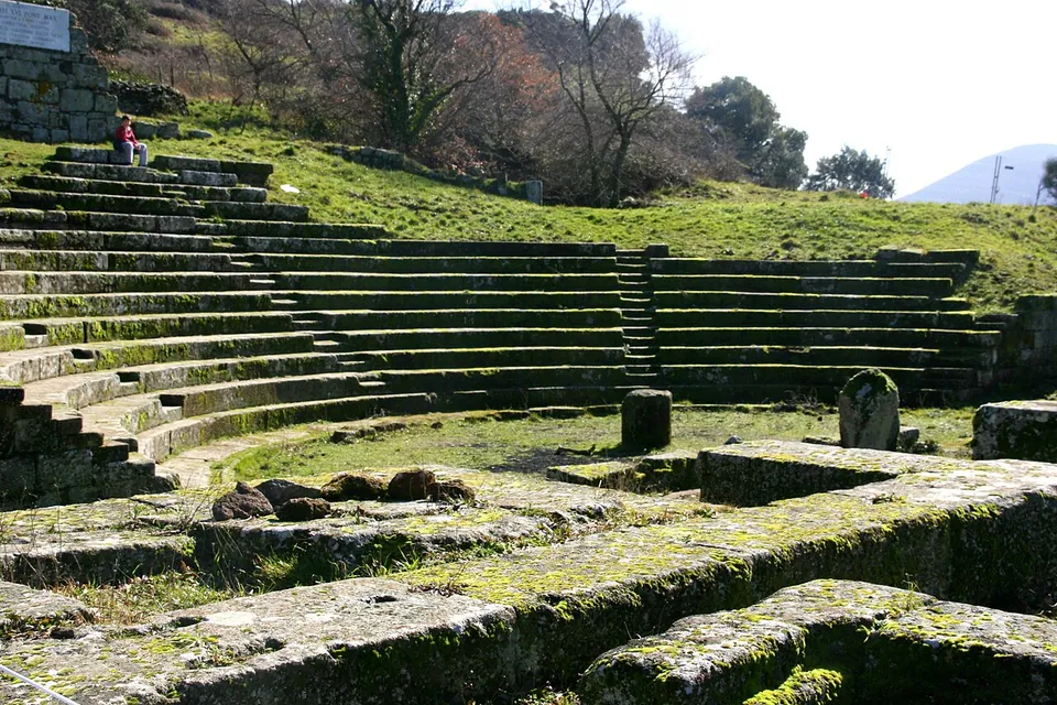
Photo: Luiza Serpa Lopes · Public domain · Commons
14 km · city · Lazio
Tusculum
The visitor route runs mainly through the forum, with the theatre halfway round (the operator).
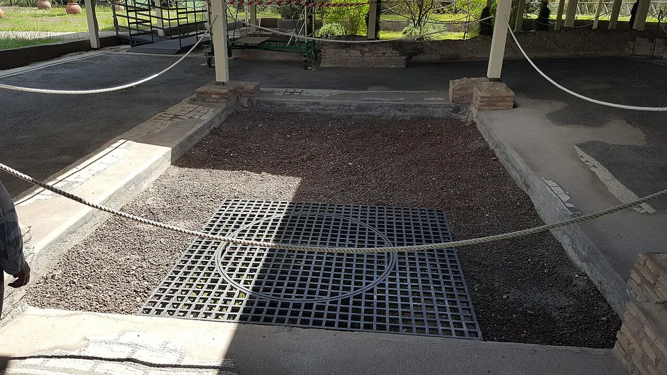
Photo: MumblerJamie · CC BY-SA 2.0 · Commons
15 km · villa · Lazio
Villa of Livia
The operator describes the private wing with the bedrooms of Livia and the emperor, an atrium and a small inner garden, and the large reception rooms that open onto a peristyle; the rooms once had painted walls and floors of mosaic and cut marble (Soprintendenza Speciale di Roma).


Straight-line distances.
Sources
Every fact on this page comes from the records below, each used under the licence noted.
| Source | Licence |
|---|---|
| Pleiades 423557 | CC BY |
| Wikidata Q622909 | CC0 |
| OpenStreetMap relation/11077947 | ODbL |
| Sovrintendenza Capitolina — Acquedotto Alessandrino (Roma Capitale's heritage office) | licence not recorded |
| Turismo Roma — Acquedotto Alessandrino (Roma Capitale's tourism office) | licence not recorded |
| Wikipedia (en) — Aqua Alexandrina | CC BY-SA 4.0 |
| Wikipedia (it) — Acquedotto alessandrino | CC BY-SA 4.0 |
| Wikipedia (de) — Aqua Alexandrina | CC BY-SA 4.0 |
| Wikipedia (fr) — Aqueduc de l'Aqua Alexandrina | CC BY-SA 4.0 |