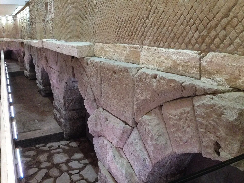
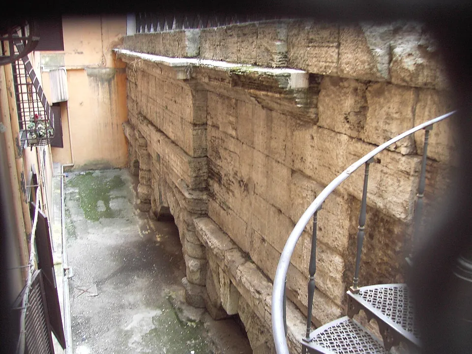
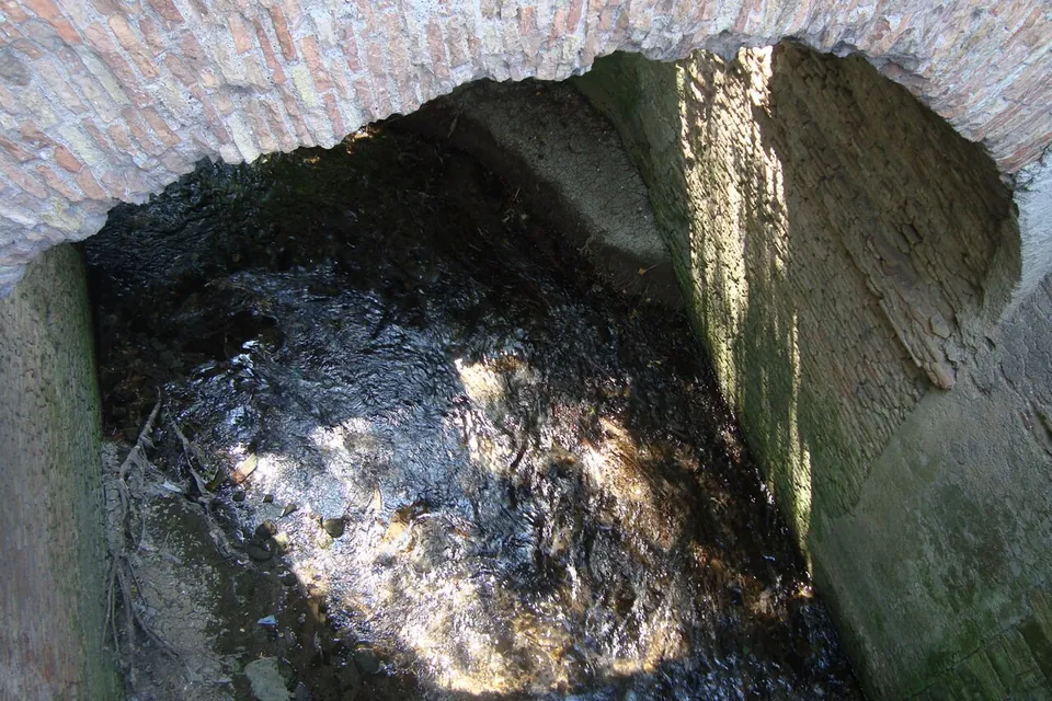


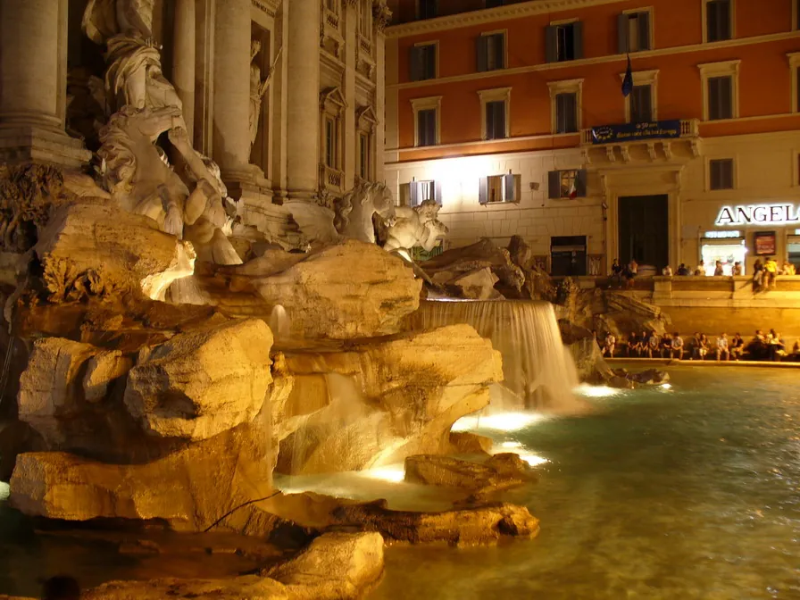
The Aqua Virgo is the aqueduct Agrippa built to bring water to the Campus Martius in 19 BC, and it is the only one of ancient Rome’s eleven main aqueducts still in use: its water comes out of the Trevi Fountain today (Sovrintendenza Capitolina; it.wikipedia). Almost all of it runs underground, so what you can see is a handful of arches a few streets from the fountain.
What is there today
Most of the aqueduct is invisible. From its springs near the eighth mile of the Via Collatina, at Salone, it runs for about 20.5 km in a wide arc round the north of the city, nearly all of it in a tunnel (en and it.wikipedia; the Sovrintendenza says “over 20 km, mainly underground”). Outside the centre the channel lies some 30–40 m down (it.wikipedia). Apart from one crossing in Pietralata, only the last 1.8 km or so, from the Pincio to the Campus Martius, ran in the open or on arches, and that is where most of the remains are. Along the line, from the centre outwards:
- Inside Rinascente, Via del Tritone. “Imposing remains”, in the Sovrintendenza’s words. When the department store was built, about 60 m of the aqueduct was uncovered and kept (de.wikipedia), and it is on show inside the store, visible to anyone who walks in (Turismo Roma).
- Via del Nazareno, a minute’s walk away. Three arches of rough-faced travertine blocks, partly buried, stand either side of a larger arch carrying Claudius’s inscription of AD 46, which records that he rebuilt from the foundations the arches Caligula had damaged (Sovrintendenza Capitolina). They can be seen from the street (Pleiades).
- Vicus Caprarius – La Città dell’Acqua, about 250 m south by the Trevi Fountain. More than nine metres below the street, excavations of 1999–2001 under a former cinema found a large distribution tank (castellum aquae) of the aqueduct, together with a Roman apartment block later turned into a grand house; it is a separate site with its own ticket and a display of the finds (the operator).
- Palazzo Sciarra, Via del Corso. The Sovrintendenza records two more travertine arches beneath the palace; no source says how a visitor can see them.
- The Pincio. A Renaissance spiral staircase leads down to the channel by a settling tank on the slopes of the Pincio, at Villa Medici (Sovrintendenza; en and it.wikipedia). No source gives any arrangement for visitors to go down.
- Pietralata. The one place outside the centre where the Sovrintendenza records the aqueduct above ground: a raised stretch 320 m long, faced in tufa reticulate, where it crossed the Fosso della Marranella on arches near its meeting with the Aniene. OpenStreetMap maps a ruined stretch of the aqueduct about 300 m long and 5 m high beside Via di Pietralata, and a photograph on Commons shows a stream there, the Fosso di Pietralata, running under one of its arches.
Is it worth the trip?
As a footnote to the Trevi Fountain, yes, and it costs nothing. The arches in Rinascente and in Via del Nazareno are a few minutes’ walk from the fountain, and they are what is left of the Roman aqueduct whose water still fills it. Add Vicus Caprarius if you want to go underground and see that water running through Roman walls.
Do not expect a line of arches striding across open country: in the centre the remains are fragments in a sunken yard and inside a shop. The Aqua Virgo is a short detour in the city centre, not a destination of its own, and the Pietralata stretch, in the suburbs about 5 km north-east of the centre, is only for the committed.
Getting there
The central remains are in the Trevi district. The Via del Nazareno arches are about 430 m from Barberini metro station and 470 m from Spagna, both on line A (OpenStreetMap). Rinascente’s entrances are at Via del Tritone 61 and Via dei Due Macelli 23 (Turismo Roma), and the remains can be seen whenever the store is open; check rinascente.it for the day’s hours. Looking at both is free.
The Sovrintendenza Capitolina also runs a booked visit to the aqueduct, normally €4 (€3 reduced; free to residents of Rome and its metropolitan area), but it is temporarily closed for works under the PNRR recovery plan (read 17 October 2026).
Vicus Caprarius opens Tuesday to Sunday, 11.00 to 17.00, with the last entry at 16.30; it is closed on Mondays. A ticket is €4, €2.50 reduced and €1 for ages 14 to 17, and under-14s go free; an audio guide is €3.50. Space underground is limited, so booking by phone or WhatsApp is required at weekends and on public holidays and advised on other days (vicuscaprarius.com, read 17 October 2026; prices and hours change, so check before going).
For the Pietralata stretch, ATAC buses stop beside it at Pietralata/Vigna Mangani (OpenStreetMap).
Visiting details
- Opening hours
- The arches in Via del Nazareno are seen from the street at any time. The remains inside Rinascente are open whenever the department store is (check rinascente.it for the day's hours). The Sovrintendenza Capitolina's own booked visit to the aqueduct is temporarily closed for works. Vicus Caprarius, with the aqueduct's distribution tank, opens Tuesday to Sunday 11.00–17.00 (last entry 16.30), closed Monday.
- Tickets
- Free to look at the Via del Nazareno arches, the Rinascente remains and the Pietralata stretch. The Sovrintendenza's visit, when it reopens, is €4 (€3 reduced; free to residents of Rome and its metropolitan area and to MIC card holders), by booking on 060608 only. Vicus Caprarius is €4, €2.50 reduced, €1 for ages 14–17 and free under 14, with an audio guide at €3.50; booking is required at weekends and on public holidays.
- Parking
- In the centre there is nothing to park for; the metro is easier. Barberini and Spagna stations (line A) are about 430 m and 470 m from the Via del Nazareno arches (OpenStreetMap). The Pietralata stretch has ATAC bus stops, Pietralata/Vigna Mangani, right beside it.
Before you go
- The Sovrintendenza Capitolina lists its own visit to the aqueduct as temporarily closed for works funded by the PNRR recovery plan (read 17 October 2026).
- Outside the city centre the channel runs deep underground; between the springs and the Pincio the only stretch recorded above ground is the one in Pietralata.
Hours and prices checked 17 October 2026 on the operator's own site. Confirm before travelling.
History
Agrippa, Augustus’s son-in-law, opened the aqueduct in 19 BC (it and de.wikipedia give the day as 9 June), chiefly to supply his baths in the Campus Martius (en, it and de.wikipedia). The name is probably owed to the purity and freshness of its water, though a legend has a young girl showing the springs to the soldiers sent to find them (Sovrintendenza Capitolina; de.wikipedia has Frontinus telling the story). The line loops round the north of the city to serve the northern suburbs, which had no water until then, and because the springs lay low, only 24 m above sea level, so that the shorter route’s steep slopes had to be avoided (en and it.wikipedia). It fell only about 4 m over its whole length (en and de.wikipedia) and delivered about 100,000 m³ of water a day; Frontinus records how it was shared between the suburbs, public works, the imperial house and private users (en and it.wikipedia). The channel ended in front of the Saepta, the great public building near the Pantheon (Sovrintendenza), and a branch reached Trastevere (en and it.wikipedia).
Claudius rebuilt the arches in AD 46 after Caligula had damaged them, as his inscription in Via del Nazareno says; some have connected the damage with an amphitheatre Caligula began in the Campus Martius and never finished (Sovrintendenza). Where the aqueduct crossed the Via Lata, today’s Via del Corso, Claudius turned its arch into a triumphal arch for the conquest of Britain (Sovrintendenza; en and de.wikipedia). Tiberius, Constantine and Theodoric repaired it too (it.wikipedia). In 537 the Goths besieging Rome tried to use the tunnel as a secret way into the city (de.wikipedia, after Procopius), the first major break in its working life (en.wikipedia).
Pope Hadrian I restored it in the 8th century (en, it and de.wikipedia), and in 1453 Nicholas V rebuilt it as the Acqua Vergine (en and de.wikipedia). Its water now feeds fountains including the Trevi Fountain, the Barcaccia in Piazza di Spagna and the Fountain of the Four Rivers (it and de.wikipedia).
More photographs

Nearby
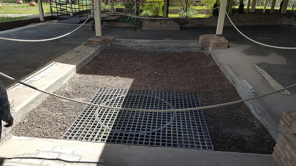
Photo: MumblerJamie · CC BY-SA 2.0 · Commons
11 km · villa · Lazio
Villa of Livia
The operator describes the private wing with the bedrooms of Livia and the emperor, an atrium and a small inner garden, and the large reception rooms that open onto a peristyle; the rooms once had painted walls and floors of mosaic and cut marble (Soprintendenza Speciale di Roma).
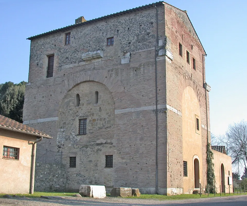
Photo: MM · Public domain · Commons
17 km · arch · Lazio
Arch of Malborghetto
At first sight you see an austere farmhouse rather than an arch (it.wikipedia).
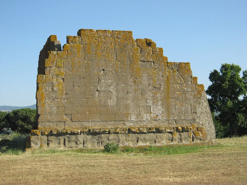
Photo: Carlomorino · CC BY-SA 3.0 · Commons
20 km · city · Lazio
Gabii
The park the state holds covers about 70 hectares on the southern rim of a volcanic crater whose lake was drained in the 19th century (the operator; en.wikipedia).


Straight-line distances.
Sources
Every fact on this page comes from the records below, each used under the licence noted.
| Source | Licence |
|---|---|
| Pleiades 423568 | CC BY |
| Wikidata Q600139 | CC0 |
| OpenStreetMap way/1390965274 | ODbL |
| Sovrintendenza Capitolina — Acquedotto Vergine (Roma Capitale's heritage body, with the visit's tariff and closure) | licence not recorded |
| Sovrintendenza Capitolina — access and booking for its monuments (list of sites closed for PNRR works) | licence not recorded |
| Turismo Roma — La Rinascente, Via del Tritone (Roma Capitale's tourism office) | licence not recorded |
| Vicus Caprarius – La Città dell'Acqua — archaeological area (the operator) | licence not recorded |
| Vicus Caprarius — opening hours (the operator) | licence not recorded |
| Vicus Caprarius — tickets (the operator) | licence not recorded |
| Wikipedia (it) — Aqua Virgo | CC BY-SA 4.0 |
| Wikipedia (en) — Aqua Virgo | CC BY-SA 4.0 |
| Wikipedia (de) — Aqua Virgo | CC BY-SA 4.0 |