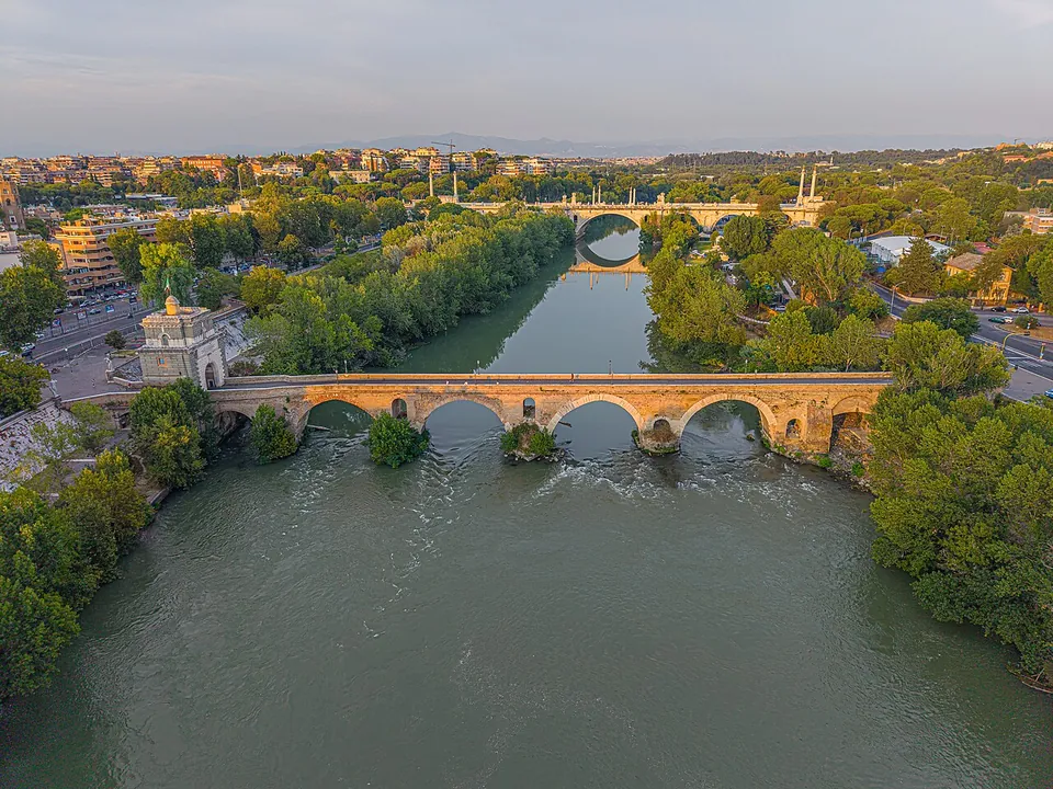
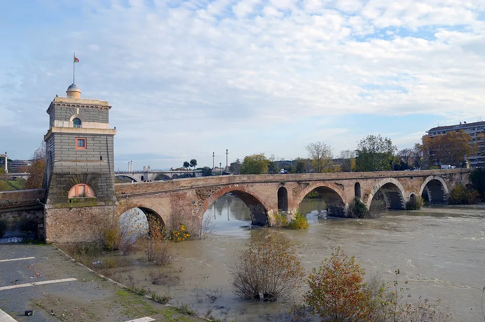


Ponte Milvio is a Roman stone bridge over the Tiber in the north of Rome, where the Via Flaminia crossed the river, and it is famous above all as the site of the battle of 312 in which Constantine defeated Maxentius. You can walk across it today: the central arches survive from the stone bridge the censor Marcus Aemilius Scaurus built in 109 BC, the ends and the gate tower are later, and it costs nothing.
What is there today
A bridge of six arches, 136 m long, with four larger arches over the river and two smaller ones at the banks (de.wikipedia; Sovrintendenza Capitolina). The Roman work is the middle: the three central arches survive from the ancient bridge, by the account of Roma Capitale’s tourism office and it.wikipedia, while de.wikipedia, the most detailed description, counts two of the four river arches as entirely Roman and one or two more as partly so. The bridge has a core of tuff from Grotta Oscura, faced with sperone stone and travertine, and each of its five piers has a triangular cutwater and an arched opening that lets floodwater through. One of the central arches, the northern one, was blown up by Garibaldi’s troops in 1849 and restored under Pius IX (Sovrintendenza Capitolina).
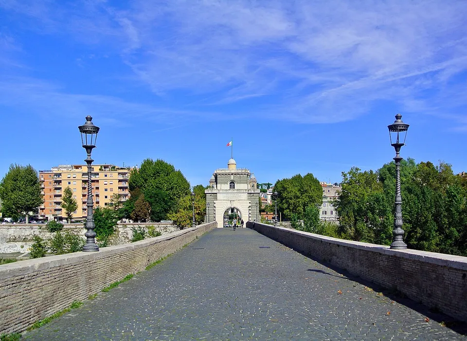
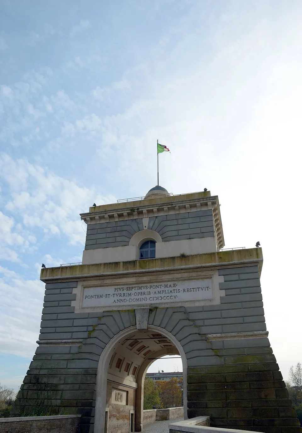
Everything at the ends is later. The two arches at the banks were wooden walkways until Giuseppe Valadier rebuilt them in masonry in 1805. The gate tower on the north bank is a square tower that Pope Callixtus III built in place of a wooden one, partly preserved and remodelled under Pius VII, whose 1805 inscription is over its arch; a marble plaque with the arms of Callixtus III and his Borgia nephews is set in the passage (Sovrintendenza Capitolina). Its present neoclassical form is Valadier’s design of 1805 (Turismo Roma). At the southern end stand statues of St John of Nepomuk and the Immaculate Virgin, and remains of medieval superstructures, with corbels and small arches, survive on the east side of the same end (Sovrintendenza Capitolina). A copy of Francesco Mochi’s 17th-century Baptism of Christ also stands at the southern end, the original now in the Museo di Roma at Palazzo Braschi (it.wikipedia).
The bridge has been closed to cars since 1978, and the area around it has become a place where young Romans meet in the evening (it.wikipedia; Turismo Roma).
Is it worth the trip?
For the history, yes, as long as you know what you are looking at. This is a working Roman bridge more than two thousand years old, for centuries the main way into Rome for travellers from the north (de.wikipedia), and the site of the battle that brought Constantine to power. What it is not is a ruin to explore: you see it in the time it takes to cross and to look at the arches from the bank, and the most conspicuous thing on it, the gate tower, has its present form from 1805.
It lies about 5 km north of the Roman Forum, away from the centre’s cluster of stops, so it suits a reader with a particular interest in Constantine, or someone already in the Flaminio district, better than a first-time visitor with one day in Rome. It is free and always open.
Getting there
The bridge is in northern Rome, in line with the Via Flaminia, between the Flaminio and Parioli quarters on the south bank and Della Vittoria and Tor di Quinto on the north (it.wikipedia). Bus stops named Lgt Thaon di Revel/P. Milvio are about 120 m from it, and there is paid street parking about 130 m away (OpenStreetMap); it.wikipedia notes that several city bus lines serve it.
There is no ticket and no gate: the bridge is a public footbridge, open at all times (Sovrintendenza Capitolina, read 17 October 2026; OpenStreetMap). One warning: the bridge is a known meeting point for football ultras, and attacks on visiting fans here on match days are on record (en.wikipedia), so on a match day it is no place to wear team colours.
Visiting details
- Opening hours
- Open at all times; it is a public footbridge across the Tiber.
- Tickets
- Free. There is no ticket and no gate.
- Parking
- Paid street parking about 130 m from the bridge (OSM way/1410008655 and way/1410008647); bus stops named Lgt Thaon di Revel/P. Milvio are about 120 m away.
Before you go
- The bridge is a known gathering point for football ultras, and attacks on visiting fans here on match days are on record; on a match day, keep away in team colours.
Hours and prices checked 17 October 2026 on the operator's own site. Confirm before travelling.
History
The bridge is first named by Livy, in connection with the return from the battle of the Metaurus in 207 BC, during the Second Punic War (Sovrintendenza Capitolina; it.wikipedia). That first bridge was probably of wood, built by a member of the Molvia (or Milvia) family, who gave it its name (it.wikipedia; de.wikipedia); Pleiades and en.wikipedia instead attribute a bridge of 206 BC to the consul Gaius Claudius Nero. In 109 BC the censor Marcus Aemilius Scaurus rebuilt it in stone (en.wikipedia; it.wikipedia). It mattered because of where it stood: it carried the Via Flaminia over the Tiber, and just beyond it the roads to the north branched off, among them the Cassia and the Clodia (Sovrintendenza Capitolina).
It turns up again and again in Roman history. In 63 BC letters from the Catilinarian conspirators were seized here, and Cicero read them to the Senate the next day (en.wikipedia). In 27 BC an arch with a statue of Augustus was built on the bridge, since lost (Sovrintendenza Capitolina). Some of the less regular work in the arches’ keystones may come from a later repair, perhaps under Maxentius (Sovrintendenza Capitolina). In 312 Constantine defeated his stronger rival Maxentius between this bridge and Saxa Rubra, the battle that led to his rule (en.wikipedia). Legend has it that Constantine saw a cross with the words In hoc signo vinces before the battle, which encouraged him to fight and later to adopt Christianity (it.wikipedia). In 537, according to fr.wikipedia, Belisarius put up the first gate tower at the northern end; it.wikipedia instead has the medieval fort there built on a defensive tower of the 3rd century.
In the Middle Ages it was the main road into Rome and was fortified, and it was damaged and repaired many times (Sovrintendenza Capitolina). Pope Martin V had it restored in 1429, and the medieval fortification at its northern end was demolished in 1458 (it.wikipedia). The Romans’ nickname, Ponte Mollo, is said to come from its being the first bridge to go under when the Tiber floods (it.wikipedia); Turismo Roma tells it differently, of a wooden walkway over a collapsed arch that swayed underfoot. Once the Ponte Flaminio opened nearby in 1951, traffic on the old bridge fell sharply, and it has carried only people on foot since 1978 (it.wikipedia).
More photographs

Nearby
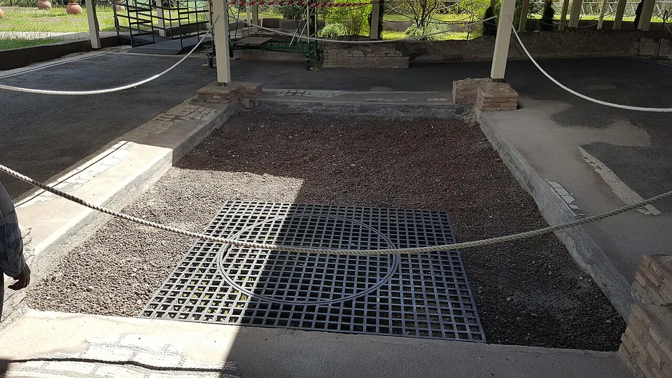
Photo: MumblerJamie · CC BY-SA 2.0 · Commons
8 km · villa · Lazio
Villa of Livia
The operator describes the private wing with the bedrooms of Livia and the emperor, an atrium and a small inner garden, and the large reception rooms that open onto a peristyle; the rooms once had painted walls and floors of mosaic and cut marble (Soprintendenza Speciale di Roma).
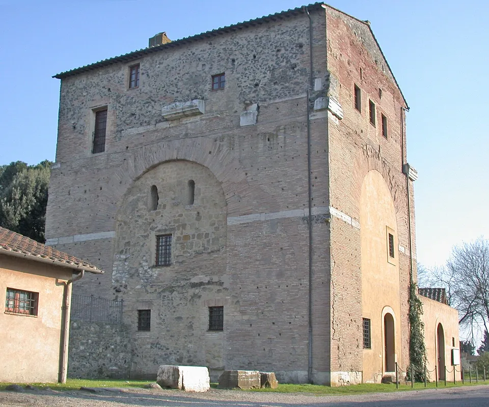
Photo: MM · Public domain · Commons
13 km · arch · Lazio
Arch of Malborghetto
At first sight you see an austere farmhouse rather than an arch (it.wikipedia).
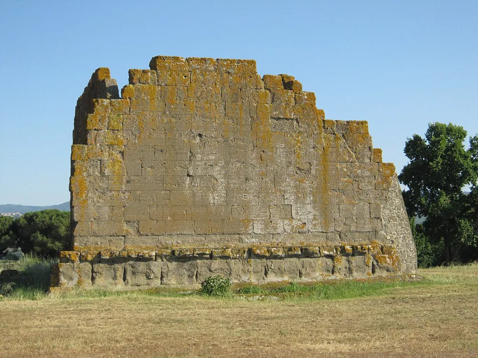
Photo: Carlomorino · CC BY-SA 3.0 · Commons
22 km · city · Lazio
Gabii
The park the state holds covers about 70 hectares on the southern rim of a volcanic crater whose lake was drained in the 19th century (the operator; en.wikipedia).


Straight-line distances.
Sources
Every fact on this page comes from the records below, each used under the licence noted.
| Source | Licence |
|---|---|
| Pleiades 423008 | CC BY |
| Wikidata Q1127325 | CC0 |
| Vici.org 2998 | CC BY-SA (text), CC0 (metadata) |
| OpenStreetMap way/224999187 | ODbL |
| Sovrintendenza Capitolina — Ponte Milvio (the city's heritage body, which looks after the bridge) | licence not recorded |
| Turismo Roma — Ponte Milvio e la Torretta Valadier (Roma Capitale's tourism office) | licence not recorded |
| Wikipedia (it) — Ponte Milvio | CC BY-SA 4.0 |
| Wikipedia (de) — Milvische Brücke | CC BY-SA 4.0 |
| Wikipedia (en) — Ponte Milvio | CC BY-SA 4.0 |
| Wikipedia (fr) — Pont Milvius | CC BY-SA 4.0 |