

What is there today
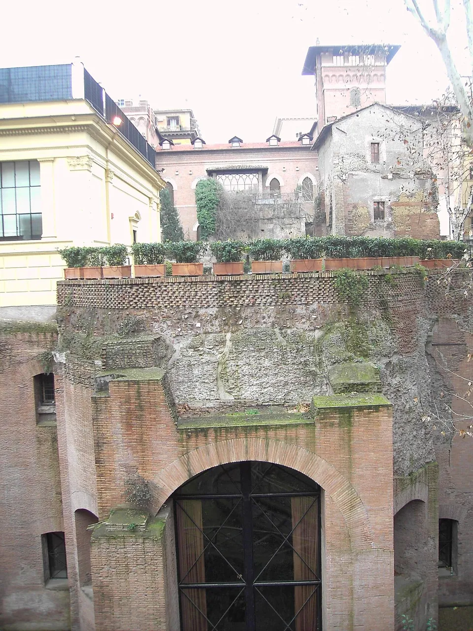
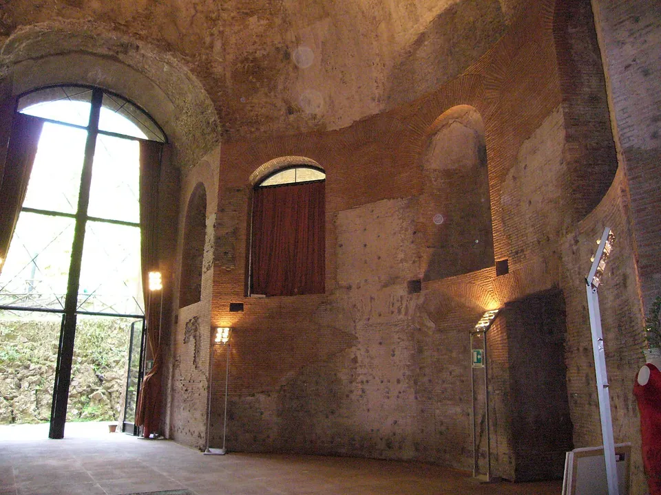
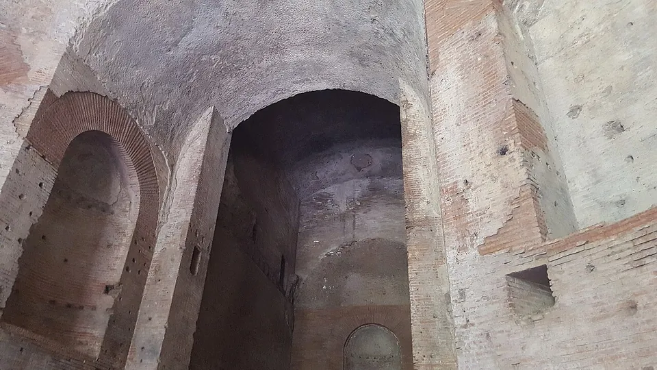
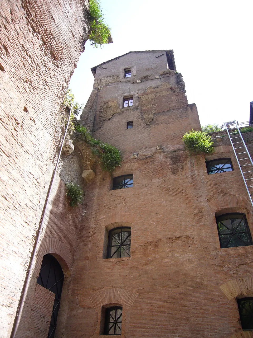
From the square you look down 14 m onto the remains of a complex of three groups of buildings (Turismo Roma), with the brick front of the domed hall at the bottom; one building beside it still stands several storeys high (Commons). Inside is a round hall about 11 m across, under a dome of alternating concave and flat segments, a form otherwise found only in the Serapeum of Hadrian’s Villa; a glass panel in the modern floor shows its foundations (it.wikipedia; Turismo Roma). A semicircular building behind it keeps black-and-white mosaics and remains of wall paintings, although its façade is largely a 19th-century restoration (it.wikipedia). Brick stamps date the pavilion to Hadrian’s reign, after 126 (it.wikipedia; de.wikipedia).
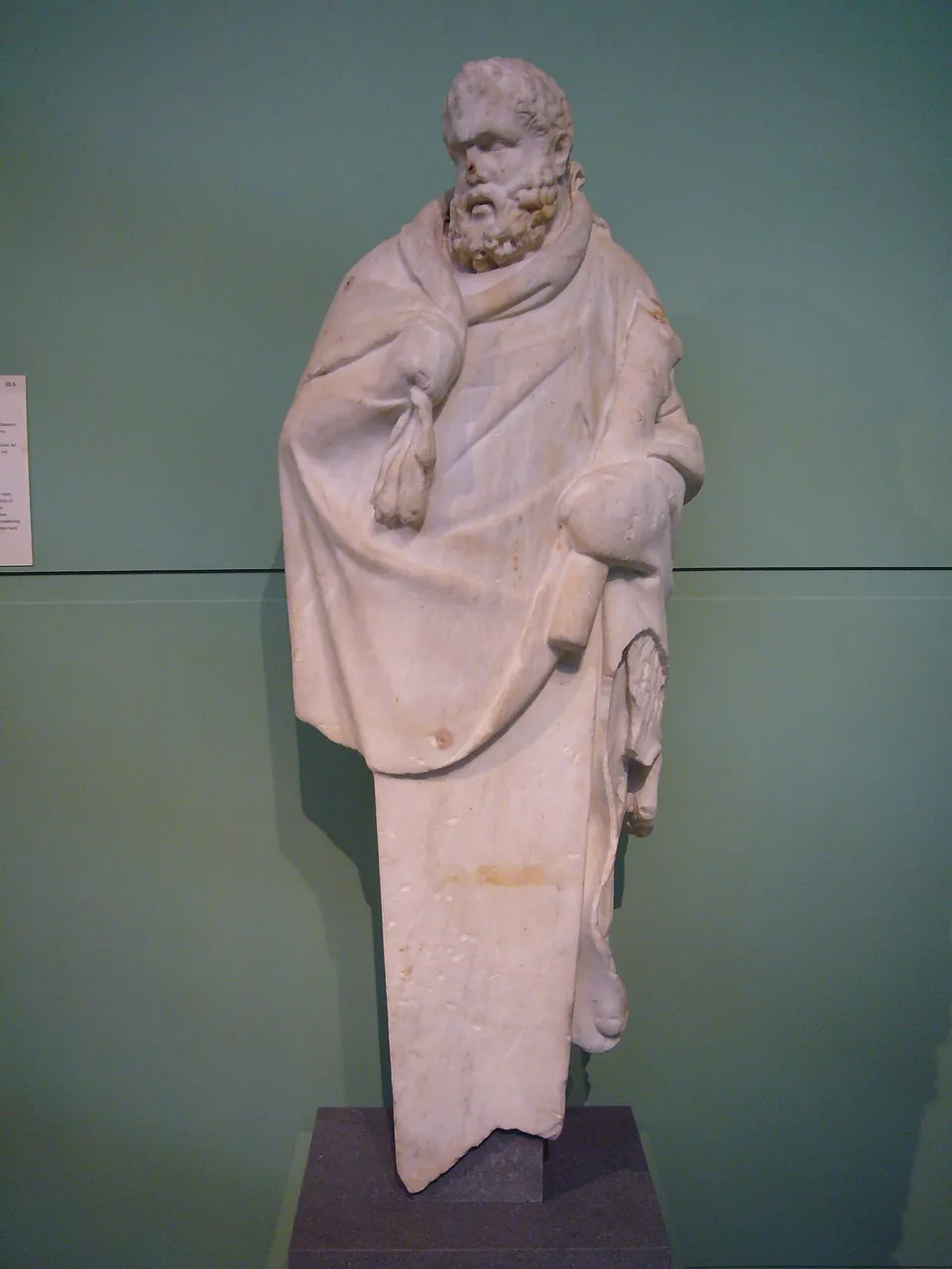
This is the only part of the gardens on show. Other remains survive out of public view: a cryptoporticus with wall paintings in the garage of the American Embassy, a large cistern under the Collegio Germanico and a wall with niches along Via Lucullo (it.wikipedia). Many famous sculptures come from the gardens, among them the Dying Gaul in the Capitoline Museums, the Ludovisi Gaul and the Ludovisi Throne in Palazzo Altemps, and the obelisk that has stood at the top of the Spanish Steps since 1789 (Turismo Roma).
Is it worth the trip?
Only as a short stop. The pavilion is remarkably well preserved (en.wikipedia), but the inside is run as a conference and events venue, and no public opening hours or tickets are published; a press report of July 2026 said new spaces would open that September with an exhibition (Artribune), and no page of the venue’s found confirms it. What any visitor can count on is the view down from the square. If you are at the Baths of Diocletian, 600 m away, that view and Porta Nomentana, 400 m beyond it, make a short detour.
Getting there
The remains are in the middle of Piazza Sallustio (en.wikipedia), about 2 km north of the Roman Forum. The nearest mapped public transport stop, Quintino Sella, is about 130 m away (OpenStreetMap). There is nothing to pay for the view from the square; the hall’s inside has no published hours or price (the venue’s site and Turismo Roma, read 22 October 2026). The venue’s own website, hortisallustiani.it, is the place to ask about access.
Visiting details
- Opening hours
- No public opening hours are published for the Hadrianic hall under Piazza Sallustio, which is run as a venue for conferences and events; its outside can be seen from the square, 14 m below street level.
- Tickets
- No admission price is published. The operator's site offers the hall for hire, not for visits.
Hours and prices checked 22 October 2026 on the operator's own site. Confirm before travelling.
Nearby
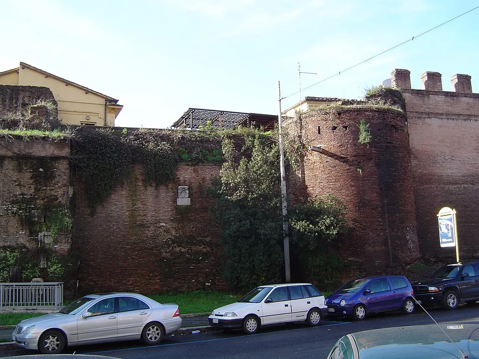
Porta Nomentana, 400 m north-east, is a gate of the Aurelian Walls built between 270 and 273, on Viale del Policlinico about 70 m east of Porta Pia. Porta Pia replaced it as the way out to the Via Nomentana in 1564, and it is now blocked, part of the boundary wall of the British Embassy; its original semicircular right-hand tower can still be seen (en.wikipedia).
The Tomb of Quintus Sulpicius Maximus is a marble grave marker, 1.61 m high, found built into a tower of Porta Salaria when the gate was demolished after 1870. It shows a boy in a toga holding a scroll, framed by the Greek verses he improvised at the Capitoline poetry contest of AD 94; he apparently died straight afterwards. The original is in the Capitoline Museums; a copy stands near where it was found, at the corner of Via Piave and Via Sulpicio Massimo (de.wikipedia).
Porta Collina, 200 m away, was the gate at the northern end of the Servian Wall where the Via Salaria and Via Nomentana began. Its remains were found in the 19th century when the Finance Ministry was built at the corner of Via XX Settembre and Via Goito; Sulla won the battle of the Colline Gate there in 82 BC (de.wikipedia).
Three more sites close by are separate stops of the Rome hub, not part of the gardens: the Castra Praetoria, the Praetorian Guard’s camp, about 900 m east; the Mausoleum of Lucilius Paetus on Via Salaria, about 800 m away; and the Catacomb of Santa Felicita, about 1.1 km north.
History
The estate belonged to Julius Caesar, and after his death it was bought by the historian Sallust, who is said to have paid for it with money gained, perhaps illegally, as governor of Africa Nova (it.wikipedia). When Sallust died in 36 BC it passed to his adopted great-nephew, and later it became imperial property, under Tiberius according to it.wikipedia and Turismo Roma, under Claudius according to en.wikipedia. Many emperors used it as a second residence beside the Palatine: Vespasian liked to stay there, Nerva died there in 98, and Hadrian and Aurelian both built there, Aurelian adding a long portico where he went riding (it.wikipedia; en.wikipedia; de.wikipedia). A small temple of Venus Erycina, a Republican building, was taken into the grounds (en.wikipedia).
In 410 Alaric’s Goths entered Rome by the nearby Porta Salaria and the villa was badly damaged and never rebuilt (it.wikipedia), although the gardens were not finally abandoned until the 6th century (en.wikipedia). Vineyards planted in the 16th century, and above all the Villa Ludovisi built on the site in the early 17th century, turned up many of the sculptures now in museums. In the late 19th century the building of the new Ludovisi quarter filled in the valley between the Pincian and the Quirinal, and almost all the finds of those years were sold to collectors abroad, above all to the founder of the Ny Carlsberg Glyptotek in Copenhagen (en.wikipedia; it.wikipedia). The surviving pavilion stands on land held within the Italian chambers of commerce’s system, Unioncamere, which restored it, not completely, and made it a centre for conferences and events (it.wikipedia; de.wikipedia).
More photographs



Nearby
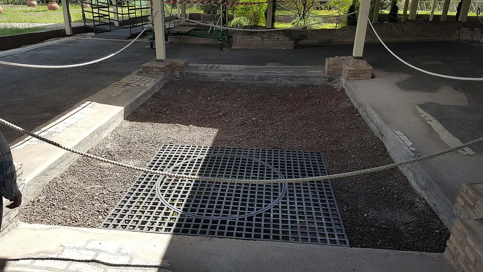
Photo: MumblerJamie · CC BY-SA 2.0 · Commons
10 km · villa · Lazio
Villa of Livia
The operator describes the private wing with the bedrooms of Livia and the emperor, an atrium and a small inner garden, and the large reception rooms that open onto a peristyle; the rooms once had painted walls and floors of mosaic and cut marble (Soprintendenza Speciale di Roma).
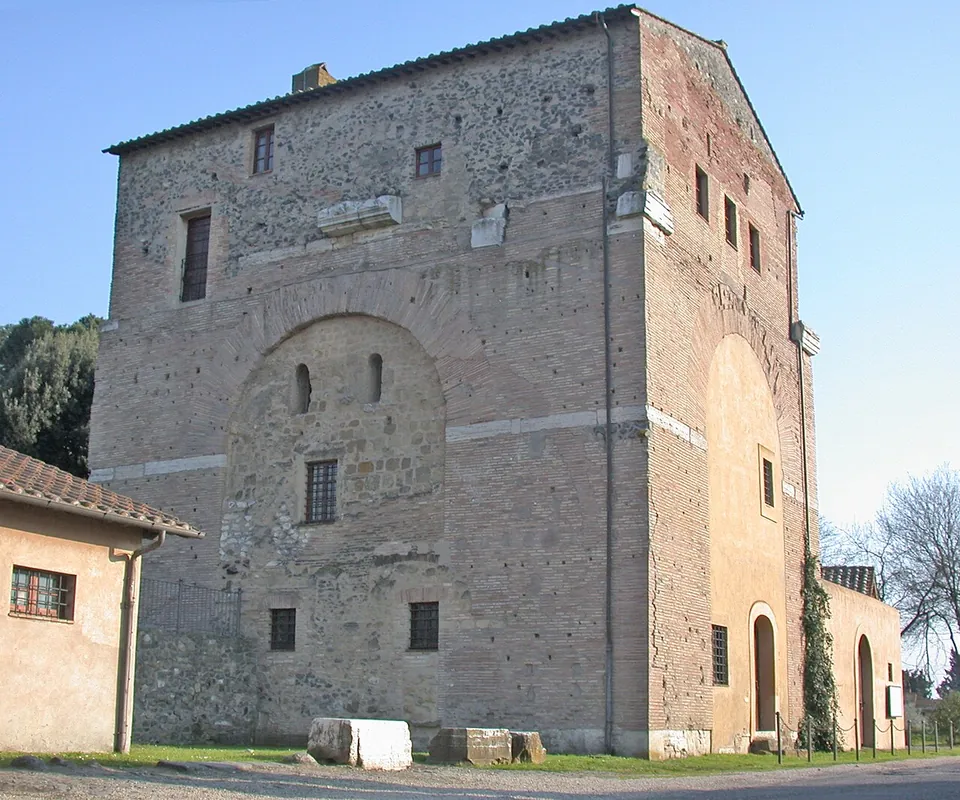
Photo: MM · Public domain · Commons
16 km · arch · Lazio
Arch of Malborghetto
At first sight you see an austere farmhouse rather than an arch (it.wikipedia).
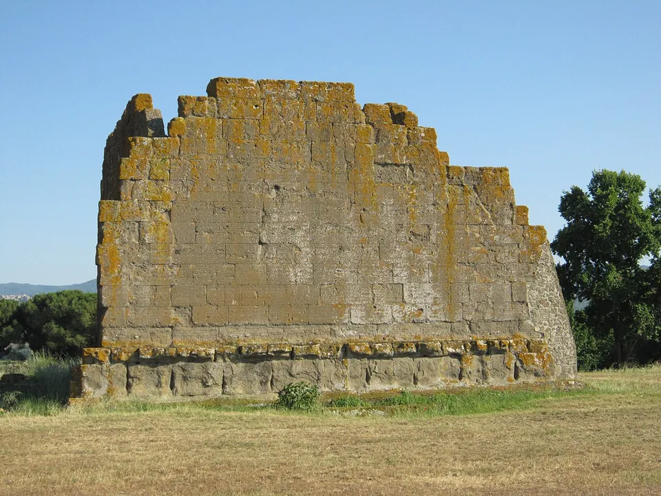
Photo: Carlomorino · CC BY-SA 3.0 · Commons
19 km · city · Lazio
Gabii
The park the state holds covers about 70 hectares on the southern rim of a volcanic crater whose lake was drained in the 19th century (the operator; en.wikipedia).


Straight-line distances.
Sources
Every fact on this page comes from the records below, each used under the licence noted.
| Source | Licence |
|---|---|
| Pleiades 166405461 | CC BY |
| Wikidata Q1241278 | CC0 |
| OpenStreetMap way/204049099 | ODbL |
| Wikipedia (it) — Horti Sallustiani | CC BY-SA 4.0 |
| Wikipedia (en) — Gardens of Sallust | CC BY-SA 4.0 |
| Wikipedia (de) — Horti Sallustiani | CC BY-SA 4.0 |
| Turismo Roma — Horti Sallustiani (Roma Capitale's tourism portal) | licence not recorded |
| Horti Sallustiani — the venue's own site (archived copy of 1 January 2026) | licence not recorded |
| Artribune — Gli Horti Sallustiani di Roma avranno un nuovo percorso (July 2026) | licence not recorded |
| Wikipedia (en) — Porta Nomentana | CC BY-SA 4.0 |
| Wikipedia (de) — Grabmal des Quintus Sulpicius Maximus | CC BY-SA 4.0 |
| Wikipedia (de) — Porta Collina | CC BY-SA 4.0 |