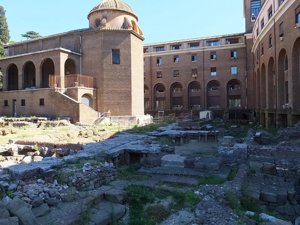
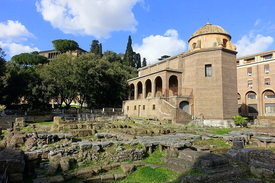
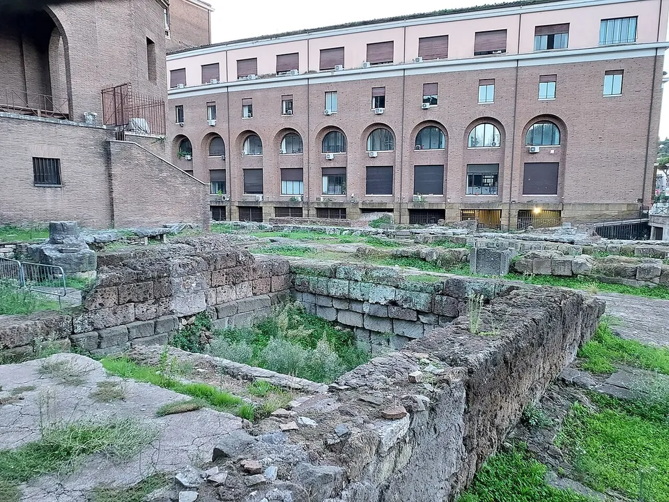


The Sacred Area of Sant’Omobono is the excavated site of two Republican temples, of Fortuna and Mater Matuta, at the foot of the Capitoline Hill. Beneath them lies a temple of the early 6th century BC, the oldest known temple remains in Rome (en.wikipedia). What you see today is a sunken, fenced excavation of a tufa platform, temple foundations and scattered slabs beside the little church of Sant’Omobono. The site is closed for works for now, so you look in from the street.
What is there today
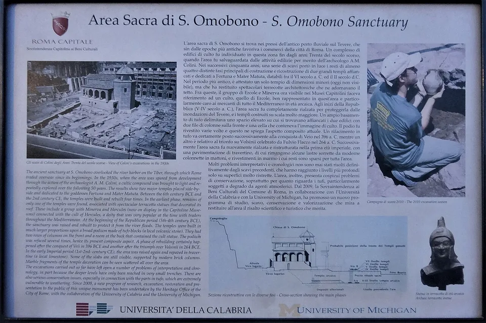
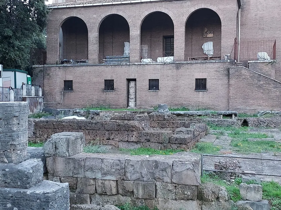
The excavation sits at the corner of Via Luigi Petroselli and the Vico Jugario, bounded on its south and east sides by modern buildings (fr.wikipedia). What fills it is a large platform of tufa blocks, and on it the remains of two temples built side by side (the operator). Only one of them, the temple usually identified as Fortuna’s, can be seen whole. The cella of the other, Mater Matuta’s, was most probably turned into a church at the end of the 5th century AD, and the church of Sant’Omobono still stands on it (the operator; de.wikipedia and fr.wikipedia put the conversion in the 6th century).
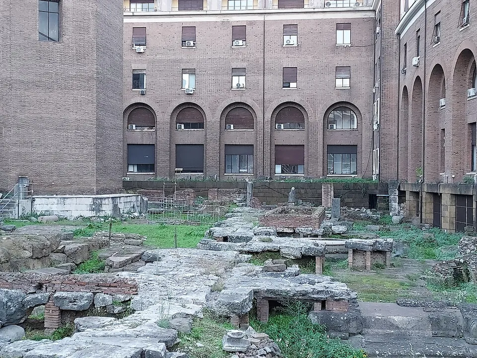
Some of the travertine slabs of the last, imperial paving survive, propped on modern brick supports, and marble fragments of the temples’ decoration lie scattered over the area (the site’s information board). The archaic temple lies deep below the later level, under the foundations of the church, and cannot be seen (the operator; the information board). A trench dug down to it in 2014 reached three courses of its podium more than 5 m down and had to be filled in again after three days because it could not be held against the groundwater (fr.wikipedia). The finds are elsewhere. The terracotta roof decoration of the archaic temple, among them a statue group of Hercules and Athena, and the objects from its votive deposit are shown in the Palazzo dei Conservatori of the Capitoline Museums, about 280 m away (the operator).
Is it worth the trip?
As a site you walk to, no. As a few minutes on a walk you are already making, yes. It lies on the way between the Forum Boarium, whose Temple of Portunus and Arch of Janus are 150 to 190 m away, and the Theatre of Marcellus, about 200 m away (OpenStreetMap). Its record reaches back before Rome’s traditional founding date (fr.wikipedia). Excavators found a hut of the 8th century BC here (the operator), and the fill dumped on the site holds pottery from the Bronze Age (de.wikipedia; it.wikipedia). What you can see does not match that. From the railings it reads as a field of foundations and loose blocks, and the oldest temple cannot be seen at all. fr.wikipedia notes that the site is hardly known outside archaeological circles. If the story draws you, the better half of the visit is the terracottas in the Capitoline Museums. The view from the street costs nothing.
Getting there and what it costs
The site is on the Vico Jugario, where it meets Via Luigi Petroselli. The nearest mapped bus stop, Petroselli, is about 50 m away, and a car park is mapped on Piazza della Consolazione, about 125 m away (OpenStreetMap).
The area is closed to visitors for works, and the operator’s page gives no reopening date. Turismo Roma, the city’s tourist site, says the works are those planned under the PNRR, Italy’s national recovery plan. Until then, the excavation can be seen from the street. When it is open, entry is free but only by booking on 060608 (daily 09.00–19.00). Groups of up to 15 must come with their own guide, and individual visitors can book on dates in a published calendar. The entrance is the gate next to Via Petroselli 45, and the operator asks visitors to wear flat, closed shoes with non-slip soles (sovraintendenzaroma.it, read 21 October 2026). Turismo Roma lists the site as not accessible to disabled visitors.
Visiting details
- Opening hours
- Temporarily closed for works; the excavation can be seen from the street. When it is open, visits are by booking only, on 060608 (daily 09.00–19.00) - groups of up to 15 with their own guide, or individual visitors on set dates.
- Tickets
- Free, when visits run; booking on 060608 is required.
- Parking
- A car park is mapped on Piazza della Consolazione, about 125 m away (OSM way/52928816).
Before you go
- Closed to visitors for works, with no reopening date published; what you can see is the view from Via Luigi Petroselli and the Vico Jugario.
- When visits run, the ground is uneven and slippery; the operator asks for flat, closed shoes with non-slip soles. Turismo Roma lists the site as not accessible to disabled visitors.
Hours and prices checked 21 October 2026 on the operator's own site. Confirm before travelling.
History
The site was found by chance in 1936 and 1937, during digging for a new municipal building beside the new Via del Mare, today’s Via Luigi Petroselli. The archaeologist Antonio Maria Colini had the building plans dropped and excavated the area in 1937 and 1938 (the operator; fr.wikipedia). The ground is waterlogged, and attempts between 1959 and 1986 to clear it completely failed. The history of the site has been worked out instead from soundings, which together cover barely a quarter of the area (de.wikipedia; fr.wikipedia). Since 2009 the city’s heritage office has run a joint research project on the site with the University of Calabria and the University of Michigan (the information board; fr.wikipedia).
The oldest remains are those of a hut of the 8th century BC. In the following century came a place of worship with altars and the bones of sacrificed animals, and from it a fragment of a vase with an Etruscan inscription, perhaps the oldest found in Rome (the operator). Around 580 BC the area was given its first temples. The operator counts two, of which only one has been found, while de.wikipedia notes that only one is attested. It was an Etruscan-Italic temple with a high tufa podium, a timber frame, mudbrick walls and a single cella with two columns at the front (the operator). Roman writers attribute temples of Fortuna and Mater Matuta here to King Servius Tullius, and the excavated temple is usually linked with them. Which goddess it belonged to is still argued over, and the research project calls it only “the archaic temple” (fr.wikipedia; de.wikipedia). It was rebuilt around 540 BC and destroyed at the end of the 6th century. That was when Rome’s last king was driven out, and the destruction is usually linked with his fall (it.wikipedia; de.wikipedia). fr.wikipedia reports a minority view that it came later and was accidental.
About a century later the whole area was raised on a great platform of earth and tufa and rebuilt as twin temples. Published figures put the rise at between 4 and 6 m (the operator; de.wikipedia; fr.wikipedia), and the platform at about 47 m square (it.wikipedia; de.wikipedia). The earth was probably brought from the Capitoline. It contained pottery from the 14th and 13th centuries BC, among the oldest evidence of settlement in the city, and Greek imports from the 8th century BC, the time of Rome’s legendary foundation (de.wikipedia; it.wikipedia). The literary tradition links the rebuilding of Mater Matuta’s temple to Camillus after he took Veii in 396 BC (de.wikipedia; it.wikipedia). The consul Marcus Fulvius Flaccus then relaid the paving and set up a base for offerings in 264 BC, after his capture of Volsinii. A fragment of its dedication survives (fr.wikipedia; de.wikipedia), and it.wikipedia says some 2,000 bronze statues were taken from the Etruscan city. A fire in 213 BC destroyed both temples, and they were rebuilt from 212 BC (fr.wikipedia; de.wikipedia). In 196 BC Lucius Stertinius set up two arches in front of them (it.wikipedia; fr.wikipedia).
Under the empire the temples stood on a travertine pavement, probably laid under Domitian, and were restored under Hadrian (117–138), as the stamps on the bricks show (it.wikipedia; the operator). They stayed in use at least into the early 3rd century (Turismo Roma). Mater Matuta’s cella then became a church, recorded as San Salvatore in Portico. It was rebuilt facing the other way in 1482 and dedicated in 1575 to Saint Homobonus, patron of tailors (the operator).
More photographs



Nearby
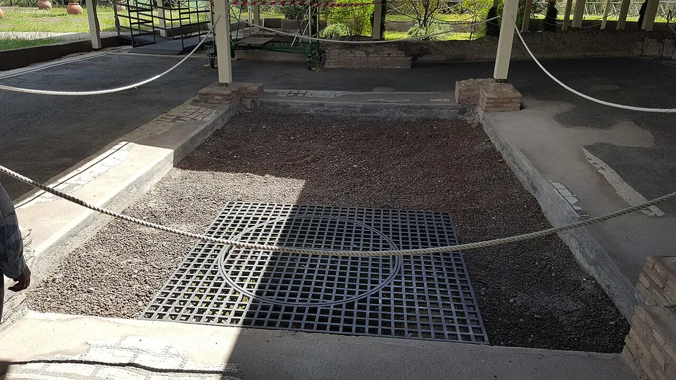
Photo: MumblerJamie · CC BY-SA 2.0 · Commons
12 km · villa · Lazio
Villa of Livia
The operator describes the private wing with the bedrooms of Livia and the emperor, an atrium and a small inner garden, and the large reception rooms that open onto a peristyle; the rooms once had painted walls and floors of mosaic and cut marble (Soprintendenza Speciale di Roma).
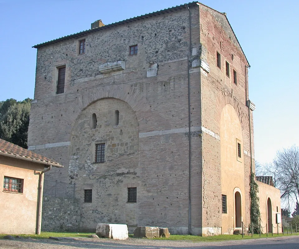
Photo: MM · Public domain · Commons
18 km · arch · Lazio
Arch of Malborghetto
At first sight you see an austere farmhouse rather than an arch (it.wikipedia).
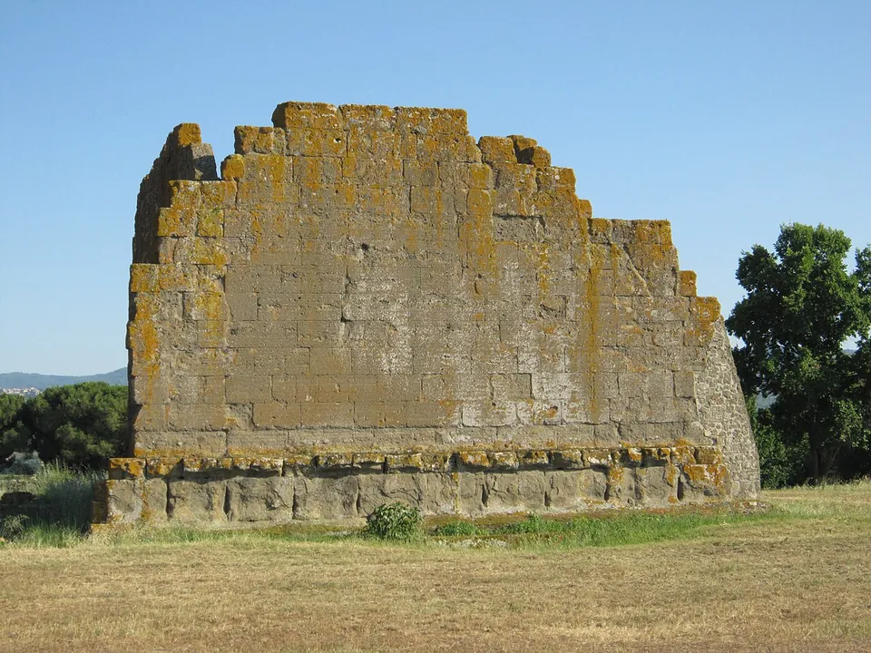
Photo: Carlomorino · CC BY-SA 3.0 · Commons
20 km · city · Lazio
Gabii
The park the state holds covers about 70 hectares on the southern rim of a volcanic crater whose lake was drained in the 19th century (the operator; en.wikipedia).


Straight-line distances.
Sources
Every fact on this page comes from the records below, each used under the licence noted.
| Source | Licence |
|---|---|
| Pleiades 103123065 | CC BY |
| Wikidata Q2552044 | CC0 |
| Vici.org 17947 | CC BY-SA (text), CC0 (metadata) |
| OpenStreetMap way/111669472 | ODbL |
| Sovrintendenza Capitolina — Area Sacra di S. Omobono (the operator) | licence not recorded |
| Turismo Roma — Area sacra di Sant'Omobono (Rome's official tourist site) | licence not recorded |
| Wikipedia (en) — Sant'Omobono Area | CC BY-SA 4.0 |
| Wikipedia (it) — Area di Sant'Omobono | CC BY-SA 4.0 |
| Wikipedia (fr) — Aire de Sant'Omobono | CC BY-SA 4.0 |
| Wikipedia (de) — Area sacra di Sant'Omobono | CC BY-SA 4.0 |