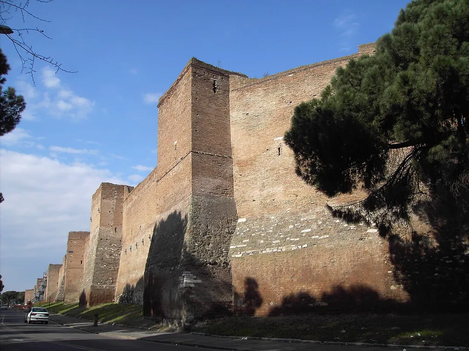
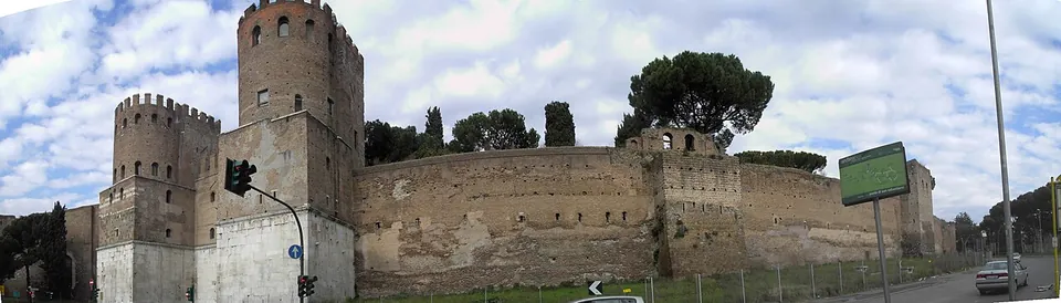
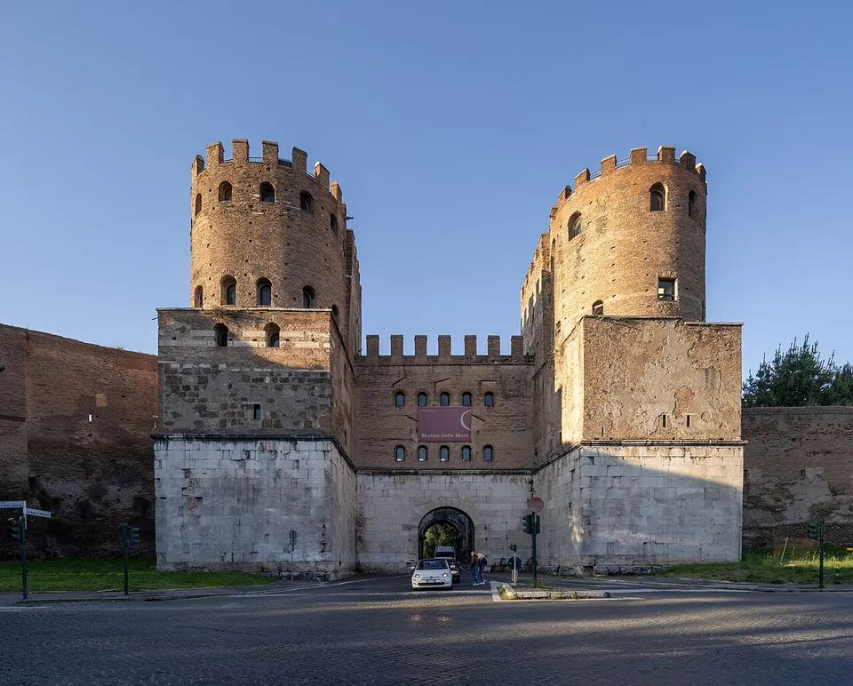


The Aurelian Walls are the brick city walls the emperor Aurelian began in AD 271 to defend Rome, and most of them are still standing: of a circuit of about 19 km, some 12.5 km survive, mostly in good condition (it.wikipedia). They are free to see from the streets they run beside, and at Porta San Sebastiano, the largest of the gates, a free museum lets you go up inside the gate and walk a stretch of the wall’s own sentry walk.
What is there today
The wall itself. It was built of brick-faced concrete, about 3.3 to 3.5 m thick and originally 6 to 8 m high, with a square tower about every 30 m (en.wikipedia; it.wikipedia), and was later raised to more than 10 m (see History). Long stretches keep their towers: beside Corso d’Italia, 18 of them are still in good condition (it.wikipedia). en.wikipedia names the best-preserved stretches as from the Muro Torto, beside Villa Borghese, along Corso d’Italia to Castro Pretorio; from Porta San Giovanni to Porta Ardeatina; from Porta San Paolo to the Tiber; and around Porta San Pancrazio. On Corso d’Italia, in a tower opposite Via Po, a cannon ball from the Italian army’s assault of 20 September 1870 is still lodged in the wall (it.wikipedia). Of the long stretch along the Tiber’s left bank nothing survives (it.wikipedia; fr.wikipedia).
Buildings the wall swallowed. To save time and money the builders took existing structures into the line, as much as a sixth of it by one estimate: the Amphitheatrum Castrense, the Praetorian Guard’s camp, the Pyramid of Cestius and the arches of the Aqua Claudia at Porta Maggiore (en.wikipedia). Several of these have pages of their own: the Pyramid of Cestius, with Porta San Paolo; Porta Maggiore, with Porta Tiburtina; and St John Lateran, with Porta Asinaria.
The southern stretch, around Porta San Sebastiano. This page’s own monuments lie here, where the Appian Way left the city. it.wikipedia counts the walls from Porta Metronia to Porta Latina among the best preserved of the circuit, and describes the stretch from Porta Latina to Porta San Sebastiano as in excellent condition, with the coats of arms of the popes who restored it, from Pius II to Alexander VII, still visible. Beyond the gate the wall runs on along Viale di Porta Ardeatina, past Porta Ardeatina, to a bastion about 300 m long that Antonio da Sangallo the Younger built for Pope Paul III in the first half of the 16th century, made for cannon rather than for the Roman ballistae (it.wikipedia). Each gate is described below.
Is it worth the trip?
Yes, and in Rome you are never far from them: the walls still mark the edge of the historic centre (en.wikipedia; fr.wikipedia). What makes them worth a deliberate visit is the southern stretch. At Porta San Sebastiano you can go up inside the gate’s towers, see models of the walls and gates in their different phases, and walk along the wall’s sentry walk for about 350 to 400 m (it.wikipedia gives about 350 m, Turismo Roma about 400 m), all free. The Arch of Drusus is just inside the gate, Porta Latina about 350 m along the wall, and the Appian Way starts at the gate, so this pairs naturally with the Baths of Caracalla, about 1 km north-west, or with a walk out along the Via Appia Antica.
Two honest caveats. The museum’s hours are short, 10.00 to 16.00 and closed on Mondays, with no more than 20 visitors inside at once (the operator). And much of the circuit elsewhere has been cut through for roads and a railway, or has houses, workshops, banks and military quarters built against it (it.wikipedia), so a walk round the whole 19 km is not the way to see it. Pick a stretch.
Getting there and what it costs
Porta San Sebastiano is about 2 km in a straight line south of the Colosseum. Bus stops named Porta S. Sebastiano are about 50 m and 110 m from the gate, and two free car parks are mapped about 200 m from the wall on Viale di Porta Ardeatina (OpenStreetMap).
The walls cost nothing to see. The Museo delle Mura, at Via di Porta San Sebastiano 18, is free for everyone; you collect the free ticket at the desk. It opens Tuesday to Sunday, 10.00 to 16.00, with last entry at 15.00, and is closed on Mondays, 1 May and 25 December. The walk along the wall keeps the museum’s hours. A visit is limited to 50 minutes, and the terrace of the gate tower is not open (Museo delle Mura, read 20 October 2026). Groups of 5 to 20 must book.
Visiting details
- Opening hours
- The walls stand along public streets and can be seen at any time. Museo delle Mura in Porta San Sebastiano, with the walk along the top of the wall: Tuesday to Sunday 10.00–16.00, last entry 15.00; closed Mondays, 1 May and 25 December.
- Tickets
- Free. The walls are in the open, and the Museo delle Mura is free for everyone; the free ticket is collected at the desk. No more than 20 visitors are let in at once, and a visit is limited to 50 minutes.
- Parking
- Two free surface car parks are mapped about 200 m from the stretch of wall on Viale di Porta Ardeatina (OSM way/1339119556 and way/1339119557). Bus stops named Porta S. Sebastiano are about 50 m and 110 m from the gate (OpenStreetMap).
Before you go
- The terrace of the gate tower at the Museo delle Mura is not open to visitors (the operator); the walk along the wall is.
Hours and prices checked 20 October 2026 on the operator's own site. Confirm before travelling.
History
By the third century Rome had long outgrown its old Servian Wall and had lived for centuries without defences. The crisis of the third century changed that: in 270 the Juthungi and the Vandals invaded northern Italy and defeated a Roman army at Placentia, modern Piacenza, before they were driven back (en.wikipedia). The walls were Aurelian’s answer, built as an emergency measure, and the historian Aurelius Victor says outright that they were meant to make the city less vulnerable (en.wikipedia). Aurelian died before they were finished; the work was completed under his successor Probus (de.wikipedia; it.wikipedia, which puts the finishing touches around 279). The garrison was far too small to man 19 km of wall, but the barbarian armies of the time raided rather than besieged, and against raids the wall was a deterrent (en.wikipedia).
The enclosed area is given as 1,400 hectares by Pleiades and en.wikipedia and as more than 1,200 by it.wikipedia; en.wikipedia adds that the city of the time actually spread over about 2,400 hectares, so the wall cut through built-up districts. It enclosed the seven hills, the Campus Martius and, across the Tiber, Trastevere (en.wikipedia).
The walls were strengthened twice in late antiquity. Maxentius, between 306 and 312, did some repair and reinforcement; en.wikipedia credits him with doubling the height of parts of it. The biggest change came around 403 under Honorius, or more precisely his general Stilicho: the walls were raised from about 6 to 8 m to at least 10.5 to 15 m, with a covered gallery for archers below and an open walkway above, and Hadrian’s mausoleum, now Castel Sant’Angelo, was taken into the defences (it.wikipedia). In 410 Alaric’s Goths entered through Porta Salaria, the first enemy inside the city since the Gauls in 390 BC; in 537 and 538 Belisarius held the walls against the Ostrogoth king Vitiges (it.wikipedia).
The walls stayed Rome’s defence until 1870. They halted the Arab raid of 846 and kept its plundering to sites outside them, Old St Peter’s and St Paul’s among them (en.wikipedia); popes rebuilt and reinforced them again and again; and their military life ended on 20 September 1870, when the Bersaglieri of the Kingdom of Italy breached them near Porta Pia and took Rome (en.wikipedia; it.wikipedia). That long use is largely why so much survives (en.wikipedia). The walls still define “central Rome” for the fixed taxi fares from the airports (en.wikipedia). They have not been trouble-free since: about 20 m collapsed in Via di Porta Ardeatina at Easter 2001, repaired by 2006, and another stretch fell along Viale Pretoriano in 2007 (it.wikipedia).
Porta San Sebastiano
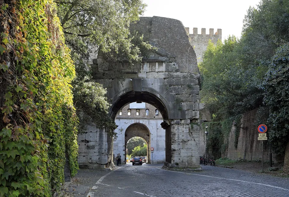
The largest gate of the walls, and one of the best preserved, it was the Porta Appia, where the Appian Way left the city (it.wikipedia; en.wikipedia; Pleiades). Aurelian’s gate of about 275 had two arches faced in travertine between two semicircular towers. Honorius rebuilt it in 401–402 with a single arch and a higher attic pierced by two rows of windows, and a later rebuilding raised the whole structure, towers included, by another storey; because no inscription of Honorius records the work, some scholars doubt it was his. A carving of the Archangel Michael on the right jamb, with a Gothic inscription, commemorates a battle fought here on 29 September 1327, and in 1536 Antonio da Sangallo turned the gate into a triumphal arch for the entry of the emperor Charles V (it.wikipedia). It took its present name, from the nearby basilica and catacombs of San Sebastiano, only in the second half of the 15th century (it.wikipedia).
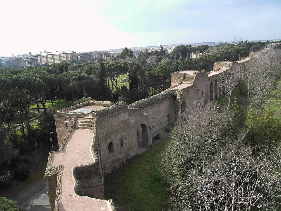
Inside, the towers house the Museo delle Mura, set up in 1989–1990 and run by the city’s civic museums: panels and models of the walls and gates in their successive phases, and black-and-white mosaic floors from 1942–1943, when the Fascist party secretary Ettore Muti occupied the gate (it.wikipedia; Turismo Roma). From the museum a walkway runs along the wall itself, restored for the Jubilee of 2000, towards the modern arches of Via Cristoforo Colombo (it.wikipedia; Turismo Roma).
Arch of Drusus
A single stone arch spanning the Appian Way about 40 m inside Porta San Sebastiano. The name is a mistake: it has nothing to do with Drusus, the general honoured with an arch on the Appian Way in 9 BC (Pleiades; en.wikipedia; it.wikipedia). What it was is disputed. it.wikipedia takes it for a span of the Aqua Antoniniana, the branch of the Aqua Marcia that Caracalla built to supply his baths; en.wikipedia thinks the arch is older, very probably the remains of an Arch of Trajan, with the aqueduct later carried over its top. It was built of travertine faced with marble, with columns of Numidian marble on either side of the opening, and only its central bay survives (en.wikipedia; Pleiades). Under Honorius it was joined to the gate by two walls, of which nothing remains (it.wikipedia).
Porta Latina
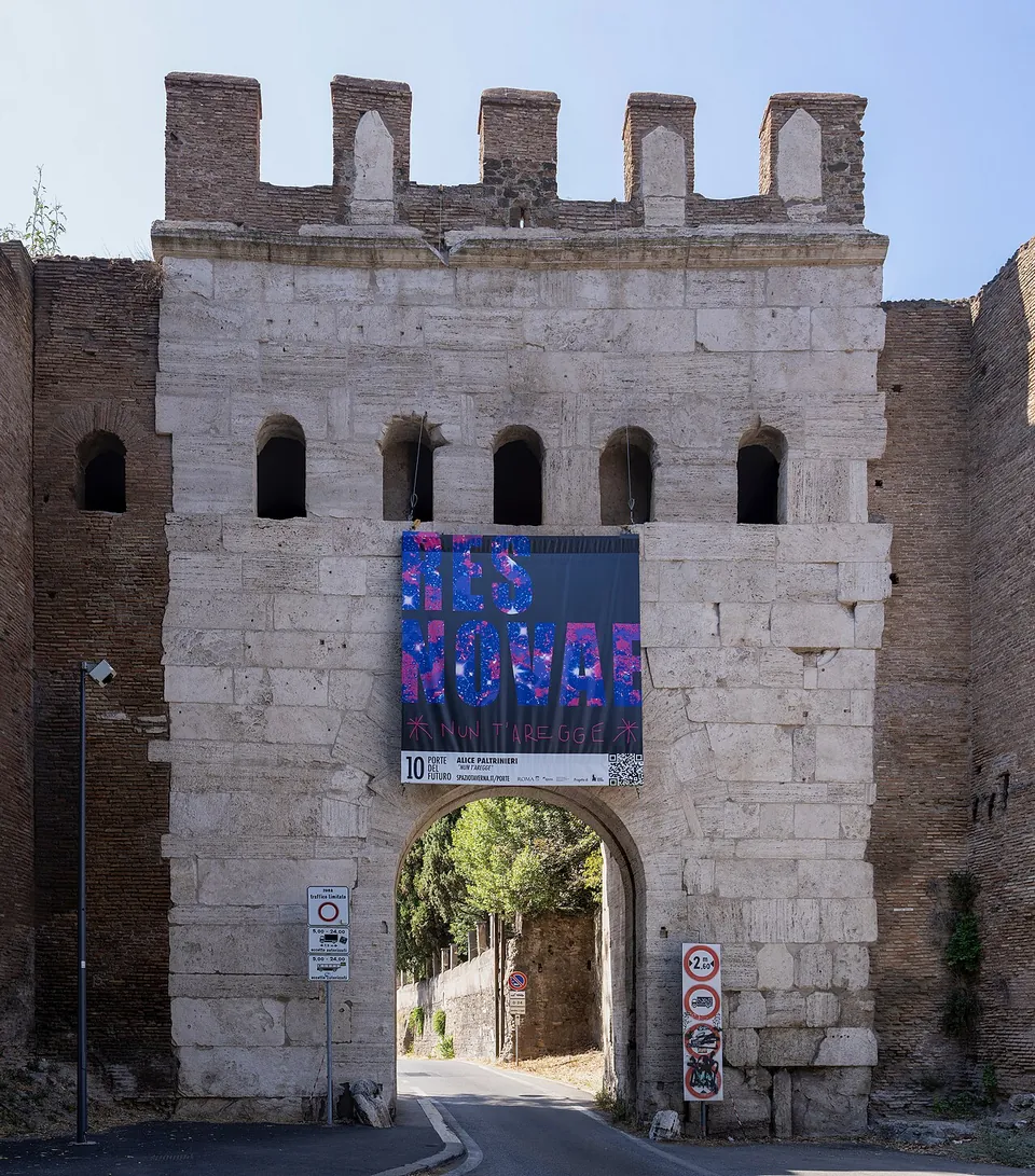
About 350 m north along the wall, this single-arched gate is where the Via Latina left the city, and it is among the most imposing and best preserved of the original gates (it.wikipedia). Its arch is built of travertine blocks, with five windows above it and battlements on top, between two semicircular brick towers (en.wikipedia). It is the only gate of the walls whose opening was made smaller under Honorius, from about 4.2 by 6.55 m to 3.73 by 5.65 m, and the outline of the original opening can still be seen. A Chi-Rho is carved on the outer keystone and a cross on the inner one (it.wikipedia; en.wikipedia). The gate was closed for most of the 19th century and reopened only in 1911; in September 1870 Italian troops tried to breach the wall here before they broke through at Porta Pia (it.wikipedia).
Porta Ardeatina
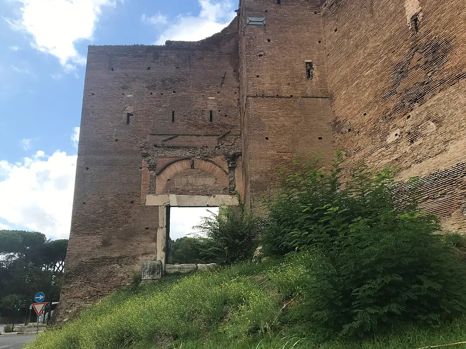
West of Porta San Sebastiano, near the arches of Via Cristoforo Colombo, the wall has a small opening framed in travertine where the Via Ardeatina left the city (it.wikipedia). Whether it was a true gate or only a postern is debated (Pleiades). It had no towers; instead the wall projects to form a small bastion. Its most interesting feature is a stretch of Roman paving, inside and outside the wall, with ruts left by carts still visible, and on the inner side the traces of a tomb built into the wall can be seen (it.wikipedia; en.wikipedia). OpenStreetMap maps the Roman paving as a footpath.
The first milestone of the Via Appia
About 135 m south of Porta San Sebastiano, outside the gate, a column is recorded as the first milestone of the Appian Way (Wikidata; vici.org, which marks it as visible). Neither source says more about it.
More photographs




Nearby
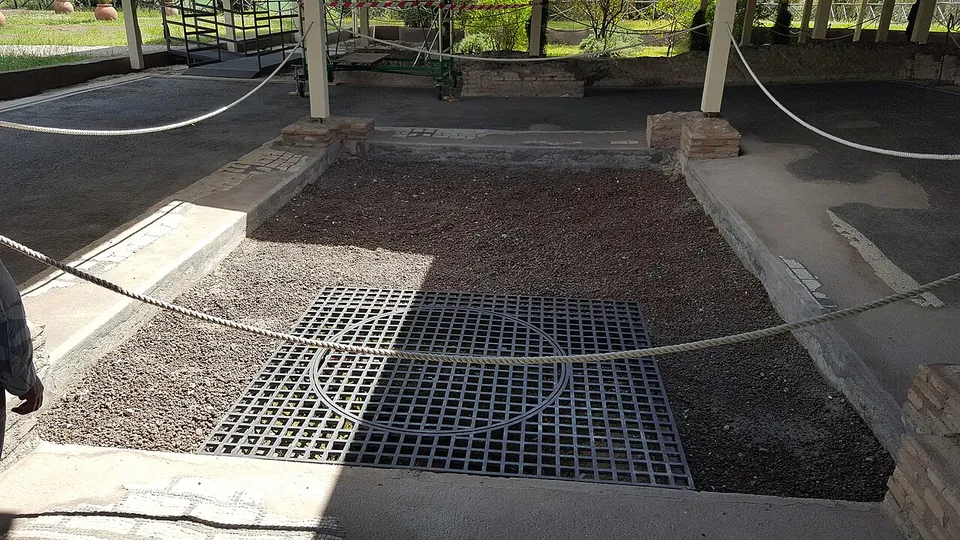
Photo: MumblerJamie · CC BY-SA 2.0 · Commons
14 km · villa · Lazio
Villa of Livia
The operator describes the private wing with the bedrooms of Livia and the emperor, an atrium and a small inner garden, and the large reception rooms that open onto a peristyle; the rooms once had painted walls and floors of mosaic and cut marble (Soprintendenza Speciale di Roma).
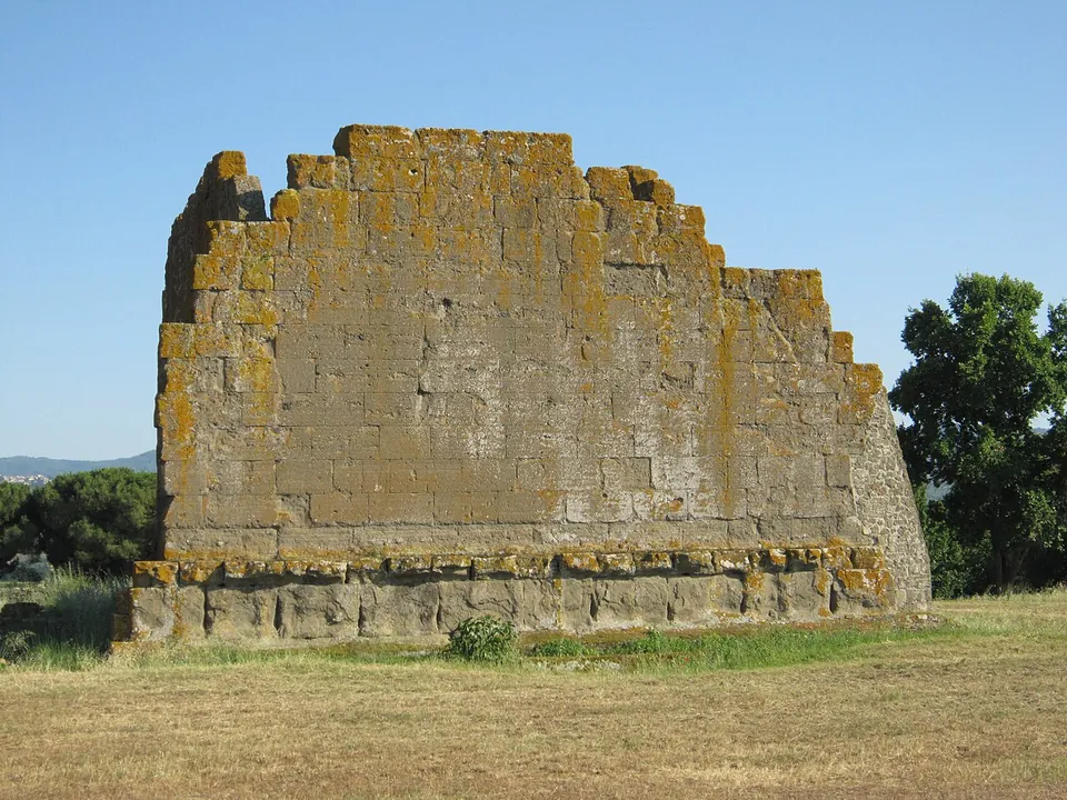
Photo: Carlomorino · CC BY-SA 3.0 · Commons
18 km · city · Lazio
Gabii
The park the state holds covers about 70 hectares on the southern rim of a volcanic crater whose lake was drained in the 19th century (the operator; en.wikipedia).
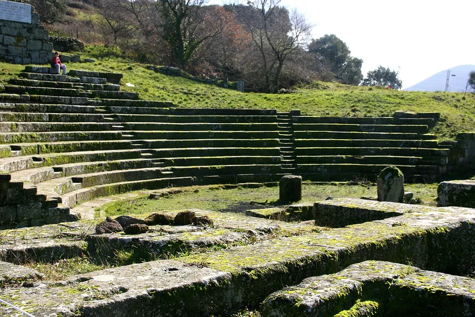
Photo: Luiza Serpa Lopes · Public domain · Commons
19 km · city · Lazio
Tusculum
The visitor route runs mainly through the forum, with the theatre halfway round (the operator).


Straight-line distances.
Sources
Every fact on this page comes from the records below, each used under the licence noted.